close
-
Layers w
- Weather Layers
- Pro
- Pro
- Pro
- Pro
- Pro
- Pro
- More Layers
- Pro
- Pro
- Pro
- Pro
-
Upgrade to

3D
Trail Conditions
- Unknown
- Snow Groomed
- Snow Packed
- Snow Covered
- Snow Cover Partial
- Freeze/thaw Cycle
- Icy
- Prevalent Mud
- Wet
- Variable
- Ideal
- Dry
- Very Dry
Trail Flow (Ridden Direction)
Trailforks scans users ridelogs to determine the most popular direction each trail is ridden. A good flowing trail network will have most trails flowing in a single direction according to their intension.
The colour categories are based on what percentage of riders are riding a trail in its intended direction.
The colour categories are based on what percentage of riders are riding a trail in its intended direction.
- > 96%
- > 90%
- > 80%
- > 70%
- > 50%
- < 50%
- bi-directional trail
- no data
Trail Last Ridden
Trailforks scans ridelogs to determine the last time a trail was ridden.
- < 2 days
- < 1 week
- < 2 weeks
- < 1 month
- < 6 months
- > 6 months
Trail Ridden Direction
The intended direction a trail should be ridden.
- Downhill Only
- Downhill Primary
- Both Directions
- Uphill Primary
- Uphill Only
- One Direction
Contribute Details
Colors indicate trail is missing specified detail.
- Description
- Photos
- Description & Photos
- Videos
Trail Popularity ?
Trailforks scans ridelogs to determine which trails are ridden the most in the last 9 months.
Trails are compared with nearby trails in the same city region with a possible 25 colour shades.
Think of this as a heatmap, more rides = more kinetic energy = warmer colors.
- most popular
- popular
- less popular
- not popular
ATV/ORV/OHV Filter
Max Vehicle Width
inches
US Cell Coverage
Legend

Radar Time
Activity Recordings
Trailforks uses anonymized public activity data.
?
Activity Recordings
Trailforks uses anonymized public activity data.
?
Personal Heatmap
▶
Activity Types
all
/
none
▶
Options
2
Date range
month
–
Winter Trails
Warning
A routing network for winter maps does not exist. Selecting trails using the winter trails layer has been disabled.
Missing Trails
Most Popular
Least Popular
Trails are colored based on popularity. The more popular a trail is, the more red. Less popular trails trend towards green.
Jump Magnitude Heatmap
Heatmap of where riders jump on trails. Zoom in to see individual jumps, click circles to view jump details.
BC Backroad Status
![map legend]()
Service Road Atlas is a free to use, community-driven service for viewing and creating reports on the numerous back-country service roads around B.C. and Alberta.

Slope Aspect
Direction the slope faces
Trails Deemphasized
Trails are shown in grey.
Only show trails with no bike usage.
Suggested Layers
Based on selected activity type
Save the current map location and zoom level as your default home location whenever this page is loaded.
Save
No description for Chania has been added yet!
Login or register to submit one.
Activities Click to view
- Mountain Bike
7 trails
- Gravel Bike
0 trails
- Adaptive Bike
0 trails
- Hike
7 trails
- Trail Running
7 trails
Region Details
- 2
- 1
- 3
Region Status
Open as of Feb 6, 2022Stats
- Avg Trail Rating
- Trails (view details)
- 6
- Trails Mountain Bike
- 7
- Trails E-Bike
- 2
- Trails Hike
- 7
- Trails Trail Running
- 7
- Total Distance
- 10 miles
- Total Descent
- 1,828 ft
- Total Vertical
- 1,768 ft
- Highest Trailhead
- 1,782 ft
- Reports
- 3
- Photos
- 14
- Ridden Counter
- 88
Sub Regions
-
Astritsi
-
Prevadorio
- 2
Popular Chania Mountain Biking Trails
• 100 ★ 5.0 • 3,278 ft • 0 ft • 14 •
The path starts parallel to the K. Mitsotaki road. It is a path with natural obstacles without big drops and jumps. The terrain is mainly downhill with a few sections that may need a little pedaling. It has a mixed terrain of dirt with...
• 5 ★ 3.3 • 2,596 ft • 0 ft • 9 •
Less popular blue difficulty doubletrack. This mountain bike primary trail can be used downhill primary and has a moderate overall physical rating. It features bridge, drop, jump, pump track and rock face. On average it takes 5 minutes to complete this trail.
• 90 ★ 0.0 • 3,652 ft • 0 ft • 7 • • hike
Popular blue difficulty other. This hike primary trail can be used both directions and has a easy overall physical rating with a 0 ft green climb. On average it takes 49 minutes to complete this trail.
• 5 ★ 4.5 • 2,200 ft • 1 ft • 6 •
Less popular blue difficulty doubletrack. This mountain bike primary trail can be used downhill primary and has a moderate overall physical rating. It features bridge, drop, jump and rock face. On average it takes 8 minutes to complete this trail.
• 5 ★ 0.0 • 3 miles • 518 ft • 4 •
Less popular white difficulty family friendly mixed. This mountain bike primary trail can be used both directions and has a moderate overall physical rating with a 518 ft green climb. On average it takes 35 minutes to complete this trail.
• 5 ★ 5.0 • 3,825 ft • 7 ft • 3 •
Τhe trail starts from the mountain of Μalaxa with the imposing view of the bay of sοuda. get ready for a steep descent that requires your constant concentration for what is coming. Τhe trail has everything from extended straights...
• 5 ★ 0.0 • 2,936 ft • 0 ft •
Less popular green difficulty singletrack. This mountain bike primary trail can be used both directions. It features other.
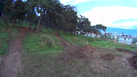
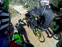
Photos of Chania Mountain Bike
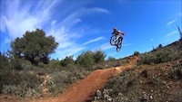
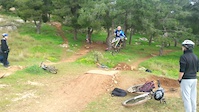
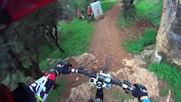
Videos of Chania Mountain Bike
trail: Prevadorio #2
0:38 |
238 |
Feb 27, 2015
trail: Prevadorio #2
2:39 |
330 |
Feb 7, 2015
trail: Prevadorio #1
0:33 |
240 |
Jan 30, 2015
trail: Prevadorio #1
0:35 |
238 |
Jan 30, 2015
trail: Prevadorio #1
0:28 |
418 |
Mar 2, 2014
Recent Trail Reports
| status | trail | date | condition | info | user |
|---|---|---|---|---|---|
| Prevadorio #2 | Feb 6, 2022 @ 9:52am Feb 6, 2022 | Ideal | KonGamer19 | ||
| Prevadorio #1 | Feb 6, 2022 @ 9:52am Feb 6, 2022 | Ideal | KonGamer19 |
Activity Feed
| username | action | type | title | date |
|---|---|---|---|---|
| ptldbkr | wishlist | trail | activity #96722356 | Jun 11, 2026 @ 12:37am Jun 11, 2026 |
| gabirel | ridden | trail | activity #56627577 | Aug 3, 2024 @ 6:52am Aug 3, 2024 |
| hparent | vote | trail | activity #48158470 | Jan 12, 2024 @ 5:15am Jan 12, 2024 |
| daringtrails | ridden | trail | activity #44254912 | Sep 18, 2023 @ 7:31am Sep 18, 2023 |
| daringtrails | vote | trail | activity #44254911 | Sep 18, 2023 @ 7:31am Sep 18, 2023 |
Local Mountain Biking Directory
-
Daring Trails
![Daring Trails]()
-
Hellas BikeGuides & Tours
Activity Type Stats
| activitytype | trails | distance | descent | descent distance | total vertical | rating | global rank | state rank | photos | reports | routes | ridelogs |
|---|---|---|---|---|---|---|---|---|---|---|---|---|
| Mountain Bike | 7 | 10 miles | 1,827 ft | 5 miles | 1,768 ft | #3,017 | #23 | 14 | 3 | 1,690 | ||
| E-Bike | 2 | 3,278 ft | 302 ft | 3,061 ft | 305 ft | 75 | ||||||
| Hike | 7 | 10 miles | 1,827 ft | 5 miles | 1,768 ft | #3,614 | #29 | 3 | 865 | |||
| Trail Running | 7 | 10 miles | 1,827 ft | 5 miles | 1,768 ft | #3,106 | #29 | 3 | 28 |
Frequently Asked Questions About Chania
▼
What are the best places to ride in Chania?
Chania has 2 areas to explore for mountain biking. The top rated areas are:
▼
What are the highest rated mountain biking trails in Chania?
The highest rated mountain biking trails in Chania are:
- Petalo Trail (4.1/5)
- Ma-laxative Trail (4.1/5)
- Prevadorio #2 (4.1/5)
- Prevadorio #1 (3.7/5)
- Balos (0/5)
▼
What is the best time of the year to ride in Chania?
Based on ride log data, the most popular months to ride in Chania are:
- June (12 activities)
- July (6 activities)
- September (6 activities)
▼
Where can I park to ride in Chania?
Check the Chania trail map for trailhead and parking information. Community members regularly update access and parking details for trails in the area.
- By grshindig & contributors
- Admins: grshindig
- #6109 - 2,902 views
- chania activity log | embed map of Chania mountain bike trails |
Downloading of trail gps tracks in kml & gpx formats is enabled for Chania.
You must login to download files.