close
-
Layers w
- Weather Layers
- Pro
- Pro
- Pro
- Pro
- Pro
- Pro
- More Layers
- Pro
- Pro
- Pro
- Pro
-
Upgrade to

3D
Trail Conditions
- Unknown
- Snow Groomed
- Snow Packed
- Snow Covered
- Snow Cover Partial
- Freeze/thaw Cycle
- Icy
- Prevalent Mud
- Wet
- Variable
- Ideal
- Dry
- Very Dry
Trail Flow (Ridden Direction)
Trailforks scans users ridelogs to determine the most popular direction each trail is ridden. A good flowing trail network will have most trails flowing in a single direction according to their intension.
The colour categories are based on what percentage of riders are riding a trail in its intended direction.
The colour categories are based on what percentage of riders are riding a trail in its intended direction.
- > 96%
- > 90%
- > 80%
- > 70%
- > 50%
- < 50%
- bi-directional trail
- no data
Trail Last Ridden
Trailforks scans ridelogs to determine the last time a trail was ridden.
- < 2 days
- < 1 week
- < 2 weeks
- < 1 month
- < 6 months
- > 6 months
Trail Ridden Direction
The intended direction a trail should be ridden.
- Downhill Only
- Downhill Primary
- Both Directions
- Uphill Primary
- Uphill Only
- One Direction
Contribute Details
Colors indicate trail is missing specified detail.
- Description
- Photos
- Description & Photos
- Videos
Trail Popularity ?
Trailforks scans ridelogs to determine which trails are ridden the most in the last 9 months.
Trails are compared with nearby trails in the same city region with a possible 25 colour shades.
Think of this as a heatmap, more rides = more kinetic energy = warmer colors.
- most popular
- popular
- less popular
- not popular
ATV/ORV/OHV Filter
Max Vehicle Width
inches
US Cell Coverage
Legend

Radar Time
Activity Recordings
Trailforks uses anonymized public activity data.
?
Activity Recordings
Trailforks uses anonymized public activity data.
?
Personal Heatmap
▶
Activity Types
all
/
none
▶
Options
2
Date range
month
–
Winter Trails
Warning
A routing network for winter maps does not exist. Selecting trails using the winter trails layer has been disabled.
Missing Trails
Most Popular
Least Popular
Trails are colored based on popularity. The more popular a trail is, the more red. Less popular trails trend towards green.
Jump Magnitude Heatmap
Heatmap of where riders jump on trails. Zoom in to see individual jumps, click circles to view jump details.
BC Backroad Status
![map legend]()
Service Road Atlas is a free to use, community-driven service for viewing and creating reports on the numerous back-country service roads around B.C. and Alberta.

Slope Aspect
Direction the slope faces
Trails Deemphasized
Trails are shown in grey.
Only show trails with no bike usage.
Suggested Layers
Based on selected activity type
Save the current map location and zoom level as your default home location whenever this page is loaded.
SavePopular Trail Networks
view all areas »
No description for Chile has been added yet!
Login or register to submit one.
Region Details
- 170
- 8
- 124
- 330
- 181
- 37
- 5
Stats
- Avg Trail Rating
- Trails (view details)
- 887
- Trails Mountain Bike
- 923
- Trails E-Bike
- 365
- Trails Gravel Bike
- 4
- Trails Adaptive Bike
- 2
- Trails Winter Fat Bike
- 3
- Trails Horse
- 21
- Trails Hike
- 822
- Trails Trail Running
- 802
- Trails Dirtbike/Moto
- 11
- Trails ATV/ORV/OHV
- 3
- Trails Snowshoe
- 1
- Trails Backcountry Ski
- 2
- Trails Nordic Ski
- 1
- Total Distance
- 1,235 miles
- Total Descent
- 435,010 ft
- Total Vertical
- 13,052 ft
- Highest Trailhead
- 13,064 ft
- Reports
- 3,744
- Photos
- 1,799
- Ridden Counter
- 52,109
Articles
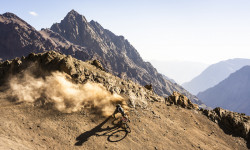
Must Watch: Nico Vink Takes Freeride Into the High Andes in 'Cordillera'
Jan 29, 2026 from pinkbike.com
Nico and crew pioneer some massive freeride lines in the Andes.
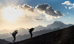
Photo Story: Summiting the Highest Volcano in Central Chile by Bike
Aug 21, 2025 from pinkbike.com
An expedition to the 6,570m peak of Tupungato is a story of extreme altitude, bitter lessons, and a dream finally realized.
Video: Guga Ortiz Tackles Chile’s Wildest Riding on an Adaptive MTB in 'IKIGAI'
May 27, 2025 from pinkbike.com
Guga Ortiz pushed the boundaries of Amtb on an epic 7000km road trip through Chile.
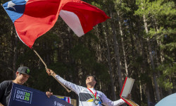
Race Report: Pan Am DH 2025 - The Most Intense Battle Yet
Mar 27, 2025 from pinkbike.com
With over 500 riders from across the continent, this event not only drew massive participation but also showcased an unprecedented level of...
Sub Regions
- Antofagasta (15)
- Antofagasta (9)
- Calama (1)
- San Pedro de Atacama (4)
- Antofagasta (9)
- Araucanía (36)
- Angol (2)
- Curacautin (2)
- Pucón (13)
- Purén (1)
- Temuco (17)
- Angol (2)
- Arica y Parinacota (0)
- Atacama (1)
- Copiapó (1)
- Copiapó (1)
- Aysén (29)
- Bío Bío (86)
- Chillan (32)
- Concepcion (35)
- Santa Juana (20)
- Chillan (32)
- Coquimbo (41)
- Illapel (8)
- La Serena (19)
- Pichidangui (14)
- Illapel (8)
- Cordón de los Españoles (0)
- Lampa (1)
- Lampa (0)
- Los Lagos (26)
- Puerto Varas (26)
- Puerto Varas (26)
- Los Rios (102)
- Corral (9)
- Lanco (3)
- Panguipulli (23)
- Valdivia (65)
- Corral (9)
- Magallanes y la Antártica Chilena (56)
- Puerto Natales (1)
- Punta Arenas (20)
- Puerto Natales (1)
- Maule (12)
- Metropolitan (286)
- Northern Chile (0)
- O'Higgins (53)
- Penco (35)
- Ninhue (35)
- Ninhue (35)
- Tarapacá (1)
- Iquique (1)
- Iquique (1)
- Valparaíso (104)
- Cachagua (14)
- Los Andes (16)
- Quilpue (31)
- San Antonio (45)
- Valparaiso (1)
- Viña del Mar (10)
- Cachagua (14)
Popular Chile Mountain Biking Trails
• 100 ★ 4.4 • 3,034 ft • 3 ft • 502 •
Highly rated popular blue difficulty dirt/gravel road. This mountain bike primary trail can be used downhill only and has a moderate overall physical rating. It features jump, gap jump and pump track. On average it takes 3 minutes to complete this trail.
• 100 ★ 0.0 • 1,678 ft • 59 ft • 457 •
Sendero principalmente de trekking. Permite pequeño atajo si se desea acceder al sector oriente del cerro.
• 95 ★ 4.9 • 2 miles • 49 ft • 444 •
Highly rated popular blue difficulty singletrack. This mountain bike primary trail can be used downhill only and has a moderate overall physical rating with a 49 ft green climb. It features berm and jump. On average it takes 7 minutes to complete this trail.
• 100 ★ 0.0 • 841 ft • 69 ft • 422 •
Popular green difficulty singletrack. This mountain bike primary trail can be used uphill primary and has a moderate overall physical rating with a 69 ft green climb. On average it takes 1 minutes to complete this trail.
• 100 ★ 3.0 • 2,394 ft • 61 ft • 394 •
Short trail, soft at the begining with a rockgarden at the end
• 90 ★ 3.0 • 2,035 ft • 5 ft • 387 •
Popular blue difficulty singletrack. This mountain bike primary trail can be used downhill primary. On average it takes 8 minutes to complete this trail.
• 95 ★ 4.3 • 2 miles • 17 ft • 383 •
fun trail, lot´s of rocks and drops, "anti-grip", very technical.
• 90 ★ 4.6 • 1 mile • 98 ft • 383 •
Popular blue difficulty singletrack. This mountain bike primary trail can be used downhill primary. On average it takes 5 minutes to complete this trail.
Chile Mountain Bike Routes
Guallipén combinación Pista Dura Featured
3 miles • 74 ft • 3 • Point to Point •
Bajada desde el inicio de Guallipén combinando en parte media con sendero y finalizando con .
Hornitos Featured
1 mile • 446 ft • 5 • Loop •
Subida por Enlace hasta sendero del , bajada por hasta Parque Cerro Ninhue MTB.
★ 5.0 • 15 miles • 3,620 ft • 3 • Point to Point •
Excelente travesia que cruza los cordones montañosos desde curva 1 de farellones hasta el durazno.
9 miles • 1,941 ft • 6 • Loop •
Good crosscountry mt. bike route for those who want more technical riding and less berms and flow. Good...
11 miles • 2,515 ft • 3 •
Bonita ruta al sur de cerro Manquehue poco tecnico. En la bajada desde el portezuelo hay opcion entre la...
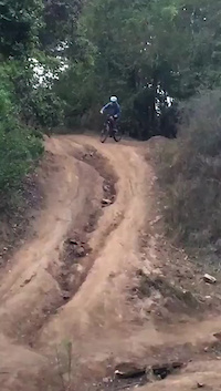
Photos of Chile Mountain Bike
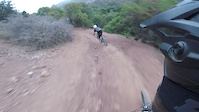
Videos of Chile Mountain Bike
trail: Han Solo
0:17 |
6 |
Oct 28, 2025
trail: Candelaria
0:02 |
8 |
May 10, 2023
trail: DH Cerro Grande
0:11 |
159 |
Feb 17, 2023
trail: Valle Hermoso
6:54 |
16 |
Dec 16, 2021
trail: Los Perros
0:09 |
112 |
Nov 19, 2021

trail: Tanketa Trail FREERIDE-DH
4:14 |
39 |
Nov 14, 2021

trail: Aguila
0:39 |
100 |
Aug 20, 2021
trail: San Juanazo XL
0:15 |
98 |
Feb 11, 2021
Recent Comments
| username | type | title | comment | date |
|---|---|---|---|---|
| trail | Sendero sumamente resbaloso con lluvia. | May 29, 2026 @ 7:19am May 29, 2026 | ||
| trail | The sign says no bicycles are allowed on this... | May 14, 2026 @ 12:17pm May 14, 2026 | ||
| trail | The sign says no bicycles are allowed | May 14, 2026 @ 12:16pm May 14, 2026 | ||
| trail | The bottom third of this trail is overgrown... | May 13, 2026 @ 3:19pm May 13, 2026 | ||
| trail | Tremendo sendero! Harta zanja y escalones... | Mar 3, 2026 @ 9:03am Mar 3, 2026 |
Bike & Skill Parks
| name | type | city | rating |
|---|---|---|---|
| Cerduo Bike Park | bike park | Pucón | |
| Bikepark RKF EL Durazno | bike park | Santiago | |
| Bikepark Huilo Huilo | bike park | Panguipulli | |
| La Parva Bikepark | bike park | Santiago | |
| Nevados de Chillán | bike park | Chillan |
Activity Type Stats
| activitytype | trails | distance | descent | descent distance | total vertical | rating | global rank | state rank | photos | reports | routes | ridelogs |
|---|---|---|---|---|---|---|---|---|---|---|---|---|
| Mountain Bike | 921 | 1,150 miles | 423,255 ft | 678 miles | 13,051 ft | #32 | 1,779 | 3,738 | 116 | 206,021 | ||
| E-Bike | 365 | 370 miles | 126,014 ft | 204 miles | 13,051 ft | #35 | 2 | 3,201 | 39 | 27,223 | ||
| Gravel Bike | 4 | #31 | 2 | 4 | 290 | |||||||
| Adaptive Bike | 2 | #29 | 2 | 8 | ||||||||
| Winter Fat Bike | 3 | #34 | 2 | 1 | 1 | |||||||
| Horse | 21 | 49 miles | 14,222 ft | 25 miles | 9,659 ft | #40 | 787 | 2 | 7 | |||
| Hike | 723 | 826 miles | 244,570 ft | 428 miles | 13,051 ft | #31 | 15 | 3,273 | 5 | 11,593 | ||
| Trail Running | 802 | 821 miles | 242,500 ft | 428 miles | 13,051 ft | #33 | 1 | 3,274 | 5 | 2,987 | ||
| Dirtbike/Moto | 11 | 27 miles | 6,473 ft | 12 miles | 8,074 ft | #40 | 787 | 18 | ||||
| ATV/ORV/OHV | 3 | 14 miles | 981 ft | 5 miles | 7,215 ft | #36 | 786 | 48 | ||||
| Snowshoe | 1 | 2 miles | 20 ft | 420 ft | 751 ft | #27 | 1 | 8 | ||||
| Backcountry Ski | 2 | 9 miles | 2,976 ft | 6 miles | 2,871 ft | #27 | 2 | 662 | ||||
| Nordic Ski | 1 | 8 miles | 2,648 ft | 5 miles | 1,982 ft | #26 | 209 |
Activities
Trails
Points of Interest
- Cerro Manquehue Summit
- Camping Tawen
- Mirador Los Alerces Viewpoint
- Mirador Rincon Viewpoint
- [falls] Salto Punta Negra Other
- [falls] Cascada Pequeña Cañi Other
- Mirador del Valle Viewpoint
- Cerro La Campana Summit
- Fuente de Agua Viewpoint
- Glacier Viewpoint
- Walter Penck (21,857 ft)
- WP 3 (21,198 ft)
- WP 2 (20,906 ft)
- By canadaka
 Trailforks & contributors
 - Admins: MB
- #3172 - 33,684 views
- chile activity log | embed map of Chile mountain bike trails | chile mountain biking points of interest
Downloading of trail gps tracks in kml & gpx formats is enabled for Chile.
You must login to download files.