close
-
Layers w
- Weather Layers
- Pro
- Pro
- Pro
- Pro
- Pro
- Pro
- More Layers
- Pro
- Pro
- Pro
- Pro
-
Upgrade to

3D
Trail Conditions
- Unknown
- Snow Groomed
- Snow Packed
- Snow Covered
- Snow Cover Partial
- Freeze/thaw Cycle
- Icy
- Prevalent Mud
- Wet
- Variable
- Ideal
- Dry
- Very Dry
Trail Flow (Ridden Direction)
Trailforks scans users ridelogs to determine the most popular direction each trail is ridden. A good flowing trail network will have most trails flowing in a single direction according to their intension.
The colour categories are based on what percentage of riders are riding a trail in its intended direction.
The colour categories are based on what percentage of riders are riding a trail in its intended direction.
- > 96%
- > 90%
- > 80%
- > 70%
- > 50%
- < 50%
- bi-directional trail
- no data
Trail Last Ridden
Trailforks scans ridelogs to determine the last time a trail was ridden.
- < 2 days
- < 1 week
- < 2 weeks
- < 1 month
- < 6 months
- > 6 months
Trail Ridden Direction
The intended direction a trail should be ridden.
- Downhill Only
- Downhill Primary
- Both Directions
- Uphill Primary
- Uphill Only
- One Direction
Contribute Details
Colors indicate trail is missing specified detail.
- Description
- Photos
- Description & Photos
- Videos
Trail Popularity ?
Trailforks scans ridelogs to determine which trails are ridden the most in the last 9 months.
Trails are compared with nearby trails in the same city region with a possible 25 colour shades.
Think of this as a heatmap, more rides = more kinetic energy = warmer colors.
- most popular
- popular
- less popular
- not popular
ATV/ORV/OHV Filter
Max Vehicle Width
inches
US Cell Coverage
Legend

Radar Time
Activity Recordings
Trailforks uses anonymized public activity data.
?
Activity Recordings
Trailforks uses anonymized public activity data.
?
Personal Heatmap
▶
Activity Types
all
/
none
▶
Options
2
Date range
month
–
Winter Trails
Warning
A routing network for winter maps does not exist. Selecting trails using the winter trails layer has been disabled.
Missing Trails
Most Popular
Least Popular
Trails are colored based on popularity. The more popular a trail is, the more red. Less popular trails trend towards green.
Jump Magnitude Heatmap
Heatmap of where riders jump on trails. Zoom in to see individual jumps, click circles to view jump details.
BC Backroad Status
![map legend]()
Service Road Atlas is a free to use, community-driven service for viewing and creating reports on the numerous back-country service roads around B.C. and Alberta.

Slope Aspect
Direction the slope faces
Trails Deemphasized
Trails are shown in grey.
Only show trails with no bike usage.
Suggested Layers
Based on selected activity type
Save the current map location and zoom level as your default home location whenever this page is loaded.
SaveChur is the capital of the most beautiful and largest mountain bike region in Switzerland: Graubünden, also known as the «Home of Trails». So it's hardly surprising that bikers also get their money's worth in the Alpine City.
eBikes Allowed:
Yes
AKA: The Capital
Links
This region uses the Uk/Euro style trail grading system.
Activities Click to view
- Mountain Bike
118 trails
- E-Bike
118 trails
- Adaptive Bike
20 trails
- Hike
108 trails
- Trail Running
109 trails
Region Details
- 22
- 17
- 33
- 24
- 16
- 1
Region Status
Open as of Jun 9, 2026Stats
- Avg Trail Rating
- Trails (view details)
- 118
- Trails Mountain Bike
- 119
- Trails E-Bike
- 118
- Trails Gravel Bike
- 40
- Trails Adaptive Bike
- 20
- Trails Hike
- 109
- Trails Trail Running
- 109
- Trails Snowshoe
- 1
- Trails Downhill Ski
- 3
- Total Distance
- 74 miles
- Total Descent Distance
- 44 miles
- Total Descent
- 37,477 ft
- Total Vertical
- 7,295 ft
- Highest Trailhead
- 9,099 ft
- Reports
- 1,478
- Photos
- 295
- Ridden Counter
- 14,797
Articles
Video: Claudio Caluori Follows Nino Schurter Down Narrow Alpine Singletrack
May 29, 2020 from pinkbike.com
Claudio must be a glutton for punishment as he's back and trying to keep up with Nino Schurter once again
Sub Regions
-
Alpen Bikepark
- 2
- 1
- 4
- 1
-
Fürstenwald
- 7
- 8
- 1
-
Mittenberg
- 2
- 13
- 9
- 5
Popular Chur Mountain Biking Trails
• 100 ★ 4.3 • 2 miles • 8 ft • 518 •
Der im Frühling 2015 neu angelegte Flowtrail führt als Freeridestrecke von der Bergstation Brambrüesch bis zum Känzeli. Im Gegensatz zu den bisherigen Freeridestrecken im Alpenbikepark Chur ist dies eine einfache Strecke, welche...
• 80 ★ 4.2 • 2 miles • 0 ft • 483 •
Die blau (einfach) klassierte Freeridestrecke führt von der Mittelstation Känzeli bis zur Talstation in Chur. Abwechslungsreich, mit einigen Sprüngen und auch für weniger Fortgeschrittene fahrbar ist diese Strecke gut ausgewogen und...
• 60 ★ 3.9 • 1 mile • 61 ft • 341 •
Die rot (mittel) klassierte Freeridestrecke führt von der Bergstation Brambrüesch bis zur Mittelstation Känzeli. Abwechslungsreich, mit einigen Sprüngen und grösstenteils auch für weniger Fortgeschrittene gut fahrbar ist diese...
• 80 ★ 4.0 • 1,867 ft • 3 ft • 310 •
Popular blue difficulty singletrack. This multi-use trail can be used downhill primary and has a easy overall physical rating with a 3 ft green climb. Trail visibility is always easy to follow. On average it takes 12 minutes to complete this trail.
• 90 ★ 3.0 • 1,690 ft • 0 ft • 248 •
Popular blue difficulty singletrack. This multi-use trail can be used downhill primary and has a easy overall physical rating. Trail visibility is always easy to follow. On average it takes 1 minutes to complete this trail.
• 35 ★ 4.4 • 2,077 ft • 12 ft • 245 •
Die schwarz (schwierig) klassierte Freeridestrecke führt von Brambrüesch zur Mittelstation Känzeli. Technisch anspruchsvoll und mit vielen Sprüngen kommen fortgeschrittene Freerider hier auf ihre Kosten. Für den Bergbahntransport...
• 90 ★ 4.5 • 3,192 ft • 0 ft • 239 •
Some easy turns, some roots and some rocks.
• 90 ★ 5.0 • 476 ft • 0 ft • 214 •
Popular black difficulty singletrack. This mountain bike primary trail can be used downhill only. On average it takes minutes to complete this trail.
Chur Mountain Bike Routes
Trail Tales #18 Fürhörnli Featured
★ 5.0 • 21 miles • 6,037 ft • 20 • Point to Point •
We will start our tour this morning in Parpan, gently beginning our ascent on asphalt roads until we reach...
★ 5.0 • 7 miles • 1,745 ft • 11 • Loop •
Die Route führt durch die Classics des Fürstenwald und sorgt dafür, das kein Höhenmeter verschwendet...
7 miles • 2,642 ft • 9 • Point to Point •
Die Maladerser Heuberge oberhalb Chur sind berühmt für ihre super steilen Uphills und sind entsprechend...
13 miles • 4,664 ft • 17 • Loop •
Schöne und Anspruchsvolle Tour auf das Führhörnli. Trails sind zum Teil etwas ausgesetzt! Fair Trail...
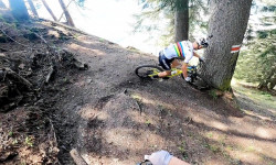
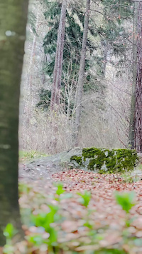
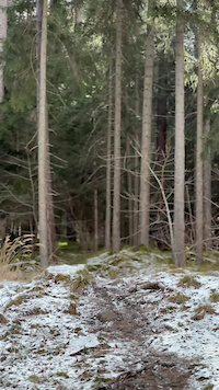
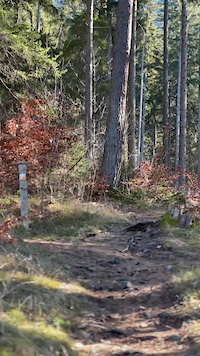
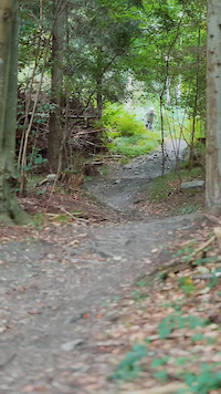
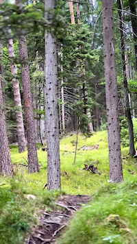
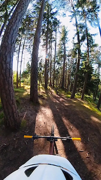
Photos of Chur Mountain Bike
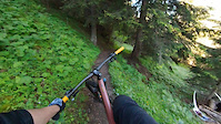
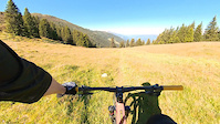
Videos of Chur Mountain Bike
trail: Richtplatz
0:19 |
9 |
Mar 23, 2026
trail: Trimmiser Rüfe Trail
0:11 |
15 |
Feb 16, 2025
trail: GnarlyCharlie
0:20 |
50 |
Feb 3, 2025
trail: Richtplatz
0:16 |
22 |
Aug 26, 2024
trail: Spundis Juchs l
2:52 |
45 |
Aug 27, 2023
trail: Spundis Juchs l
0:35 |
36 |
Aug 27, 2023
trail: Scalära
0:32 |
124 |
Aug 18, 2023
trail: GnarlyCharlie
0:00 |
85 |
Aug 18, 2023
Recent Trail Reports
| status | trail | date | condition | info | user |
|---|---|---|---|---|---|
| Brandrüti Scalära | Jun 2, 2026 @ 5:00pm (Europe/Zurich) Jun 2, 2026 | Ideal | bikefritzel ZO-Biketrails | ||
| FürstenFlow Royale Superiore | Jun 2, 2026 @ 5:00pm (Europe/Zurich) Jun 2, 2026 | Ideal | bikefritzel ZO-Biketrails | ||
| Haldenflash | May 21, 2026 @ 6:30pm (Europe/Vaduz) May 21, 2026 | Dry | trailpapst TRAILFORKS | ||
| Highline | May 21, 2026 @ 6:30pm (Europe/Vaduz) May 21, 2026 | Dry | trailpapst TRAILFORKS | ||
| Mittenberg Freeride | May 21, 2026 @ 6:30pm (Europe/Vaduz) May 21, 2026 | Dry | trailpapst TRAILFORKS | ||
| Steinries | May 21, 2026 @ 6:30pm (Europe/Vaduz) May 21, 2026 | Ideal | trailpapst TRAILFORKS | ||
| Ochsenberg | May 21, 2026 @ 6:30pm (Europe/Vaduz) May 21, 2026 | Dry | trailpapst TRAILFORKS | ||
| Ochsenberg uphill | May 21, 2026 @ 6:30pm (Europe/Vaduz) May 21, 2026 | Ideal | trailpapst TRAILFORKS | ||
| Maiasäss Access | May 21, 2026 @ 6:30pm (Europe/Vaduz) May 21, 2026 | Ideal | trailpapst TRAILFORKS | ||
| Lürlibad Pivot | May 28, 2026 @ 6:33pm (Europe/Vaduz) May 28, 2026 | Dry | trailpapst TRAILFORKS |
Activity Feed
| username | action | type | title | date |
|---|---|---|---|---|
| Ask2100 | wishlist | trail | activity #97263906 | Jun 18, 2026 @ 11:05am 23 hours |
| DanielevZ8jVj | wishlist | route | activity #97169576 | Jun 17, 2026 @ 2:14am 2 days |
| XTAdventures | ridden | trail | activity #97160398 and 1 more | Jun 16, 2026 @ 8:44pm 3 days |
| Olin30hup9 | wishlist | trail | activity #97029136 | Jun 15, 2026 @ 2:28am Jun 15, 2026 |
| fin-tonic | ridden | trail | activity #97001334 and 4 more | Jun 14, 2026 @ 1:37pm Jun 14, 2026 |
Recent Comments
| username | type | title | comment | date |
|---|---|---|---|---|
| trail | Es hat mittlerweile ein paar coole alternative... | Mar 23, 2026 @ 11:16am Mar 23, 2026 | ||
| trail | Ein humorloser Geselle, dieser Trail | Oct 19, 2025 @ 1:43pm Oct 19, 2025 | ||
| trail | Würde de Alternative nicht empfehlen. | Sep 1, 2025 @ 1:37am Sep 1, 2025 | ||
| trail | The top connects to the road via some stairs.... | Jul 18, 2025 @ 1:03pm Jul 18, 2025 | ||
| trail | Very flat and straight. | Jun 1, 2025 @ 6:11am Jun 1, 2025 |
Local Badges
-

Big City Life219 awarded -

10 Black Trails28 awarded -
10 Red Trails30 awarded -

Top 10 Trails0 awarded -

10 Blue Trails137 awarded -

Epic Ride 50k389 awarded
Bike & Skill Parks
| name | type | city | rating |
|---|---|---|---|
| Alpen Bikepark | bike park | Chur | |
| Pumptrack Segnes Chur | skill park | Chur |
Upcoming Local Events
Activity Type Stats
| activitytype | trails | distance | descent | descent distance | total vertical | rating | global rank | state rank | photos | reports | routes | ridelogs |
|---|---|---|---|---|---|---|---|---|---|---|---|---|
| Mountain Bike | 118 | 70 miles | 35,476 ft | 41 miles | 7,297 ft | #1,020 | #9 | 293 | 1,485 | 5 | 7,658 | |
| E-Bike | 118 | 69 miles | 35,072 ft | 41 miles | 7,297 ft | #288 | #40 | 1 | 1,417 | 6 | 1,003 | |
| Gravel Bike | 40 | #1,261 | #10 | 78 | ||||||||
| Adaptive Bike | 20 | #108 | #86 | |||||||||
| Hike | 108 | 62 miles | 27,733 ft | 34 miles | 7,297 ft | #1,185 | #26 | 1 | 1,457 | 2 | 358 | |
| Trail Running | 109 | 62 miles | 27,733 ft | 34 miles | 7,297 ft | #1,033 | #25 | 1,457 | 2 | 384 | ||
| Snowshoe | 1 | 8 | 10 | |||||||||
| Downhill Ski | 3 | 2 miles | 1,847 ft | 2 miles | 1,726 ft | 6 | 19 |
Frequently Asked Questions About Chur
▼
What are the best places to ride in Chur?
Chur has 4 areas to explore for mountain biking. The top rated areas are:
▼
What are the highest rated mountain biking trails in Chur?
The highest rated mountain biking trails in Chur are:
- GnarlyCharlie (4.6/5)
- Antenna Lower (4.5/5)
- Ochsenberg (4.5/5)
- FürstenFlow Royale Superiore (4.5/5)
- Scalära (4.4/5)
▼
What is the best time of the year to ride in Chur?
Based on ride log data, the most popular months to ride in Chur are:
- May (41 activities)
- June (27 activities)
- October (26 activities)
▼
Where can I park to ride in Chur?
There are 6 parking locations listed in Chur. The most popular parking spots are: View all parking and trailhead locations on the map to plan your visit.
Activities
Trails
Points of Interest
- Mittenberg Viewpoint
- Fürhörnli Summit
- Graubünden Tourismus Information
- Spundisköpf 1847m Viewpoint
- Camp Au Chur Camping
- Climbing Garden Haldenstein Sight
- St. Luzi Chapel Sight
- Chur Gondola Bottom Information
- Känzeli Gondola Center Information
- Brambrüesch Gondola Top Information
- Ful Berg (2,344 m)
- Montalin (2,243 m)
- Gromser Chopf (2,217 m)
- By StephaneMarceau
 TRAILFORKS & contributors
 - Admins: Bike Kingdom
- #9223 - 15,053 views
- chur activity log | embed map of Chur mountain bike trails | chur mountain biking points of interest polygons
Downloading of trail gps tracks in kml & gpx formats is enabled for Chur.
You must login to download files.