
close
3D
Trail Conditions
- Unknown
- Snow Groomed
- Snow Packed
- Snow Covered
- Snow Cover Partial
- Freeze/thaw Cycle
- Icy
- Prevalent Mud
- Wet
- Variable
- Ideal
- Dry
- Very Dry
Trail Flow (Ridden Direction)
Trailforks scans users activity logs to determine the most popular direction each trail is ridden. A good flowing trail network will have most trails flowing in a single direction according to their intension.
The colour categories are based on what percentage of users are riding a trail in its intended direction.
The colour categories are based on what percentage of users are riding a trail in its intended direction.
- > 96%
- > 90%
- > 80%
- > 70%
- > 50%
- < 50%
- bi-directional trail
- no data
Trail Last Used
Trailforks scans activity logs to determine the last time a trail was ridden.
- < 2 days
- < 1 week
- < 2 weeks
- < 1 month
- < 6 months
- > 6 months
Trail Ridden Direction
The intended direction a trail should be ridden.
- Downhill Only
- Downhill Primary
- Both Directions
- Uphill Primary
- Uphill Only
- One Direction
Contribute Details
Colors indicate trail is missing specified detail.
- Description
- Photos
- Description & Photos
- Videos
Trail Popularity ?
Trailforks scans activity logs to determine which trails are ridden the most in the last 9 months.
Trails are compared with nearby trails in the same city region with a possible 25 colour shades.
Think of this as a heatmap, more activities = more kinetic energy = warmer colors.
- most popular
- popular
- less popular
- not popular
ATV/ORV/OHV Filter
Max Vehicle Width
inches
US Cell Coverage
Legend

Radar Time
Activity Recordings
Trailforks uses anonymized public activity data.
?
Activity Recordings
Trailforks uses anonymized public activity data.
?
Winter Trails
Warning
A routing network for winter maps does not exist. Selecting trails using the winter trails layer has been disabled.
Missing Trails
Most Popular
Least Popular
Trails are colored based on popularity. The more popular a trail is, the more red. Less popular trails trend towards green.
Jump Magnitude Heatmap
Heatmap of where users jump on trails. Zoom in to see individual jumps, click circles to view jump details.
BC Backroad Status
![map legend]()
Service Road Atlas is a free to use, community-driven service for viewing and creating reports on the numerous back-country service roads around B.C. and Alberta.

Slope Aspect
Direction the slope faces
Trails Deemphasized
Trails are shown in grey.
Only show trails with no bike usage.
Suggested Layers
Based on selected activity type
Save the current map location and zoom level as your default home location whenever this page is loaded.
Save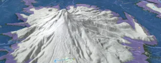
Snow & Rain 3D forecast Pro
See where it will snow, sleet or rain on Cloudcroft hour by hour, on 3D terrain.
View 3D snow forecast
High elevation, mix conifer and aspen with lots of steep and rocky trails leading out of and around the mountain Village of Cloudcroft NM. Big Elevation change down to the desert of the Tularosa Basin is possible, 4000ft Large views of White Sands National Monument along the Rim Trail. Home of the High Altitude Classic!
Trail info last updated
Activities Click to view
- Mountain Bike
63 trails
- E-Bike
45 trails
- Gravel Bike
31 trails
- Adaptive Bike
15 trails
- Winter Fat Bike
3 trails
- Horse
47 trails
- Hike
67 trails
- Trail Running
67 trails
- Dirtbike/Moto
31 trails
- Observed Trials
20 trails
- ATV/ORV/OHV
27 trails
- Downhill Ski
28 trails
Region Details
- 14
- 3
- 10
- 4
Region Status
Open as of Oct 12, 2026Gravel Bike Stats
- Global Ranking
- #764
- State Ranking
- #5
- Trails (view details)
- 31
- Trails Mountain Bike
- 63
- Trails E-Bike
- 45
- Trails Gravel Bike
- 31
- Trails Adaptive Bike
- 15
- Trails Winter Fat Bike
- 3
- Trails Horse
- 47
- Trails Hike
- 67
- Trails Trail Running
- 67
- Trails Dirtbike/Moto
- 31
- Trails Observed Trials
- 20
- Trails ATV/ORV/OHV
- 27
- Trails Downhill Ski
- 28
- Total Distance
- 124 miles
- Total Descent Distance
- 64 miles
- Total Descent
- 16,837 ft
- Total Vertical
- 3,776 ft
- Reports
- 9
- Completed Counter
- 6
Popular Cloudcroft Gravel Biking Trails
• 5 ★ 0.0 • 3,852 ft • 0 ft •
The Old Sunspot Hwy Trail is 0.7 miles long. It begins at the end of Forest Road 5009 (Water Canyon) and ends at the junction of NM6563 and Forest Road 64. The trail is open for the following uses: Hiking, Horseback Riding, Mountain...
• 5 ★ 0.0 • 4,388 ft • 139 ft •
The Benson Canyon Spur Trail is a short 0.8 miles loop trail amongst the Benson Canyon area trails.
• 5 ★ 5.0 • 4 miles • 271 ft •
Southern most loop from the Rim Road to the rim's edge. Several short out-and-back excursions, and a ton of black diamond and double black cattle trails. Excellent spot for the backdrop brah photograhs.
• 5 ★ 5.0 • 2 miles • 14 ft •
Another fast and open downhill in the Crooked Canyon trail system, This one connects to the South Crooked Canyon trail.
• 5 ★ 0.0 • 3 miles • 1,121 ft •
The Benson Ridge / Bluff Springs trail is 2.3 miles long. It begins at Forest Road 5007 and ends at Forest Road 5597B. The trail is open for the following uses: Hiking, Horseback Riding, Mountain Biking, Motorcycle Trail Riding, Off...
• 5 ★ 5.0 • 5 miles • 248 ft •
A sweet loop through Artesia Group evaporites and siltstone that has lots of rocky sections and side runs of technical trail features.
• 5 ★ 4.5 • 5 miles • 47 ft •
A longer downhill that ends on the Crooked Canyon trail.
Photos of Cloudcroft
Videos of Cloudcroft

mtb
7:45 |
395 |
Oct 3, 2022
mtb
9:55 |
404 |
Jul 9, 2022
Recent Trail Reports
| status | trail | date | condition | info | user |
|---|---|---|---|---|---|
| Benson Ridge / Bluff Springs Trail | Oct 12, 2026 @ 5:09pm (America/Denver) Oct 12, 2026 | Unknown | LonMirll | ||
| Water Canyon Road | Oct 12, 2026 @ 5:09pm (America/Denver) Oct 12, 2026 | Unknown | LonMirll | ||
| Willie White East | Oct 12, 2026 @ 4:57pm (America/Denver) Oct 12, 2026 | Unknown | LonMirll | ||
| Wave Site | Oct 11, 2026 @ 10:28am (America/Denver) Oct 11, 2026 | Unknown | Hagemann1704 | ||
| West Side Road | Jul 31, 2026 @ 12:27pm (America/Denver) Jul 31, 2026 | Unknown | CharlescrviJu | ||
| Coats Peak | Mar 30, 2025 @ 11:15am Mar 30, 2025 | Dry | Roadwarriorxo | ||
| Last Chance Canyon | Mar 29, 2025 @ 10:57am Mar 29, 2025 | Dry | Roadwarriorxo | ||
| Trail 5510 | Mar 29, 2025 @ 10:57am Mar 29, 2025 | Dry | Roadwarriorxo | ||
| Crooked Canyon | Apr 23, 2018 @ 4:18pm Apr 23, 2018 | Dry | Honda1262 |
Activity Feed
| username | action | type | title | date |
|---|---|---|---|---|
| Bskied | wishlist | trail | activity #107990854 | Nov 18, 2026 @ 8:44am 1 day |
| shredskitt | wishlist | region | activity #107498607 | Nov 9, 2026 @ 10:56am Nov 9, 2026 |
| LonMirll | comment | report | activity #105778199 | Oct 12, 2026 @ 4:06pm Oct 12, 2026 |
| LonMirll | add | report | activity #105777972 and 6 more | Oct 12, 2026 @ 4:03pm Oct 12, 2026 |
| Hagemann1704 | add | report | activity #105688598 | Oct 11, 2026 @ 9:28am Oct 11, 2026 |
Recent Comments
| username | type | title | comment | date |
|---|---|---|---|---|
| report | Willie White East is open Posted NO Overnight... | Oct 12, 2026 @ 4:06pm Oct 12, 2026 | ||
| trail | Ride this down. Going up from Karr Canyon road... | Sep 1, 2023 @ 4:35am Sep 1, 2023 | ||
| trail | Not single track. Lots of moo cows. Baby head... | Sep 30, 2020 @ 6:12pm Sep 30, 2020 |
Activity Type Stats
| activitytype | trails | distance | descent | descent distance | total vertical | rating | global rank | state rank | photos | reports | routes | activity logs |
|---|---|---|---|---|---|---|---|---|---|---|---|---|
| Mountain Bike | 63 | 208 miles | 33,875 ft | 113 miles | 3,799 ft | #1,430 | #12 | 16 | 28 | 9 | 1,034 | |
| E-Bike | 45 | 187 miles | 28,822 ft | 99 miles | 3,799 ft | #1,058 | #15 | 23 | 26 | |||
| Gravel Bike | 31 | 124 miles | 16,837 ft | 64 miles | 3,776 ft | #764 | #5 | 9 | 8 | |||
| Adaptive Bike | 15 | 84 miles | 8,658 ft | 40 miles | 3,074 ft | #1,245 | #5 | 7 | ||||
| Winter Fat Bike | 3 | 30 miles | 4,081 ft | 15 miles | 1,804 ft | #1,897 | #10 | 5 | ||||
| Horse | 47 | 147 miles | 26,594 ft | 79 miles | 2,513 ft | #305 | #11 | 14 | ||||
| Hike | 67 | 213 miles | 35,023 ft | 116 miles | 3,799 ft | #1,199 | #14 | 2 | 28 | 319 | ||
| Trail Running | 67 | 213 miles | 35,023 ft | 116 miles | 3,799 ft | #911 | #8 | 4 | 28 | 68 | ||
| Dirtbike/Moto | 31 | 103 miles | 19,656 ft | 57 miles | 2,326 ft | #490 | #4 | 12 | 7 | |||
| Observed Trials | 20 | 80 miles | 11,601 ft | 41 miles | 2,513 ft | #171 | #3 | 5 | ||||
| ATV/ORV/OHV | 27 | 93 miles | 16,289 ft | 50 miles | 2,513 ft | #383 | #3 | 13 | ||||
| Downhill Ski | 28 | 5 miles | 3,363 ft | 5 miles | 591 ft | #644 | #9 | 2 |
Frequently Asked Questions
▼
What are the best places to ride in Cloudcroft?
Cloudcroft has 3 areas to explore for gravel biking. The top rated areas are:
▼
What are the highest rated gravel biking trails in Cloudcroft?
The highest rated gravel biking trails in Cloudcroft are:
- Razor's Edge (0/5)
- Crooked Canyon (0/5)
- Crooked Water Tank Downhill (0/5)
- Last Chance Canyon (0/5)
- Trail 5510 (0/5)
▼
What is the best time of the year to ride in Cloudcroft?
Based on activity log data, the most popular months to ride in Cloudcroft are:
- May (5 activities)
- July (1 activities)
- April (1 activities)
▼
Where can I park to ride in Cloudcroft?
There are 4 parking locations listed in Cloudcroft. The most popular parking spots are: View all parking and trailhead locations on the map to plan your visit.
▼
What is the longest trail in Cloudcroft?
The longest trail in Cloudcroft is Razor's Edge at 8.9 miles. View all trails sorted by distance.
▼
What are the best & highest rated hiking trails in Cloudcroft?
The best hiking trails in Cloudcroft are: View all hiking trails sorted by popularity score.
▼
What are the best & highest rated trail running trails in Cloudcroft?
The best trail running trails in Cloudcroft are: View all trail running trails sorted by popularity score.
▼
What are the best & highest rated dirtbiking trails in Cloudcroft?
The best dirtbiking trails in Cloudcroft are: View all dirtbiking trails sorted by popularity score.
▼
How many trails are in Cloudcroft?
Cloudcroft has a total of 95 trails. Of those, 31 are designated for gravel biking. Browse top gravel biking trails in Cloudcroft to find detailed information including difficulty ratings, distances, and trail conditions.
▼
Which trail has the most elevation gain in Cloudcroft?
The trail with the most elevation gain in Cloudcroft is Benson Ridge / Bluff Springs Trail with 1,121 ft of elevation gain. View all trails sorted by elevation gain.
▼
Which trail has the most elevation descent in Cloudcroft?
The trail with the most elevation descent in Cloudcroft is Razor's Edge with 1,091 ft of elevation descent. View all trails sorted by elevation descent.
▼
What activities are most popular in Cloudcroft?
Cloudcroft supports the following activities: Mountain Biking, E-Biking, Gravel Biking, Adaptive Biking, Winter Fat Biking, Horseback, Hiking, Trail Running, Dirtbiking, Observed Trials, ATVing/Offroading, Skiing.
▼
What are the steepest gravel biking trails in Cloudcroft?
The steepest gravel biking trail in Cloudcroft is Corral Canyon Trail with an average grade of 12.3%. View all trails sorted by grade.
▼
Are there any trails with scenic viewpoints in Cloudcroft?
Yes, there are 2 scenic viewpoints marked along trails in Cloudcroft. Some popular viewpoints include: Explore more points of interest to find trails with the best views.
▼
Are the trails open in Cloudcroft?
The overall region status for Cloudcroft is Clear / Green. Out of 4 trails:
- Clear / Green: 1
- Closed: 3
▼
What is the highest summit in Cloudcroft?
The highest summit in Cloudcroft is Cathey Peak at 9,652 ft elevation.
▼
What trails are closed in Cloudcroft?
There are currently 3 closed trails in Cloudcroft. The breakdown of all trail statuses is:
- Clear / Green: 1
- Closed: 3
▼
Are there accessible or adaptive trails in Cloudcroft?
Yes, there are 15 accessible/adaptive trails in Cloudcroft. View all adaptive trails in Cloudcroft for specific accessibility information.
▼
What are the most popular gravel biking trails in Cloudcroft?
The most popular gravel biking trails in Cloudcroft are: View all gravel biking trails sorted by popularity.
Activities
- Cloudcroft Mountain Biking Trails
- Cloudcroft E-Biking Trails
- Cloudcroft Gravel Biking Trails
- Cloudcroft Adaptive Biking Trails
- Cloudcroft Horseback Trails
- Cloudcroft Hiking Trails
- Cloudcroft Trail Running Trails
- Cloudcroft Dirtbiking Trails
- Cloudcroft Observed Trials Trails
- Cloudcroft ATVing/Offroading Trails
- Cloudcroft Skiing Trails
Trails
Points of Interest
- Bluff Springs Campground Camping
- Mexico Canyon Railroad Trestle Sight
- Trestle Observation Deck Viewpoint
- Pines Campground Camping
- Tularosa Basin Overlook Viewpoint
- Silver Campground Camping
- Saddle Campground Camping
- Apache Campground Camping
- L Lodge
- Cathey Peak (9,652 ft)
- Sacramento Peak (9,249 ft)
- Prestridge Hill (8,655 ft)
- By Geochemistry & contributors
- Admins: apply
- #20572 - 6,939 views
- cloudcroft activity log | embed map of Cloudcroft mountain bike trails | cloudcroft mountain biking points of interest
Downloading of trail gps tracks in kml & gpx formats is enabled for Cloudcroft.
You must login to download files.
