close
-
Layers w
- Weather Layers
- Pro
- Pro
- Pro
- Pro
- Pro
- Pro
- More Layers
- Pro
- Pro
- Pro
- Pro
-
Upgrade to

3D
Trail Conditions
- Unknown
- Snow Groomed
- Snow Packed
- Snow Covered
- Snow Cover Partial
- Freeze/thaw Cycle
- Icy
- Prevalent Mud
- Wet
- Variable
- Ideal
- Dry
- Very Dry
Trail Flow (Ridden Direction)
Trailforks scans users ridelogs to determine the most popular direction each trail is ridden. A good flowing trail network will have most trails flowing in a single direction according to their intension.
The colour categories are based on what percentage of riders are riding a trail in its intended direction.
The colour categories are based on what percentage of riders are riding a trail in its intended direction.
- > 96%
- > 90%
- > 80%
- > 70%
- > 50%
- < 50%
- bi-directional trail
- no data
Trail Last Ridden
Trailforks scans ridelogs to determine the last time a trail was ridden.
- < 2 days
- < 1 week
- < 2 weeks
- < 1 month
- < 6 months
- > 6 months
Trail Ridden Direction
The intended direction a trail should be ridden.
- Downhill Only
- Downhill Primary
- Both Directions
- Uphill Primary
- Uphill Only
- One Direction
Contribute Details
Colors indicate trail is missing specified detail.
- Description
- Photos
- Description & Photos
- Videos
Trail Popularity ?
Trailforks scans ridelogs to determine which trails are ridden the most in the last 9 months.
Trails are compared with nearby trails in the same city region with a possible 25 colour shades.
Think of this as a heatmap, more rides = more kinetic energy = warmer colors.
- most popular
- popular
- less popular
- not popular
ATV/ORV/OHV Filter
Max Vehicle Width
inches
US Cell Coverage
Legend

Radar Time
Activity Recordings
Trailforks uses anonymized public activity data.
?
Activity Recordings
Trailforks uses anonymized public activity data.
?
Personal Heatmap
▶
Activity Types
all
/
none
▶
Options
2
Date range
month
–
Winter Trails
Warning
A routing network for winter maps does not exist. Selecting trails using the winter trails layer has been disabled.
Missing Trails
Most Popular
Least Popular
Trails are colored based on popularity. The more popular a trail is, the more red. Less popular trails trend towards green.
Jump Magnitude Heatmap
Heatmap of where riders jump on trails. Zoom in to see individual jumps, click circles to view jump details.
BC Backroad Status
![map legend]()
Service Road Atlas is a free to use, community-driven service for viewing and creating reports on the numerous back-country service roads around B.C. and Alberta.

Slope Aspect
Direction the slope faces
Trails Deemphasized
Trails are shown in grey.
Only show trails with no bike usage.
Suggested Layers
Based on selected activity type
Save the current map location and zoom level as your default home location whenever this page is loaded.
SaveCollie is a growing Mountain Bike Trails destination that is well worth a visit.
Just under 2 hour drive from Perth.
There are currently a good range of trails in the area:
- Pocket park trails close to the CBD
- Munda Biddi MTB Touring Trail stop (Munda Biddi Trail runs from Perth all the way to Albany - over 1000km of trail),
- Arklow Trail Network 4km North of Collie (can be accessed via riding out on the Munda Biddi from the local visitors centre / CBD) or drive out to one of the trail head car parks.
- Trails at Wellington National Park / Mt Lennard Trail Circuit West of town (can drive out or [Long] ride out via Munda Biddi Trail)
- There are more trails in development - The Western Australian Government is spending over $10 Million on Trails in the Collie Area between 2019 and 2023
The trails (as at 2021) are predominantly green and blue over rolling terrain - so limited jumps/big flow trail - but this type of trail is being planned (or otherwise pop up to the Dwellingup Trail Network 50km North of Collie). The green and blue trails are built to a high standard and are great for all riders from family/beginner to the competitive trail and cross country rider.
Collie has a really good range of amenities - accomodation - retail - supermarkets (7 day trading) - excellent bicycle shop/repairs service - helpful visitors centre - trail shuttling service - hospital - dentists - and more!
You can check out the "Collie MTB Club" facebook page, and also check out "Social MTB Rides (Collie)" on facebook for local trail / ride information.
In planning for 2021/22/23 is another 60+ km of trails, a big pump/jump/skills park... so visit and enjoy - and come back again to check out the new trails as they are built!
We would highly recommend an extended 'Road Trip' if visiting from interstate and Spend a couple of days in the Perth Hills, couple of Days in Dwellingup, three of four days in Collie/Wellington National Park, then head down south and ride in Pemberton / Nannup and then head back via Margaret River / Dwellingup. If you are visiting from interstate - welcome and enjoy learning how to ride on many of our 'Pea Gravel' Trails !
Enjoy riding in WA!
Activities Click to view
- Mountain Bike
82 trails
- E-Bike
75 trails
- Gravel Bike
38 trails
- Adaptive Bike
18 trails
- Winter Fat Bike
5 trails
- Hike
27 trails
- Trail Running
28 trails
Region Details
- 5
- 2
- 34
- 35
- 5
- 1
Region Status
Open as of Jun 24, 2026Stats
- Avg Trail Rating
- Trails (view details)
- 83
- Trails Mountain Bike
- 82
- Trails E-Bike
- 75
- Trails Gravel Bike
- 38
- Trails Adaptive Bike
- 18
- Trails Winter Fat Bike
- 5
- Trails Horse
- 1
- Trails Hike
- 27
- Trails Trail Running
- 28
- Total Distance
- 145 miles
- Total Descent
- 13,598 ft
- Total Vertical
- 847 ft
- Highest Trailhead
- 1,155 ft
- Reports
- 525
- Photos
- 143
- Ridden Counter
- 10,639
Sub Regions
-
Arklow
- 7
- 8
-
Mornington Adventure Camp
- 3
-
South Collie
- 2
- 5
- 8
-
Wellington National Park
- 9
- 16
- 4
- 1
Popular Collie Mountain Biking Trails
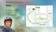
• 90 ★ 4.5 • 4,075 ft • 240 ft • 406 •
A cross-country climb with some tight, spectacular switchbacks, creek crossings, and lichen and moss-covered boulders. This trail winds its way from the on the Collie River up to the and then it’s a short ride to the carpark where you...
• 90 ★ 4.8 • 2 miles • 111 ft • 396 •
This flowing roller coaster-like cross-country trail starts with a bit of a climb, but rewards you with its sweet berms and rollers, making you yahoo and whoopee all the way down. If you really like it, there are two loopback options...
• 70 ★ 3.8 • 2 miles • 178 ft • 359 •
The original is the second oldest trail in this area (with being the first). It is one of the most used trails as it is an access trail to other trails in the area. The trail is narrow traditional singletrack, the surface is generally...
• 60 ★ 2.9 • 4 miles • 286 ft • 354 •
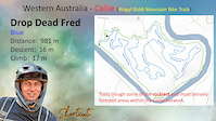
This blue trail has optional black features and alternate lines. It will take you south over some top-notch table-top jumps and an unforgettable optional log ride with some sections of fast flowing descent.
• 50 ★ 3.7 • 5 miles • 421 ft • 345 •
Located north of Collie in the Arklow Trail Network, is an 'old school' narrow, technical track with lots of twists and turns. The trail runs in a clockwise direction. The first few kilometres are mainly flat (and twisty) before some...
• 80 ★ 4.0 • 3,629 ft • 11 ft • 344 •
A descending trail to the river that starts with some rock gardens and jumpable double rollers. This trail has some exciting half pipe switchbacks criss-crossing a very steep gully. Not for the faint hearted!
• 100 ★ 5.0 • 1 mile • 115 ft • 344 •
Van Dam is a trail built as part of the Wambenger Trails Project for the Collie - Wellington region and is the first of the new trails to be opened in the Wellington National Park / Wellington Dam Precinct. It is a green trail with two...
Collie Mountain Bike Routes
6 miles • 597 ft • 2 • Loop •
This trail is a relatively easy walk through a forest of marri, jarrah and blackbutt. It is also a...
5 miles • 351 ft • 1 •
Arklow Adaptive is a 9.2 km, hand cycle friendly green loop, in the Arklow Network near Collie, just two...
13 miles • 1,039 ft • 7 • Loop •
Enjoy a loop of the best sections of Arklow compiled into a 20k ride.
4 miles • 391 ft • 0 •
Use the new connection to get from Pile Rd to Honeymmon Pool
★ 5.0 • 27 miles • 1,161 ft • 1 • Loop • Race •
Hi All! This is the first lap of the 90km Collie River MTB Marathon for 2024 - we've structured this loop...
25 miles • 1,454 ft • 6 • Loop • Race •
50km Course for the Synergy Collie River MTB Marathon event on the 13th July 2024. It'll be a great day -...
Photos of Collie Mountain Bike
Videos of Collie Mountain Bike
trail: Kylie Trail
2:04 |
25 |
Feb 21, 2025
trail: Sprocket's Rocket
2:06 |
6 |
Feb 19, 2025

trail: Marri Meander
3:34 |
4 |
Feb 19, 2025
trail: Drop Dead Fred
4:25 |
14 |
Feb 19, 2025
trail: Rocky Horror
6:37 |
12 |
Feb 19, 2025
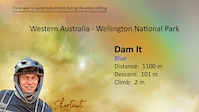
trail: Dam It
3:29 |
38 |
Feb 19, 2025
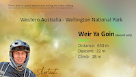
trail: Weir Ya Goin'
0:32 |
14 |
Dec 28, 2024

trail: Big Dipper
4:28 |
21 |
Dec 28, 2024
Recent Trail Reports
| status | trail | date | condition | info | user |
|---|---|---|---|---|---|
| Kylie Trail | Jun 25, 2026 @ 6:21am (Australia/Perth) Jun 24, 2026 | Variable | XandaPanda | ||
| Pet Cemetery | Jun 9, 2026 @ 8:30am (Australia/Perth) Jun 8, 2026 | Variable | Chappy-55 CMTBA | ||
| Munda Biddi - Myles Av To Collie | Jun 9, 2026 @ 8:27am (Australia/Perth) Jun 8, 2026 | Dry | Chappy-55 CMTBA | ||
| Kylie Came Back | Jun 4, 2026 @ 11:33am (Australia/Perth) Jun 3, 2026 | Variable | XandaPanda | ||
| Deadcats Trail | Jun 3, 2026 @ 9:09am (Australia/Perth) Jun 2, 2026 | Variable | Chappy-55 CMTBA | ||
| Arklow Adaptive - Ashcroft | Jun 3, 2026 @ 9:09am (Australia/Perth) Jun 2, 2026 | Variable | Chappy-55 CMTBA | ||
| Arklow Adaptive - Dufton Trail | Jun 3, 2026 @ 9:09am (Australia/Perth) Jun 2, 2026 | Variable | Chappy-55 CMTBA | ||
| Mornington Glory | Jun 3, 2026 @ 9:09am (Australia/Perth) Jun 2, 2026 | Variable | Chappy-55 CMTBA | ||
| Cash Out | May 22, 2026 @ 11:11am (Australia/Perth) May 21, 2026 | Wet | Chappy-55 CMTBA | ||
| Collie to Minningup Path | May 17, 2026 @ 8:37am (Australia/Perth) May 16, 2026 | Ideal | MeganReynolds4 |
Activity Feed
| username | action | type | title | date |
|---|---|---|---|---|
| V3HhrO | ridden | trail | activity #98049317 | Jun 29, 2026 @ 12:56am 19 hours |
| LukeNardini | wishlist | trail | activity #98045931 | Jun 28, 2026 @ 10:49pm 21 hours |
| D4oaOw | ridden | trail | activity #97747547 and 6 more | Jun 24, 2026 @ 9:53pm Jun 24, 2026 |
| XandaPanda | add | report | activity #97727142 and 1 more | Jun 24, 2026 @ 3:18pm Jun 24, 2026 |
| sweatytechie | add | trail | activity #97673678 and 2 more | Jun 23, 2026 @ 9:03pm Jun 23, 2026 |
Recent Comments
| username | type | title | comment | date |
|---|---|---|---|---|
| trail | The Watcher is a janky, rough, old-school XC... | Jun 10, 2026 @ 7:37pm Jun 10, 2026 | ||
| trail | Is there another way up? Because no way in all... | Dec 16, 2025 @ 5:52am Dec 16, 2025 | ||
| trail | This is proper steep in sections. It is almost... | Oct 14, 2025 @ 5:46am Oct 14, 2025 | ||
| trail | -58.6%, especially on a loose, eroded pea... | Oct 14, 2025 @ 5:41am Oct 14, 2025 | ||
| trail | Good old school single-track that's... | Oct 5, 2025 @ 4:40am Oct 5, 2025 |
Local Badges
-

Epic Ride Climb 2k21 awarded -

Climbing 10k Badge29 awarded -

Climbing 100k Badge2 awarded -

Epic Ride Descent 2k21 awarded -

Descent 10k Badge29 awarded -

Descent 100k Badge2 awarded
Activity Type Stats
| activitytype | trails | distance | descent | descent distance | total vertical | rating | global rank | state rank | photos | reports | routes | ridelogs |
|---|---|---|---|---|---|---|---|---|---|---|---|---|
| Mountain Bike | 82 | 143 miles | 13,409 ft | 56 miles | 846 ft | #1,031 | #57 | 131 | 525 | 24 | 9,437 | |
| E-Bike | 75 | 106 miles | 12,113 ft | 45 miles | 846 ft | #587 | #50 | 11 | 506 | 22 | 1,191 | |
| Gravel Bike | 38 | 37 miles | 2,792 ft | 14 miles | 423 ft | #86 | #82 | 1 | 35 | 5 | 41 | |
| Adaptive Bike | 18 | 35 miles | 974 ft | 10 miles | 538 ft | #76 | #124 | 50 | 1 | |||
| Winter Fat Bike | 5 | 29 miles | 410 ft | 8 miles | 440 ft | #74 | #69 | 9 | ||||
| Horse | 1 | 29 miles | 410 ft | 8 miles | 440 ft | 26 | 1 | |||||
| Hike | 27 | 73 miles | 3,963 ft | 26 miles | 830 ft | #2,368 | #70 | 413 | 2 | 116 | ||
| Trail Running | 28 | 74 miles | 4,078 ft | 27 miles | 830 ft | #1,912 | #54 | 413 | 2 | 231 |
Frequently Asked Questions About Collie
▼
What are the best places to ride in Collie?
Collie has 4 areas to explore for mountain biking. The top rated areas are:
▼
What are the highest rated mountain biking trails in Collie?
The highest rated mountain biking trails in Collie are:
- Big Dipper (4.4/5)
- Elixir (4.3/5)
- Van Dam (4.2/5)
- Kylie Trail (4.2/5)
- Scull (4.2/5)
▼
What is the best time of the year to ride in Collie?
Based on ride log data, the most popular months to ride in Collie are:
- October (65 activities)
- July (65 activities)
- November (64 activities)
▼
Where can I park to ride in Collie?
There are 9 parking locations listed in Collie. The most popular parking spots are: View all parking and trailhead locations on the map to plan your visit.
Activities
Trails
Points of Interest
- By Jake-Hannah
 MPTA & contributors
 - Admins: MTBWA, CMTBA
- #5961 - 29,219 views
- collie activity log | embed map of Collie mountain bike trails | collie mountain biking points of interest
Downloading of trail gps tracks in kml & gpx formats is enabled for Collie.
You must login to download files.