close
-
Layers w
- Weather Layers
- Pro
- Pro
- Pro
- Pro
- Pro
- Pro
- More Layers
- Pro
- Pro
- Pro
- Pro
-
Upgrade to

3D
Trail Conditions
- Unknown
- Snow Groomed
- Snow Packed
- Snow Covered
- Snow Cover Partial
- Freeze/thaw Cycle
- Icy
- Prevalent Mud
- Wet
- Variable
- Ideal
- Dry
- Very Dry
Trail Flow (Ridden Direction)
Trailforks scans users ridelogs to determine the most popular direction each trail is ridden. A good flowing trail network will have most trails flowing in a single direction according to their intension.
The colour categories are based on what percentage of riders are riding a trail in its intended direction.
The colour categories are based on what percentage of riders are riding a trail in its intended direction.
- > 96%
- > 90%
- > 80%
- > 70%
- > 50%
- < 50%
- bi-directional trail
- no data
Trail Last Ridden
Trailforks scans ridelogs to determine the last time a trail was ridden.
- < 2 days
- < 1 week
- < 2 weeks
- < 1 month
- < 6 months
- > 6 months
Trail Ridden Direction
The intended direction a trail should be ridden.
- Downhill Only
- Downhill Primary
- Both Directions
- Uphill Primary
- Uphill Only
- One Direction
Contribute Details
Colors indicate trail is missing specified detail.
- Description
- Photos
- Description & Photos
- Videos
Trail Popularity ?
Trailforks scans ridelogs to determine which trails are ridden the most in the last 9 months.
Trails are compared with nearby trails in the same city region with a possible 25 colour shades.
Think of this as a heatmap, more rides = more kinetic energy = warmer colors.
- most popular
- popular
- less popular
- not popular
ATV/ORV/OHV Filter
Max Vehicle Width
inches
US Cell Coverage
Legend

Radar Time
Activity Recordings
Trailforks uses anonymized public activity data.
?
Activity Recordings
Trailforks uses anonymized public activity data.
?
Personal Heatmap
▶
Activity Types
all
/
none
▶
Options
2
Date range
month
–
Winter Trails
Warning
A routing network for winter maps does not exist. Selecting trails using the winter trails layer has been disabled.
Missing Trails
Most Popular
Least Popular
Trails are colored based on popularity. The more popular a trail is, the more red. Less popular trails trend towards green.
Jump Magnitude Heatmap
Heatmap of where riders jump on trails. Zoom in to see individual jumps, click circles to view jump details.
BC Backroad Status
![map legend]()
Service Road Atlas is a free to use, community-driven service for viewing and creating reports on the numerous back-country service roads around B.C. and Alberta.

Slope Aspect
Direction the slope faces
Trails Deemphasized
Trails are shown in grey.
Only show trails with no bike usage.
Suggested Layers
Based on selected activity type
Save the current map location and zoom level as your default home location whenever this page is loaded.
Save
No description for Como has been added yet!
Login or register to submit one.
This region uses the Uk/Euro style trail grading system.
Activities Click to view
- Mountain Bike
64 trails
- E-Bike
58 trails
- Adaptive Bike
0 trails
- Winter Fat Bike
0 trails
- Horse
2 trails
- Hike
59 trails
- Trail Running
59 trails
Region Details
- 7
- 5
- 20
- 17
Region Status
Open as of Jun 27, 2026Stats
- Avg Trail Rating
- Trails (view details)
- 62
- Trails Mountain Bike
- 64
- Trails E-Bike
- 58
- Trails Horse
- 2
- Trails Hike
- 59
- Trails Trail Running
- 59
- Trails Snowshoe
- 1
- Trails Backcountry Ski
- 1
- Total Distance
- 71 miles
- Total Descent
- 33,593 ft
- Total Vertical
- 4,600 ft
- Highest Trailhead
- 5,349 ft
- Reports
- 1,476
- Photos
- 77
- Ridden Counter
- 8,504
Sub Regions
-
Monte Bisbino
- 6
- 7
-
Spina Verde
- 3
- 9
- 6
- 1
-
Triangolo Lariano
- 2
- 5
- 3
Popular Como Mountain Biking Trails
• 100 ★ 3.5 • 1,070 ft • 54 ft • 484 •
Accesso al bellissimo punto panoramico del Pin Umbrela. All'inizio ripido strappo su selciata dal fondo variabile (variante singletrack sulla destra, non meno faticosa ma su fondo generalmente pulito), poi spiana e in breve si arriva a...
• 95 ★ 4.5 • 1 mile • 6 ft • 382 •
Iconic and very popular downhill only track, it's pure flow. Tight turns, short steep sections, it isn't really difficult but some points in the bottom part are exposed. A little step up close to a tibetan bridge divides the top part to...
• 100 ★ 4.4 • 2,362 ft • 3 ft • 338 •
Trail flow caratterizzato dalla presenza di diversi drop/salti con relative chicken-line.
• 90 ★ 4.6 • 2 miles • 302 ft • 335 •
Uno dei più suggestivi sentieri del circondario. Meglio se percorso nella stagione asciutta o in autunno per i colori. E' esposto prevalentemente a nord, può presentare residui di nevicate anche se le montagne intorno non presentano...
• 90 ★ 4.7 • 4,400 ft • 5 ft • 330 •
Natural single track with some jumps and tight switbacks
• 95 ★ 4.3 • 3,271 ft • 0 ft • 311 •
Highly rated popular blue difficulty alpine singletrack. This mountain bike primary trail can be used downhill only. It features berm. On average it takes 8 minutes to complete this trail.
Como Mountain Bike Routes
★ 5.0 • 14 miles • 4,071 ft • 6 • Loop •
Salita prevalentemente in fuori strada, molto bella ed impegnativa con pendenze importanti soprattutto...
★ 4.0 • 21 miles • 4,158 ft • 1 •
Bel tour che unisce tre trail molto divertenti
10 miles • 2,219 ft • 3 •
Si parcheggia in zona cimitero di Monte Olimpino. Dopo un breve tratto sulla strada principale si devia in...
★ 4.0 • 15 miles • 3,836 ft • 2 •
Tour che unisce due bellissimi trail, il primo quasi tutto su roccia il secondo molto ripido e flow con...
★ 2.0 • 10 miles • 2,504 ft • 3 •
Giro che unisce due discese AM/Enduro che partono dal Pin Umbrela. Giro facilmente estendibile con...
Photos of Como Mountain Bike
Videos of Como Mountain Bike
trail: Monte Olimpino DH
3:55 |
491 |
Jul 22, 2017
trail: Monte Olimpino DH
2:25 |
635 |
Mar 12, 2017

trail: Black Snake
11:16 |
9 |
Jun 24, 2026 , Como
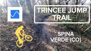
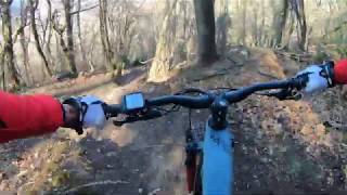
trail: Trincee Jump Trail
6:30 |
9 |
Jun 24, 2026 , Como
trail: Sentiero Confinale Basso
5:39 |
25 |
Apr 10, 2026 , Como
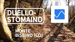
trail: Duello-Stomaino
18:01 |
43 |
Jan 13, 2026 , Como
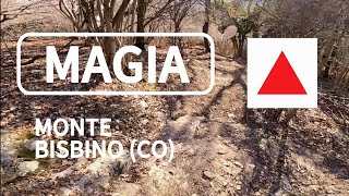
trail: Magia
13:00 |
65 |
Jan 12, 2026 , Como
trail: Magia
7:17 |
75 |
Oct 11, 2025 , Como
Current Trail Warnings
| status | trail | date | condition | user | info |
|---|---|---|---|---|---|
| BLine | Jun 20, 2026 @ 3:22pm (Europe/Rome) Jun 20, 2026 | Variable | bas79 | Sentiero abbandonato, pieno di foglie e... |
Recent Trail Reports
| status | trail | date | condition | info | user |
|---|---|---|---|---|---|
| La Ponte 2019 | Jun 28, 2026 @ 8:52am (Europe/Vaduz) Jun 27, 2026 | Ideal | Beppemtbendu | ||
| Risalita al Pin Umbrela | Jun 28, 2026 @ 8:52am (Europe/Vaduz) Jun 27, 2026 | Ideal | Beppemtbendu | ||
| Black Snake | Jun 28, 2026 @ 8:52am (Europe/Vaduz) Jun 27, 2026 | Ideal | Beppemtbendu | ||
| Trincee Jump Trail | Jun 28, 2026 @ 8:52am (Europe/Vaduz) Jun 27, 2026 | Ideal | Beppemtbendu | ||
| Pino | Jun 28, 2026 @ 8:52am (Europe/Vaduz) Jun 27, 2026 | Ideal | Beppemtbendu | ||
| Corta | Jun 28, 2026 @ 8:52am (Europe/Vaduz) Jun 27, 2026 | Ideal | Beppemtbendu | ||
| Traversata Delle Bocchette (Dorsale Lariana) | Jun 27, 2026 @ 8:21am (Europe/Rome) Jun 26, 2026 | Ideal | 31alex80 | ||
| Radici nel Bosco Trail | Jun 20, 2026 @ 3:23pm (Europe/Rome) Jun 20, 2026 | Ideal | bas79 | ||
| Monte Olimpino DH | Jun 20, 2026 @ 3:14pm (Europe/Rome) Jun 20, 2026 | Variable | bas79 | ||
| Vertical | Jun 13, 2026 @ 9:38am (Europe/Rome) Jun 13, 2026 | Ideal | Ale-B-IT |
Activity Feed
| username | action | type | title | date |
|---|---|---|---|---|
| Beppemtbendu | add | report | activity #97994867 and 5 more | Jun 28, 2026 @ 8:55am Jun 28, 2026 |
| 31alex80 | add | report | activity #97907117 | Jun 27, 2026 @ 8:39am Jun 27, 2026 |
| alpinemattiyt | add | video | activity #97751042 | Jun 24, 2026 @ 11:49pm Jun 24, 2026 |
| ChristophgfpTu | wishlist | trail | activity #97702035 | Jun 24, 2026 @ 9:03am Jun 24, 2026 |
| alpinemattiyt | add | photo | activity #97694447 and 1 more | Jun 24, 2026 @ 7:00am Jun 24, 2026 |
Recent Comments
| username | type | title | comment | date |
|---|---|---|---|---|
| trail | bel traverso mangia e bevi nel bosco | May 15, 2026 @ 1:57am May 15, 2026 | ||
| trail | Molto bello e panoramico, peccato non abbia... | May 4, 2026 @ 6:05am May 4, 2026 | ||
| trail | Sistemato la difficoltà. Effettivamente era... | Apr 6, 2026 @ 12:39am Apr 6, 2026 | ||
| trail | Trail molto bello, con tante parti scorrevoli,... | Apr 5, 2026 @ 1:54pm Apr 5, 2026 | ||
| trail | bel trail, ideale se abbinato a black snake... | Apr 5, 2026 @ 1:47pm Apr 5, 2026 |
Local Badges
-

10 Green Trails136 awarded -

10 Blue Trails88 awarded -

Epic Ride Climb 2k616 awarded -

Climbing 10k Badge124 awarded -

Climbing 100k Badge8 awarded -

Epic Ride Descent 2k638 awarded
Activity Type Stats
| activitytype | trails | distance | descent | descent distance | total vertical | rating | global rank | state rank | photos | reports | routes | ridelogs |
|---|---|---|---|---|---|---|---|---|---|---|---|---|
| Mountain Bike | 64 | 69 miles | 33,527 ft | 44 miles | 4,600 ft | #1,572 | #54 | 71 | 1,475 | 9 | 9,549 | |
| E-Bike | 58 | 60 miles | 28,212 ft | 38 miles | 4,600 ft | #540 | #51 | 6 | 1,352 | 2 | 2,278 | |
| Horse | 2 | 3 miles | 7 ft | 59 ft | 2,644 ft | #716 | #15 | 93 | ||||
| Hike | 59 | 67 miles | 29,682 ft | 40 miles | 4,600 ft | #2,366 | #79 | 1,402 | 577 | |||
| Trail Running | 59 | 67 miles | 29,682 ft | 40 miles | 4,600 ft | #1,923 | #60 | 1,402 | 350 | |||
| Snowshoe | 1 | 2 miles | 633 ft | 1 | ||||||||
| Backcountry Ski | 1 | 2 miles | 633 ft | 1 | 5 |
Frequently Asked Questions About Como
▼
What are the best places to ride in Como?
Como has 3 areas to explore for mountain biking. The top rated areas are:
▼
What are the highest rated mountain biking trails in Como?
The highest rated mountain biking trails in Como are:
- Monte Olimpino DH (4.5/5)
- Sentiero dei Faggi (4.4/5)
- Black Snake (4.4/5)
- Piastrella (4.3/5)
- Trincee Jump Trail (4.2/5)
▼
What is the best time of the year to ride in Como?
Based on ride log data, the most popular months to ride in Como are:
- June (32 activities)
- October (31 activities)
- April (30 activities)
▼
Where can I park to ride in Como?
There are 5 parking locations listed in Como. The most popular parking spots are: View all parking and trailhead locations on the map to plan your visit.
Activities
Trails
- By Ale-B-IT & contributors
- Admins: marcoangeletti, adessoomaipiu, micheletraversi, NORTHNLINE, adessoomaipiu
- #5360 - 19,764 views
- como activity log | embed map of Como mountain bike trails | como mountain biking points of interest
Downloading of trail gps tracks in kml & gpx formats is enabled for Como.
You must login to download files.