close
-
Layers w
- Weather Layers
- Pro
- Pro
- Pro
- Pro
- Pro
- Pro
- More Layers
- Pro
- Pro
- Pro
- Pro
-
Upgrade to

3D
Trail Conditions
- Unknown
- Snow Groomed
- Snow Packed
- Snow Covered
- Snow Cover Partial
- Freeze/thaw Cycle
- Icy
- Prevalent Mud
- Wet
- Variable
- Ideal
- Dry
- Very Dry
Trail Flow (Ridden Direction)
Trailforks scans users ridelogs to determine the most popular direction each trail is ridden. A good flowing trail network will have most trails flowing in a single direction according to their intension.
The colour categories are based on what percentage of riders are riding a trail in its intended direction.
The colour categories are based on what percentage of riders are riding a trail in its intended direction.
- > 96%
- > 90%
- > 80%
- > 70%
- > 50%
- < 50%
- bi-directional trail
- no data
Trail Last Ridden
Trailforks scans ridelogs to determine the last time a trail was ridden.
- < 2 days
- < 1 week
- < 2 weeks
- < 1 month
- < 6 months
- > 6 months
Trail Ridden Direction
The intended direction a trail should be ridden.
- Downhill Only
- Downhill Primary
- Both Directions
- Uphill Primary
- Uphill Only
- One Direction
Contribute Details
Colors indicate trail is missing specified detail.
- Description
- Photos
- Description & Photos
- Videos
Trail Popularity ?
Trailforks scans ridelogs to determine which trails are ridden the most in the last 9 months.
Trails are compared with nearby trails in the same city region with a possible 25 colour shades.
Think of this as a heatmap, more rides = more kinetic energy = warmer colors.
- most popular
- popular
- less popular
- not popular
ATV/ORV/OHV Filter
Max Vehicle Width
inches
US Cell Coverage
Legend

Radar Time
Activity Recordings
Trailforks uses anonymized public activity data.
?
Activity Recordings
Trailforks uses anonymized public activity data.
?
Personal Heatmap
▶
Activity Types
all
/
none
▶
Options
2
Date range
month
–
Winter Trails
Warning
A routing network for winter maps does not exist. Selecting trails using the winter trails layer has been disabled.
Missing Trails
Most Popular
Least Popular
Trails are colored based on popularity. The more popular a trail is, the more red. Less popular trails trend towards green.
Jump Magnitude Heatmap
Heatmap of where riders jump on trails. Zoom in to see individual jumps, click circles to view jump details.
BC Backroad Status
![map legend]()
Service Road Atlas is a free to use, community-driven service for viewing and creating reports on the numerous back-country service roads around B.C. and Alberta.

Slope Aspect
Direction the slope faces
Trails Deemphasized
Trails are shown in grey.
Only show trails with no bike usage.
Suggested Layers
Based on selected activity type
Save the current map location and zoom level as your default home location whenever this page is loaded.
Save
No description for Coram has been added yet!
Login or register to submit one.
Activities Click to view
- Mountain Bike
29 trails
- Gravel Bike
0 trails
- Adaptive Bike
0 trails
- Winter Fat Bike
0 trails
- Hike
21 trails
- Trail Running
21 trails
Region Details
- 3
- 5
- 6
- 12
- 3
Region Status
Open as of 1 dayStats
- Avg Trail Rating
- Trails (view details)
- 29
- Trails Mountain Bike
- 30
- Trails Hike
- 21
- Trails Trail Running
- 21
- Total Distance
- 17 miles
- Total Descent Distance
- 6 miles
- Total Descent
- 755 ft
- Total Vertical
- 80 ft
- Highest Trailhead
- 170 ft
- Reports
- 818
- Photos
- 176
- Ridden Counter
- 5,312
Sub Regions
-
Overton Preserve
- 5
- 6
- 12
- 3
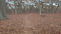
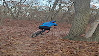
Popular Coram Mountain Biking Trails
• 70 ★ 4.7 • 1 mile • 80 ft • 1,120 •
This loop has some pumps and berms. It's a heck of a lot of fun. You can do a few loops of trail 6 cause it's fun. Not to be missed!
• 90 ★ 4.0 • 4,790 ft • 24 ft • 681 •
Use this loop to get back to the 112 parking area near Pauls Path. It's twisty and fun.
• 80 ★ 4.0 • 3,510 ft • 56 ft • 675 •
Nice optional loop that is a mellow addition to your ride.
• 95 ★ 4.4 • 1 mile • 49 ft • 654 •
Adds about a mile of ups and downs with access to the more wild turkey expert loop
• 55 ★ 4.5 • 1,486 ft • 13 ft • 647 •
Just a more mellow and winding short trail (1/4 mile) in the jungle area.
• 80 ★ 4.4 • 3,018 ft • 23 ft • 647 •
This trail is so mellow your granny could ride it. Actually is a fun as it winds through the woods.
Coram Mountain Bike Routes
Overton Featured
★ 5.0 • 14 miles • 651 ft • 21 • Loop •
This route includes trails at Overton Preserve without DRC.
Overton with DRC Featured
★ 5.0 • 16 miles • 789 ft • 23 • Loop •
This router includes all sections of Overton Preserve with B C sections.
Overton Blue Only Featured
★ 5.0 • 6 miles • 249 ft • 4 • Loop •
This route includes only blue trails.
Overton DRC Only Featured
★ 5.0 • 2 miles • 107 ft • 3 • Loop •
This route includes the B and C sections in proper sequence.
Photos of Coram Mountain Bike
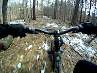
Videos of Coram Mountain Bike
trail: Loop 6
0:15 |
|
Nov 7, 2024
trail: Loop 6
0:04 |
|
Nov 7, 2024

trail: Loop 4
2:48 |
405 |
Dec 30, 2013
trail: Wish You Were Here
0:52 |
238 |
Jan 25, 2012

7:11 |
134 |
Oct 7, 2023
youtuber
![L.I. Trail Guide: Overton Part 2 Pumps & Jumps]()

16:45 |
387 |
Sep 28, 2020
youtuber
![L.I. Trail Guide: Overton Preserve Part 1]()
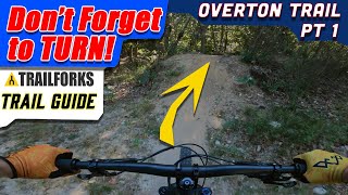
23:03 |
354 |
Sep 21, 2020

trail: Overton Main Loop
4:51 |
1061 |
May 22, 2018 , Coram
Recent Trail Reports
| status | trail | date | condition | info | user |
|---|---|---|---|---|---|
| 112 Parking Access | Jun 16, 2026 @ 5:59pm (America/New_York) 1 day | Unknown | Mtbiker3 | ||
| Old Sheep Pasture | May 26, 2026 @ 1:01pm (America/New_York) May 26, 2026 | Unknown | hallycat CLIMB-TV | ||
| Got Six Minutes? | May 5, 2026 @ 12:35pm (America/New_York) May 5, 2026 | Ideal | Nedermeyer CLIMB-OV | ||
| David Overton Loop | May 5, 2026 @ 12:35pm (America/New_York) May 5, 2026 | Ideal | Nedermeyer CLIMB-OV | ||
| Loop 6 | May 5, 2026 @ 12:35pm (America/New_York) May 5, 2026 | Ideal | Nedermeyer CLIMB-OV | ||
| Wild Turkey Loop | May 5, 2026 @ 12:35pm (America/New_York) May 5, 2026 | Ideal | Nedermeyer CLIMB-OV | ||
| More Wild Turkeys | May 5, 2026 @ 12:35pm (America/New_York) May 5, 2026 | Ideal | Nedermeyer CLIMB-OV | ||
| Wild Turkey Loop | May 5, 2026 @ 12:35pm (America/New_York) May 5, 2026 | Ideal | Nedermeyer CLIMB-OV | ||
| Styron Stretch | May 5, 2026 @ 12:35pm (America/New_York) May 5, 2026 | Ideal | Nedermeyer CLIMB-OV | ||
| Granny Road Loop | May 5, 2026 @ 12:35pm (America/New_York) May 5, 2026 | Ideal | Nedermeyer CLIMB-OV |
Activity Feed
| username | action | type | title | date |
|---|---|---|---|---|
| MTBMarcin | comment | report | activity #97169064 | Jun 17, 2026 @ 1:48am 16 hours |
| MTBMarcin | like | report | activity #97169060 | Jun 17, 2026 @ 1:47am 17 hours |
| Mtbiker3 | add | report | activity #97139682 | Jun 16, 2026 @ 2:59pm 1 day |
| hallycat | comment | report | activity #95600277 | May 26, 2026 @ 5:03pm May 26, 2026 |
| MTBMarcin | comment | report | activity #95597484 | May 26, 2026 @ 4:25pm May 26, 2026 |
Recent Comments
| username | type | title | comment | date |
|---|---|---|---|---|
| report | Thank you! | Jun 17, 2026 @ 1:48am 16 hours | ||
| report | I just opened the app on my phone and now the... | May 26, 2026 @ 5:03pm May 26, 2026 | ||
| report | Thank you for reporting | May 26, 2026 @ 4:25pm May 26, 2026 | ||
| report | Thank you for reporting. Planning to ride... | May 5, 2026 @ 12:41pm May 5, 2026 | ||
| report | Thank you very much! | Apr 12, 2026 @ 1:34pm Apr 12, 2026 |
Local Badges
-

Chased Turkeys at Overton158 awarded -

Completionist1 awarded -

10 Black Trails219 awarded -

Epic Mountain Bike Climb 2k0 awarded -

Climbing 10k Badge4 awarded -

Mountain Biking 100k Badge0 awarded
Activity Type Stats
| activitytype | trails | distance | descent | descent distance | total vertical | rating | global rank | state rank | photos | reports | routes | ridelogs |
|---|---|---|---|---|---|---|---|---|---|---|---|---|
| Mountain Bike | 29 | 17 miles | 755 ft | 6 miles | 79 ft | #1,239 | #478 | 178 | 818 | 2 | 7,853 | |
| Hike | 21 | 14 miles | 640 ft | 5 miles | 79 ft | #9,636 | #3,398 | 3 | 780 | 90 | ||
| Trail Running | 21 | 14 miles | 640 ft | 5 miles | 79 ft | #9,185 | #3,090 | 780 | 19 |
Frequently Asked Questions About Coram
▼
What are the best places to ride in Coram?
Coram has 1 areas to explore for mountain biking. The top rated areas are:
▼
What are the highest rated mountain biking trails in Coram?
The highest rated mountain biking trails in Coram are:
- Mo' Fo' (4.2/5)
- Loop 1 (4.2/5)
- Wish You Were Here (4.2/5)
- Loop 6 (4.2/5)
- Wild Turkey Loop (4.2/5)
▼
What is the best time of the year to ride in Coram?
Based on ride log data, the most popular months to ride in Coram are:
- May (187 activities)
- June (176 activities)
- August (174 activities)
▼
Where can I park to ride in Coram?
There are 3 parking locations listed in Coram. The most popular parking spots are: View all parking and trailhead locations on the map to plan your visit.
Trails
Points of Interest
- By wottawa
 & contributors
 - Admins: CLIMB
- #12091 - 1,669 views
- coram activity log | embed map of Coram mountain bike trails | coram mountain biking points of interest
Downloading of trail gps tracks in kml & gpx formats is enabled for Coram.
You must login to download files.