close
-
Layers w
- Weather Layers
- Pro
- Pro
- Pro
- Pro
- Pro
- Pro
- More Layers
- Pro
- Pro
- Pro
- Pro
-
Upgrade to

3D
Trail Conditions
- Unknown
- Snow Groomed
- Snow Packed
- Snow Covered
- Snow Cover Partial
- Freeze/thaw Cycle
- Icy
- Prevalent Mud
- Wet
- Variable
- Ideal
- Dry
- Very Dry
Trail Flow (Ridden Direction)
Trailforks scans users ridelogs to determine the most popular direction each trail is ridden. A good flowing trail network will have most trails flowing in a single direction according to their intension.
The colour categories are based on what percentage of riders are riding a trail in its intended direction.
The colour categories are based on what percentage of riders are riding a trail in its intended direction.
- > 96%
- > 90%
- > 80%
- > 70%
- > 50%
- < 50%
- bi-directional trail
- no data
Trail Last Ridden
Trailforks scans ridelogs to determine the last time a trail was ridden.
- < 2 days
- < 1 week
- < 2 weeks
- < 1 month
- < 6 months
- > 6 months
Trail Ridden Direction
The intended direction a trail should be ridden.
- Downhill Only
- Downhill Primary
- Both Directions
- Uphill Primary
- Uphill Only
- One Direction
Contribute Details
Colors indicate trail is missing specified detail.
- Description
- Photos
- Description & Photos
- Videos
Trail Popularity ?
Trailforks scans ridelogs to determine which trails are ridden the most in the last 9 months.
Trails are compared with nearby trails in the same city region with a possible 25 colour shades.
Think of this as a heatmap, more rides = more kinetic energy = warmer colors.
- most popular
- popular
- less popular
- not popular
ATV/ORV/OHV Filter
Max Vehicle Width
inches
US Cell Coverage
Legend

Radar Time
Activity Recordings
Trailforks uses anonymized public activity data.
?
Activity Recordings
Trailforks uses anonymized public activity data.
?
Personal Heatmap
▶
Activity Types
all
/
none
▶
Options
2
Date range
month
–
Winter Trails
Warning
A routing network for winter maps does not exist. Selecting trails using the winter trails layer has been disabled.
Missing Trails
Most Popular
Least Popular
Trails are colored based on popularity. The more popular a trail is, the more red. Less popular trails trend towards green.
Jump Magnitude Heatmap
Heatmap of where riders jump on trails. Zoom in to see individual jumps, click circles to view jump details.
BC Backroad Status
![map legend]()
Service Road Atlas is a free to use, community-driven service for viewing and creating reports on the numerous back-country service roads around B.C. and Alberta.

Slope Aspect
Direction the slope faces
Trails Deemphasized
Trails are shown in grey.
Only show trails with no bike usage.
Suggested Layers
Based on selected activity type
Save the current map location and zoom level as your default home location whenever this page is loaded.
Save
No description for Corby has been added yet!
Login or register to submit one.
This region uses the Uk/Euro style trail grading system.
Activities Click to view
- Mountain Bike
3 trails
- E-Bike
1 trails
- Gravel Bike
0 trails
- Adaptive Bike
0 trails
- Winter Fat Bike
0 trails
- Hike
2 trails
- Trail Running
2 trails
Region Details
- 1
- 1
- 1
Region Status
Open as of Apr 25, 2026Stats
- Avg Trail Rating
- Trails (view details)
- 3
- Trails Mountain Bike
- 3
- Trails E-Bike
- 1
- Trails Hike
- 2
- Trails Trail Running
- 2
- Total Distance
- 4 miles
- Total Descent
- 248 ft
- Total Vertical
- 95 ft
- Highest Trailhead
- 336 ft
- Reports
- 63
- Photos
- 67
- Ridden Counter
- 147
Sub Regions
-
Wakerley Woods
- 1
- 1
Popular Corby Mountain Biking Trails
• 100 ★ 3.2 • 2 miles • 146 ft • 108 •
Good Points The official trail (Scartree) is short, but well armoured for all weathers and has some decent bermed sections to blast through - it's good for beginners and more experienced riders will still get grins out of it if they...
• 5 ★ 4.0 • 0 ft • 0 ft • 1 •
Two waymarked trails (a green with blue 'skills loops' on the Fineshades side and a short, flowy blue (Scartree Trail) in Wakerley Great Wood). Car parks at both sides of the woods (pay at Fineshades, free at Wakerley). Also lots of...
Photos of Corby Mountain Bike
Videos of Corby Mountain Bike

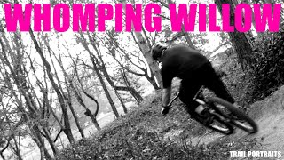
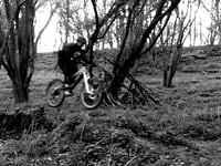
trail: Scar Tree Trail
0:14 |
81 |
Jun 2, 2025 , Corby
trail: Scar Tree Trail
0:55 |
48 |
Jun 2, 2025 , Corby

trail: Scar Tree Trail
2:19 |
649 |
Jun 2, 2018 , Corby

trail: Scar Tree Trail
0:26 |
2016 |
Jun 2, 2018 , Corby

trail: Scar Tree Trail
0:30 |
632 |
Jun 2, 2018 , Corby

trail: Scar Tree Trail
0:45 |
884 |
Jun 2, 2018 , Corby

trail: Scar Tree Trail
0:59 |
457 |
Jun 2, 2018 , Corby
trail: Scar Tree Trail
0:23 |
395 |
Jun 2, 2018 , Corby
Recent Trail Reports
| status | trail | date | condition | info | user |
|---|---|---|---|---|---|
| Scar Tree Trail | Dec 13, 2025 @ 11:23am (Europe/London) Dec 13, 2025 | Variable | rrrooobbbppp | ||
| Forest Road | Oct 5, 2019 @ 12:26pm Oct 5, 2019 | Prevalent Mud | NickRospopa |
Activity Feed
| username | action | type | title | date |
|---|---|---|---|---|
| RichardSe74qZ | ridden | trail | activity #93846781 | May 2, 2026 @ 4:41am May 2, 2026 |
| fg98 | ridden | trail | activity #93485296 | Apr 26, 2026 @ 3:57pm Apr 26, 2026 |
| deanotvr | wishlist | trail | activity #92380895 | Apr 11, 2026 @ 5:22am Apr 11, 2026 |
| BXsaYJ | wishlist | skillpark | activity #87633395 and 1 more | Jan 22, 2026 @ 10:22am Jan 22, 2026 |
| rrrooobbbppp | add | photo | activity #85487773 and 1 more | Dec 13, 2025 @ 3:44pm Dec 13, 2025 |
Recent Comments
| username | type | title | comment | date |
|---|---|---|---|---|
| trail | No longer maintained so the trail isn't in... | Jan 3, 2022 @ 10:30am Jan 3, 2022 | ||
| report | felling not bad , trails in good condition ,... | Mar 24, 2020 @ 2:54am Mar 24, 2020 | ||
| report | Ok good trail and met some great guys but... | Apr 30, 2017 @ 10:01am Apr 30, 2017 | ||
| trail | Odd directions. Anyone trying to follow those... | Mar 13, 2017 @ 1:53pm Mar 13, 2017 |
Bike & Skill Parks
| name | type | city | rating |
|---|---|---|---|
| Barrow upon Soar Pumptrack | skill park | Corby | |
| Groby Pumptrack | skill park | Corby | |
| The Rally Pumptrack | skill park | Corby | |
| Rockingham Park Pumptrack | skill park | Corby |
Activity Type Stats
| activitytype | trails | distance | descent | descent distance | total vertical | rating | global rank | state rank | photos | reports | routes | ridelogs |
|---|---|---|---|---|---|---|---|---|---|---|---|---|
| Mountain Bike | 3 | 4 miles | 246 ft | 2 miles | 95 ft | #5,667 | #201 | 67 | 62 | 6,649 | ||
| E-Bike | 1 | #4,141 | #162 | 43 | 416 | |||||||
| Hike | 2 | 1 mile | 98 ft | 4,849 ft | 95 ft | #6,779 | #181 | 44 | 196 | |||
| Trail Running | 2 | 1 mile | 98 ft | 4,849 ft | 95 ft | #6,219 | #171 | 44 | 7 |
- By rrrooobbbppp & contributors
- Admins: wisey, MathieuC, cemoorelife
- #7183 - 7,052 views
- corby activity log | embed map of Corby mountain bike trails |
Downloading of trail gps tracks in kml & gpx formats is enabled for Corby.
You must login to download files.