close
-
Layers w
- Weather Layers
- Pro
- Pro
- Pro
- Pro
- Pro
- Pro
- More Layers
- Pro
- Pro
- Pro
- Pro
-
Upgrade to

3D
Trail Conditions
- Unknown
- Snow Groomed
- Snow Packed
- Snow Covered
- Snow Cover Partial
- Freeze/thaw Cycle
- Icy
- Prevalent Mud
- Wet
- Variable
- Ideal
- Dry
- Very Dry
Trail Flow (Ridden Direction)
Trailforks scans users ridelogs to determine the most popular direction each trail is ridden. A good flowing trail network will have most trails flowing in a single direction according to their intension.
The colour categories are based on what percentage of riders are riding a trail in its intended direction.
The colour categories are based on what percentage of riders are riding a trail in its intended direction.
- > 96%
- > 90%
- > 80%
- > 70%
- > 50%
- < 50%
- bi-directional trail
- no data
Trail Last Ridden
Trailforks scans ridelogs to determine the last time a trail was ridden.
- < 2 days
- < 1 week
- < 2 weeks
- < 1 month
- < 6 months
- > 6 months
Trail Ridden Direction
The intended direction a trail should be ridden.
- Downhill Only
- Downhill Primary
- Both Directions
- Uphill Primary
- Uphill Only
- One Direction
Contribute Details
Colors indicate trail is missing specified detail.
- Description
- Photos
- Description & Photos
- Videos
Trail Popularity ?
Trailforks scans ridelogs to determine which trails are ridden the most in the last 9 months.
Trails are compared with nearby trails in the same city region with a possible 25 colour shades.
Think of this as a heatmap, more rides = more kinetic energy = warmer colors.
- most popular
- popular
- less popular
- not popular
ATV/ORV/OHV Filter
Max Vehicle Width
inches
US Cell Coverage
Legend

Radar Time
Activity Recordings
Trailforks uses anonymized public activity data.
?
Activity Recordings
Trailforks uses anonymized public activity data.
?
Personal Heatmap
▶
Activity Types
all
/
none
▶
Options
2
Date range
month
–
Winter Trails
Warning
A routing network for winter maps does not exist. Selecting trails using the winter trails layer has been disabled.
Missing Trails
Most Popular
Least Popular
Trails are colored based on popularity. The more popular a trail is, the more red. Less popular trails trend towards green.
Jump Magnitude Heatmap
Heatmap of where riders jump on trails. Zoom in to see individual jumps, click circles to view jump details.
BC Backroad Status
![map legend]()
Service Road Atlas is a free to use, community-driven service for viewing and creating reports on the numerous back-country service roads around B.C. and Alberta.

Slope Aspect
Direction the slope faces
Trails Deemphasized
Trails are shown in grey.
Only show trails with no bike usage.
Suggested Layers
Based on selected activity type
Save the current map location and zoom level as your default home location whenever this page is loaded.
SaveLinks
This region uses the Uk/Euro style trail grading system.
Activities Click to view
- Mountain Bike
47 trails
- E-Bike
46 trails
- Adaptive Bike
0 trails
- Hike
44 trails
- Trail Running
45 trails
Region Details
- 6
- 2
- 11
- 14
Region Status
Caution as of May 9, 2026Stats
- Avg Trail Rating
- Trails (view details)
- 47
- Trails Mountain Bike
- 47
- Trails E-Bike
- 46
- Trails Hike
- 44
- Trails Trail Running
- 45
- Trails Snowshoe
- 3
- Trails Nordic Ski
- 3
- Total Distance
- 70 miles
- Total Descent Distance
- 29 miles
- Total Descent
- 23,767 ft
- Total Vertical
- 4,144 ft
- Highest Trailhead
- 5,387 ft
- Reports
- 161
- Photos
- 39
- Ridden Counter
- 1,278
Popular Cuorgnè Mountain Biking Trails
• 100 ★ 4.5 • 1 mile • 0 ft • 52 •
Sentiero naturale, a tratti ripido e con passaggi su rocce impegnativi. In genare un sentiero complesso da affrontare Partenza dai tavolini dell'area pic nic del Nero di Alpette e arrivo in prossimita della frazione Giaudrone
• 85 ★ 5.0 • 1 mile • 3 ft • 35 •
Enduro natural trail. Start from Monsoffietto pic nic area near Alpette. First part shared with cresta.
• 95 ★ 3.8 • 1 mile • 3 ft • 34 •
Popular red difficulty singletrack. This mountain bike primary trail can be used downhill only. It features berm, drop, jump and rock face. On average it takes 14 minutes to complete this trail.
• 80 ★ 2.5 • 3 miles • 79 ft • 29 •
Lungo sentiero che parte da San Bernardo di Mares fino a Monsoffietto. Il primo tratto affronta il sentiero balcone che da San Bernardo di Mares arriva fino alle Rocche di S.Martino Sentiero tecnico in alcune parti, con passaggi su...
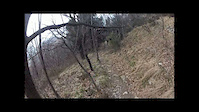
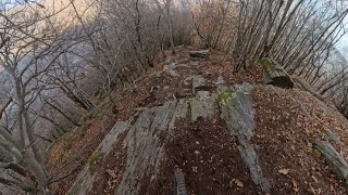
Photos of Cuorgnè Mountain Bike
Videos of Cuorgnè Mountain Bike
trail: Classica
8:33 |
200 |
Mar 3, 2012
trail: Cresta Nera
6:20 |
151 |
Jan 9, 2025 , Cuorgnè

trail: 406
28:26 |
187 |
Apr 6, 2023 , Cuorgnè

28:26 |
199 |
Apr 6, 2023 , Cuorgnè
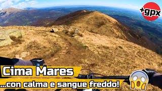
trail: DH Cima Mares
28:26 |
97 |
Apr 6, 2023 , Cuorgnè

28:26 |
229 |
Apr 6, 2023 , Cuorgnè
Recent Trail Reports
| status | trail | date | condition | info | user |
|---|---|---|---|---|---|
| Mares-Rocche di S. Martino- Monsoffietto | May 9, 2026 @ 9:11pm (Europe/Rome) May 9, 2026 | Ideal | Sevenpol | ||
| Campore | May 9, 2026 @ 9:08pm (Europe/Rome) May 9, 2026 | Unknown | Sevenpol | ||
| Bioletto | Apr 6, 2026 @ 10:59am (Europe/Rome) Apr 6, 2026 | Unknown | Aldosalassa | ||
| Alpe Rossetto | Mar 13, 2026 @ 2:14pm (Europe/Monaco) Mar 13, 2026 | Wet | Aldosalassa | ||
| Milani - Alpe del Conte | Mar 13, 2026 @ 2:14pm (Europe/Monaco) Mar 13, 2026 | Wet | Aldosalassa | ||
| Munta e Cala | Oct 22, 2025 @ 10:25am (Europe/Rome) Oct 22, 2025 | Unknown | VAlberto2088 | ||
| Bastiglia | Oct 4, 2025 @ 2:47pm (Europe/Rome) Oct 4, 2025 | Unknown | VAlberto2088 | ||
| Cresta Nera | Sep 28, 2025 @ 6:31pm (Europe/Rome) Sep 28, 2025 | Unknown | gabrielewOmFrN | ||
| Carella Prascorsano | Sep 13, 2025 @ 2:28pm (Europe/Rome) Sep 13, 2025 | Ideal | st3ve00 | ||
| Sentiero Balcone - Sabbionere | May 27, 2025 @ 3:13am May 27, 2025 | Wet | LucaP4jfTW |
Activity Feed
| username | action | type | title | date |
|---|---|---|---|---|
| mattiapic | ridden | trail | activity #95412769 | May 24, 2026 @ 8:26am May 24, 2026 |
| Sevenpol | add | report | activity #94366598 and 1 more | May 9, 2026 @ 12:08pm May 9, 2026 |
| mattiapic | ridden | trail | activity #94346712 and 1 more | May 9, 2026 @ 8:54am May 9, 2026 |
| Alessandro0wXon9 | ridden | trail | activity #92342233 | Apr 10, 2026 @ 2:03pm Apr 10, 2026 |
| Aldosalassa | add | report | activity #92033182 | Apr 6, 2026 @ 1:59am Apr 6, 2026 |
Recent Comments
| username | type | title | comment | date |
|---|---|---|---|---|
| trail | Brividi! Complimenti ai local trailbuilders... | Dec 4, 2023 @ 6:11am Dec 4, 2023 |
Local Badges
-

10 Blue Trails12 awarded -

Epic Mountain Bike Climb 2k47 awarded -

Climbing 10k Badge23 awarded -

Mountain Biking 100k Badge3 awarded -

Epic Ride Descent 2k47 awarded -

Descent 10k Badge22 awarded
Activity Type Stats
| activitytype | trails | distance | descent | descent distance | total vertical | rating | global rank | state rank | photos | reports | routes | ridelogs |
|---|---|---|---|---|---|---|---|---|---|---|---|---|
| Mountain Bike | 47 | 70 miles | 23,766 ft | 29 miles | 4,144 ft | #2,817 | #135 | 19 | 161 | 2,414 | ||
| E-Bike | 46 | 61 miles | 23,629 ft | 28 miles | 4,144 ft | #1,268 | #155 | 20 | 156 | 546 | ||
| Hike | 44 | 67 miles | 22,113 ft | 27 miles | 4,144 ft | #3,729 | #130 | 159 | 174 | |||
| Trail Running | 45 | 68 miles | 22,346 ft | 28 miles | 4,144 ft | #804 | #21 | 159 | 105 | |||
| Snowshoe | 3 | 6 miles | 1,129 ft | 1 mile | 3,123 ft | 5 | 2 | |||||
| Nordic Ski | 3 | 6 miles | 1,129 ft | 1 mile | 3,123 ft | 5 |
Frequently Asked Questions About Cuorgnè
▼
What are the highest rated mountain biking trails in Cuorgnè?
The highest rated mountain biking trails in Cuorgnè are:
- Bioletto (4.1/5)
- DH Cima Mares (4.1/5)
- 406 (4.1/5)
- Alpe Rossetto (4.1/5)
- Sentiero del Bellono (4.1/5)
▼
What is the best time of the year to ride in Cuorgnè?
Based on ride log data, the most popular months to ride in Cuorgnè are:
- September (8 activities)
- July (7 activities)
- August (7 activities)
▼
Where can I park to ride in Cuorgnè?
Check the Cuorgnè trail map for trailhead and parking information. Community members regularly update access and parking details for trails in the area.
▼
What is the longest trail in Cuorgnè?
The longest trail in Cuorgnè is Canischio - San Bernardo di Mares at 8.2 km. View all trails sorted by distance.
Activities
Trails
Points of Interest
- By Alevetto
 & contributors
 - Admins: silviu86, adessoomaipiu
- #27055 - 5,267 views
- cuorgnè activity log | embed map of Cuorgnè mountain bike trails |
Downloading of trail gps tracks in kml & gpx formats is enabled for Cuorgnè.
You must login to download files.