close
-
Layers w
- Weather Layers
- Pro
- Pro
- Pro
- Pro
- Pro
- Pro
- More Layers
- Pro
- Pro
- Pro
- Pro
-
Upgrade to

3D
Trail Conditions
- Unknown
- Snow Groomed
- Snow Packed
- Snow Covered
- Snow Cover Partial
- Freeze/thaw Cycle
- Icy
- Prevalent Mud
- Wet
- Variable
- Ideal
- Dry
- Very Dry
Trail Flow (Ridden Direction)
Trailforks scans users ridelogs to determine the most popular direction each trail is ridden. A good flowing trail network will have most trails flowing in a single direction according to their intension.
The colour categories are based on what percentage of riders are riding a trail in its intended direction.
The colour categories are based on what percentage of riders are riding a trail in its intended direction.
- > 96%
- > 90%
- > 80%
- > 70%
- > 50%
- < 50%
- bi-directional trail
- no data
Trail Last Ridden
Trailforks scans ridelogs to determine the last time a trail was ridden.
- < 2 days
- < 1 week
- < 2 weeks
- < 1 month
- < 6 months
- > 6 months
Trail Ridden Direction
The intended direction a trail should be ridden.
- Downhill Only
- Downhill Primary
- Both Directions
- Uphill Primary
- Uphill Only
- One Direction
Contribute Details
Colors indicate trail is missing specified detail.
- Description
- Photos
- Description & Photos
- Videos
Trail Popularity ?
Trailforks scans ridelogs to determine which trails are ridden the most in the last 9 months.
Trails are compared with nearby trails in the same city region with a possible 25 colour shades.
Think of this as a heatmap, more rides = more kinetic energy = warmer colors.
- most popular
- popular
- less popular
- not popular
ATV/ORV/OHV Filter
Max Vehicle Width
inches
US Cell Coverage
Legend

Radar Time
Activity Recordings
Trailforks uses anonymized public activity data.
?
Activity Recordings
Trailforks uses anonymized public activity data.
?
Personal Heatmap
▶
Activity Types
all
/
none
▶
Options
2
Date range
month
–
Winter Trails
Warning
A routing network for winter maps does not exist. Selecting trails using the winter trails layer has been disabled.
Missing Trails
Most Popular
Least Popular
Trails are colored based on popularity. The more popular a trail is, the more red. Less popular trails trend towards green.
Jump Magnitude Heatmap
Heatmap of where riders jump on trails. Zoom in to see individual jumps, click circles to view jump details.
BC Backroad Status
![map legend]()
Service Road Atlas is a free to use, community-driven service for viewing and creating reports on the numerous back-country service roads around B.C. and Alberta.

Slope Aspect
Direction the slope faces
Trails Deemphasized
Trails are shown in grey.
Only show trails with no bike usage.
Suggested Layers
Based on selected activity type
Save the current map location and zoom level as your default home location whenever this page is loaded.
SaveDalton is home to the Northwest Georgia chapter of SORBA (Southern Off-road Bicycle Association).
Mountain biking in the Dalton area is focused on the four ride areas listed in the index lower down on this page. To make contact with NWGA SORBA, click on the NWGA SORBA logo link below.
Dalton is famous for hosting The Snake mountain bike race, wich is listed in the Events Tab. The routes for this event is available in the Routes tab.
Activities Click to view
- Mountain Bike
79 trails
- E-Bike
14 trails
- Adaptive Bike
0 trails
- Horse
8 trails
- Hike
75 trails
- Trail Running
74 trails
- Dirtbike/Moto
23 trails
- ATV/ORV/OHV
22 trails
Region Details
- 25
- 7
- 32
- 12
Region Status
Caution as of Jun 6, 2026Stats
- Avg Trail Rating
- Trails (view details)
- 94
- Trails Mountain Bike
- 80
- Trails E-Bike
- 14
- Trails Horse
- 8
- Trails Hike
- 76
- Trails Trail Running
- 74
- Trails Dirtbike/Moto
- 23
- Trails Observed Trials
- 1
- Trails ATV/ORV/OHV
- 22
- Total Distance
- 117 miles
- Total Descent Distance
- 48 miles
- Total Descent
- 16,709 ft
- Total Vertical
- 1,175 ft
- Highest Trailhead
- 1,879 ft
- Reports
- 532
- Photos
- 369
- Ridden Counter
- 5,485
Sub Regions
-
Haig Mill Lake Park
- 1
-
Houston Valley OHV Trails
- 6
- 15
-
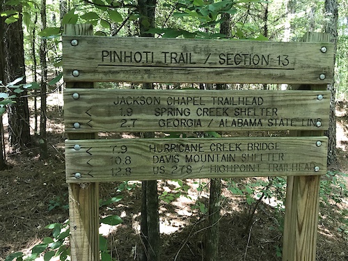
Pinhoti Trail (NWGA SORBA)
- 4
- 7
-
Raisin Woods
- 1
- 6
- 5
-
Rocky Face Ridge Park
- 5
Popular Dalton Mountain Biking Trails
• 100 ★ 4.5 • 1 mile • 274 ft • 234 •
The system at Rocky Face Ridge Park is a 10.2 mile loop with a 3 mile climb CCW, and a 3.5 mile climb CW. Once at the top, you have a 360-degree view of the surrounding mountains. To the east, you see Fort Mountain. To the south, you...
• 100 ★ 4.5 • 1 mile • 442 ft • 225 •
The trail system at Rocky Face Ridge Park is a 10.2 mile loop with a 3 mile climb CCW, and a 3.5 mile climb CW. Once at the top, you have a 360-degree view of the surrounding mountains. To the east, you see Fort Mountain. To the south,...
• 90 ★ 4.5 • 12 miles • 1,846 ft • 215 •
Popular black diamond difficulty singletrack. This multi-use trail can be used both directions. On average it takes 1 hour59 minutes to complete this trail.
• 95 ★ 3.5 • 2 miles • 264 ft • 176 •
Counter Clockwise: Monday, Wednesday, Friday, Sunday Clockwise: Tuesday, Thursday, Saturday
• 85 ★ 4.0 • 5 miles • 891 ft • 166 •
Popular black diamond difficulty singletrack. This multi-use trail. On average it takes 41 minutes to complete this trail.
• 95 ★ 4.6 • 2 miles • 58 ft • 162 •
Popular blue difficulty singletrack. This mountain bike primary trail can be used both directions. On average it takes 11 minutes to complete this trail.
• 80 ★ 4.3 • 2 miles • 329 ft • 159 •
Highly rated popular black diamond difficulty singletrack. This mountain bike primary trail can be used both directions and has a easy overall physical rating with a 329 ft green climb. It features berm, jump, gap jump and roller coaster. On average it takes 14 minutes to complete this trail.
Dalton Mountain Bike Routes
15 miles • 1,916 ft • 5 • Point to Point • Race •
Ridden from south to north, this portion of the Georgia Pinhoti Trail begins at a small trailhead parking...
15 miles • 1,865 ft • 1 • Point to Point • Race •
This is the section of the long-distance, multiuse Pinhoti trail, best known from the Snake Creek Gap Time...
17 miles • 2,517 ft • 3 • Race •
This is the Snake 17 Miler Route which includes the infamous rock gardens on Dug Gap Mountain!
48 miles • 6,031 ft • 12 • Race •
The Snake 50 Mile route starts at the System for 18 miles and then continues onto the 34 Mile route at the...
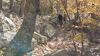
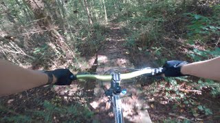
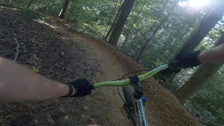
Photos of Dalton Mountain Bike
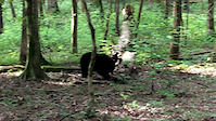
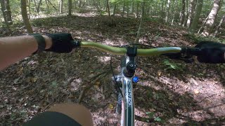
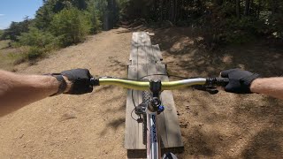
Videos of Dalton Mountain Bike
trail: Skyview
0:11 |
|
Nov 6, 2022

trail: Hurricane Creek Trail
2:08 |
|
Nov 24, 2021
trail: Bear
0:38 |
155 |
Aug 13, 2017

trail: Bear
4:33 |
8618 |
May 29, 2010
trail: Holey Coley
2:31 |
362 |
Oct 5, 2020 , Dalton
trail: Bear
0:39 |
367 |
Oct 5, 2020 , Dalton
trail: Rootie Tootie
3:07 |
395 |
Oct 5, 2020 , Dalton
trail: Fast and Loud
13:23 |
1082 |
Oct 5, 2020 , Dalton
Recent Trail Reports
National Scenic Trails & Official Routes
-
Pinhoti Trail (Georgia)
- Mountain Bike
- Hike
- Trail Running
Activity Feed
| username | action | type | title | date |
|---|---|---|---|---|
| Ernie9vqgfl | wishlist | region | activity #96773727 | Jun 11, 2026 @ 5:55pm 2 days |
| johnnygreenpants | add | report | activity #96533787 and 2 more | Jun 8, 2026 @ 5:55am Jun 8, 2026 |
| Rrobii | wishlist | region | activity #95774164 | May 29, 2026 @ 7:01am May 29, 2026 |
| CBag29 | wishlist | region | activity #95315734 | May 23, 2026 @ 7:26am May 23, 2026 |
| dpforestry | wishlist | trail | activity #94683094 | May 14, 2026 @ 5:43am May 14, 2026 |
Recent Comments
| username | type | title | comment | date |
|---|---|---|---|---|
| trail | This should be a green trail not blue.... | Jun 26, 2025 @ 10:46am Jun 26, 2025 | ||
| trail | 181 N | Apr 23, 2025 @ 5:52pm Apr 23, 2025 | ||
| trail | This trail must be “fast “ on Sun, Mon,... | Apr 1, 2025 @ 10:14am Apr 1, 2025 | ||
| trail | The trail has gotten way easier than it used... | Nov 29, 2024 @ 6:10pm Nov 29, 2024 | ||
| trail | are spiders unique to this trail? | Nov 29, 2024 @ 6:07pm Nov 29, 2024 |
Local Badges
-

10 Blue Trails66 awarded -

Epic Ride Climb 2k61 awarded -

Climbing 10k Badge24 awarded -

Climbing 100k Badge2 awarded -

Epic Ride Descent 2k58 awarded -

Descent 10k Badge24 awarded
Activity Type Stats
| activitytype | trails | distance | descent | descent distance | total vertical | rating | global rank | state rank | photos | reports | routes | ridelogs |
|---|---|---|---|---|---|---|---|---|---|---|---|---|
| Mountain Bike | 79 | 95 miles | 12,559 ft | 38 miles | 1,175 ft | #2,565 | #921 | 212 | 526 | 6 | 3,991 | |
| E-Bike | 14 | 19 miles | 1,808 ft | 7 miles | 823 ft | #5,255 | #1,629 | 373 | 1 | 201 | ||
| Horse | 8 | 21 miles | 2,306 ft | 8 miles | 906 ft | #1,998 | #1,113 | 58 | 3 | 2 | ||
| Hike | 75 | 94 miles | 13,323 ft | 38 miles | 1,175 ft | #1,592 | #711 | 176 | 533 | 3 | 378 | |
| Trail Running | 74 | 91 miles | 12,621 ft | 37 miles | 1,175 ft | #1,310 | #475 | 12 | 533 | 3 | 81 | |
| Dirtbike/Moto | 23 | 24 miles | 3,606 ft | 10 miles | 571 ft | #791 | #282 | 46 | 6 | |||
| Observed Trials | 1 | 3,419 ft | 610 ft | 4 | ||||||||
| ATV/ORV/OHV | 22 | 23 miles | 3,386 ft | 10 miles | 479 ft | #703 | #290 | 46 |
Frequently Asked Questions About Dalton
▼
What are the best places to ride in Dalton?
Dalton has 6 areas to explore for mountain biking. The top rated areas are:
▼
What are the highest rated mountain biking trails in Dalton?
The highest rated mountain biking trails in Dalton are:
- Bone Picker (4.3/5)
- Raptor (4.2/5)
- Vulture Culture (4.2/5)
- Skyview (4.2/5)
- Pinhoti Trail - The Snake (4.2/5)
▼
What is the best time of the year to ride in Dalton?
Based on ride log data, the most popular months to ride in Dalton are:
- June (23 activities)
- May (19 activities)
- July (19 activities)
▼
Where can I park to ride in Dalton?
There are 10 parking locations listed in Dalton. The most popular parking spots are: View all parking and trailhead locations on the map to plan your visit.
Activities
Trails
- By brenthillier
 NSMBA TRAILFORKS & contributors
 - Admins: apply
- #3470 - 9,043 views
- dalton activity log | embed map of Dalton mountain bike trails | dalton mountain biking points of interest
Downloading of trail gps tracks in kml & gpx formats is enabled for Dalton.
You must login to download files.