close
-
Layers w
- Weather Layers
- Pro
- Pro
- Pro
- Pro
- Pro
- Pro
- More Layers
- Pro
- Pro
- Pro
- Pro
-
Upgrade to

3D
Trail Conditions
- Unknown
- Snow Groomed
- Snow Packed
- Snow Covered
- Snow Cover Partial
- Freeze/thaw Cycle
- Icy
- Prevalent Mud
- Wet
- Variable
- Ideal
- Dry
- Very Dry
Trail Flow (Ridden Direction)
Trailforks scans users ridelogs to determine the most popular direction each trail is ridden. A good flowing trail network will have most trails flowing in a single direction according to their intension.
The colour categories are based on what percentage of riders are riding a trail in its intended direction.
The colour categories are based on what percentage of riders are riding a trail in its intended direction.
- > 96%
- > 90%
- > 80%
- > 70%
- > 50%
- < 50%
- bi-directional trail
- no data
Trail Last Ridden
Trailforks scans ridelogs to determine the last time a trail was ridden.
- < 2 days
- < 1 week
- < 2 weeks
- < 1 month
- < 6 months
- > 6 months
Trail Ridden Direction
The intended direction a trail should be ridden.
- Downhill Only
- Downhill Primary
- Both Directions
- Uphill Primary
- Uphill Only
- One Direction
Contribute Details
Colors indicate trail is missing specified detail.
- Description
- Photos
- Description & Photos
- Videos
Trail Popularity ?
Trailforks scans ridelogs to determine which trails are ridden the most in the last 9 months.
Trails are compared with nearby trails in the same city region with a possible 25 colour shades.
Think of this as a heatmap, more rides = more kinetic energy = warmer colors.
- most popular
- popular
- less popular
- not popular
ATV/ORV/OHV Filter
Max Vehicle Width
inches
US Cell Coverage
Legend

Radar Time
Activity Recordings
Trailforks uses anonymized public activity data.
?
Activity Recordings
Trailforks uses anonymized public activity data.
?
Personal Heatmap
▶
Activity Types
all
/
none
▶
Options
2
Date range
month
–
Winter Trails
Warning
A routing network for winter maps does not exist. Selecting trails using the winter trails layer has been disabled.
Missing Trails
Most Popular
Least Popular
Trails are colored based on popularity. The more popular a trail is, the more red. Less popular trails trend towards green.
Jump Magnitude Heatmap
Heatmap of where riders jump on trails. Zoom in to see individual jumps, click circles to view jump details.
BC Backroad Status
![map legend]()
Service Road Atlas is a free to use, community-driven service for viewing and creating reports on the numerous back-country service roads around B.C. and Alberta.

Slope Aspect
Direction the slope faces
Trails Deemphasized
Trails are shown in grey.
Only show trails with no bike usage.
Suggested Layers
Based on selected activity type
Save the current map location and zoom level as your default home location whenever this page is loaded.
Save
No description for Davis has been added yet!
Login or register to submit one.
Activities Click to view
- Mountain Bike
120 trails
- E-Bike
19 trails
- Gravel Bike
14 trails
- Adaptive Bike
0 trails
- Hike
177 trails
- Trail Running
176 trails
- Snowshoe
6 trails
- Downhill Ski
64 trails
- Backcountry Ski
8 trails
- Nordic Ski
9 trails
Region Details
- 17
- 17
- 73
- 10
Region Status
Caution as of 3 daysStats
- Avg Trail Rating
- Trails (view details)
- 237
- Trails Mountain Bike
- 120
- Trails E-Bike
- 19
- Trails Gravel Bike
- 14
- Trails Winter Fat Bike
- 2
- Trails Horse
- 1
- Trails Hike
- 177
- Trails Trail Running
- 176
- Trails Snowshoe
- 6
- Trails Downhill Ski
- 64
- Trails Backcountry Ski
- 8
- Trails Nordic Ski
- 9
- Total Distance
- 327 miles
- Total Descent
- 45,468 ft
- Total Vertical
- 2,991 ft
- Highest Trailhead
- 4,700 ft
- Reports
- 242
- Photos
- 164
- Ridden Counter
- 8,462
Articles
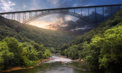
This Is the Most Underrated State for Outdoor Adventure
Jul 14, 2024 from outsideonline.com
The Mountain State has it all: rivers, 36 state parks, nine state forests, our newest national park, and a nearly million-acre national forest....
Sub Regions
-
Blackwater Falls State Park
- 8
- 3
-
Blackwater Wildlife Management Area
- 1
- 17
- 5
-
Canaan Valley National Wildlife Refuge
- 4
- 20
-
Canaan Valley Resort State Park
- 7
- 12
-
Canaan/Backbone Mountain Area
- 4
- 10
-
CVI Trails
- 11
- 2
Popular Davis Mountain Biking Trails
• 100 ★ 4.2 • 2,654 ft • 24 ft • 316 •
really neat trail. google moonrocks trail WV for more info.
• 100 ★ 3.5 • 2 miles • 177 ft • 234 •
Really fun and mellow ride. From the parking lot, you head up a little hill, then it's pretty easy up and down for a while. If it's hunting season, don't get shot. I saw several blinds along the trail.
• 100 ★ 4.4 • 6 miles • 372 ft • 230 •
Great beginner xc loop. It is a machine built trail and flows quite well in both directions. This is a great way to pick up a new habit of mountain biking!
• 95 ★ 3.0 • 2 miles • 57 ft • 211 •
Popular blue difficulty singletrack. This multi-use trail can be used both directions. On average it takes 11 minutes to complete this trail.
• 95 ★ 2.0 • 1,598 ft • 59 ft • 171 •
Popular green difficulty singletrack. This multi-use trail can be used downhill primary. On average it takes 3 minutes to complete this trail.
• 100 ★ 4.4 • 2 miles • 324 ft • 135 •
Popular black diamond difficulty singletrack. This multi-use trail can be used both directions and has a hard overall physical rating with a 324 ft black diamond climb.
• 90 ★ 4.5 • 2,159 ft • 3 ft • 129 •
Extension of the through mixed hardwoods and rhododendron to Pase Point, a rock outcropping overlooking the North Fork of the Blackwater River. Trail work recently cleared out the trail, very technical ride and beautiful hike.
Davis Mountain Bike Routes
★ 5.0 • 16 miles • 2,679 ft • 3 • Loop •
Wild & Wonderful North Mountain An incredibly fun backcountry ride with an amazing payoff downhill of...
6 miles • 350 ft • 1 • Loop •
One of a few flow trails in the region, is the site of the annual Rally in the Valley NICA race. It’s...
4 miles • 462 ft • 3 • Point to Point •
This classic race route is excellent ridden in either direction and offers some great alt lines off the...
27 miles • 2,071 ft • 10 •
Based on data provided by a local. Start and finish were not from the lodge
1 mile • 356 ft • 0 • Point to Point •
This descent should get your juices flowing with tight switchbacks, a stretch of janky rocks, and some...
11 miles • 1,231 ft • 4 • Loop •
A fun 11 mile loop with moderate hills. Rides well either way, park in town, easily altered to include...
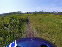
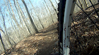
Photos of Davis Mountain Bike
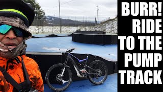
Videos of Davis Mountain Bike
trail: Trials Road Trail
0:08 |
165 |
Dec 10, 2022

trail: Promised Land
0:10 |
127 |
Oct 13, 2021

trail: Black River Creek Trail
0:15 |
8753 |
Jun 7, 2016
trail: Alternate
0:34 |
108 |
Mar 7, 2012
trail: Back Hollow Trail
7:13 |
194 |
Aug 17, 2022 , Davis

trail: Promised Land
7:13 |
303 |
Aug 17, 2022 , Davis
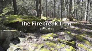
trail: Fire Break Trail
0:20 |
340 |
Mar 24, 2022 , Davis
Recent Trail Reports
| status | trail | date | condition | info | user |
|---|---|---|---|---|---|
| Middle Ridge Trail | Jun 22, 2026 @ 9:18am (America/New_York) 3 days | Ideal | wcyoung | ||
| Bottle Neck | Jun 22, 2026 @ 9:18am (America/New_York) 3 days | Ideal | wcyoung | ||
| Club Moss | Jun 22, 2026 @ 9:18am (America/New_York) 3 days | Ideal | wcyoung | ||
| Three Pin | Jun 22, 2026 @ 9:18am (America/New_York) 3 days | Ideal | wcyoung | ||
| Club Moss | Jun 22, 2026 @ 9:18am (America/New_York) 3 days | Ideal | wcyoung | ||
| Club Run Trail | Jun 22, 2026 @ 9:18am (America/New_York) 3 days | Ideal | wcyoung | ||
| Promised Land | Jun 20, 2026 @ 10:00am (America/New_York) Jun 20, 2026 | Ideal | wcyoung | ||
| HooDoo Rocks Trail | May 24, 2026 @ 11:31am (America/Detroit) May 24, 2026 | Wet | TimWhittemore | ||
| Moon Rocks Trail | May 24, 2026 @ 11:31am (America/Detroit) May 24, 2026 | Wet | TimWhittemore | ||
| Yellow Creek Trail | May 24, 2026 @ 11:31am (America/Detroit) May 24, 2026 | Prevalent Mud | TimWhittemore |
National Scenic Trails & Official Routes
-
Allegheny Trail
- Mountain Bike
- E-Bike
- Hike
- Trail Running
Activity Feed
| username | action | type | title | date |
|---|---|---|---|---|
| wcyoung | add | report | activity #97581662 and 6 more | Jun 22, 2026 @ 1:16pm 2 days |
| jdfreedman | wishlist | route | activity #97575906 | Jun 22, 2026 @ 11:41am 2 days |
| wcyoung | add | report | activity #97435864 | Jun 20, 2026 @ 3:01pm Jun 20, 2026 |
| nfrykman | wishlist | trail | activity #97338570 | Jun 19, 2026 @ 12:44pm Jun 19, 2026 |
| nfrykman | wishlist | trail | activity #97338344 and 1 more | Jun 19, 2026 @ 12:40pm Jun 19, 2026 |
Recent Comments
| username | type | title | comment | date |
|---|---|---|---|---|
| trail | Great family ride! We rode clockwise - a bit... | Apr 21, 2026 @ 10:51am Apr 21, 2026 | ||
| report | This is not a trail. | Apr 2, 2026 @ 9:12am Apr 2, 2026 | ||
| trail | Bicycles are not allowed on Brown Mountain... | Apr 2, 2026 @ 9:09am Apr 2, 2026 | ||
| trail | Fun trail, definitely not a blue though. Local... | Sep 18, 2025 @ 6:17am Sep 18, 2025 | ||
| trail | Stop or call Blackwater Bikes for latest trail... | Aug 25, 2025 @ 5:11am Aug 25, 2025 |
Local Badges
-

10 Blue Trails61 awarded -

Epic Ride Climb 2k38 awarded -

Climbing 10k Badge16 awarded -

Climbing 100k Badge0 awarded -

Epic Ride Descent 2k45 awarded -

Descent 10k Badge16 awarded
Bike & Skill Parks
| name | type | city | rating |
|---|---|---|---|
| Canaan Valley Ski Resort | bike park | Davis |
Activity Type Stats
| activitytype | trails | distance | descent | descent distance | total vertical | rating | global rank | state rank | photos | reports | routes | ridelogs |
|---|---|---|---|---|---|---|---|---|---|---|---|---|
| Mountain Bike | 120 | 181 miles | 18,740 ft | 88 miles | 2,592 ft | #1,379 | #519 | 137 | 237 | 7 | 5,360 | |
| E-Bike | 19 | 13 miles | 1,135 ft | 5 miles | 482 ft | #5,588 | #1,726 | 188 | 170 | |||
| Gravel Bike | 14 | 37 miles | 2,717 ft | 16 miles | 1,985 ft | #347 | #947 | 10 | 35 | |||
| Winter Fat Bike | 2 | #3,278 | #1,240 | 1 | ||||||||
| Horse | 1 | 1 mile | 203 ft | 1 mile | 203 ft | 25 | 2 | |||||
| Hike | 177 | 311 miles | 34,154 ft | 139 miles | 2,992 ft | #372 | #176 | 13 | 242 | 1 | 1,471 | |
| Trail Running | 176 | 311 miles | 34,088 ft | 139 miles | 2,992 ft | #182 | #80 | 14 | 242 | 163 | ||
| Snowshoe | 6 | 4,482 ft | 112 ft | 115 ft | #1,206 | #639 | 20 | |||||
| Downhill Ski | 64 | 15 miles | 11,316 ft | 14 miles | 971 ft | #304 | #121 | 1,049 | ||||
| Backcountry Ski | 8 | 4 miles | 417 ft | 2 miles | 272 ft | #507 | #137 | 145 | ||||
| Nordic Ski | 9 | 3 miles | 112 ft | 3,369 ft | 377 ft | #1,154 | #508 | 400 |
Frequently Asked Questions About Davis
▼
What are the best places to ride in Davis?
Davis has 11 areas to explore for mountain biking. The top rated areas are:
▼
What are the highest rated mountain biking trails in Davis?
The highest rated mountain biking trails in Davis are:
- Dobbin House Trail (4.3/5)
- Woodcock Trail (4.2/5)
- Son of Plantation (4.2/5)
- Yellow Creek Trail (4.2/5)
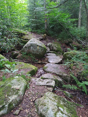
- Fire Break Trail (4.2/5)
▼
What is the best time of the year to ride in Davis?
Based on ride log data, the most popular months to ride in Davis are:
- June (92 activities)
- July (86 activities)
- August (80 activities)
▼
Where can I park to ride in Davis?
There are 26 parking locations listed in Davis. The most popular parking spots are: View all parking and trailhead locations on the map to plan your visit.
Activities
Trails
Points of Interest
- Lion's Head Viewpoint
- C-Warming Hut Cabin
- Bear Paw Lodge
- Kiosk Information
- Bear Rocks Sign Information
- Bear Rocks Sign Information
- Bear Rocks Sign Information
- Rohrbaugh Cliffs Overlook Viewpoint
- Bickle Knob Viewpoint
- Lindy Point Overlook Viewpoint
- Mount Porte Crayon (4,764 ft)
- Green Knob (4,672 ft)
- Haystack Knob (4,514 ft)
- By antikid
 & contributors
 - Admins: BBA, SHARC, UWV
- #9584 - 19,719 views
- davis activity log | embed map of Davis mountain bike trails | davis mountain biking points of interest
Downloading of trail gps tracks in kml & gpx formats is enabled for Davis.
You must login to download files.