close
-
Layers w
- Weather Layers
- Pro
- Pro
- Pro
- Pro
- Pro
- Pro
- More Layers
- Pro
- Pro
- Pro
- Pro
-
Upgrade to

3D
Trail Conditions
- Unknown
- Snow Groomed
- Snow Packed
- Snow Covered
- Snow Cover Partial
- Freeze/thaw Cycle
- Icy
- Prevalent Mud
- Wet
- Variable
- Ideal
- Dry
- Very Dry
Trail Flow (Ridden Direction)
Trailforks scans users ridelogs to determine the most popular direction each trail is ridden. A good flowing trail network will have most trails flowing in a single direction according to their intension.
The colour categories are based on what percentage of riders are riding a trail in its intended direction.
The colour categories are based on what percentage of riders are riding a trail in its intended direction.
- > 96%
- > 90%
- > 80%
- > 70%
- > 50%
- < 50%
- bi-directional trail
- no data
Trail Last Ridden
Trailforks scans ridelogs to determine the last time a trail was ridden.
- < 2 days
- < 1 week
- < 2 weeks
- < 1 month
- < 6 months
- > 6 months
Trail Ridden Direction
The intended direction a trail should be ridden.
- Downhill Only
- Downhill Primary
- Both Directions
- Uphill Primary
- Uphill Only
- One Direction
Contribute Details
Colors indicate trail is missing specified detail.
- Description
- Photos
- Description & Photos
- Videos
Trail Popularity ?
Trailforks scans ridelogs to determine which trails are ridden the most in the last 9 months.
Trails are compared with nearby trails in the same city region with a possible 25 colour shades.
Think of this as a heatmap, more rides = more kinetic energy = warmer colors.
- most popular
- popular
- less popular
- not popular
ATV/ORV/OHV Filter
Max Vehicle Width
inches
US Cell Coverage
Legend

Radar Time
Activity Recordings
Trailforks uses anonymized public activity data.
?
Activity Recordings
Trailforks uses anonymized public activity data.
?
Personal Heatmap
▶
Activity Types
all
/
none
▶
Options
2
Date range
month
–
Winter Trails
Warning
A routing network for winter maps does not exist. Selecting trails using the winter trails layer has been disabled.
Missing Trails
Most Popular
Least Popular
Trails are colored based on popularity. The more popular a trail is, the more red. Less popular trails trend towards green.
Jump Magnitude Heatmap
Heatmap of where riders jump on trails. Zoom in to see individual jumps, click circles to view jump details.
BC Backroad Status
![map legend]()
Service Road Atlas is a free to use, community-driven service for viewing and creating reports on the numerous back-country service roads around B.C. and Alberta.

Slope Aspect
Direction the slope faces
Trails Deemphasized
Trails are shown in grey.
Only show trails with no bike usage.
Suggested Layers
Based on selected activity type
Save the current map location and zoom level as your default home location whenever this page is loaded.
Save
No description for Denison has been added yet!
Login or register to submit one.
Activities Click to view
- Mountain Bike
9 trails
- Hike
9 trails
- Trail Running
9 trails
Region Details
- 5
- 3
Region Status
Caution as of 6 hoursStats
- Avg Trail Rating
- Trails (view details)
- 8
- Trails Mountain Bike
- 9
- Trails Hike
- 9
- Trails Trail Running
- 9
- Total Distance
- 10 miles
- Total Descent
- 990 ft
- Total Vertical
- 197 ft
- Highest Trailhead
- 823 ft
- Reports
- 941
- Photos
- 60
- Ridden Counter
- 525
Sub Regions
-
Eisenhower State Park
- 1
- 1
-
Preston Peninsula
-
Waterloo Lake Regional Park
- 4
- 2
Popular Denison Mountain Biking Trails
• 80 ★ 3.6 • 3 miles • 481 ft • 32 •
Popular blue difficulty singletrack. This multi-use trail can be used both directions and has a moderate overall physical rating with a 481 ft blue climb. On average it takes 32 minutes to complete this trail.
• 5 ★ 4.0 • 3,233 ft • 118 ft • 27 •
Less popular green difficulty singletrack. This multi-use trail can be used both directions and has a moderate overall physical rating with a 118 ft blue climb. On average it takes 7 minutes to complete this trail.
Videos of Denison Mountain Bike
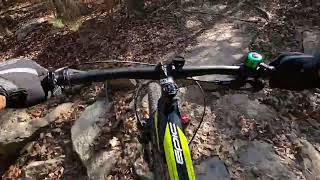
23:45 |
628 |
Feb 9, 2022
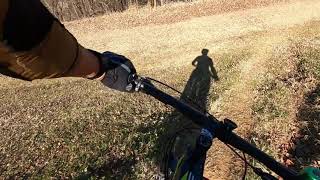
23:37 |
638 |
Jan 28, 2022
Recent Trail Reports
| status | trail | date | condition | info | user |
|---|---|---|---|---|---|
| Woodlands Connector | Jun 18, 2026 @ 12:02pm (America/Chicago) 6 hours | Ideal | broncboz Trail Steward | ||
| Waterloo Woodlands Loop | Jun 18, 2026 @ 12:02pm (America/Chicago) 6 hours | Ideal | broncboz Trail Steward | ||
| Waterloo Lake Trail | Jun 18, 2026 @ 12:02pm (America/Chicago) 6 hours | Ideal | broncboz Trail Steward | ||
| Creek Trail | Jun 18, 2026 @ 12:02pm (America/Chicago) 6 hours | Ideal | broncboz Trail Steward | ||
| Church Loop | Jun 18, 2026 @ 12:02pm (America/Chicago) 6 hours | Ideal | broncboz Trail Steward | ||
| Ike's Hike and Bike | Jun 12, 2026 @ 7:54am (America/Chicago) Jun 12, 2026 | Variable | Kf835m Trail Steward | ||
| Armadillo Hill | Jun 12, 2026 @ 7:54am (America/Chicago) Jun 12, 2026 | Variable | Kf835m Trail Steward | ||
| Ansley Loop | Jul 16, 2025 @ 8:59am Jul 16, 2025 | Variable | chrisjennings |
Activity Feed
| username | action | type | title | date |
|---|---|---|---|---|
| broncboz | add | report | activity #97259791 and 4 more | Jun 18, 2026 @ 10:02am 6 hours |
| JimHallTx | add | report | activity #96811642 and 4 more | Jun 12, 2026 @ 10:01am Jun 12, 2026 |
| Kf835m | add | report | activity #96797591 and 1 more | Jun 12, 2026 @ 5:54am Jun 12, 2026 |
| broncboz | add | report | activity #95853386 and 4 more | May 30, 2026 @ 8:09am May 30, 2026 |
| broncboz | add | report | activity #95592655 and 4 more | May 26, 2026 @ 3:10pm May 26, 2026 |
Recent Comments
| username | type | title | comment | date |
|---|---|---|---|---|
| report | How is the trail today ? | Sep 7, 2025 @ 12:48pm Sep 7, 2025 | ||
| trail | I don’t think it’s a green… but I also... | Jul 8, 2025 @ 12:17pm Jul 8, 2025 | ||
| trail | I would defiantly rate this as a blue at... | Sep 14, 2022 @ 5:10am Sep 14, 2022 | ||
| trail | Pretty miserable ride. Huge clunky rocks... | Oct 5, 2021 @ 2:45pm Oct 5, 2021 | ||
| trail | Very nice. Trail keeper was very nice and... | Sep 21, 2020 @ 7:23am Sep 21, 2020 |
Local Badges
-

Epic Ride Climb 2k3 awarded -

Climbing 10k Badge6 awarded -

Climbing 100k Badge1 awarded -

Epic Ride Descent 2k3 awarded -

Descent 10k Badge6 awarded -

Descent 100k Badge1 awarded
Activity Type Stats
| activitytype | trails | distance | descent | descent distance | total vertical | rating | global rank | state rank | photos | reports | routes | ridelogs |
|---|---|---|---|---|---|---|---|---|---|---|---|---|
| Mountain Bike | 9 | 10 miles | 991 ft | 4 miles | 197 ft | #6,052 | #2,051 | 61 | 941 | 2,511 | ||
| Hike | 9 | 10 miles | 991 ft | 4 miles | 197 ft | #11,379 | #4,064 | 776 | 167 | |||
| Trail Running | 9 | 10 miles | 991 ft | 4 miles | 197 ft | #10,881 | #3,749 | 776 | 129 |
Frequently Asked Questions About Denison
▼
What are the best places to ride in Denison?
Denison has 3 areas to explore for mountain biking. The top rated areas are:
▼
What are the highest rated mountain biking trails in Denison?
The highest rated mountain biking trails in Denison are:
- Waterloo Woodlands Loop (4.1/5)
- Waterloo Lake Trail (4/5)
- Armadillo Hill (4/5)
- Creek Trail (3.9/5)
- Ike's Hike and Bike (3.8/5)
▼
What is the best time of the year to ride in Denison?
Based on ride log data, the most popular months to ride in Denison are:
- July (34 activities)
- January (20 activities)
- April (18 activities)
▼
Where can I park to ride in Denison?
Trails
Points of Interest
- By canadaka
 Trailforks & contributors
 - Admins: FWMBA, DORBA MAIN
- #5017 - 2,779 views
- denison activity log | embed map of Denison mountain bike trails | denison mountain biking points of interest
Downloading of trail gps tracks in kml & gpx formats is enabled for Denison.
You must login to download files.