close
-
Layers w
- Weather Layers
- Pro
- Pro
- Pro
- Pro
- Pro
- Pro
- More Layers
- Pro
- Pro
- Pro
- Pro
-
Upgrade to

3D
Trail Conditions
- Unknown
- Snow Groomed
- Snow Packed
- Snow Covered
- Snow Cover Partial
- Freeze/thaw Cycle
- Icy
- Prevalent Mud
- Wet
- Variable
- Ideal
- Dry
- Very Dry
Trail Flow (Ridden Direction)
Trailforks scans users ridelogs to determine the most popular direction each trail is ridden. A good flowing trail network will have most trails flowing in a single direction according to their intension.
The colour categories are based on what percentage of riders are riding a trail in its intended direction.
The colour categories are based on what percentage of riders are riding a trail in its intended direction.
- > 96%
- > 90%
- > 80%
- > 70%
- > 50%
- < 50%
- bi-directional trail
- no data
Trail Last Ridden
Trailforks scans ridelogs to determine the last time a trail was ridden.
- < 2 days
- < 1 week
- < 2 weeks
- < 1 month
- < 6 months
- > 6 months
Trail Ridden Direction
The intended direction a trail should be ridden.
- Downhill Only
- Downhill Primary
- Both Directions
- Uphill Primary
- Uphill Only
- One Direction
Contribute Details
Colors indicate trail is missing specified detail.
- Description
- Photos
- Description & Photos
- Videos
Trail Popularity ?
Trailforks scans ridelogs to determine which trails are ridden the most in the last 9 months.
Trails are compared with nearby trails in the same city region with a possible 25 colour shades.
Think of this as a heatmap, more rides = more kinetic energy = warmer colors.
- most popular
- popular
- less popular
- not popular
ATV/ORV/OHV Filter
Max Vehicle Width
inches
US Cell Coverage
Legend

Radar Time
Activity Recordings
Trailforks uses anonymized public activity data.
?
Activity Recordings
Trailforks uses anonymized public activity data.
?
Personal Heatmap
▶
Activity Types
all
/
none
▶
Options
2
Date range
month
–
Winter Trails
Warning
A routing network for winter maps does not exist. Selecting trails using the winter trails layer has been disabled.
Missing Trails
Most Popular
Least Popular
Trails are colored based on popularity. The more popular a trail is, the more red. Less popular trails trend towards green.
Jump Magnitude Heatmap
Heatmap of where riders jump on trails. Zoom in to see individual jumps, click circles to view jump details.
BC Backroad Status
![map legend]()
Service Road Atlas is a free to use, community-driven service for viewing and creating reports on the numerous back-country service roads around B.C. and Alberta.

Slope Aspect
Direction the slope faces
Trails Deemphasized
Trails are shown in grey.
Only show trails with no bike usage.
Suggested Layers
Based on selected activity type
Save the current map location and zoom level as your default home location whenever this page is loaded.
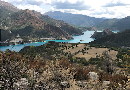
SaveA nice little town with lots of trails, campings and two bike shops
This region uses the Uk/Euro style trail grading system.
Activities Click to view
- Mountain Bike
93 trails
- E-Bike
51 trails
- Adaptive Bike
5 trails
- Hike
93 trails
- Trail Running
93 trails
Region Details
- 25
- 9
- 23
- 26
- 4
Region Status
Open as of May 28, 2026Stats
- Avg Trail Rating
- Trails (view details)
- 88
- Trails Mountain Bike
- 93
- Trails E-Bike
- 51
- Trails Adaptive Bike
- 5
- Trails Hike
- 93
- Trails Trail Running
- 93
- Trails Dirtbike/Moto
- 1
- Total Distance
- 100 miles
- Total Descent
- 40,224 ft
- Total Vertical
- 4,114 ft
- Highest Trailhead
- 5,365 ft
- Reports
- 225
- Photos
- 146
- Ridden Counter
- 2,499
Popular Die Mountain Biking Trails
• 100 ★ 3.9 • 3 miles • 17 ft • 126 • • hike
One of the most iconic trail of Die ! At the start you'll need to climb down a huge rock then it's a really fun trail with lots of turns. Some parts have been reworked by the MBF after a landslide.
• 85 ★ 3.5 • 2 miles • 0 ft • 77 • • hike
Very fun trail, fast and flowy, some roots at the end Jolie sentier, rapide avec du flow, quelques passages plus raide et racine sur la fin
• 85 ★ 3.2 • 2 miles • 558 ft • 65 • • hike
Mountain trail at the bottom of Glandasse cliffs. First part of the singletrack in traverse, awesome view, some parts where you have to push the bike, but pedalling good ! Sentier au pied des falaises du Glandasse. Première partie du...
• 90 ★ 3.7 • 1 mile • 310 ft • 57 • • hike
The second part of Balcons route Gives you access to Sagatte, Sentier du Paradis, Col du Villard...
• 90 ★ 3.5 • 2 miles • 837 ft • 54 • • hike
Liaison Facile Attention : Un passage aérien et dangereux si le guidon touche le rocher : On peut passer a pied
• 90 ★ 4.0 • 4,688 ft • 99 ft • 49 • • hike
Popular green difficulty singletrack. This hike primary trail can be used both directions and has a moderate overall physical rating with a 99 ft green climb. Trail visibility is always easy to follow. On average it takes 5 minutes to complete this trail.
Die Mountain Bike Routes
23 miles • 6,321 ft • 8 • Shuttled •
The whole Balcon rout, you need a shuttle to climb to col du rousset Beautiful scenic trail at the bottom...
★ 3.7 • 21 miles • 4,000 ft • 0 • Loop •
Départ pour Beaufort, dans le village direction Eygluy et arrêt à proximité de l'aire de pique nique....
18 miles • 4,592 ft • 5 • Shuttled •
From pas de pilouse to die via Pierre de sacrifice exposed trail super flowy
19 miles • 3,604 ft • 6 • Shuttled •
Another great day in Diois. You'll need a car to shuttle up to Col du Rousset.
20 miles • 5,959 ft • 3 • Loop •
test of we via wandelpad naar de zwarte route kunnen komen
20 miles • 4,520 ft • 5 • Loop •
A nice loop to discover two Diois typical trails. A nice start for a Diois bike trip.
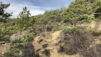
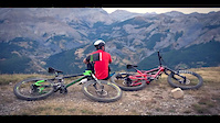
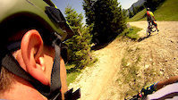
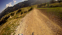
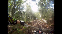
Photos of Die Mountain Bike
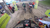
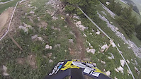
Videos of Die Mountain Bike
trail: Col de Ponet
0:09 |
54 |
Feb 21, 2022
trail: Col De Villard Die
3:55 |
88 |
Aug 18, 2017
trail: Col De Villard Die
4:01 |
246 |
Jun 7, 2016
trail: Col De Villard Die
7:02 |
40 |
Jul 15, 2015
trail: Col De Villard Die
3:29 |
55 |
Jun 7, 2015
trail: Col De Villard Die
2:15 |
402 |
Sep 8, 2014
trail: Col De Villard Die
4:46 |
174 |
Sep 3, 2013
trail: Col De Villard Die
5:53 |
81 |
Jul 10, 2012
Recent Trail Reports
National Scenic Trails & Official Routes
-
Grande Traversée VTT des Préalpes - Les Chemins du Soleil
- Mountain Bike
- E-Bike
Activity Feed
| username | action | type | title | date |
|---|---|---|---|---|
| ika-rus | comment | trail | activity #95763386 | May 29, 2026 @ 2:33am May 29, 2026 |
| freerider48 | comment | trail | activity #95762288 | May 29, 2026 @ 1:38am May 29, 2026 |
| freerider48 | add | trail | activity #95762271 | May 29, 2026 @ 1:37am May 29, 2026 |
| ika-rus | add | report | activity #95691735 and 8 more | May 28, 2026 @ 1:12am May 28, 2026 |
| ika-rus | comment | trail | activity #95691725 and 3 more | May 28, 2026 @ 1:12am May 28, 2026 |
Recent Comments
| username | type | title | comment | date |
|---|---|---|---|---|
| trail | Thanks! | May 29, 2026 @ 2:33am May 29, 2026 | ||
| trail | Thanks, just add the part in gravel road here... | May 29, 2026 @ 1:38am May 29, 2026 | ||
| trail | Part of the trail is a gravel road, trail a... | May 28, 2026 @ 3:18am May 28, 2026 | ||
| trail | The first 15-20 switchbacks are a bit tight,... | May 28, 2026 @ 1:19am May 28, 2026 | ||
| trail | Good uphill trail | May 28, 2026 @ 1:15am May 28, 2026 |
Local Badges
-

Epic Ride Climb 2k139 awarded -

Climbing 10k Badge15 awarded -

Climbing 100k Badge0 awarded -

Epic Ride Descent 2k148 awarded -

Descent 10k Badge15 awarded -

Descent 100k Badge0 awarded
Activity Type Stats
| activitytype | trails | distance | descent | descent distance | total vertical | rating | global rank | state rank | photos | reports | routes | ridelogs |
|---|---|---|---|---|---|---|---|---|---|---|---|---|
| Mountain Bike | 93 | 100 miles | 40,223 ft | 53 miles | 4,114 ft | #2,083 | #47 | 146 | 225 | 7 | 1,186 | |
| E-Bike | 51 | 27 miles | 9,918 ft | 13 miles | 3,622 ft | #3,101 | #179 | 211 | 1 | 107 | ||
| Adaptive Bike | 5 | #177 | #135 | |||||||||
| Hike | 93 | 100 miles | 40,223 ft | 53 miles | 4,114 ft | #1,627 | #41 | 226 | 89 | |||
| Trail Running | 93 | 100 miles | 40,223 ft | 53 miles | 4,114 ft | #1,592 | #46 | 226 | 25 | |||
| Dirtbike/Moto | 1 | 19 |
Frequently Asked Questions About Die
▼
What are the highest rated mountain biking trails in Die?
The highest rated mountain biking trails in Die are:
- Col de Chironne (4.4/5)
- Col de Ponet (4.4/5)
- Pas de la Perdrix (4.3/5)
- Tête-Dure (4.2/5)
- Col De Villard Die (4.2/5)
▼
What is the best time of the year to ride in Die?
Based on ride log data, the most popular months to ride in Die are:
- May (10 activities)
- October (7 activities)
- April (7 activities)
▼
Where can I park to ride in Die?
There are 2 parking locations listed in Die. The most popular parking spots are:
▼
What is the longest trail in Die?
The longest trail in Die is Balcon du Glandasse : Vire-sac to Bichon at 4.9 km. View all trails sorted by distance.
Activities
Trails
Points of Interest
- By Whipperman
 & contributors
 - Admins: Whipperman, provencemb
- #20032 - 5,025 views
- die activity log | embed map of Die mountain bike trails | die mountain biking points of interest
Downloading of trail gps tracks in kml & gpx formats is enabled for Die.
You must login to download files.