close
-
Layers w
- Weather Layers
- Pro
- Pro
- Pro
- Pro
- Pro
- Pro
- More Layers
- Pro
- Pro
- Pro
- Pro
-
Upgrade to

3D
Trail Conditions
- Unknown
- Snow Groomed
- Snow Packed
- Snow Covered
- Snow Cover Partial
- Freeze/thaw Cycle
- Icy
- Prevalent Mud
- Wet
- Variable
- Ideal
- Dry
- Very Dry
Trail Flow (Ridden Direction)
Trailforks scans users ridelogs to determine the most popular direction each trail is ridden. A good flowing trail network will have most trails flowing in a single direction according to their intension.
The colour categories are based on what percentage of riders are riding a trail in its intended direction.
The colour categories are based on what percentage of riders are riding a trail in its intended direction.
- > 96%
- > 90%
- > 80%
- > 70%
- > 50%
- < 50%
- bi-directional trail
- no data
Trail Last Ridden
Trailforks scans ridelogs to determine the last time a trail was ridden.
- < 2 days
- < 1 week
- < 2 weeks
- < 1 month
- < 6 months
- > 6 months
Trail Ridden Direction
The intended direction a trail should be ridden.
- Downhill Only
- Downhill Primary
- Both Directions
- Uphill Primary
- Uphill Only
- One Direction
Contribute Details
Colors indicate trail is missing specified detail.
- Description
- Photos
- Description & Photos
- Videos
Trail Popularity ?
Trailforks scans ridelogs to determine which trails are ridden the most in the last 9 months.
Trails are compared with nearby trails in the same city region with a possible 25 colour shades.
Think of this as a heatmap, more rides = more kinetic energy = warmer colors.
- most popular
- popular
- less popular
- not popular
ATV/ORV/OHV Filter
Max Vehicle Width
inches
US Cell Coverage
Legend

Radar Time
Activity Recordings
Trailforks uses anonymized public activity data.
?
Activity Recordings
Trailforks uses anonymized public activity data.
?
Personal Heatmap
▶
Activity Types
all
/
none
▶
Options
2
Date range
month
–
Winter Trails
Warning
A routing network for winter maps does not exist. Selecting trails using the winter trails layer has been disabled.
Missing Trails
Most Popular
Least Popular
Trails are colored based on popularity. The more popular a trail is, the more red. Less popular trails trend towards green.
Jump Magnitude Heatmap
Heatmap of where riders jump on trails. Zoom in to see individual jumps, click circles to view jump details.
BC Backroad Status
![map legend]()
Service Road Atlas is a free to use, community-driven service for viewing and creating reports on the numerous back-country service roads around B.C. and Alberta.

Slope Aspect
Direction the slope faces
Trails Deemphasized
Trails are shown in grey.
Only show trails with no bike usage.
Suggested Layers
Based on selected activity type
Save the current map location and zoom level as your default home location whenever this page is loaded.
Save
No description for Dnipro has been added yet!
Login or register to submit one.
Activities Click to view
- Mountain Bike
6 trails
- E-Bike
5 trails
Region Details
- 5
Region Status
Caution as of Nov 5, 2024Stats
- Trails (view details)
- 6
- Trails Mountain Bike
- 6
- Trails E-Bike
- 5
- Trails Trail Running
- 1
- Total Distance
- 6 miles
- Total Descent
- 913 ft
- Total Vertical
- 299 ft
- Highest Trailhead
- 573 ft
- Reports
- 3
- Photos
- 6
- Ridden Counter
- 19
Popular Dnipro Mountain Biking Trails
• 50 ★ 0.0 • 2,454 ft • 0 ft • 5 •
Moderately popular blue difficulty singletrack. This mountain bike primary trail can be used downhill only and has a moderate overall physical rating with a 0 ft blue climb. It features drop, jump, roller coaster and other. Trail visibility is sometimes hard to follow.
• 100 ★ 0.0 • 1,093 ft • 0 ft • 4 •
Popular blue difficulty singletrack. This mountain bike primary trail can be used downhill only and has a easy overall physical rating. It features jump, ladder bridge and pump track. Trail visibility is always easy to follow.
• 85 ★ 0.0 • 3,901 ft • 2 ft • 4 •
Popular blue difficulty singletrack. This mountain bike primary trail can be used downhill only and has a moderate overall physical rating with a 2 ft blue climb. Trail visibility is no clear path.
• 35 ★ 0.0 • 2,566 ft • 0 ft • 2 •
Less popular blue difficulty singletrack. This mountain bike primary trail can be used downhill only and has a moderate overall physical rating with a 0 ft blue climb. It features drop, jump, wallride and other. Trail visibility is sometimes hard to follow.
• 70 ★ 0.0 • 1,178 ft • 0 ft •
Перший спуск трейлу "KozyrniTrails" починається з різкого скидання висоти та продовжується невеликим ухилом. На трейлі присутні різні...
Dnipro Mountain Bike Routes
6 miles • 722 ft • 0 •
Отже! Запрошення на V6 21.09.24 (балка Сухачівська, старт 10:00)!...
Photos of Dnipro Mountain Bike
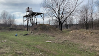
Videos of Dnipro Mountain Bike

trail: Dniprovski Kruchi V6
0:11 |
|
Apr 3, 2020
trail: Dniprovski Kruchi V6
0:11 |
|
Apr 3, 2020
Recent Trail Reports
| status | trail | date | condition | info | user |
|---|---|---|---|---|---|
| Dniprovski Kruchi V6 | May 20, 2022 @ 7:51am May 20, 2022 | Dry | VLKjuve |
Activity Feed
| username | action | type | title | date |
|---|---|---|---|---|
| SpaceHamsterBoo | add | photo | activity #73636310 and 5 more | Jun 12, 2025 @ 1:02pm Jun 12, 2025 |
| SpaceHamsterBoo | add | trail | activity #73634373 | Jun 12, 2025 @ 12:29pm Jun 12, 2025 |
| SpaceHamsterBoo | add | trail | activity #71768029 and 1 more | May 16, 2025 @ 8:47am May 16, 2025 |
| oZcfjc | add | trail | activity #66451458 | Feb 19, 2025 @ 9:57am Feb 19, 2025 |
| AlexF1 | add | route | activity #59076697 | Sep 18, 2024 @ 7:04am Sep 18, 2024 |
Activity Type Stats
| activitytype | trails | distance | descent | descent distance | total vertical | rating | global rank | state rank | photos | reports | routes | ridelogs |
|---|---|---|---|---|---|---|---|---|---|---|---|---|
| Mountain Bike | 6 | 6 miles | 912 ft | 3 miles | 299 ft | #11,343 | #29 | 6 | 3 | 1 | 1,143 | |
| E-Bike | 5 | 1,093 ft | 102 ft | 1,047 ft | 102 ft | #1,955 | #15 | 2 | 1 | 57 | ||
| Trail Running | 1 | 1,093 ft | 102 ft | 1,047 ft | 102 ft | 2 | 1 |
Frequently Asked Questions About Dnipro
▼
What are the highest rated mountain biking trails in Dnipro?
The highest rated mountain biking trails in Dnipro are:
- Blue trail (0/5)
- KTrail (0/5)
- Whined (0/5)
- Cascades (0/5)
- Number 14 (0/5)
▼
Where can I park to ride in Dnipro?
Check the Dnipro trail map for trailhead and parking information. Community members regularly update access and parking details for trails in the area.
▼
What is the longest trail in Dnipro?
The longest trail in Dnipro is Dniprovski Kruchi V6 at 6.0 miles. View all trails sorted by distance.
▼
How many trails are in Dnipro?
Dnipro has a total of 6 trails. Browse top mountain biking trails in Dnipro to find detailed information including difficulty ratings, distances, and trail conditions.
- By wibob & contributors
- Admins: bartek457
- #28785 - 1,142 views
- dnipro activity log | embed map of Dnipro mountain bike trails |
Downloading of trail gps tracks in kml & gpx formats is enabled for Dnipro.
You must login to download files.