close
-
Layers w
- Weather Layers
- Pro
- Pro
- Pro
- Pro
- Pro
- Pro
- More Layers
- Pro
- Pro
- Pro
- Pro
-
Upgrade to

3D
Trail Conditions
- Unknown
- Snow Groomed
- Snow Packed
- Snow Covered
- Snow Cover Partial
- Freeze/thaw Cycle
- Icy
- Prevalent Mud
- Wet
- Variable
- Ideal
- Dry
- Very Dry
Trail Flow (Ridden Direction)
Trailforks scans users ridelogs to determine the most popular direction each trail is ridden. A good flowing trail network will have most trails flowing in a single direction according to their intension.
The colour categories are based on what percentage of riders are riding a trail in its intended direction.
The colour categories are based on what percentage of riders are riding a trail in its intended direction.
- > 96%
- > 90%
- > 80%
- > 70%
- > 50%
- < 50%
- bi-directional trail
- no data
Trail Last Ridden
Trailforks scans ridelogs to determine the last time a trail was ridden.
- < 2 days
- < 1 week
- < 2 weeks
- < 1 month
- < 6 months
- > 6 months
Trail Ridden Direction
The intended direction a trail should be ridden.
- Downhill Only
- Downhill Primary
- Both Directions
- Uphill Primary
- Uphill Only
- One Direction
Contribute Details
Colors indicate trail is missing specified detail.
- Description
- Photos
- Description & Photos
- Videos
Trail Popularity ?
Trailforks scans ridelogs to determine which trails are ridden the most in the last 9 months.
Trails are compared with nearby trails in the same city region with a possible 25 colour shades.
Think of this as a heatmap, more rides = more kinetic energy = warmer colors.
- most popular
- popular
- less popular
- not popular
ATV/ORV/OHV Filter
Max Vehicle Width
inches
US Cell Coverage
Legend

Radar Time
Activity Recordings
Trailforks uses anonymized public activity data.
?
Activity Recordings
Trailforks uses anonymized public activity data.
?
Personal Heatmap
▶
Activity Types
all
/
none
▶
Options
2
Date range
month
–
Winter Trails
Warning
A routing network for winter maps does not exist. Selecting trails using the winter trails layer has been disabled.
Missing Trails
Most Popular
Least Popular
Trails are colored based on popularity. The more popular a trail is, the more red. Less popular trails trend towards green.
Jump Magnitude Heatmap
Heatmap of where riders jump on trails. Zoom in to see individual jumps, click circles to view jump details.
BC Backroad Status
![map legend]()
Service Road Atlas is a free to use, community-driven service for viewing and creating reports on the numerous back-country service roads around B.C. and Alberta.

Slope Aspect
Direction the slope faces
Trails Deemphasized
Trails are shown in grey.
Only show trails with no bike usage.
Suggested Layers
Based on selected activity type
Save the current map location and zoom level as your default home location whenever this page is loaded.
Save
No description for Dollar has been added yet!
Login or register to submit one.
This region uses the Uk/Euro style trail grading system.
Activities Click to view
- Mountain Bike
42 trails
- E-Bike
42 trails
- Adaptive Bike
0 trails
- Winter Fat Bike
0 trails
- Hike
31 trails
- Trail Running
31 trails
Region Details
- 10
- 6
- 10
- 3
- 7
- 1
Region Status
Open as of Jun 11, 2026Stats
- Avg Trail Rating
- Trails (view details)
- 37
- Trails Mountain Bike
- 44
- Trails E-Bike
- 42
- Trails Horse
- 1
- Trails Hike
- 31
- Trails Trail Running
- 31
- Total Distance
- 20 miles
- Total Descent
- 4,858 ft
- Total Vertical
- 1,580 ft
- Highest Trailhead
- 2,091 ft
- Reports
- 209
- Photos
- 60
- Ridden Counter
- 3,477
Sub Regions
-
Hillfoot Hill
- 5
- 8
- 2
- 7
- 1
Popular Dollar Mountain Biking Trails
• 85 ★ 4.9 • 1,867 ft • 0 ft • 397 •
Fast rough and technical, steep in places with flow in others. Drops, berms and jumps. All rollable with care or avoidable. Requires focus from top to bottom. Well worth riding if you are in the area.
• 100 ★ 4.8 • 827 ft • 0 ft • 263 •
Middle trail drops into a dense wooded section which is usually quite dark. This is a natural technical trail with a good steep gradient. There is 1 optional gap jump half way down and 1 natural drop near the end of the trail. Both...
• 95 ★ 4.4 • 1,004 ft • 3 ft • 232 •
Popular black difficulty singletrack. This mountain bike primary trail can be used downhill only and has a moderate overall physical rating with a 3 ft blue climb. It features berm, drop, jump and gap jump. Trail visibility is always easy to follow. On average it takes 1 minutes to complete this trail.
• 90 ★ 5.0 • 545 ft • 0 ft • 215 •
Popular black difficulty singletrack. This mountain bike primary trail and has a moderate overall physical rating with a 0 ft blue climb. It features berm, drop and rock garden. Trail visibility is always easy to follow. On average it takes minutes to complete this trail.
• 80 ★ 4.6 • 1,424 ft • 0 ft • 150 •
Popular black difficulty singletrack. This mountain bike primary trail and has a moderate overall physical rating with a 0 ft blue climb. It features berm and drop. Trail visibility is always easy to follow. On average it takes 3 minutes to complete this trail.
• 95 ★ 4.5 • 1,014 ft • 0 ft • 123 •
Popular black difficulty singletrack. This mountain bike primary trail can be used downhill only and has a moderate overall physical rating with a 0 ft blue climb. It features berm and drop. Trail visibility is always easy to follow. On average it takes 2 minutes to complete this trail.
• 75 ★ 5.0 • 837 ft • 149 ft • 121 • • hike
Popular green difficulty singletrack. This hike primary trail can be used both directions and has a moderate overall physical rating with a 149 ft blue climb. Trail visibility is always easy to follow. On average it takes 4 minutes to complete this trail.
Dollar Mountain Bike Routes
Hillfoot Carpark to Trailhead Featured
2 miles • 979 ft • 0 • Point to Point •
Route from Hillfoot carpark to Trail Head at top of . Uses well surfaced fire road for majority of climb...
★ 4.0 • 9 miles • 2,536 ft • 0 • Loop •
Beginning in Ochil HIlls Woodland Park, there is a tough climb to the top of Ben Buck. After a short but...
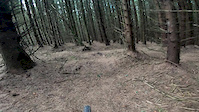
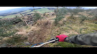
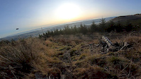
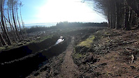
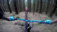
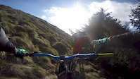
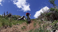
Photos of Dollar Mountain Bike
Videos of Dollar Mountain Bike
trail: DH Tree Line
3:10 |
396 |
Jul 21, 2020
trail: Heritage Trail
5:42 |
718 |
Dec 3, 2019
trail: DH Tree Line
0:00 |
177 |
Dec 2, 2019
trail: Heritage Trail
5:42 |
431 |
Dec 1, 2019
trail: DH Tree Line
3:34 |
744 |
Jun 4, 2017
trail: DH Tree Line
5:06 |
305 |
Apr 24, 2017
trail: DH Tree Line
0:11 |
448 |
Jun 25, 2016
Recent Trail Reports
| status | trail | date | condition | info | user |
|---|---|---|---|---|---|
| Lukes | May 17, 2026 @ 8:28pm (Europe/London) May 17, 2026 | Dry | aag87 BCDC | ||
| Lone Tree | May 17, 2026 @ 8:28pm (Europe/London) May 17, 2026 | Dry | aag87 BCDC | ||
| DH Bottom | May 17, 2026 @ 8:28pm (Europe/London) May 17, 2026 | Dry | aag87 BCDC | ||
| DH Top | May 4, 2026 @ 9:03am (Europe/London) May 4, 2026 | Unknown | Pinkleg1 DTC | ||
| Walkers Path | Jan 24, 2026 @ 10:37am (Pacific/Midway) Jan 24, 2026 | Variable | aag87 BCDC | ||
| Walkers Path | Jan 24, 2026 @ 10:37am (Pacific/Midway) Jan 24, 2026 | Ideal | aag87 BCDC | ||
| DH Middle | Jan 24, 2026 @ 10:37am (Pacific/Midway) Jan 24, 2026 | Ideal | aag87 BCDC | ||
| DH Tree Line | Jan 24, 2026 @ 10:37am (Pacific/Midway) Jan 24, 2026 | Variable | aag87 BCDC | ||
| Forest Road | Jan 24, 2026 @ 10:37am (Pacific/Midway) Jan 24, 2026 | Ideal | aag87 BCDC | ||
| Path | Oct 23, 2025 @ 1:56pm (America/Vancouver) Oct 23, 2025 | Wet | monkeystu52 |
Activity Feed
| username | action | type | title | date |
|---|---|---|---|---|
| WayneCsEvnF | wishlist | route | activity #97026517 | Jun 15, 2026 @ 12:28am 3 days |
| Callumwreford | ridden | trail | activity #96293356 | Jun 5, 2026 @ 7:12am Jun 5, 2026 |
| aag87 | update | trail | activity #94931609 | May 17, 2026 @ 12:42pm May 17, 2026 |
| aag87 | add | report | activity #94931359 and 2 more | May 17, 2026 @ 12:39pm May 17, 2026 |
| stuartw | add | report | activity #94841537 and 2 more | May 16, 2026 @ 12:21pm May 16, 2026 |
Recent Comments
| username | type | title | comment | date |
|---|---|---|---|---|
| trail | Cheers Rab! Give me a shout next time you're... | Aug 12, 2025 @ 2:11am Aug 12, 2025 | ||
| report | Running well sawcy now the growth has died off. | Jan 4, 2025 @ 11:43am Jan 4, 2025 | ||
| trail | Nice work been done on it. Flowy. | Jan 4, 2025 @ 11:41am Jan 4, 2025 | ||
| trail | Riding well in the hard frosty snow. Plenty... | Jan 4, 2025 @ 11:40am Jan 4, 2025 | ||
| trail | Nice stuff. | Jan 4, 2025 @ 11:39am Jan 4, 2025 |
Local Badges
-

Completionist6 awarded -

Epic Mountain Bike Climb 2k4 awarded -

Climbing 10k Badge16 awarded -

Mountain Biking 100k Badge0 awarded -

Epic Ride Descent 2k4 awarded -

Descent 10k Badge16 awarded
Activity Type Stats
| activitytype | trails | distance | descent | descent distance | total vertical | rating | global rank | state rank | photos | reports | routes | ridelogs |
|---|---|---|---|---|---|---|---|---|---|---|---|---|
| Mountain Bike | 42 | 20 miles | 4,859 ft | 10 miles | 1,581 ft | #2,826 | #91 | 51 | 213 | 3 | 2,790 | |
| E-Bike | 42 | 20 miles | 4,859 ft | 10 miles | 1,581 ft | #2,921 | #100 | 7 | 216 | 3 | 701 | |
| Horse | 1 | 2 miles | 650 ft | 2 miles | 584 ft | 18 | ||||||
| Hike | 31 | 18 miles | 2,907 ft | 8 miles | 1,581 ft | #5,105 | #116 | 2 | 129 | 1 | 466 | |
| Trail Running | 31 | 18 miles | 2,907 ft | 8 miles | 1,581 ft | #5,325 | #129 | 130 | 1 | 75 |
Frequently Asked Questions About Dollar
▼
What are the best places to ride in Dollar?
Dollar has 1 areas to explore for mountain biking. The top rated areas are:
▼
What are the highest rated mountain biking trails in Dollar?
The highest rated mountain biking trails in Dollar are:
- Heritage Trail (4.6/5)
- DH Top (4.4/5)
- DH Tree Line (4.4/5)
- DH Middle (4.3/5)
- DH Bottom (4.2/5)
▼
What is the best time of the year to ride in Dollar?
Based on ride log data, the most popular months to ride in Dollar are:
- August (16 activities)
- July (13 activities)
- September (6 activities)
▼
Where can I park to ride in Dollar?
There are 3 parking locations listed in Dollar. The most popular parking spots are: View all parking and trailhead locations on the map to plan your visit.
Activities
Trails
- dollar activity log | embed map of Dollar mountain bike trails | dollar mountain biking points of interest
Downloading of trail gps tracks in kml & gpx formats is enabled for Dollar.
You must login to download files.