close
-
Layers w
- Weather Layers
- Pro
- Pro
- Pro
- Pro
- Pro
- Pro
- More Layers
- Pro
- Pro
- Pro
- Pro
-
Upgrade to

3D
Trail Conditions
- Unknown
- Snow Groomed
- Snow Packed
- Snow Covered
- Snow Cover Partial
- Freeze/thaw Cycle
- Icy
- Prevalent Mud
- Wet
- Variable
- Ideal
- Dry
- Very Dry
Trail Flow (Ridden Direction)
Trailforks scans users ridelogs to determine the most popular direction each trail is ridden. A good flowing trail network will have most trails flowing in a single direction according to their intension.
The colour categories are based on what percentage of riders are riding a trail in its intended direction.
The colour categories are based on what percentage of riders are riding a trail in its intended direction.
- > 96%
- > 90%
- > 80%
- > 70%
- > 50%
- < 50%
- bi-directional trail
- no data
Trail Last Ridden
Trailforks scans ridelogs to determine the last time a trail was ridden.
- < 2 days
- < 1 week
- < 2 weeks
- < 1 month
- < 6 months
- > 6 months
Trail Ridden Direction
The intended direction a trail should be ridden.
- Downhill Only
- Downhill Primary
- Both Directions
- Uphill Primary
- Uphill Only
- One Direction
Contribute Details
Colors indicate trail is missing specified detail.
- Description
- Photos
- Description & Photos
- Videos
Trail Popularity ?
Trailforks scans ridelogs to determine which trails are ridden the most in the last 9 months.
Trails are compared with nearby trails in the same city region with a possible 25 colour shades.
Think of this as a heatmap, more rides = more kinetic energy = warmer colors.
- most popular
- popular
- less popular
- not popular
ATV/ORV/OHV Filter
Max Vehicle Width
inches
US Cell Coverage
Legend

Radar Time
Activity Recordings
Trailforks uses anonymized public activity data.
?
Activity Recordings
Trailforks uses anonymized public activity data.
?
Personal Heatmap
▶
Activity Types
all
/
none
▶
Options
2
Date range
month
–
Winter Trails
Warning
A routing network for winter maps does not exist. Selecting trails using the winter trails layer has been disabled.
Missing Trails
Most Popular
Least Popular
Trails are colored based on popularity. The more popular a trail is, the more red. Less popular trails trend towards green.
Jump Magnitude Heatmap
Heatmap of where riders jump on trails. Zoom in to see individual jumps, click circles to view jump details.
BC Backroad Status
![map legend]()
Service Road Atlas is a free to use, community-driven service for viewing and creating reports on the numerous back-country service roads around B.C. and Alberta.

Slope Aspect
Direction the slope faces
Trails Deemphasized
Trails are shown in grey.
Only show trails with no bike usage.
Suggested Layers
Based on selected activity type
Save the current map location and zoom level as your default home location whenever this page is loaded.
Save
No description for Duno has been added yet!
Login or register to submit one.
This region uses the Uk/Euro style trail grading system.
Activities Click to view
- Mountain Bike
24 trails
- E-Bike
15 trails
- Adaptive Bike
0 trails
- Winter Fat Bike
0 trails
- Hike
29 trails
- Trail Running
29 trails
Region Details
- 1
- 1
- 9
- 11
Region Status
Open as of Apr 4, 2026Stats
- Avg Trail Rating
- Trails (view details)
- 25
- Trails Mountain Bike
- 24
- Trails E-Bike
- 15
- Trails Hike
- 29
- Trails Trail Running
- 29
- Total Distance
- 19 miles
- Total Descent Distance
- 16 miles
- Total Descent
- 11,878 ft
- Total Vertical
- 3,011 ft
- Highest Trailhead
- 3,864 ft
- Reports
- 235
- Photos
- 39
- Ridden Counter
- 1,113
Sub Regions
-
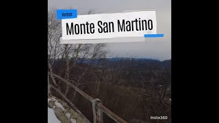
Monte San Martino
- 1
- 8
- 11
Popular Duno Mountain Biking Trails
• 90 ★ 4.7 • 3,875 ft • 4 ft • 87 •
Rocky, steep and loose trail equipped with some drops
• 95 ★ 4.7 • 3,993 ft • 0 ft • 79 •
Flow trail equipped with jumps, drops, berms and steep sections.
• 100 ★ 4.0 • 4,042 ft • 0 ft • 73 •
Flow trail, with some high gradient and off-camber sections.
• 70 ★ 4.0 • 1,509 ft • 0 ft • 58 •
Flow trail equipped with some jumps and a little toboga.
• 60 ★ 4.0 • 1,542 ft • 0 ft • 56 •
Moderately popular red difficulty singletrack. This multi-use trail can be used downhill only. It features berm, drop, jump, rock face, rock garden and skinny. On average it takes 6 minutes to complete this trail.
• 80 ★ 3.0 • 2 miles • 378 ft • 37 •
Tipica strada funzionale alla Linea Cadorna che taglia in costa una bella faggeta. Dapprima qualche saliscendi poi discesa continua con leggera pendenza che invita a correre ma prestare attenzione al fondo spesso smosso.
• 85 ★ 4.0 • 4 miles • 216 ft • 35 •
Tipica strada funzionale alla Linea Cadorna, mai ripida e con fondo discreto a volte un poco smosso.
• 75 ★ 3.0 • 4,085 ft • 0 ft • 29 •
Da e per Cassano Valcuvia su bella stradina sterrata con buon fondo.
Duno Mountain Bike Routes
★ 4.0 • 13 miles • 3,503 ft • 7 •
I Mufloni della Valcuvia sono un bel gruppo di bikers che recentemente hanno iniziato a sistemare, sulle...
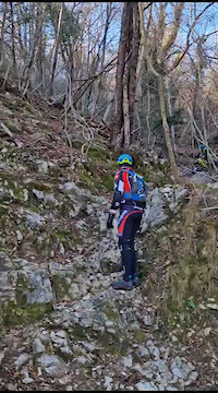
Photos of Duno Mountain Bike
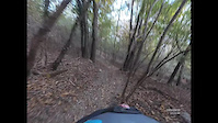
Videos of Duno Mountain Bike
trail: Il Nano 2nd Part
0:32 |
22 |
Dec 18, 2023
trail: La Laida (Furnasascia)
0:00 |
153 |
Oct 30, 2021
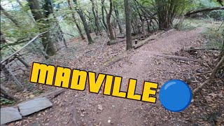
trail: Madville
5:45 |
21 |
Dec 1, 2025 , Duno
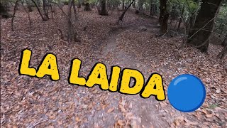
trail: La Laida (Furnasascia)
6:44 |
33 |
Dec 1, 2025 , Duno
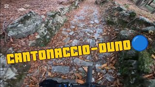
trail: Cantonaccio-Duno
6:45 |
43 |
Nov 21, 2025 , Duno
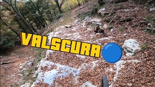
trail: Valscura
8:33 |
24 |
Nov 21, 2025 , Duno
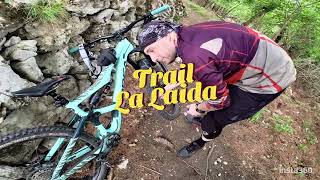
trail: La Laida (Furnasascia)
6:35 |
150 |
May 2, 2024 , Duno
trail: Valalta DH
13:27 |
170 |
Jan 7, 2024 , Duno
Recent Trail Reports
| status | trail | date | condition | info | user |
|---|---|---|---|---|---|
| S.Michele - Valalta | Apr 4, 2026 @ 6:41am (America/Vancouver) Apr 4, 2026 | Variable | AlbertokKbRr1 | ||
| Valscura | Oct 20, 2025 @ 7:18am (Europe/Rome) Oct 19, 2025 | Dry | StefanoTWTOCw | ||
| Cantonaccio-Duno | Oct 19, 2025 @ 11:04pm (Europe/Rome) Oct 19, 2025 | Dry | StefanoTWTOCw | ||
| Madville | Oct 19, 2025 @ 10:56pm (Europe/Rome) Oct 19, 2025 | Dry | StefanoTWTOCw | ||
| La Laida (Furnasascia) | Oct 19, 2025 @ 10:50pm (Europe/Rome) Oct 19, 2025 | Dry | StefanoTWTOCw | ||
| Ca' de' Rocc | Sep 20, 2025 @ 1:41pm (Europe/Rome) Sep 20, 2025 | Ideal | Jolf73 | ||
| Alpe Bisio | Sep 14, 2025 @ 8:57am (Europe/Rome) Sep 13, 2025 | Variable | Jolf73 | ||
| L' Aves | Sep 14, 2025 @ 8:57am (Europe/Rome) Sep 13, 2025 | Variable | Jolf73 | ||
| Il Nano 2nd Part | Feb 27, 2025 @ 11:21am Feb 27, 2025 | Ideal | dellock6 | ||
| Nano Trail 1st Part | Feb 27, 2025 @ 11:21am Feb 27, 2025 | Ideal | dellock6 |
Activity Feed
| username | action | type | title | date |
|---|---|---|---|---|
| Stefanof2Io9R | ridden | trail | activity #94273129 and 4 more | May 8, 2026 @ 12:49pm May 8, 2026 |
| AlbertokKbRr1 | checkin | trail | activity #91890911 | Apr 4, 2026 @ 6:41am Apr 4, 2026 |
| AlbertokKbRr1 | add | report | activity #91890910 | Apr 4, 2026 @ 6:41am Apr 4, 2026 |
| AlbertokKbRr1 | ridden | trail | activity #91890838 | Apr 4, 2026 @ 6:40am Apr 4, 2026 |
| therebex | ridden | trail | activity #90539359 | Mar 14, 2026 @ 4:06am Mar 14, 2026 |
Recent Comments
| username | type | title | comment | date |
|---|---|---|---|---|
| trail | sentiero inizialmente nel bosco su terreno... | Oct 19, 2025 @ 10:15pm Oct 19, 2025 | ||
| trail | tecnicamente sempice, ma da guidare con... | Oct 19, 2025 @ 2:05pm Oct 19, 2025 | ||
| trail | più che un trail a se stante, direi che è... | Oct 19, 2025 @ 2:00pm Oct 19, 2025 | ||
| trail | Trail veramente divertente. Tracciato e... | Oct 19, 2025 @ 1:55pm Oct 19, 2025 | ||
| report | That might be interesting as a trail comment :) | May 27, 2024 @ 3:24am May 27, 2024 |
Local Badges
-

Epic Mountain Bike Climb 2k10 awarded -

Climbing 10k Badge4 awarded -

Mountain Biking 100k Badge0 awarded -

Epic Ride Descent 2k10 awarded -

Descent 10k Badge4 awarded -

Descent 100k Badge0 awarded
Activity Type Stats
| activitytype | trails | distance | descent | descent distance | total vertical | rating | global rank | state rank | photos | reports | routes | ridelogs |
|---|---|---|---|---|---|---|---|---|---|---|---|---|
| Mountain Bike | 24 | 18 miles | 11,457 ft | 15 miles | 3,012 ft | #6,065 | #478 | 40 | 235 | 1 | 480 | |
| E-Bike | 15 | 9 miles | 5,049 ft | 7 miles | 3,012 ft | #6,010 | #609 | 214 | 1 | 134 | ||
| Hike | 29 | 19 miles | 11,198 ft | 15 miles | 3,012 ft | #6,991 | #378 | 235 | 23 | |||
| Trail Running | 29 | 19 miles | 11,198 ft | 15 miles | 3,012 ft | #6,814 | #389 | 235 | 68 |
Frequently Asked Questions About Duno
▼
What are the best places to ride in Duno?
Duno has 1 areas to explore for mountain biking. The top rated areas are:
▼
What are the highest rated mountain biking trails in Duno?
The highest rated mountain biking trails in Duno are:
- La Laida (Furnasascia) (4.2/5)
- Valalta DH (4.2/5)
- L' Aves (4.1/5)
- Madville (4/5)
- Il Nano 2nd Part (4/5)
▼
What is the best time of the year to ride in Duno?
Based on ride log data, the most popular months to ride in Duno are:
- March (5 activities)
- April (4 activities)
- December (4 activities)
▼
Where can I park to ride in Duno?
Check the Duno trail map for trailhead and parking information. Community members regularly update access and parking details for trails in the area.
Activities
Trails
Points of Interest
- By Luchino83
 & contributors
 - Admins: marcoangeletti, adessoomaipiu, micheletraversi, adessoomaipiu
- #38148 - 1,300 views
- duno activity log | embed map of Duno mountain bike trails |
Downloading of trail gps tracks in kml & gpx formats is enabled for Duno.
You must login to download files.