close
-
Layers w
- Weather Layers
- Pro
- Pro
- Pro
- Pro
- Pro
- Pro
- More Layers
- Pro
- Pro
- Pro
- Pro
-
Upgrade to

3D
Trail Conditions
- Unknown
- Snow Groomed
- Snow Packed
- Snow Covered
- Snow Cover Partial
- Freeze/thaw Cycle
- Icy
- Prevalent Mud
- Wet
- Variable
- Ideal
- Dry
- Very Dry
Trail Flow (Ridden Direction)
Trailforks scans users ridelogs to determine the most popular direction each trail is ridden. A good flowing trail network will have most trails flowing in a single direction according to their intension.
The colour categories are based on what percentage of riders are riding a trail in its intended direction.
The colour categories are based on what percentage of riders are riding a trail in its intended direction.
- > 96%
- > 90%
- > 80%
- > 70%
- > 50%
- < 50%
- bi-directional trail
- no data
Trail Last Ridden
Trailforks scans ridelogs to determine the last time a trail was ridden.
- < 2 days
- < 1 week
- < 2 weeks
- < 1 month
- < 6 months
- > 6 months
Trail Ridden Direction
The intended direction a trail should be ridden.
- Downhill Only
- Downhill Primary
- Both Directions
- Uphill Primary
- Uphill Only
- One Direction
Contribute Details
Colors indicate trail is missing specified detail.
- Description
- Photos
- Description & Photos
- Videos
Trail Popularity ?
Trailforks scans ridelogs to determine which trails are ridden the most in the last 9 months.
Trails are compared with nearby trails in the same city region with a possible 25 colour shades.
Think of this as a heatmap, more rides = more kinetic energy = warmer colors.
- most popular
- popular
- less popular
- not popular
ATV/ORV/OHV Filter
Max Vehicle Width
inches
US Cell Coverage
Legend

Radar Time
Activity Recordings
Trailforks uses anonymized public activity data.
?
Activity Recordings
Trailforks uses anonymized public activity data.
?
Personal Heatmap
▶
Activity Types
all
/
none
▶
Options
2
Date range
month
–
Winter Trails
Warning
A routing network for winter maps does not exist. Selecting trails using the winter trails layer has been disabled.
Missing Trails
Most Popular
Least Popular
Trails are colored based on popularity. The more popular a trail is, the more red. Less popular trails trend towards green.
Jump Magnitude Heatmap
Heatmap of where riders jump on trails. Zoom in to see individual jumps, click circles to view jump details.
BC Backroad Status
![map legend]()
Service Road Atlas is a free to use, community-driven service for viewing and creating reports on the numerous back-country service roads around B.C. and Alberta.

Slope Aspect
Direction the slope faces
Trails Deemphasized
Trails are shown in grey.
Only show trails with no bike usage.
Suggested Layers
Based on selected activity type
Save the current map location and zoom level as your default home location whenever this page is loaded.
Save
No description for Epinal has been added yet!
Login or register to submit one.
This region uses the Uk/Euro style trail grading system.
Activities Click to view
- Mountain Bike
86 trails
- E-Bike
64 trails
- Adaptive Bike
- Winter Fat Bike
0 trails
- Hike
62 trails
- Trail Running
64 trails
Region Details
- 25
- 14
- 31
- 14
- 2
Region Status
Caution as of May 10, 2025Stats
- Trails (view details)
- 86
- Trails Mountain Bike
- 86
- Trails E-Bike
- 64
- Trails Hike
- 62
- Trails Trail Running
- 64
- Trails Dirtbike/Moto
- 1
- Total Distance
- 36 miles
- Total Descent Distance
- 15 miles
- Total Descent
- 5,975 ft
- Total Vertical
- 487 ft
- Highest Trailhead
- 1,595 ft
- Reports
- 30
- Ridden Counter
- 870
Sub Regions
-
La 40 Semaine
- 2
-
Vallon d'Olima
- 14
- 25
- 13
- 2
Popular Epinal Mountain Biking Trails
• 100 ★ 0.0 • 2,195 ft • 11 ft • 16 •
Main singletrack link to the Olima Valley. Good flow and fast track.
• 95 ★ 0.0 • 430 ft • 0 ft • 16 •
Popular black difficulty singletrack. This mountain bike primary trail can be used downhill only. On average it takes minutes to complete this trail.
• 80 ★ 0.0 • 1,440 ft • 0 ft • 15 •
Trail on soft surface and rocks as well. Quiet technical.
• 45 ★ 0.0 • 1,102 ft • 0 ft • 13 •
Moderately popular red difficulty singletrack. This mountain bike primary trail can be used downhill only and has a easy overall physical rating. It features jump and gap jump. Trail visibility is always easy to follow. On average it takes minutes to complete this trail.
• 100 ★ 0.0 • 397 ft • 14 ft • 13 •
Popular blue difficulty singletrack. This mountain bike primary trail can be used uphill primary. On average it takes minutes to complete this trail.
• 100 ★ 0.0 • 4,475 ft • 27 ft • 12 •
Popular green difficulty machine groomed. This mountain bike primary trail can be used both directions. On average it takes 3 minutes to complete this trail.
• 25 ★ 0.0 • 1,798 ft • 19 ft • 12 •
Less popular blue difficulty singletrack. This mountain bike primary trail can be used both directions. On average it takes 5 minutes to complete this trail.
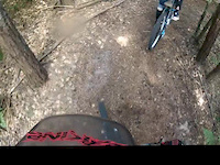
Videos of Epinal Mountain Bike
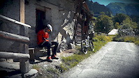
trail: Desire
2:16 |
49 |
Aug 27, 2020
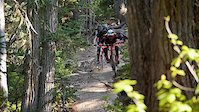
trail: Nelson
5:06 |
37051 |
Nov 17, 2015
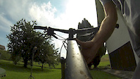
trail: Desire
2:34 |
349 |
Aug 9, 2014
trail: L'ONF
0:16 |
135 |
Feb 8, 2013
trail: The North Face
8:14 |
248 |
Sep 25, 2011
Recent Trail Reports
| status | trail | date | condition | info | user |
|---|---|---|---|---|---|
| Access Trail / Chemin d'accès | Nov 1, 2023 @ 2:30am Nov 1, 2023 | Wet | FannyArno | ||
| La Crèche | Apr 16, 2021 @ 11:09am Apr 16, 2021 | Dry | felixfritz | ||
| Access Trail / Chemin d'accès | Mar 2, 2021 @ 1:23am Mar 2, 2021 | Ideal | Desmo88R | ||
| L'antenne | Nov 21, 2020 @ 5:14am Nov 21, 2020 | Wet | Vicfri88 | ||
| Marquisat Uphill | Nov 21, 2020 @ 5:14am Nov 21, 2020 | Wet | Vicfri88 | ||
| L'Homme Mort | Sep 20, 2020 @ 5:56am Sep 20, 2020 | Very Dry | Vicfri88 |
Activity Feed
| username | action | type | title | date |
|---|---|---|---|---|
| mattmalabanan | add | poi | activity #73947933 and 1 more | Jun 16, 2025 @ 7:45pm Jun 16, 2025 |
| ejensen3 | wishlist | region | activity #69274214 | Apr 8, 2025 @ 10:46pm Apr 8, 2025 |
| Deschaseaux | wishlist | region | activity #47604750 | Dec 25, 2023 @ 11:23am Dec 25, 2023 |
| FannyArno | add | report | activity #45821261 | Nov 1, 2023 @ 5:26am Nov 1, 2023 |
| flo5459 | wishlist | skillpark | activity #45106637 | Oct 11, 2023 @ 2:56am Oct 11, 2023 |
Local Badges
-

Completionist0 awarded
Bike & Skill Parks
| name | type | city | rating |
|---|---|---|---|
| Buzzline | skill park | Epinal | |
| BMX Uxegney | skill park | Epinal |
Activity Type Stats
| activitytype | trails | distance | descent | descent distance | total vertical | rating | global rank | state rank | photos | reports | routes | ridelogs |
|---|---|---|---|---|---|---|---|---|---|---|---|---|
| Mountain Bike | 86 | 36 miles | 5,974 ft | 15 miles | 486 ft | #10,679 | #701 | 30 | 1,301 | |||
| E-Bike | 64 | 31 miles | 4,619 ft | 13 miles | 486 ft | #3,094 | #180 | 10 | 68 | |||
| Hike | 62 | 31 miles | 4,268 ft | 12 miles | 486 ft | #4,921 | #159 | 29 | 20 | |||
| Trail Running | 64 | 32 miles | 4,495 ft | 13 miles | 486 ft | #4,177 | #137 | 30 | 274 | |||
| Dirtbike/Moto | 1 | 2,884 ft | 157 ft | 2,700 ft | 157 ft | 1 |
Frequently Asked Questions About Epinal
▼
What are the best places to ride in Epinal?
Epinal has 2 areas to explore for mountain biking. The top rated areas are:
▼
What are the highest rated mountain biking trails in Epinal?
The highest rated mountain biking trails in Epinal are:
- Beau Désir Link (0/5)
- Ti Lift (0/5)
- The Long Way Down (0/5)
- La Chauve Souris (0/5)
- The Duke (0/5)
▼
What is the best time of the year to ride in Epinal?
Based on ride log data, the most popular months to ride in Epinal are:
- September (2 activities)
- August (2 activities)
- June (1 activities)
▼
Where can I park to ride in Epinal?
There are 11 parking locations listed in Epinal. The most popular parking spots are: View all parking and trailhead locations on the map to plan your visit.
Activities
Trails
- By Vicfri88 & contributors
- Admins: mtbrideman, Vicfri88
- #33739 - 2,000 views
- epinal activity log | embed map of Epinal mountain bike trails | epinal mountain biking points of interest
Downloading of trail gps tracks in kml & gpx formats is enabled for Epinal.
You must login to download files.