close
-
Layers w
- Weather Layers
- Pro
- Pro
- Pro
- Pro
- Pro
- Pro
- More Layers
- Pro
- Pro
- Pro
- Pro
-
Upgrade to

3D
Trail Conditions
- Unknown
- Snow Groomed
- Snow Packed
- Snow Covered
- Snow Cover Partial
- Freeze/thaw Cycle
- Icy
- Prevalent Mud
- Wet
- Variable
- Ideal
- Dry
- Very Dry
Trail Flow (Ridden Direction)
Trailforks scans users ridelogs to determine the most popular direction each trail is ridden. A good flowing trail network will have most trails flowing in a single direction according to their intension.
The colour categories are based on what percentage of riders are riding a trail in its intended direction.
The colour categories are based on what percentage of riders are riding a trail in its intended direction.
- > 96%
- > 90%
- > 80%
- > 70%
- > 50%
- < 50%
- bi-directional trail
- no data
Trail Last Ridden
Trailforks scans ridelogs to determine the last time a trail was ridden.
- < 2 days
- < 1 week
- < 2 weeks
- < 1 month
- < 6 months
- > 6 months
Trail Ridden Direction
The intended direction a trail should be ridden.
- Downhill Only
- Downhill Primary
- Both Directions
- Uphill Primary
- Uphill Only
- One Direction
Contribute Details
Colors indicate trail is missing specified detail.
- Description
- Photos
- Description & Photos
- Videos
Trail Popularity ?
Trailforks scans ridelogs to determine which trails are ridden the most in the last 9 months.
Trails are compared with nearby trails in the same city region with a possible 25 colour shades.
Think of this as a heatmap, more rides = more kinetic energy = warmer colors.
- most popular
- popular
- less popular
- not popular
ATV/ORV/OHV Filter
Max Vehicle Width
inches
US Cell Coverage
Legend

Radar Time
Activity Recordings
Trailforks uses anonymized public activity data.
?
Activity Recordings
Trailforks uses anonymized public activity data.
?
Personal Heatmap
▶
Activity Types
all
/
none
▶
Options
2
Date range
month
–
Winter Trails
Warning
A routing network for winter maps does not exist. Selecting trails using the winter trails layer has been disabled.
Missing Trails
Most Popular
Least Popular
Trails are colored based on popularity. The more popular a trail is, the more red. Less popular trails trend towards green.
Jump Magnitude Heatmap
Heatmap of where riders jump on trails. Zoom in to see individual jumps, click circles to view jump details.
BC Backroad Status
![map legend]()
Service Road Atlas is a free to use, community-driven service for viewing and creating reports on the numerous back-country service roads around B.C. and Alberta.

Slope Aspect
Direction the slope faces
Trails Deemphasized
Trails are shown in grey.
Only show trails with no bike usage.
Suggested Layers
Based on selected activity type
Save the current map location and zoom level as your default home location whenever this page is loaded.
Save
No description for Exeter has been added yet!
Login or register to submit one.
This region uses the Uk/Euro style trail grading system.
Activities Click to view
- Mountain Bike
22 trails
- E-Bike
11 trails
- Adaptive Bike
0 trails
- Horse
4 trails
- Hike
15 trails
- Trail Running
15 trails
Region Details
- 4
- 1
- 13
- 4
Region Status
Caution as of Feb 24, 2026Stats
- Avg Trail Rating
- Trails (view details)
- 22
- Trails Mountain Bike
- 22
- Trails E-Bike
- 11
- Trails Horse
- 4
- Trails Hike
- 15
- Trails Trail Running
- 15
- Total Distance
- 3 miles
- Total Descent
- 462 ft
- Total Vertical
- 311 ft
- Highest Trailhead
- 779 ft
- Reports
- 21
- Photos
- 4
- Ridden Counter
- 538
Sub Regions
-
Cafe Side Haldon
- 1
- 1
-
Stoke Woods
- 5
- 3
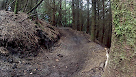
Popular Exeter Mountain Biking Trails
• 5 ★ 4.4 • 1,759 ft • 0 ft • 68 •
Less popular red difficulty singletrack. This mountain bike primary trail can be used downhill only. It features berm, drop, jump, gap jump and rock garden. On average it takes 1 minutes to complete this trail.
• 100 ★ 0.0 • 899 ft • 0 ft • 50 •
Popular blue difficulty singletrack. This mountain bike primary trail can be used downhill only.
• 5 ★ 0.0 • 3,048 ft • 83 ft • 20 •
Bi directional but a good climb alternative than the standard tracks
• 5 ★ 3.0 • 1,876 ft • 17 ft • 12 •
Mixture of flatter and steeper sections. Lots of roots and flint. A few small jumps. Traverses left around the hill to the end and the road. Climb the road to run it again. New trail and needs traffic on it.
• 95 ★ 0.0 • 1,161 ft • 0 ft • 7 •
Orange peel simple flow through trees across flat to drop and roll through twisting trees to exit
• 90 ★ 0.0 • 1,594 ft • 0 ft • 5 •
Popular blue difficulty singletrack. This mountain bike primary trail can be used both directions.
• 65 ★ 0.0 • 266 ft • 0 ft • 2 •
steep trail starting from below the first set of stairs after the main decent from car park. steep narrow start to trail followed by sharp and steep right hand turn, with option to drop on far right side. small log drop towards end of...


Recent Trail Reports
| status | trail | date | condition | info | user |
|---|---|---|---|---|---|
| Shelter 1 | Feb 24, 2026 @ 5:34pm (Europe/London) Feb 24, 2026 | Variable | davemassive | ||
| All The Way | Dec 28, 2025 @ 9:57am (Europe/London) Dec 28, 2025 | Ideal | RHoward1234 | ||
| Tin Can Alley | Mar 7, 2025 @ 5:11pm Mar 7, 2025 | Unknown | davemassive | ||
| Orange Peel | Feb 11, 2025 @ 5:46pm Feb 11, 2025 | Ideal | davemassive | ||
| Flint Vs Holly | Jun 30, 2024 @ 1:35am Jun 30, 2024 | Very Dry | ThexMiniman | ||
| better on the up | Mar 14, 2021 @ 12:20am Mar 14, 2021 | Wet | davemassive | ||
| To the Trailhead | Oct 8, 2020 @ 9:28am Oct 8, 2020 | Variable | JacobL993 | ||
| Access | Oct 8, 2020 @ 9:28am Oct 8, 2020 | Ideal | JacobL993 | ||
| Access | Jun 8, 2020 @ 10:08am Jun 8, 2020 | Ideal | JacobL993 |
Activity Feed
| username | action | type | title | date |
|---|---|---|---|---|
| davemassive | add | report | activity #89481139 | Feb 24, 2026 @ 1:01pm Feb 24, 2026 |
| RHoward1234 | add | report | activity #86214739 | Dec 28, 2025 @ 8:25am Dec 28, 2025 |
| JayvdiUrg | add | trail | activity #82444409 and 7 more | Oct 16, 2025 @ 7:06am Oct 16, 2025 |
| patagonia | comment | trail | activity #70235788 | Apr 23, 2025 @ 2:41pm Apr 23, 2025 |
| ZanderMTB | wishlist | trail | activity #69275543 | Apr 8, 2025 @ 11:41pm Apr 8, 2025 |
Recent Comments
| username | type | title | comment | date |
|---|---|---|---|---|
| trail | Freshened up recently and downed tree removed... | Apr 23, 2025 @ 2:41pm Apr 23, 2025 | ||
| trail | Anyone know who the builder is | Feb 20, 2021 @ 7:54am Feb 20, 2021 |
Local Badges
-

Epic Mountain Bike Climb 2k0 awarded -

Climbing 10k Badge0 awarded -

Mountain Biking 100k Badge0 awarded -

Epic Ride Descent 2k0 awarded -

Descent 10k Badge0 awarded -

Descent 100k Badge0 awarded
Bike & Skill Parks
| name | type | city | rating |
|---|---|---|---|
| Willand jumps | skill park | Exeter |
Activity Type Stats
| activitytype | trails | distance | descent | descent distance | total vertical | rating | global rank | state rank | photos | reports | routes | ridelogs |
|---|---|---|---|---|---|---|---|---|---|---|---|---|
| Mountain Bike | 22 | 3 miles | 463 ft | 1 mile | 312 ft | #8,857 | #344 | 4 | 21 | 4,862 | ||
| E-Bike | 11 | 3 miles | 318 ft | 4,800 ft | 312 ft | #4,968 | #209 | 19 | 118 | |||
| Horse | 4 | 2 miles | 141 ft | 2,513 ft | 174 ft | #1,468 | #78 | |||||
| Hike | 15 | 2 miles | 141 ft | 2,513 ft | 174 ft | #8,067 | #239 | 17 | 875 | |||
| Trail Running | 15 | 2 miles | 141 ft | 2,513 ft | 174 ft | #7,911 | #240 | 17 | 8 |
Frequently Asked Questions About Exeter
▼
What are the best places to ride in Exeter?
Exeter has 2 areas to explore for mountain biking. The top rated areas are:
▼
What are the highest rated mountain biking trails in Exeter?
The highest rated mountain biking trails in Exeter are:
- V2 (4.1/5)
- Flint Vs Holly (3.8/5)
- All The Way (0/5)
- Orange Peel (0/5)
- Tin Can Alley (0/5)
▼
What is the best time of the year to ride in Exeter?
Based on ride log data, the most popular months to ride in Exeter are:
- August (3 activities)
- October (3 activities)
- July (3 activities)
▼
Where can I park to ride in Exeter?
Check the Exeter trail map for trailhead and parking information. Community members regularly update access and parking details for trails in the area.
- By mtbmonkey & contributors
- Admins: wisey, MathieuC, cemoorelife
- #8083 - 6,985 views
- exeter activity log | embed map of Exeter mountain bike trails |
Downloading of trail gps tracks in kml & gpx formats is enabled for Exeter.
You must login to download files.