close
-
Layers w
- Weather Layers
- Pro
- Pro
- Pro
- Pro
- Pro
- Pro
- More Layers
- Pro
- Pro
- Pro
- Pro
-
Upgrade to

3D
Trail Conditions
- Unknown
- Snow Groomed
- Snow Packed
- Snow Covered
- Snow Cover Partial
- Freeze/thaw Cycle
- Icy
- Prevalent Mud
- Wet
- Variable
- Ideal
- Dry
- Very Dry
Trail Flow (Ridden Direction)
Trailforks scans users ridelogs to determine the most popular direction each trail is ridden. A good flowing trail network will have most trails flowing in a single direction according to their intension.
The colour categories are based on what percentage of riders are riding a trail in its intended direction.
The colour categories are based on what percentage of riders are riding a trail in its intended direction.
- > 96%
- > 90%
- > 80%
- > 70%
- > 50%
- < 50%
- bi-directional trail
- no data
Trail Last Ridden
Trailforks scans ridelogs to determine the last time a trail was ridden.
- < 2 days
- < 1 week
- < 2 weeks
- < 1 month
- < 6 months
- > 6 months
Trail Ridden Direction
The intended direction a trail should be ridden.
- Downhill Only
- Downhill Primary
- Both Directions
- Uphill Primary
- Uphill Only
- One Direction
Contribute Details
Colors indicate trail is missing specified detail.
- Description
- Photos
- Description & Photos
- Videos
Trail Popularity ?
Trailforks scans ridelogs to determine which trails are ridden the most in the last 9 months.
Trails are compared with nearby trails in the same city region with a possible 25 colour shades.
Think of this as a heatmap, more rides = more kinetic energy = warmer colors.
- most popular
- popular
- less popular
- not popular
ATV/ORV/OHV Filter
Max Vehicle Width
inches
US Cell Coverage
Legend

Radar Time
Activity Recordings
Trailforks uses anonymized public activity data.
?
Activity Recordings
Trailforks uses anonymized public activity data.
?
Personal Heatmap
▶
Activity Types
all
/
none
▶
Options
2
Date range
month
–
Winter Trails
Warning
A routing network for winter maps does not exist. Selecting trails using the winter trails layer has been disabled.
Missing Trails
Most Popular
Least Popular
Trails are colored based on popularity. The more popular a trail is, the more red. Less popular trails trend towards green.
Jump Magnitude Heatmap
Heatmap of where riders jump on trails. Zoom in to see individual jumps, click circles to view jump details.
BC Backroad Status
![map legend]()
Service Road Atlas is a free to use, community-driven service for viewing and creating reports on the numerous back-country service roads around B.C. and Alberta.

Slope Aspect
Direction the slope faces
Trails Deemphasized
Trails are shown in grey.
Only show trails with no bike usage.
Suggested Layers
Based on selected activity type
Save the current map location and zoom level as your default home location whenever this page is loaded.
Save
No description for Fulton has been added yet!
Login or register to submit one.
Activities Click to view
- Mountain Bike
41 trails
- E-Bike
5 trails
- Gravel Bike
0 trails
- Adaptive Bike
0 trails
- Horse
4 trails
- Hike
41 trails
- Trail Running
41 trails
- Snowmobile
180 trails
Region Details
- 1
- 37
- 3
Region Status
Open as of 2 daysStats
- Avg Trail Rating
- Trails (view details)
- 221
- Trails Mountain Bike
- 41
- Trails E-Bike
- 5
- Trails Horse
- 4
- Trails Hike
- 41
- Trails Trail Running
- 41
- Trails Snowmobile
- 180
- Total Distance
- 746 miles
- Total Descent
- 34,406 ft
- Total Vertical
- 1,634 ft
- Highest Trailhead
- 1,880 ft
- Reports
- 201
- Photos
- 16
- Ridden Counter
- 6,295
Sub Regions
-
Great Bear Recreational Trails
- 1
- 37
- 3
Popular Fulton Mountain Biking Trails
• 100 ★ 5.0 • 2,185 ft • 27 ft • 222 •
Popular green difficulty singletrack. This mountain bike primary trail can be used both directions. On average it takes 2 minutes to complete this trail.
• 95 ★ 5.0 • 1,057 ft • 72 ft • 215 •
Popular green difficulty singletrack. This mountain bike primary trail can be used both directions. On average it takes 1 minutes to complete this trail.
• 95 ★ 5.0 • 2,842 ft • 76 ft • 213 •
Popular green difficulty singletrack. This mountain bike primary trail can be used both directions. On average it takes 4 minutes to complete this trail.
• 100 ★ 0.0 • 3,737 ft • 98 ft • 213 •
Popular green difficulty singletrack. This mountain bike primary trail can be used both directions. On average it takes 4 minutes to complete this trail.
• 100 ★ 5.0 • 787 ft • 25 ft • 211 •
Popular green difficulty singletrack. This mountain bike primary trail can be used both directions. On average it takes 1 minutes to complete this trail.
• 90 ★ 5.0 • 1,339 ft • 17 ft • 204 •
Popular green difficulty singletrack. This mountain bike primary trail can be used both directions. On average it takes 2 minutes to complete this trail.
• 80 ★ 5.0 • 2,745 ft • 22 ft • 193 •
Popular green difficulty singletrack. This mountain bike primary trail can be used both directions. On average it takes 2 minutes to complete this trail.
• 65 ★ 0.0 • 896 ft • 11 ft • 184 •
Moderately popular green difficulty singletrack. This mountain bike primary trail can be used both directions. On average it takes 1 minutes to complete this trail.
Fulton Mountain Bike Routes
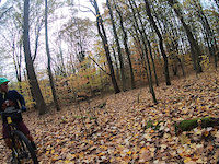
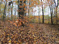
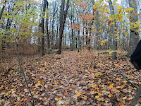
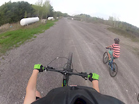
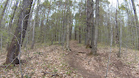
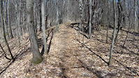
Photos of Fulton Mountain Bike
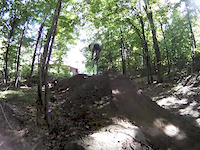
Videos of Fulton Mountain Bike
trail: Whiskey Island
2:24 |
68 |
Nov 2, 2020
trail: Whiskey Island
2:30 |
24 |
Nov 2, 2020
trail: Whiskey Island
2:23 |
18 |
Nov 2, 2020

trail: Out
0:16 |
128 |
Oct 26, 2015
trail: Back
0:07 |
164 |
Jul 30, 2015
trail: Back
0:58 |
220 |
May 6, 2015
trail: Pumphouse Trail
0:35 |
143 |
May 5, 2015
trail: Pumphouse Trail
2:08 |
109 |
Apr 30, 2015
Recent Trail Reports
| status | trail | date | condition | info | user |
|---|---|---|---|---|---|
| Mishemokwa Springs | Jun 15, 2026 @ 6:35pm (America/Toronto) 2 days | Variable | Mustang289 | ||
| Homestead | Jun 15, 2026 @ 6:35pm (America/Toronto) 2 days | Variable | Mustang289 | ||
| Stone Stairs | Jun 15, 2026 @ 6:35pm (America/Toronto) 2 days | Variable | Mustang289 | ||
| Six South | Jun 15, 2026 @ 6:35pm (America/Toronto) 2 days | Variable | Mustang289 | ||
| Long Trail | Jun 15, 2026 @ 6:35pm (America/Toronto) 2 days | Variable | Mustang289 | ||
| 440 Ridge | Jun 15, 2026 @ 6:35pm (America/Toronto) 2 days | Variable | Mustang289 | ||
| 440 Ridge | Jun 15, 2026 @ 6:35pm (America/Toronto) 2 days | Variable | Mustang289 | ||
| Back | Jun 15, 2026 @ 6:35pm (America/Toronto) 2 days | Variable | Mustang289 | ||
| Out | Jun 15, 2026 @ 6:35pm (America/Toronto) 2 days | Variable | Mustang289 | ||
| Deer Run | Jun 15, 2026 @ 6:35pm (America/Toronto) 2 days | Variable | Mustang289 |
Activity Feed
| username | action | type | title | date |
|---|---|---|---|---|
| Mustang289 | add | report | activity #97086075 and 12 more | Jun 15, 2026 @ 9:00pm 2 days |
| MrEndo | add | report | activity #77259696 and 8 more | Aug 2, 2025 @ 2:03pm Aug 2, 2025 |
| RexBanner | add | report | activity #74545511 and 3 more | Jun 25, 2025 @ 10:52am Jun 25, 2025 |
| DavidKoRyk9 | vote | trail | activity #71743820 | May 15, 2025 @ 7:18pm May 15, 2025 |
| mcoulter-cny | wishlist | region | activity #71652843 | May 14, 2025 @ 11:00am May 14, 2025 |
Local Badges
-

10 Green Trails169 awarded -

Epic Ride Climb 2k1 awarded -

Climbing 10k Badge13 awarded -

Climbing 100k Badge3 awarded -

Epic Ride Descent 2k1 awarded -

Descent 10k Badge13 awarded
Local Trail Supporters
- Friends of Great Bear
Activity Type Stats
| activitytype | trails | distance | descent | descent distance | total vertical | rating | global rank | state rank | photos | reports | routes | ridelogs |
|---|---|---|---|---|---|---|---|---|---|---|---|---|
| Mountain Bike | 41 | 12 miles | 1,444 ft | 5 miles | 144 ft | #2,526 | #906 | 16 | 201 | 1 | 5,099 | |
| E-Bike | 5 | 4,849 ft | 30 ft | 1,030 ft | 52 ft | #10,147 | #3,199 | 153 | 73 | |||
| Horse | 4 | 4,121 ft | 30 ft | 1,030 ft | 52 ft | #3,439 | #1,993 | 48 | ||||
| Hike | 41 | 12 miles | 1,444 ft | 5 miles | 144 ft | #8,674 | #3,039 | 201 | 190 | |||
| Trail Running | 41 | 12 miles | 1,444 ft | 5 miles | 144 ft | #8,227 | #2,747 | 201 | 67 | |||
| Snowmobile | 180 | 734 miles | 32,966 ft | 266 miles | 1,634 ft | #5 | #3 | 8 |
Frequently Asked Questions About Fulton
▼
What are the best places to ride in Fulton?
Fulton has 1 areas to explore for mountain biking. The top rated areas are:
▼
What are the highest rated mountain biking trails in Fulton?
The highest rated mountain biking trails in Fulton are:
- 440 Ridge (4.2/5)
- Pumphouse Trail (4.2/5)
- 440 Ridge (4.1/5)
- Back (4.1/5)
- Stone Stairs (4.1/5)
▼
What is the best time of the year to ride in Fulton?
Based on ride log data, the most popular months to ride in Fulton are:
- September (78 activities)
- August (71 activities)
- June (69 activities)
▼
Where can I park to ride in Fulton?
There are 1 parking locations listed in Fulton. The most popular parking spots are:
Activities
Trails
Points of Interest
- By Captain1ndustry & contributors
- Admins: apply
- #4216 - 3,184 views
- fulton activity log | embed map of Fulton mountain bike trails | fulton mountain biking points of interest
Downloading of trail gps tracks in kml & gpx formats is enabled for Fulton.
You must login to download files.