close
-
Layers w
- Weather Layers
- Pro
- Pro
- Pro
- Pro
- Pro
- Pro
- More Layers
- Pro
- Pro
- Pro
- Pro
-
Upgrade to

3D
Trail Conditions
- Unknown
- Snow Groomed
- Snow Packed
- Snow Covered
- Snow Cover Partial
- Freeze/thaw Cycle
- Icy
- Prevalent Mud
- Wet
- Variable
- Ideal
- Dry
- Very Dry
Trail Flow (Ridden Direction)
Trailforks scans users ridelogs to determine the most popular direction each trail is ridden. A good flowing trail network will have most trails flowing in a single direction according to their intension.
The colour categories are based on what percentage of riders are riding a trail in its intended direction.
The colour categories are based on what percentage of riders are riding a trail in its intended direction.
- > 96%
- > 90%
- > 80%
- > 70%
- > 50%
- < 50%
- bi-directional trail
- no data
Trail Last Ridden
Trailforks scans ridelogs to determine the last time a trail was ridden.
- < 2 days
- < 1 week
- < 2 weeks
- < 1 month
- < 6 months
- > 6 months
Trail Ridden Direction
The intended direction a trail should be ridden.
- Downhill Only
- Downhill Primary
- Both Directions
- Uphill Primary
- Uphill Only
- One Direction
Contribute Details
Colors indicate trail is missing specified detail.
- Description
- Photos
- Description & Photos
- Videos
Trail Popularity ?
Trailforks scans ridelogs to determine which trails are ridden the most in the last 9 months.
Trails are compared with nearby trails in the same city region with a possible 25 colour shades.
Think of this as a heatmap, more rides = more kinetic energy = warmer colors.
- most popular
- popular
- less popular
- not popular
ATV/ORV/OHV Filter
Max Vehicle Width
inches
US Cell Coverage
Legend

Radar Time
Activity Recordings
Trailforks uses anonymized public activity data.
?
Activity Recordings
Trailforks uses anonymized public activity data.
?
Personal Heatmap
▶
Activity Types
all
/
none
▶
Options
2
Date range
month
–
Winter Trails
Warning
A routing network for winter maps does not exist. Selecting trails using the winter trails layer has been disabled.
Missing Trails
Most Popular
Least Popular
Trails are colored based on popularity. The more popular a trail is, the more red. Less popular trails trend towards green.
Jump Magnitude Heatmap
Heatmap of where riders jump on trails. Zoom in to see individual jumps, click circles to view jump details.
BC Backroad Status
![map legend]()
Service Road Atlas is a free to use, community-driven service for viewing and creating reports on the numerous back-country service roads around B.C. and Alberta.

Slope Aspect
Direction the slope faces
Trails Deemphasized
Trails are shown in grey.
Only show trails with no bike usage.
Suggested Layers
Based on selected activity type
Save the current map location and zoom level as your default home location whenever this page is loaded.
Save
No description for Goleta has been added yet!
Login or register to submit one.
Activities Click to view
- Mountain Bike
5 trails
- Hike
9 trails
- Trail Running
10 trails
Region Details
- 1
- 2
- 1
Region Status
Open as of Jun 2, 2026Stats
- Trails (view details)
- 4
- Trails Mountain Bike
- 5
- Trails Horse
- 2
- Trails Hike
- 10
- Trails Trail Running
- 10
- Total Distance
- 2 miles
- Total Descent Distance
- 2,464 ft
- Total Descent
- 117 ft
- Total Vertical
- 1,175 ft
- Highest Trailhead
- 1,198 ft
- Reports
- 43
- Photos
- 8
- Ridden Counter
- 251
Sub Regions
-
Baron Ranch
- 2
-
More Mesa
- 1
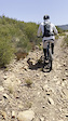
Popular Goleta Mountain Biking Trails
• 100 ★ 0.0 • 4,810 ft • 10 ft • 70 •
Nice trail (actually two that run parallel and intersect frequently, which is nice to swerve around hikers) with epic views of the ocean and mountains.
• 50 ★ 0.0 • 6 miles • 2,623 ft • 5 •
Long trail going from the creek up to the ridge with stellar views the whole time. Great place to practice tight switchbacks.
• 5 ★ 0.0 • 2 miles • 756 ft • 1 •
Less popular blue difficulty singletrack. This multi-use trail can be used both directions.
Videos of Goleta Mountain Bike
trail: Arroyo Quemado
0:14 |
41 |
Dec 1, 2025
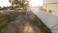
0:33 |
2157 |
May 24, 2016

trail: Bluff Trail
2:35 |
407 |
Apr 17, 2022 , Goleta
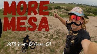
2:35 |
752 |
Apr 17, 2022
Recent Trail Reports
| status | trail | date | condition | info | user |
|---|---|---|---|---|---|
| Bluff Trail | May 19, 2022 @ 12:53pm May 19, 2022 | Dry | dkkerr |
Activity Feed
| username | action | type | title | date |
|---|---|---|---|---|
| gimafi | comment | trail | activity #86643857 | Jan 4, 2026 @ 10:10am Jan 4, 2026 |
| HannahUEoeGs | wishlist | skillpark | activity #86124476 | Dec 26, 2025 @ 9:39pm Dec 26, 2025 |
| HannahUEoeGs | wishlist | region | activity #86124441 | Dec 26, 2025 @ 9:36pm Dec 26, 2025 |
| kaiser-in-slo | add | photo | activity #85025855 | Dec 1, 2025 @ 12:35pm Dec 1, 2025 |
| maxbrah | add | trail | activity #77421294 and 1 more | Aug 4, 2025 @ 4:41pm Aug 4, 2025 |
Recent Comments
| username | type | title | comment | date |
|---|---|---|---|---|
| trail | Good place to do trail maintenance | Jan 4, 2026 @ 10:10am Jan 4, 2026 |
Bike & Skill Parks
| name | type | city | rating |
|---|---|---|---|
| Isla Vista Pumptrack | skill park | Goleta | |
| More Mesa Dirt Jumps | skill park | Goleta |
Local Mountain Biking Directory
-
Velo Pro Cyclery GoletaBike Shop
-
Bicycle Bob’s In GoletaBike Shop
Activity Type Stats
| activitytype | trails | distance | descent | descent distance | total vertical | rating | global rank | state rank | photos | reports | routes | ridelogs |
|---|---|---|---|---|---|---|---|---|---|---|---|---|
| Mountain Bike | 5 | 2 miles | 118 ft | 2,464 ft | 1,175 ft | #13,394 | #4,081 | 8 | 43 | 6,582 | ||
| Horse | 2 | |||||||||||
| Hike | 9 | 2 miles | 118 ft | 2,464 ft | 1,175 ft | #9,473 | #3,335 | 43 | 420 | |||
| Trail Running | 10 | 2 miles | 118 ft | 2,464 ft | 1,175 ft | #9,489 | #3,228 | 43 | 199 |
- By gmcgurk
 & contributors
 - Admins: STA
- #20527 - 2,837 views
- goleta activity log | embed map of Goleta mountain bike trails |
Downloading of trail gps tracks in kml & gpx formats is enabled for Goleta.
You must login to download files.