close
-
Layers w
- Weather Layers
- Pro
- Pro
- Pro
- Pro
- Pro
- Pro
- More Layers
- Pro
- Pro
- Pro
- Pro
-
Upgrade to

3D
Trail Conditions
- Unknown
- Snow Groomed
- Snow Packed
- Snow Covered
- Snow Cover Partial
- Freeze/thaw Cycle
- Icy
- Prevalent Mud
- Wet
- Variable
- Ideal
- Dry
- Very Dry
Trail Flow (Ridden Direction)
Trailforks scans users ridelogs to determine the most popular direction each trail is ridden. A good flowing trail network will have most trails flowing in a single direction according to their intension.
The colour categories are based on what percentage of riders are riding a trail in its intended direction.
The colour categories are based on what percentage of riders are riding a trail in its intended direction.
- > 96%
- > 90%
- > 80%
- > 70%
- > 50%
- < 50%
- bi-directional trail
- no data
Trail Last Ridden
Trailforks scans ridelogs to determine the last time a trail was ridden.
- < 2 days
- < 1 week
- < 2 weeks
- < 1 month
- < 6 months
- > 6 months
Trail Ridden Direction
The intended direction a trail should be ridden.
- Downhill Only
- Downhill Primary
- Both Directions
- Uphill Primary
- Uphill Only
- One Direction
Contribute Details
Colors indicate trail is missing specified detail.
- Description
- Photos
- Description & Photos
- Videos
Trail Popularity ?
Trailforks scans ridelogs to determine which trails are ridden the most in the last 9 months.
Trails are compared with nearby trails in the same city region with a possible 25 colour shades.
Think of this as a heatmap, more rides = more kinetic energy = warmer colors.
- most popular
- popular
- less popular
- not popular
ATV/ORV/OHV Filter
Max Vehicle Width
inches
US Cell Coverage
Legend

Radar Time
Activity Recordings
Trailforks uses anonymized public activity data.
?
Activity Recordings
Trailforks uses anonymized public activity data.
?
Personal Heatmap
▶
Activity Types
all
/
none
▶
Options
2
Date range
month
–
Winter Trails
Warning
A routing network for winter maps does not exist. Selecting trails using the winter trails layer has been disabled.
Missing Trails
Most Popular
Least Popular
Trails are colored based on popularity. The more popular a trail is, the more red. Less popular trails trend towards green.
Jump Magnitude Heatmap
Heatmap of where riders jump on trails. Zoom in to see individual jumps, click circles to view jump details.
BC Backroad Status
![map legend]()
Service Road Atlas is a free to use, community-driven service for viewing and creating reports on the numerous back-country service roads around B.C. and Alberta.

Slope Aspect
Direction the slope faces
Trails Deemphasized
Trails are shown in grey.
Only show trails with no bike usage.
Suggested Layers
Based on selected activity type
Save the current map location and zoom level as your default home location whenever this page is loaded.
Save
No description for Gorham has been added yet!
Login or register to submit one.
Activities Click to view
- Mountain Bike
134 trails
- E-Bike
132 trails
- Gravel Bike
4 trails
- Adaptive Bike
3 trails
- Winter Fat Bike
3 trails
- Hike
147 trails
- Trail Running
146 trails
- Snowmobile
12 trails
- Snowshoe
102 trails
- Backcountry Ski
13 trails
- Nordic Ski
21 trails
Region Details
- 18
- 3
- 37
- 66
- 1
Region Status
Open as of Jun 3, 2026Stats
- Avg Trail Rating
- Trails (view details)
- 130
- Trails Mountain Bike
- 140
- Trails E-Bike
- 132
- Trails Gravel Bike
- 4
- Trails Adaptive Bike
- 3
- Trails Winter Fat Bike
- 3
- Trails Hike
- 147
- Trails Trail Running
- 146
- Trails Observed Trials
- 3
- Trails Snowmobile
- 12
- Trails Snowshoe
- 102
- Trails Downhill Ski
- 3
- Trails Backcountry Ski
- 13
- Trails Nordic Ski
- 21
- Total Distance
- 49 miles
- Total Descent
- 3,990 ft
- Total Vertical
- 317 ft
- Highest Trailhead
- 380 ft
- Reports
- 4,880
- Photos
- 281
- Ridden Counter
- 61,870
Sub Regions
-
Alden Hill/USM
- 4
- 20
-
Claire Drew Trail Park
- 1
- 2
-
Hamblen
- 1
- 4
- 9
- 1
-
Shaw Cherry Hill Farm
- 1
- 6
- 1
-
Tannery
- 1
- 3
- 7
-
Weeks/Moody's
- 13
- 27
Popular Gorham Mountain Biking Trails
• 95 ★ 4.7 • 1 mile • 60 ft • 1,245 •
Super fun trail, top section can be very wet in the spring. Middle section is fast and flowy. Lower section is curvy s's thru the pines. Built to be ridden from north to south.
• 95 ★ 4.5 • 1,969 ft • 11 ft • 1,233 •
Popular blue difficulty singletrack. This mountain bike primary trail. On average it takes 2 minutes to complete this trail.
• 100 ★ 5.0 • 3,488 ft • 10 ft • 1,177 •
Highly rated popular blue difficulty singletrack. This mountain bike primary trail can be used downhill primary and has a moderate overall physical rating. On average it takes 4 minutes to complete this trail.
• 100 ★ 5.0 • 820 ft • 3 ft • 1,121 •
Popular blue difficulty singletrack. This mountain bike primary trail. On average it takes 1 minutes to complete this trail.
• 90 ★ 5.0 • 1,654 ft • 35 ft • 1,086 •
Popular blue difficulty singletrack. This mountain bike primary trail. On average it takes 4 minutes to complete this trail.
• 95 ★ 5.0 • 3,343 ft • 46 ft • 1,026 •
Popular blue difficulty singletrack. This mountain bike primary trail can be used downhill primary and has a moderate overall physical rating with a 46 ft green climb. On average it takes 4 minutes to complete this trail.
Gorham Mountain Bike Routes
★ 4.0 • 53 miles • 3,400 ft • 106 • Loop •
Only 2 trails were closed during the time of this ride: "Bones" and "Got the Time" This route hits all of...
★ 5.0 • 7 miles • 340 ft • 32 •
Based on recommendation from other riders, this could be a good loop for first timers. Will modify if needed.
6 miles • 698 ft • 20 • Loop •
This CCW loop hits most of the trails at Alden Hill without crossing trails or repeating sections. Its got...
★ 3.0 • 6 miles • 353 ft • 11 •
Quick 6 to 7 mile loop. Avoids lots of wet sections immediately after rain.
7 miles • 322 ft • 22 •
Another option that gets more downhill added to the ride.
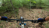
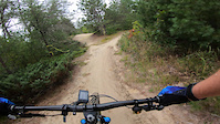
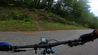
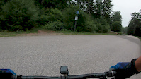
Photos of Gorham Mountain Bike
Videos of Gorham Mountain Bike
trail: Unchained
3:40 |
416 |
Sep 8, 2021
trail: River Run
0:24 |
150 |
Sep 8, 2021
trail: Orange Crush
2:39 |
159 |
Sep 7, 2021
trail: Sledgehammer
0:19 |
163 |
Jul 5, 2020
0:17 |
1997 |
Oct 7, 2019

trail: Old Man
3:30 |
174 |
Jun 5, 2019

trail: Old Man
3:30 |
130 |
Jun 4, 2019

trail: Desire
3:21 |
6597 |
Jun 24, 2013
Recent Trail Reports
| status | trail | date | condition | info | user |
|---|---|---|---|---|---|
| MBWEEE | Jun 3, 2026 @ 4:16pm (America/New_York) Jun 3, 2026 | Ideal | Aperro13 | ||
| Green Line Squiggle | May 26, 2026 @ 7:35pm (America/New_York) May 26, 2026 | Unknown | LHUWSiJ6 | ||
| Blue Henry's Delight | May 5, 2026 @ 5:54pm (America/New_York) May 5, 2026 | Variable | mgrohman | ||
| Louie Louie | May 5, 2026 @ 5:54pm (America/New_York) May 5, 2026 | Variable | mgrohman | ||
| GTO Flow | May 5, 2026 @ 5:54pm (America/New_York) May 5, 2026 | Ideal | mgrohman | ||
| Rampage | May 5, 2026 @ 5:54pm (America/New_York) May 5, 2026 | Ideal | mgrohman | ||
| Gorham Way | May 5, 2026 @ 5:54pm (America/New_York) May 5, 2026 | Ideal | mgrohman | ||
| Climb Trail 1 | May 5, 2026 @ 5:54pm (America/New_York) May 5, 2026 | Ideal | mgrohman | ||
| Wildmen | Apr 27, 2026 @ 5:05pm (America/New_York) Apr 27, 2026 | Dry | mgrohman | ||
| Buttercup | Apr 27, 2026 @ 5:05pm (America/New_York) Apr 27, 2026 | Ideal | mgrohman |
National Scenic Trails & Official Routes
-
Sebago To Sea Trail
- Mountain Bike
- Hike
- Trail Running

Activity Feed
| username | action | type | title | date |
|---|---|---|---|---|
| LenaAASuvO | wishlist | trail | activity #96335402 | Jun 5, 2026 @ 6:24pm 2 days |
| LenaAASuvO | wishlist | trail | activity #96335312 | Jun 5, 2026 @ 6:22pm 2 days |
| LenaAASuvO | wishlist | trail | activity #96335212 | Jun 5, 2026 @ 6:20pm 2 days |
| Aperro13 | add | report | activity #96176908 | Jun 3, 2026 @ 1:16pm Jun 3, 2026 |
| Joshua0mN06W | wishlist | route | activity #95622194 | May 27, 2026 @ 3:11am May 27, 2026 |
Recent Comments
| username | type | title | comment | date |
|---|---|---|---|---|
| trail | Still rough shape. Trail hard to navigate | Nov 8, 2025 @ 1:55pm Nov 8, 2025 | ||
| trail | Tons of broken glass. Bumped into someone... | Aug 9, 2025 @ 11:57am Aug 9, 2025 | ||
| trail | So much glass I assumed it was intentional . I... | Aug 5, 2025 @ 8:55am Aug 5, 2025 | ||
| trail | Still has lots of glass | Jun 20, 2025 @ 5:50pm Jun 20, 2025 | ||
| trail | Fun trail! I can’t imagine what is black... | Nov 25, 2024 @ 1:47pm Nov 25, 2024 |
Local Badges
-

Completionist31 awarded -

Epic Ride 50k285 awarded -

Top 10 Trails984 awarded -
Completionist34 awarded -

Big Ride 30k1,125 awarded -

10 Green Trails415 awarded
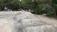
Bike & Skill Parks
| name | type | city | rating |
|---|---|---|---|
| Gorham Pump Track | skill park | Gorham | |
| 3 Drops | skill park | Gorham | |
| Super Skinny | skill park | Gorham |
Activity Type Stats
| activitytype | trails | distance | descent | descent distance | total vertical | rating | global rank | state rank | photos | reports | routes | ridelogs |
|---|---|---|---|---|---|---|---|---|---|---|---|---|
| Mountain Bike | 134 | 47 miles | 3,852 ft | 19 miles | 318 ft | #244 | #87 | 283 | 4,960 | 8 | 29,844 | |
| E-Bike | 132 | 45 miles | 3,770 ft | 18 miles | 315 ft | #1,432 | #862 | 2 | 1,789 | 1,132 | ||
| Gravel Bike | 4 | #371 | #983 | 22 | ||||||||
| Adaptive Bike | 3 | #264 | #1,624 | 3 | ||||||||
| Winter Fat Bike | 3 | #43 | #873 | 2 | 1 | 82 | ||||||
| Hike | 147 | 42 miles | 3,740 ft | 18 miles | 315 ft | #919 | #418 | 2 | 4,860 | 389 | ||
| Trail Running | 146 | 42 miles | 3,740 ft | 18 miles | 315 ft | #2,859 | #823 | 4,859 | 678 | |||
| Observed Trials | 3 | 1 | 16 | |||||||||
| Snowmobile | 12 | 3 miles | 200 ft | 3 miles | 144 ft | #84 | #51 | 2,568 | 14 | |||
| Snowshoe | 102 | 28 miles | 2,854 ft | 11 miles | 315 ft | #332 | #90 | 3,306 | 100 | |||
| Downhill Ski | 3 | 4 | 1 | |||||||||
| Backcountry Ski | 13 | 3 miles | 131 ft | 2 miles | 121 ft | #373 | #77 | 98 | 28 | |||
| Nordic Ski | 21 | 3 miles | 226 ft | 2 miles | 174 ft | #664 | #232 | 11 | 67 |
Frequently Asked Questions About Gorham
▼
What are the best places to ride in Gorham?
Gorham has 8 areas to explore for mountain biking. The top rated areas are:
▼
What are the highest rated mountain biking trails in Gorham?
The highest rated mountain biking trails in Gorham are:
- MBWEEE (4.5/5)
- 1783 (4.4/5)
- Sugaree (4.4/5)
- Connectivity (4.4/5)
- Wildmen (4.4/5)
▼
What is the best time of the year to ride in Gorham?
Based on ride log data, the most popular months to ride in Gorham are:
- July (849 activities)
- August (777 activities)
- June (741 activities)
▼
Where can I park to ride in Gorham?
There are 10 parking locations listed in Gorham. The most popular parking spots are:
- Main Parking Lot
- Parking
- Parking for Weeks/Moody's Area - Gorham H.S.
- Overflow Parking
- Parking-USM Huskey Dr Lot
Activities
Trails
Points of Interest
- By msandora
 & contributors
 - Admins: NEMBAEXEC, GPNEMBA Gorham, GP NEMBA
- #13443 - 48,995 views
- gorham activity log | embed map of Gorham mountain bike trails | gorham mountain biking points of interest
Downloading of trail gps tracks in kml & gpx formats is enabled for Gorham.
You must login to download files.