close
-
Layers w
- Weather Layers
- Pro
- Pro
- Pro
- Pro
- Pro
- Pro
- More Layers
- Pro
- Pro
- Pro
- Pro
-
Upgrade to

3D
Trail Conditions
- Unknown
- Snow Groomed
- Snow Packed
- Snow Covered
- Snow Cover Partial
- Freeze/thaw Cycle
- Icy
- Prevalent Mud
- Wet
- Variable
- Ideal
- Dry
- Very Dry
Trail Flow (Ridden Direction)
Trailforks scans users ridelogs to determine the most popular direction each trail is ridden. A good flowing trail network will have most trails flowing in a single direction according to their intension.
The colour categories are based on what percentage of riders are riding a trail in its intended direction.
The colour categories are based on what percentage of riders are riding a trail in its intended direction.
- > 96%
- > 90%
- > 80%
- > 70%
- > 50%
- < 50%
- bi-directional trail
- no data
Trail Last Ridden
Trailforks scans ridelogs to determine the last time a trail was ridden.
- < 2 days
- < 1 week
- < 2 weeks
- < 1 month
- < 6 months
- > 6 months
Trail Ridden Direction
The intended direction a trail should be ridden.
- Downhill Only
- Downhill Primary
- Both Directions
- Uphill Primary
- Uphill Only
- One Direction
Contribute Details
Colors indicate trail is missing specified detail.
- Description
- Photos
- Description & Photos
- Videos
Trail Popularity ?
Trailforks scans ridelogs to determine which trails are ridden the most in the last 9 months.
Trails are compared with nearby trails in the same city region with a possible 25 colour shades.
Think of this as a heatmap, more rides = more kinetic energy = warmer colors.
- most popular
- popular
- less popular
- not popular
ATV/ORV/OHV Filter
Max Vehicle Width
inches
US Cell Coverage
Legend

Radar Time
Activity Recordings
Trailforks uses anonymized public activity data.
?
Activity Recordings
Trailforks uses anonymized public activity data.
?
Personal Heatmap
▶
Activity Types
all
/
none
▶
Options
2
Date range
month
–
Winter Trails
Warning
A routing network for winter maps does not exist. Selecting trails using the winter trails layer has been disabled.
Missing Trails
Most Popular
Least Popular
Trails are colored based on popularity. The more popular a trail is, the more red. Less popular trails trend towards green.
Jump Magnitude Heatmap
Heatmap of where riders jump on trails. Zoom in to see individual jumps, click circles to view jump details.
BC Backroad Status
![map legend]()
Service Road Atlas is a free to use, community-driven service for viewing and creating reports on the numerous back-country service roads around B.C. and Alberta.

Slope Aspect
Direction the slope faces
Trails Deemphasized
Trails are shown in grey.
Only show trails with no bike usage.
Suggested Layers
Based on selected activity type
Save the current map location and zoom level as your default home location whenever this page is loaded.
Save
No description for Gränichen has been added yet!
Login or register to submit one.
Links
This region uses the Uk/Euro style trail grading system.
Activities Click to view
- Mountain Bike
72 trails
- E-Bike
62 trails
- Hike
65 trails
- Trail Running
64 trails
Region Details
- 3
- 44
- 17
- 3
- 1
Region Status
Open as of 2 daysStats
- Avg Trail Rating
- Trails (view details)
- 68
- Trails Mountain Bike
- 72
- Trails E-Bike
- 62
- Trails Hike
- 65
- Trails Trail Running
- 64
- Total Distance
- 21 miles
- Total Descent
- 5,854 ft
- Total Vertical
- 798 ft
- Highest Trailhead
- 2,152 ft
- Reports
- 409
- Photos
- 27
- Ridden Counter
- 1,402
Sub Regions
-
Unteren Suhren-/Wynental
- 43
- 14
- 3
- 1
Popular Gränichen Mountain Biking Trails
• 90 ★ 4.2 • 2 miles • 40 ft • 117 •
Highly rated popular blue difficulty singletrack. This mountain bike primary trail can be used downhill primary and has a moderate overall physical rating with a 40 ft green climb. It features jump, skinny and wallride. On average it takes 33 minutes to complete this trail.
• 95 ★ 5.0 • 1,286 ft • 0 ft • 92 •
Popular blue difficulty singletrack. This mountain bike primary trail can be used downhill only. It features berm, jump and wallride. Trail visibility is always easy to follow. On average it takes 2 minutes to complete this trail.
• 100 ★ 4.0 • 1,106 ft • 0 ft • 91 •
Popular green difficulty singletrack. This multi-use trail can be used both directions and has a easy overall physical rating with a 0 ft green climb. Trail visibility is always easy to follow. On average it takes 1 minutes to complete this trail.
• 100 ★ 3.5 • 4,692 ft • 36 ft • 69 •
Popular green difficulty singletrack. This multi-use trail can be used both directions with a 36 ft green climb. It features berm. Trail visibility is always easy to follow.
• 100 ★ 5.0 • 1,709 ft • 0 ft • 66 •
Popular blue difficulty singletrack. This mountain bike primary trail can be used downhill primary. It features berm and pump track. Trail visibility is always easy to follow.
• 95 ★ 0.0 • 1,089 ft • 0 ft • 59 •
Popular green difficulty singletrack. This mountain bike primary trail can be used downhill primary and has a easy overall physical rating with a 0 ft blue climb. It features jump. Trail visibility is always easy to follow.
• 90 ★ 0.0 • 1,191 ft • 26 ft • 58 •
Popular green difficulty singletrack. This mountain bike primary trail can be used both directions and has a easy overall physical rating with a 26 ft green climb. Trail visibility is always easy to follow. On average it takes 1 minutes to complete this trail.
Rifegrind Lower Permanently Closed
• 50 ★ 3.0 • 843 ft • 0 ft • 54 •
Moderately popular blue difficulty closed singletrack. This multi-use trail can be used downhill primary. Trail visibility is always easy to follow. On average it takes 1 minutes to complete this trail.
Gränichen Mountain Bike Routes
15 miles • 1,742 ft • 7 • Loop •
A perfect route to discover all the trails around the well known bike region around Gränichen. I...
15 miles • 1,742 ft • 7 • Loop •
A perfect route to discover all the trails around the well known bike region around Gränichen. I...
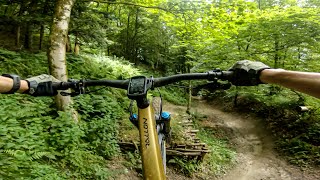
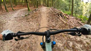
Photos of Gränichen Mountain Bike
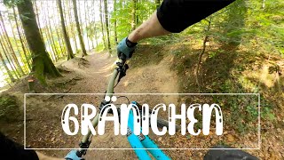
Videos of Gränichen Mountain Bike
trail: Rifegrind Middle
0:01 |
235 |
Jul 8, 2024 , Gränichen
trail: Böhler Trail
4:21 |
864 |
Sep 18, 2021 , Gränichen
trail: Fudechopftrail
3:04 |
467 |
Dec 6, 2020 , Gränichen
Recent Trail Reports
| status | trail | date | condition | info | user |
|---|---|---|---|---|---|
| Rittersmatte | Jun 15, 2026 @ 7:33pm (Europe/Zurich) 2 days | Ideal | fempel | ||
| Langmatt | Jun 15, 2026 @ 7:33pm (Europe/Zurich) 2 days | Ideal | fempel | ||
| Rifegrind Middle | Jun 15, 2026 @ 7:33pm (Europe/Zurich) 2 days | Ideal | fempel | ||
| Rifegrind Upper | Jun 15, 2026 @ 7:33pm (Europe/Zurich) 2 days | Ideal | fempel | ||
| Schoornig East | Jun 15, 2026 @ 7:33pm (Europe/Zurich) 2 days | Ideal | fempel | ||
| Chlippe | Jun 15, 2026 @ 7:33pm (Europe/Zurich) 2 days | Ideal | fempel | ||
| Zwölfruete | Jun 15, 2026 @ 7:33pm (Europe/Zurich) 2 days | Ideal | fempel | ||
| Bründlibode | Jun 15, 2026 @ 7:33pm (Europe/Zurich) 2 days | Ideal | fempel | ||
| Fornech | Jun 15, 2026 @ 7:33pm (Europe/Zurich) 2 days | Ideal | fempel | ||
| Böhler Trail | Apr 10, 2026 @ 1:55pm (Europe/Zurich) Apr 10, 2026 | Ideal | iomi |
Activity Feed
| username | action | type | title | date |
|---|---|---|---|---|
| fempel | add | report | activity #97064069 and 8 more | Jun 15, 2026 @ 1:58pm 2 days |
| Fehlstart | ridden | trail | activity #95590309 | May 26, 2026 @ 2:30pm May 26, 2026 |
| calitrifreeride | wishlist | region | activity #94428002 | May 10, 2026 @ 8:07am May 10, 2026 |
| fempel | add | report | activity #93248399 and 6 more | Apr 23, 2026 @ 4:44pm Apr 23, 2026 |
| BrunozWv9yh | ridden | trail | activity #92814314 | Apr 17, 2026 @ 3:07pm Apr 17, 2026 |
Recent Comments
| username | type | title | comment | date |
|---|---|---|---|---|
| trail | Furchtbar zugewachsen, auch sonst nicht... | Aug 13, 2024 @ 9:46am Aug 13, 2024 | ||
| trail | Völlig zugewachsen | Jul 14, 2024 @ 1:09pm Jul 14, 2024 | ||
| trail | Achtung! Bei der Weggabelung der... | Jul 12, 2024 @ 11:13am Jul 12, 2024 | ||
| trail | Der Wurzeltrail ist irgendwie nicht fahrbar... | Jul 9, 2024 @ 12:54pm Jul 9, 2024 | ||
| trail | Sehr geil gebaut! Vielen Dank an die... | Jul 9, 2024 @ 12:53pm Jul 9, 2024 |
Local Badges
-

Completionist0 awarded -

Epic Mountain Bike Climb 2k2 awarded -

Climbing 10k Badge2 awarded -

Mountain Biking 100k Badge0 awarded -

Epic Ride Descent 2k2 awarded -

Descent 10k Badge2 awarded
Bike & Skill Parks
| name | type | city | rating |
|---|---|---|---|
| BikeLehrPfad Gränichen | skill park | Gränichen |
Activity Type Stats
| activitytype | trails | distance | descent | descent distance | total vertical | rating | global rank | state rank | photos | reports | routes | ridelogs |
|---|---|---|---|---|---|---|---|---|---|---|---|---|
| Mountain Bike | 72 | 21 miles | 5,853 ft | 14 miles | 797 ft | #3,302 | #53 | 27 | 409 | 2 | 1,711 | |
| E-Bike | 62 | 18 miles | 4,800 ft | 12 miles | 768 ft | #3,406 | #128 | 395 | 2 | 194 | ||
| Hike | 65 | 19 miles | 5,335 ft | 13 miles | 797 ft | #5,441 | #134 | 409 | 21 | |||
| Trail Running | 64 | 19 miles | 5,335 ft | 13 miles | 797 ft | #4,907 | #115 | 409 | 8 |
Frequently Asked Questions About Gränichen
▼
What are the best places to ride in Gränichen?
Gränichen has 1 areas to explore for mountain biking. The top rated areas are:
▼
What are the highest rated mountain biking trails in Gränichen?
The highest rated mountain biking trails in Gränichen are:
- Rifegrind Middle (4.4/5)
- Langmatt (4.2/5)
- Lotte (4.2/5)
- Chlippe (4.1/5)
- Böhler Trail Start Old (4.1/5)
▼
What is the best time of the year to ride in Gränichen?
Based on ride log data, the most popular months to ride in Gränichen are:
- June (12 activities)
- July (6 activities)
- April (4 activities)
▼
Where can I park to ride in Gränichen?
There are 2 parking locations listed in Gränichen. The most popular parking spots are:
- By canadaka
 Trailforks & contributors
 - Admins: apply
- #18169 - 2,558 views
- gränichen activity log | embed map of Gränichen mountain bike trails | gränichen mountain biking points of interest
Downloading of trail gps tracks in kml & gpx formats is enabled for Gränichen.
You must login to download files.