close
-
Layers w
- Weather Layers
- Pro
- Pro
- Pro
- Pro
- Pro
- Pro
- More Layers
- Pro
- Pro
- Pro
- Pro
-
Upgrade to

3D
Trail Conditions
- Unknown
- Snow Groomed
- Snow Packed
- Snow Covered
- Snow Cover Partial
- Freeze/thaw Cycle
- Icy
- Prevalent Mud
- Wet
- Variable
- Ideal
- Dry
- Very Dry
Trail Flow (Ridden Direction)
Trailforks scans users ridelogs to determine the most popular direction each trail is ridden. A good flowing trail network will have most trails flowing in a single direction according to their intension.
The colour categories are based on what percentage of riders are riding a trail in its intended direction.
The colour categories are based on what percentage of riders are riding a trail in its intended direction.
- > 96%
- > 90%
- > 80%
- > 70%
- > 50%
- < 50%
- bi-directional trail
- no data
Trail Last Ridden
Trailforks scans ridelogs to determine the last time a trail was ridden.
- < 2 days
- < 1 week
- < 2 weeks
- < 1 month
- < 6 months
- > 6 months
Trail Ridden Direction
The intended direction a trail should be ridden.
- Downhill Only
- Downhill Primary
- Both Directions
- Uphill Primary
- Uphill Only
- One Direction
Contribute Details
Colors indicate trail is missing specified detail.
- Description
- Photos
- Description & Photos
- Videos
Trail Popularity ?
Trailforks scans ridelogs to determine which trails are ridden the most in the last 9 months.
Trails are compared with nearby trails in the same city region with a possible 25 colour shades.
Think of this as a heatmap, more rides = more kinetic energy = warmer colors.
- most popular
- popular
- less popular
- not popular
ATV/ORV/OHV Filter
Max Vehicle Width
inches
US Cell Coverage
Legend

Radar Time
Activity Recordings
Trailforks uses anonymized public activity data.
?
Activity Recordings
Trailforks uses anonymized public activity data.
?
Personal Heatmap
▶
Activity Types
all
/
none
▶
Options
2
Date range
month
–
Winter Trails
Warning
A routing network for winter maps does not exist. Selecting trails using the winter trails layer has been disabled.
Missing Trails
Most Popular
Least Popular
Trails are colored based on popularity. The more popular a trail is, the more red. Less popular trails trend towards green.
Jump Magnitude Heatmap
Heatmap of where riders jump on trails. Zoom in to see individual jumps, click circles to view jump details.
BC Backroad Status
![map legend]()
Service Road Atlas is a free to use, community-driven service for viewing and creating reports on the numerous back-country service roads around B.C. and Alberta.

Slope Aspect
Direction the slope faces
Trails Deemphasized
Trails are shown in grey.
Only show trails with no bike usage.
Suggested Layers
Based on selected activity type
Save the current map location and zoom level as your default home location whenever this page is loaded.
SaveThis region is Unsanctioned, Ride at your own Risk!
A few trails here and a bikepark
 google parking directions
This region uses the Uk/Euro style trail grading system.
Activities Click to view
- Mountain Bike
21 trails
- E-Bike
20 trails
- Hike
21 trails
- Trail Running
21 trails
Region Details
- 4
- 15
- 2
Region Status
Open as of Apr 8, 2026Stats
- Avg Trail Rating
- Trails (view details)
- 21
- Trails Mountain Bike
- 21
- Trails E-Bike
- 20
- Trails Hike
- 21
- Trails Trail Running
- 21
- Total Distance
- 9 miles
- Total Descent
- 214 ft
- Total Vertical
- 46 ft
- Highest Trailhead
- 56 ft
- Reports
- 305
- Photos
- 23
- Ridden Counter
- 2,329
Popular Ham Mountain Biking Trails
• 90 ★ 0.0 • 4,613 ft • 11 ft • 205 • • hike
Albany Park to Teddington Lock. A long paved path that goes along the river. Part of NCN route 4.
• 85 ★ 4.0 • 3 miles • 133 ft • 184 •
A trail that runs by the river and is a mix of cement and other surfaces. The area coming up to Richmond is prone to flooding so check the local flood warnings before you set out in rainy seasons.
• 70 ★ 3.0 • 571 ft • 0 ft • 38 •
Popular green difficulty singletrack. This mountain bike primary trail can be used both directions and has a easy overall physical rating with a 0 ft green climb. On average it takes minutes to complete this trail.
• 75 ★ 3.0 • 942 ft • 0 ft • 32 •
An easy trail but can be loose hence the green rating
• 70 ★ 5.0 • 3,202 ft • 22 ft • 29 •
Long doubletrack that follows the perimeter of the woodland.
• 65 ★ 4.0 • 1,220 ft • 7 ft • 27 •
Easy, flowing trail with berm and then lip that can be turned into a jump if you have enough speed.
• 75 ★ 0.0 • 509 ft • 9 ft • 26 •
Popular green difficulty family friendly singletrack. This mountain bike primary trail can be used both directions. On average it takes minutes to complete this trail.
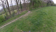
Photos of Ham Mountain Bike
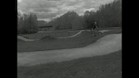
Videos of Ham Mountain Bike
trail: Short and Sweet
0:42 |
50 |
Apr 15, 2017

trail: Short and Sweet
0:43 |
4394 |
Oct 13, 2014
trail: Short and Sweet
2:27 |
431 |
May 13, 2012

trail: Short and Sweet
0:06 |
252 |
Dec 19, 2011
Recent Trail Reports
| status | trail | date | condition | info | user |
|---|---|---|---|---|---|
| Thames Path | Sep 17, 2024 @ 11:36am Sep 17, 2024 | Dry | belgianwaffle1 | ||
| Across the common | Sep 17, 2024 @ 11:36am Sep 17, 2024 | Ideal | belgianwaffle1 | ||
| Santa Max | Sep 17, 2024 @ 11:36am Sep 17, 2024 | Variable | belgianwaffle1 | ||
| Barge Walk | Jul 12, 2024 @ 1:07am Jul 12, 2024 | Dry | belgianwaffle1 | ||
| Ham Gate Trail | Jun 17, 2024 @ 4:54am Jun 17, 2024 | Variable | belgianwaffle1 | ||
| Trail | Jun 17, 2024 @ 4:54am Jun 17, 2024 | Ideal | belgianwaffle1 | ||
| Thames Path Teddington Lock to Richmond | Apr 4, 2023 @ 11:28pm Apr 4, 2023 | Ideal | NeilxA8I1y | ||
| Trail | Jul 22, 2022 @ 2:01am Jul 22, 2022 | Dry | belgianwaffle1 | ||
| Central reservation | Jul 7, 2022 @ 7:24am Jul 7, 2022 | Dry | belgianwaffle1 | ||
| Trail | Jul 2, 2022 @ 3:58am Jul 2, 2022 | Dry | belgianwaffle1 |
Activity Feed
| username | action | type | title | date |
|---|---|---|---|---|
| maooosnow | vote | trail | activity #76590357 | Jul 24, 2025 @ 4:58am Jul 24, 2025 |
| maooosnow | ridden | trail | activity #76590325 and 3 more | Jul 24, 2025 @ 4:57am Jul 24, 2025 |
| Mplugge | wishlist | trail | activity #63370138 | Dec 22, 2024 @ 10:23am Dec 22, 2024 |
| belgianwaffle1 | add | report | activity #59021479 and 2 more | Sep 17, 2024 @ 6:25am Sep 17, 2024 |
| Schmidt911 | wishlist | trail | activity #58739454 | Sep 12, 2024 @ 5:08am Sep 12, 2024 |
Nearby Areas
| name | distance | ||||
|---|---|---|---|---|---|
| Ham Avenues/The Copse | 0.6 km | ||||
| Latchmere Recreational Area | 2 | 0.8 km | |||
| Richmond Park | 1 | 1 | 1 km | ||
| Petersham Lodge Woods | 1 km | ||||
| Ham Lands | 15 | 4 | 1 km |
Bike & Skill Parks
| name | type | city | rating |
|---|---|---|---|
| Teddington Lock Jumps | skill park | Richmond upon Thames |
Activity Type Stats
| activitytype | trails | distance | descent | descent distance | total vertical | rating | global rank | state rank | photos | reports | routes | ridelogs |
|---|---|---|---|---|---|---|---|---|---|---|---|---|
| Mountain Bike | 21 | 9 miles | 213 ft | 3 miles | 46 ft | #6,839 | #219 | 23 | 305 | 6,305 | ||
| E-Bike | 20 | 9 miles | 213 ft | 3 miles | 46 ft | #5,648 | #253 | 286 | 52 | |||
| Hike | 21 | 9 miles | 213 ft | 3 miles | 46 ft | #9,441 | #258 | 303 | 19 | |||
| Trail Running | 21 | 9 miles | 213 ft | 3 miles | 46 ft | #7,965 | #210 | 304 | 598 |
Frequently Asked Questions About Ham
▼
What are the highest rated mountain biking trails in Ham?
The highest rated mountain biking trails in Ham are:
- Santa Max (4.1/5)
- Thames Path Teddington Lock to Richmond (4/5)
- Ham Gate Trail (4/5)
- Green Bean (4/5)
- Green Bean 3 (4/5)
▼
What is the best time of the year to ride in Ham?
Based on ride log data, the most popular months to ride in Ham are:
- July (36 activities)
- October (17 activities)
- September (17 activities)
▼
Where can I park to ride in Ham?
There are 2 parking locations listed in Ham. The most popular parking spots are:
▼
What is the longest trail in Ham?
The longest trail in Ham is Thames Path Teddington Lock to Richmond at 2.8 miles. View all trails sorted by distance.
Activities
Trails
Points of Interest
- By belgianwaffle1
 & contributors
 - Admins: apply
- #25273 - 4,122 views
- ham activity log | embed map of Ham mountain bike trails | ham mountain biking points of interest
Downloading of trail gps tracks in kml & gpx formats is enabled for Ham.
You must login to download files.