close
-
Layers w
- Weather Layers
- Pro
- Pro
- Pro
- Pro
- Pro
- Pro
- More Layers
- Pro
- Pro
- Pro
- Pro
-
Upgrade to

3D
Trail Conditions
- Unknown
- Snow Groomed
- Snow Packed
- Snow Covered
- Snow Cover Partial
- Freeze/thaw Cycle
- Icy
- Prevalent Mud
- Wet
- Variable
- Ideal
- Dry
- Very Dry
Trail Flow (Ridden Direction)
Trailforks scans users ridelogs to determine the most popular direction each trail is ridden. A good flowing trail network will have most trails flowing in a single direction according to their intension.
The colour categories are based on what percentage of riders are riding a trail in its intended direction.
The colour categories are based on what percentage of riders are riding a trail in its intended direction.
- > 96%
- > 90%
- > 80%
- > 70%
- > 50%
- < 50%
- bi-directional trail
- no data
Trail Last Ridden
Trailforks scans ridelogs to determine the last time a trail was ridden.
- < 2 days
- < 1 week
- < 2 weeks
- < 1 month
- < 6 months
- > 6 months
Trail Ridden Direction
The intended direction a trail should be ridden.
- Downhill Only
- Downhill Primary
- Both Directions
- Uphill Primary
- Uphill Only
- One Direction
Contribute Details
Colors indicate trail is missing specified detail.
- Description
- Photos
- Description & Photos
- Videos
Trail Popularity ?
Trailforks scans ridelogs to determine which trails are ridden the most in the last 9 months.
Trails are compared with nearby trails in the same city region with a possible 25 colour shades.
Think of this as a heatmap, more rides = more kinetic energy = warmer colors.
- most popular
- popular
- less popular
- not popular
ATV/ORV/OHV Filter
Max Vehicle Width
inches
US Cell Coverage
Legend

Radar Time
Activity Recordings
Trailforks uses anonymized public activity data.
?
Activity Recordings
Trailforks uses anonymized public activity data.
?
Personal Heatmap
▶
Activity Types
all
/
none
▶
Options
2
Date range
month
–
Winter Trails
Warning
A routing network for winter maps does not exist. Selecting trails using the winter trails layer has been disabled.
Missing Trails
Most Popular
Least Popular
Trails are colored based on popularity. The more popular a trail is, the more red. Less popular trails trend towards green.
Jump Magnitude Heatmap
Heatmap of where riders jump on trails. Zoom in to see individual jumps, click circles to view jump details.
BC Backroad Status
![map legend]()
Service Road Atlas is a free to use, community-driven service for viewing and creating reports on the numerous back-country service roads around B.C. and Alberta.

Slope Aspect
Direction the slope faces
Trails Deemphasized
Trails are shown in grey.
Only show trails with no bike usage.
Suggested Layers
Based on selected activity type
Save the current map location and zoom level as your default home location whenever this page is loaded.
SaveHimarë is a bilingual town in Southern Albania along the Albanian Riviera and part of the Vlorë County. It is the largest settlement and the seat of the municipality of Himarë.
Himara has an ancient Albanian culture and an autochthonous Albanian population that preserves the traditions and customs of this area from ancient times. It is especially distinguished for songs with many voices (polyphonic), for paved dances and traditional costumes for occasions of joy. Himara mourning is also heard throughout southern Albania. Literature and arts are also developing in Himara. Petro Marko - one of the masters of Albanian language and literature was from Dhërmiu, Himara.
Himara opened one of the first Albanian schools around 1160-1161 and then continuing in 1660-1661 by Onufër Kostandini, a prominent Albanian of that time, despite the harsh conditions of the Ottoman occupation. Efforts to continue the Albanian school were carried on by others, such as Zef Skiro (Italian: Giuseppe Schirò), an Orthodox priest and Apostolic Vicar on a mission to Himara, the prominent Arbëresh of his time. This made Himara one of the first initiators of the Albanian Renaissance.
Activities Click to view
- Mountain Bike
40 trails
- E-Bike
50 trails
- Adaptive Bike
0 trails
- Winter Fat Bike
0 trails
- Horse
37 trails
- Hike
54 trails
- Trail Running
50 trails
- Dirtbike/Moto
20 trails
- Observed Trials
3 trails
- ATV/ORV/OHV
26 trails
Region Details
- 11
- 6
- 8
- 13
- 1
- 1
Region Status
Caution as of Jun 2, 2023Stats
- Avg Trail Rating
- Trails (view details)
- 53
- Trails Mountain Bike
- 40
- Trails E-Bike
- 50
- Trails Horse
- 37
- Trails Hike
- 54
- Trails Trail Running
- 50
- Trails Dirtbike/Moto
- 20
- Trails Observed Trials
- 3
- Trails ATV/ORV/OHV
- 26
- Total Distance
- 89 miles
- Total Descent Distance
- 42 miles
- Total Descent
- 19,770 ft
- Total Vertical
- 3,085 ft
- Highest Trailhead
- 3,086 ft
- Reports
- 1
- Photos
- 262
- Ridden Counter
- 169
Sub Regions
-
Canyon of Gjipe
-
Kalaja e Himarës
-
Riviera
- 5
- 7
- 12
- 1
Popular Himare Mountain Biking Trails
• 5 ★ 3.0 • 2 miles • 269 ft • 5 •
Less popular green difficulty dirt/gravel road. This multi-use trail can be used both directions and has a easy overall physical rating with a 269 ft green climb. It features berm, rock garden and other. Trail visibility is always easy to follow. On average it takes 16 minutes to complete this trail.
• 5 ★ 4.0 • 3,891 ft • 85 ft • 5 •
Less popular black diamond difficulty alpine singletrack. This mountain bike primary trail can be used downhill only and has a moderate overall physical rating. It features berm and rock garden. Trail visibility is always easy to follow. On average it takes 10 minutes to complete this trail.
• 5 ★ 4.0 • 3,629 ft • 0 ft • 4 •
Less popular blue difficulty primitive. This multi-use trail can be used downhill only and has a moderate overall physical rating. It features berm, drop, rock face and rock garden. Trail visibility is sometimes hard to follow.
• 5 ★ 0.0 • 1 mile • 33 ft • 4 •
Ridable in both directions but you better wear your bigboy pants if you want to climb this one towards Dhermi ...
• 95 ★ 3.5 • 4,173 ft • 6 ft • 3 •
If you like steep stairs, bridges and challenging single track, just watch for the water lines laying diagonally across the trail. IMPORTANT: Mind the hikers, bird-watchers, tortoises and other slow-moving obstacles so this trail...
• 5 ★ 0.0 • 1 mile • 741 ft • 3 •
Less popular green difficulty dirt/gravel road. This multi-use trail can be used both directions and has a moderate overall physical rating with a 741 ft blue climb. It features berm and other. Trail visibility is always easy to follow.
• 5 ★ 4.0 • 3,333 ft • 50 ft • 2 •
Less popular proline difficulty alpine singletrack. This mountain bike primary trail can be used downhill only and has a hard overall physical rating with a 50 ft double black diamond climb. It features drop, rock face and rock garden. Trail visibility is always easy to follow.
• 5 ★ 0.0 • 2,438 ft • 512 ft • 2 •
Less popular blue difficulty dirt/gravel road. This multi-use trail can be used both directions and has a hard overall physical rating with a 512 ft black diamond climb. It features berm. Trail visibility is always easy to follow.
Himare Mountain Bike Routes
★ 5.0 • 4,249 ft • 0 •
Epic descent from the main road heading towards Himare down to Dhermi beach ... if you like steep stairs...
★ 5.0 • 1 mile • 37 ft • 0 • Out & Back •
Fast rocky descent towards beach. Can be climbed but better wear your bigboy pants.
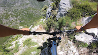
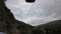
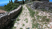
Photos of Himare Mountain Bike
Videos of Himare Mountain Bike
trail: Maja Pandelemonit Trail
0:49 |
27 |
Jun 7, 2021
trail: Qeparo i Sipërm Trail p2
0:04 |
34 |
May 31, 2021
trail: Shtegu Koramit
0:22 |
23 |
May 24, 2021

0:45 |
|
Apr 26, 2021

trail: Kodra Kalasë Trail
0:57 |
|
Apr 12, 2021

trail: Gjipe Trail
0:52 |
|
Apr 5, 2021

trail: Plazhi i Bunecit Trail
0:31 |
43 |
Nov 23, 2020

trail: Lukovë Shtegu i Kanalit
0:42 |
16 |
Nov 9, 2020
Recent Trail Reports
| status | trail | date | condition | info | user |
|---|---|---|---|---|---|
| Shtegu i Mullinjve | Sep 7, 2020 @ 2:41am Sep 7, 2020 | Unknown | andiqyqja TRAILFORKS |
Activity Feed
| username | action | type | title | date |
|---|---|---|---|---|
| Augebike | wishlist | region | activity #96875085 | Jun 13, 2026 @ 7:33am Jun 13, 2026 |
| Hoschl | comment | trail | activity #94882823 | May 17, 2026 @ 3:09am May 17, 2026 |
| skigal | comment | trail | activity #94737171 | May 15, 2026 @ 1:32am May 15, 2026 |
| Ronaldnk9KtK | ridden | trail | activity #92893727 | Apr 18, 2026 @ 2:27pm Apr 18, 2026 |
| Henrikasi8bX6s | wishlist | trail | activity #87198308 | Jan 14, 2026 @ 1:26pm Jan 14, 2026 |
Recent Comments
| username | type | title | comment | date |
|---|---|---|---|---|
| trail | Not worth it- entrance fully overgrown and... | May 17, 2026 @ 3:09am May 17, 2026 | ||
| trail | Not bike friendly too many waterlines | May 15, 2026 @ 1:32am May 15, 2026 | ||
| trail | Maybe red, definitely not black. Very nice... | Aug 25, 2025 @ 11:52am Aug 25, 2025 | ||
| trail | New buildings being built on the trail, really... | Aug 25, 2025 @ 11:51am Aug 25, 2025 | ||
| trail | Rocky fire road, kinda nice | Aug 25, 2025 @ 11:49am Aug 25, 2025 |
Local Badges
-

Epic Mountain Bike Climb 2k11 awarded -

Climbing 10k Badge0 awarded -

Mountain Biking 100k Badge0 awarded -

Epic Ride Descent 2k11 awarded -

Descent 10k Badge0 awarded -

Descent 100k Badge0 awarded
Activity Type Stats
| activitytype | trails | distance | descent | descent distance | total vertical | rating | global rank | state rank | photos | reports | routes | ridelogs |
|---|---|---|---|---|---|---|---|---|---|---|---|---|
| Mountain Bike | 40 | 68 miles | 14,843 ft | 31 miles | 2,270 ft | #2,046 | #7 | 261 | 1 | 2 | 122 | |
| E-Bike | 50 | 81 miles | 18,310 ft | 37 miles | 3,084 ft | #805 | #5 | 1 | 1 | 11 | ||
| Horse | 37 | 66 miles | 13,865 ft | 30 miles | 2,470 ft | #188 | #5 | |||||
| Hike | 54 | 89 miles | 19,770 ft | 42 miles | 3,084 ft | #1,161 | #8 | 1 | 1 | 2 | 106 | |
| Trail Running | 50 | 84 miles | 19,495 ft | 41 miles | 2,592 ft | #949 | #6 | 1 | 1 | 27 | ||
| Dirtbike/Moto | 20 | 46 miles | 6,398 ft | 16 miles | 2,270 ft | #205 | #4 | |||||
| Observed Trials | 3 | 10 miles | 2,113 ft | 6 miles | 1,627 ft | #96 | #8 | |||||
| ATV/ORV/OHV | 26 | 61 miles | 8,691 ft | 24 miles | 3,084 ft | #93 | #3 |
Frequently Asked Questions About Himare
▼
What are the best places to ride in Himare?
Himare has 3 areas to explore for mountain biking. The top rated areas are:
▼
What are the highest rated mountain biking trails in Himare?
The highest rated mountain biking trails in Himare are:
- Manastiri i Krimanovës (4.1/5)
- Qeparo i Sipërm Trail p2 (4/5)
- Gjipe Trail (4/5)
- Gjipe Trail (4/5)
- Shtegu i Mullinjve (3.9/5)
▼
What is the best time of the year to ride in Himare?
Based on ride log data, the most popular months to ride in Himare are:
- July (1 activities)
▼
Where can I park to ride in Himare?
Activities
Trails
- By andiqyqja
 TRAILFORKS & contributors
 - Admins: andiqyqja
- #29892 - 2,708 views
- himare activity log | embed map of Himare mountain bike trails | himare mountain biking points of interest
Downloading of trail gps tracks in kml & gpx formats is enabled for Himare.
You must login to download files.