close
-
Layers w
- Weather Layers
- Pro
- Pro
- Pro
- Pro
- Pro
- Pro
- More Layers
- Pro
- Pro
- Pro
- Pro
-
Upgrade to

3D
Trail Conditions
- Unknown
- Snow Groomed
- Snow Packed
- Snow Covered
- Snow Cover Partial
- Freeze/thaw Cycle
- Icy
- Prevalent Mud
- Wet
- Variable
- Ideal
- Dry
- Very Dry
Trail Flow (Ridden Direction)
Trailforks scans users ridelogs to determine the most popular direction each trail is ridden. A good flowing trail network will have most trails flowing in a single direction according to their intension.
The colour categories are based on what percentage of riders are riding a trail in its intended direction.
The colour categories are based on what percentage of riders are riding a trail in its intended direction.
- > 96%
- > 90%
- > 80%
- > 70%
- > 50%
- < 50%
- bi-directional trail
- no data
Trail Last Ridden
Trailforks scans ridelogs to determine the last time a trail was ridden.
- < 2 days
- < 1 week
- < 2 weeks
- < 1 month
- < 6 months
- > 6 months
Trail Ridden Direction
The intended direction a trail should be ridden.
- Downhill Only
- Downhill Primary
- Both Directions
- Uphill Primary
- Uphill Only
- One Direction
Contribute Details
Colors indicate trail is missing specified detail.
- Description
- Photos
- Description & Photos
- Videos
Trail Popularity ?
Trailforks scans ridelogs to determine which trails are ridden the most in the last 9 months.
Trails are compared with nearby trails in the same city region with a possible 25 colour shades.
Think of this as a heatmap, more rides = more kinetic energy = warmer colors.
- most popular
- popular
- less popular
- not popular
ATV/ORV/OHV Filter
Max Vehicle Width
inches
US Cell Coverage
Legend

Radar Time
Activity Recordings
Trailforks uses anonymized public activity data.
?
Activity Recordings
Trailforks uses anonymized public activity data.
?
Personal Heatmap
▶
Activity Types
all
/
none
▶
Options
2
Date range
month
–
Winter Trails
Warning
A routing network for winter maps does not exist. Selecting trails using the winter trails layer has been disabled.
Missing Trails
Most Popular
Least Popular
Trails are colored based on popularity. The more popular a trail is, the more red. Less popular trails trend towards green.
Jump Magnitude Heatmap
Heatmap of where riders jump on trails. Zoom in to see individual jumps, click circles to view jump details.
BC Backroad Status
![map legend]()
Service Road Atlas is a free to use, community-driven service for viewing and creating reports on the numerous back-country service roads around B.C. and Alberta.

Slope Aspect
Direction the slope faces
Trails Deemphasized
Trails are shown in grey.
Only show trails with no bike usage.
Suggested Layers
Based on selected activity type
Save the current map location and zoom level as your default home location whenever this page is loaded.
Save
No description for Hogbacks has been added yet!
Login or register to submit one.
 google parking directions
google parking directions Activities Click to view
- Mountain Bike
9 trails
- Hike
9 trails
- Trail Running
9 trails
Region Details
- 2
- 3
- 1
- 1
Region Status
Open as of May 30, 2026Local Trail Association
Stats
- Avg Trail Rating
- Global Ranking
- #10,476
- State Ranking
- #4,157
- Trails (view details)
- 7
- Trails Mountain Bike
- 9
- Trails Hike
- 9
- Trails Trail Running
- 9
- Total Distance
- 6 miles
- Total Descent
- 750 ft
- Total Vertical
- 559 ft
- Highest Trailhead
- 6,011 ft
- Reports
- 374
- Photos
- 9
- Ridden Counter
- 339
Popular Hogbacks Mountain Biking Trails
• 85 ★ 4.4 • 2 miles • 381 ft • 87 •
Popular green difficulty singletrack. This mountain bike primary trail can be used both directions. On average it takes 14 minutes to complete this trail.
• 55 ★ 4.0 • 1 mile • 406 ft • 30 •
Moderately popular black diamond difficulty singletrack. This mountain bike primary trail can be used both directions with a 406 ft double black diamond climb. On average it takes 5 minutes to complete this trail.
• 30 ★ 0.0 • 1,093 ft • 14 ft • 30 •
Less popular blue difficulty singletrack. This mountain bike primary trail can be used both directions. On average it takes 3 minutes to complete this trail.
• 40 ★ 0.0 • 892 ft • 0 ft • 29 •
Moderately popular black diamond difficulty singletrack. This mountain bike primary trail can be used downhill primary. On average it takes 2 minutes to complete this trail.
• 40 ★ 0.0 • 1 mile • 367 ft • 8 •
Nice bench half way up the ridge. Several punchy ups/downs and a few rock moves to keep you on your toes.
• 20 ★ 0.0 • 322 ft • 15 ft • 7 •
Less popular green difficulty singletrack. This mountain bike primary trail can be used both directions. On average it takes minutes to complete this trail.
Hogbacks Mountain Bike Routes
Videos of Hogbacks Mountain Bike
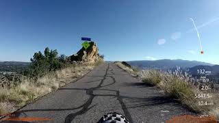
trail: Greenhorn
18:13 |
222 |
Oct 4, 2020 , Cañon City
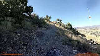
trail: Graneros
8:03 |
256 |
Oct 4, 2020 , Cañon City

trail: Dakota Ridge
8:03 |
342 |
Sep 27, 2020 , Cañon City
Recent Trail Reports
| status | trail | date | condition | info | user |
|---|---|---|---|---|---|
| Greenhorn | Apr 1, 2026 @ 8:24am (America/Denver) Apr 1, 2026 | Ideal | jetdriverbam | ||
| Stone Quarry Spur II | Jan 7, 2025 @ 6:35am Jan 7, 2025 | Snow Covered | Lower-Ark-MBA LAMBA | ||
| Stone Quarry Spur | Jan 7, 2025 @ 6:35am Jan 7, 2025 | Snow Covered | Lower-Ark-MBA LAMBA | ||
| Stone Quarry | Jan 7, 2025 @ 6:35am Jan 7, 2025 | Snow Covered | Lower-Ark-MBA LAMBA | ||
| Old Skyline Drive | Jan 7, 2025 @ 6:35am Jan 7, 2025 | Snow Covered | Lower-Ark-MBA LAMBA | ||
| Graneros | Jan 7, 2025 @ 6:35am Jan 7, 2025 | Snow Covered | Lower-Ark-MBA LAMBA | ||
| Fairview Link | Jan 7, 2025 @ 6:35am Jan 7, 2025 | Snow Covered | Lower-Ark-MBA LAMBA | ||
| Dakota Ridge | Jan 7, 2025 @ 6:35am Jan 7, 2025 | Snow Covered | Lower-Ark-MBA LAMBA |
Activity Feed
| username | action | type | title | date |
|---|---|---|---|---|
| jetdriverbam | add | report | activity #91705785 and 1 more | Apr 1, 2026 @ 7:24am Apr 1, 2026 |
| jetdriverbam | vote | trail | activity #91689277 | Mar 31, 2026 @ 9:15pm Mar 31, 2026 |
| jetdriverbam | ridden | trail | activity #91689129 and 1 more | Mar 31, 2026 @ 9:06pm Mar 31, 2026 |
| Lower-Ark-MBA | add | trail | activity #68508404 | Mar 27, 2025 @ 9:07am Mar 27, 2025 |
| Lower-Ark-MBA | add | report | activity #64217717 and 7 more | Jan 7, 2025 @ 6:35am Jan 7, 2025 |
Recent Comments
| username | type | title | comment | date |
|---|---|---|---|---|
| trail | Gnarly! | Sep 27, 2020 @ 9:39pm Sep 27, 2020 | ||
| trail | A legit single black, of the older school,... | Jun 9, 2020 @ 7:31pm Jun 9, 2020 | ||
| trail | Great for new and/or young mountain bikers,... | Jul 19, 2019 @ 10:03am Jul 19, 2019 | ||
| trail | Very technical | Jul 19, 2019 @ 10:02am Jul 19, 2019 |
Nearby Areas
| name | distance | ||||
|---|---|---|---|---|---|
| Royal Gorge Park | 7 | 17 | 6 | 2 | 3.3 km |
| South Cañon | 8 | 12 | 1 | 3.7 km | |
| Oil Well Flats | 3 | 5 | 1 | 5.4 km | |
| Wet Mountains | 1 | 3 | 1 | 7.3 km | |
| Red Canyon Park | 8.8 km |
Local Products
Activity Type Stats
| activitytype | trails | distance | descent | descent distance | total vertical | rating | global rank | state rank | photos | reports | routes | ridelogs |
|---|---|---|---|---|---|---|---|---|---|---|---|---|
| Mountain Bike | 9 | 6 miles | 751 ft | 2 miles | 558 ft | #10,476 | #4,157 | 9 | 374 | 1 | 1,706 | |
| Hike | 9 | 6 miles | 751 ft | 2 miles | 558 ft | #15,378 | #6,919 | 371 | 118 | |||
| Trail Running | 9 | 6 miles | 751 ft | 2 miles | 558 ft | #14,178 | #6,011 | 371 | 105 |
Frequently Asked Questions About Hogbacks
▼
What are the highest rated mountain biking trails in Hogbacks?
The highest rated mountain biking trails in Hogbacks are:
- Graneros (4.1/5)
- Dakota Ridge (4/5)
- Stone Quarry (0/5)
- Stone Quarry Spur II (0/5)
- Stone Quarry Spur (0/5)
▼
What is the best time of the year to ride in Hogbacks?
Based on ride log data, the most popular months to ride in Hogbacks are:
- July (49 activities)
- May (35 activities)
- August (33 activities)
▼
Where can I park to ride in Hogbacks?
There are 3 parking locations listed in Hogbacks. The most popular parking spots are: View all parking and trailhead locations on the map to plan your visit.
▼
What is the longest trail in Hogbacks?
The longest trail in Hogbacks is Graneros at 1.9 miles. View all trails sorted by distance.
- By brenthillier
 NSMBA TRAILFORKS & contributors
 - Admins: LAMBA, LAMBA
- #15622 - 2,995 views
- hogbacks activity log | embed map of Hogbacks mountain bike trails | hogbacks mountain biking points of interest
Downloading of trail gps tracks in kml & gpx formats is enabled for Hogbacks.
You must login to download files.