
close
3D
Trail Conditions
- Unknown
- Snow Groomed
- Snow Packed
- Snow Covered
- Snow Cover Partial
- Freeze/thaw Cycle
- Icy
- Prevalent Mud
- Wet
- Variable
- Ideal
- Dry
- Very Dry
Trail Flow (Ridden Direction)
Trailforks scans users activity logs to determine the most popular direction each trail is ridden. A good flowing trail network will have most trails flowing in a single direction according to their intension.
The colour categories are based on what percentage of users are riding a trail in its intended direction.
The colour categories are based on what percentage of users are riding a trail in its intended direction.
- > 96%
- > 90%
- > 80%
- > 70%
- > 50%
- < 50%
- bi-directional trail
- no data
Trail Last Used
Trailforks scans activity logs to determine the last time a trail was ridden.
- < 2 days
- < 1 week
- < 2 weeks
- < 1 month
- < 6 months
- > 6 months
Trail Ridden Direction
The intended direction a trail should be ridden.
- Downhill Only
- Downhill Primary
- Both Directions
- Uphill Primary
- Uphill Only
- One Direction
Contribute Details
Colors indicate trail is missing specified detail.
- Description
- Photos
- Description & Photos
- Videos
Trail Popularity ?
Trailforks scans activity logs to determine which trails are ridden the most in the last 9 months.
Trails are compared with nearby trails in the same city region with a possible 25 colour shades.
Think of this as a heatmap, more activities = more kinetic energy = warmer colors.
- most popular
- popular
- less popular
- not popular
ATV/ORV/OHV Filter
Max Vehicle Width
inches
US Cell Coverage
Legend

Radar Time
Activity Recordings
Trailforks uses anonymized public activity data.
?
Activity Recordings
Trailforks uses anonymized public activity data.
?
Winter Trails
Warning
A routing network for winter maps does not exist. Selecting trails using the winter trails layer has been disabled.
Missing Trails
Most Popular
Least Popular
Trails are colored based on popularity. The more popular a trail is, the more red. Less popular trails trend towards green.
Jump Magnitude Heatmap
Heatmap of where users jump on trails. Zoom in to see individual jumps, click circles to view jump details.
BC Backroad Status
![map legend]()
Service Road Atlas is a free to use, community-driven service for viewing and creating reports on the numerous back-country service roads around B.C. and Alberta.

Slope Aspect
Direction the slope faces
Trails Deemphasized
Trails are shown in grey.
Only show trails with no bike usage.
Suggested Layers
Based on selected activity type
Save the current map location and zoom level as your default home location whenever this page is loaded.
SaveNorsk
Mellom Knapstad & Spydeberg, Nord-Øst for Spydeberg Sentrum.
Området er egnet for løping, MTB og fotturer.
Området byr på fra enkle stier til krevende bratte stier, og mellom.
Ca 30 minutters avstand på sykkel fra Askim sentrum med party fart.
English
Between Knapstad & Spydeberg, North-East of Spydeberg City centre.
The area is suited for running, MTB, and hiking.
The area offers from easy trails to demanding steep trails, and between.
Ca 30 min minutes on bike from from Askim city centre with party pace.
eBikes Allowed:
Yes
AKA: Hylliåsen
 google parking directions plan a road trip here
Links
- https://www.facebook.com/pages/Hylliskogen/
- mtbmap.no
- norgeskart.no
- Ski track map
- Instagram tag
- Instagram location
- https://turperler.wordpress.com/2021/11/21/hylliasen/
- https://www.visitoestfold.com/no/indre-ostfold/produkt/?tlp=6138493&name=Turperler-Hylliasen
- https://www.visitnorway.no/listings/turperler%3a-hylli%c3%a5sen/232172/
This region uses the Uk/Euro style trail grading system.
Trail info last updated
Activities Click to view
- Mountain Bike
36 trails
- E-Bike
24 trails
- Hike
33 trails
- Trail Running
33 trails
Region Details
- 12
- 6
- 13
- 4
- 1
Region Status
Caution as of Sep 18, 2024
Stats
- Avg Trail Rating
- Trails (view details)
- 36
- Trails Mountain Bike
- 36
- Trails E-Bike
- 24
- Trails Gravel Bike
- 13
- Trails Adaptive Bike
- 12
- Trails Winter Fat Bike
- 22
- Trails Hike
- 33
- Trails Trail Running
- 33
- Trails Nordic Ski
- 1
- Total Distance
- 12 miles
- Total Descent Distance
- 4 miles
- Total Descent
- 825 ft
- Total Vertical
- 269 ft
- Highest Trailhead
- 626 ft
- Reports
- 36
- Photos
- 173
- Completed Counter
- 125
Popular Hylliskogen Mountain Biking Trails
• 5 ★ 5.0 • 1,253 ft • 18 ft • 5 •
Norsk Stien er på toppen gjengrodd med små nåletrær, så goggles anbefales. Det er to inn-/utganger der. Stien er ganske lett for, begge retninger, fra toppen fra nåletrærne kan du gå veldig fort, gjennom hugget skog. Men det er...
• 70 ★ 5.0 • 1,985 ft • 39 ft • 5 •
Norsk Kenneth er lett, kan fint sykles med MTB, har noen små forseringer. English Kenneth is easy, easily be ridden with MTB, has some reinforcements.
• 5 ★ 5.0 • 2,582 ft • 86 ft • 4 •
Norsk Ganske lett sti, men små tekniske partier, men de fleste skal klare det. Stien går fint å sykle begge retninger. Stien er smalere midt til toppen, grunnet dette egner stien seg ikke aMTB. Bunnen er bred og er blanding av flyt...
• 95 ★ 5.0 • 2,001 ft • 7 ft • 4 •
Norsk Stiener en herlig sti som kan sykles med vanlig MTB dersom man er litt erfaren. Røffe rotpartier og korte stigninger, noen opp og ned, opp og ned små bergruller, noe flyt. English The trail is a wonderful trail that can be...
• 95 ★ 5.0 • 2,667 ft • 31 ft • 4 •
Norsk Starten på løypa fra veien er en fin hardpakket smal sti i skogkanten, den går ut av skogen og mellom jordene, og går tilbake til venstre inn i skogen med lett stigning før den gamle speiderhytta (Gullberg), og snart er du...
• 5 ★ 0.0 • 112 ft • 0 ft • 4 •
Less popular green difficulty singletrack. This mountain bike primary trail can be used both directions and has a easy overall physical rating with a 0 ft green climb. Trail visibility is always easy to follow.
• 80 ★ 5.0 • 436 ft • 24 ft • 3 •
Norsk Lett fra starten men så kommer det bratt teknisk klartreparti fult av røtter, nesten håpløst når det er vått, veldig teknisk og vanskelig klarting, mange linjevalg, men etterpå er det lett sti. Men mye lettere ned. English...
Hylliskogen Mountain Bike Routes
★ 5.0 • 2,185 ft • 3 • Point to Point •
thee top trail has a lot of bare rock, ends with easy exit at to the gravel road.
Photos of Hylliskogen Mountain Bike
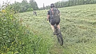
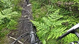
Videos of Hylliskogen Mountain Bike
Recent Trail Reports
| status | trail | date | condition | info | user |
|---|---|---|---|---|---|
| Rattlesnake | Sep 18, 2024 @ 4:12pm Sep 18, 2024 | Variable | mtbboy1993 TRAILFORKS | ||
| Tårnåsen Downhill | Sep 18, 2024 @ 4:05pm Sep 18, 2024 | Ideal | mtbboy1993 TRAILFORKS | ||
| Langstien | Sep 18, 2024 @ 4:01pm Sep 18, 2024 | Prevalent Mud | mtbboy1993 TRAILFORKS | ||
| Lettstien | Sep 18, 2024 @ 3:59pm Sep 18, 2024 | Variable | mtbboy1993 TRAILFORKS | ||
| Hovin Over Hyllibekken | Sep 18, 2024 @ 3:59pm Sep 18, 2024 | Prevalent Mud | mtbboy1993 TRAILFORKS | ||
| Gullstien | Jun 5, 2024 @ 9:24am Jun 5, 2024 | Variable | mtbboy1993 TRAILFORKS | ||
| Hyllijordet | Jun 5, 2024 @ 9:17am Jun 5, 2024 | Ideal | mtbboy1993 TRAILFORKS | ||
| Svabergetstien | May 29, 2024 @ 2:07pm May 29, 2024 | Wet | mtbboy1993 TRAILFORKS | ||
| Bakstien | May 29, 2024 @ 1:41pm May 29, 2024 | Unknown | mtbboy1993 TRAILFORKS | ||
| Hylliveien | May 8, 2024 @ 1:38pm May 8, 2024 | Dry | mtbboy1993 TRAILFORKS |
Activity Feed
| username | action | type | title | date |
|---|---|---|---|---|
| mtbboy1993 | add | video | activity #94961907 | May 18, 2026 @ 12:00am May 18, 2026 |
| mtbboy1993 | add | video | activity #94903468 and 1 more | May 17, 2026 @ 8:00am May 17, 2026 |
| mtbboy1993 | add | video | activity #79307766 and 1 more | Aug 31, 2025 @ 1:00am Aug 31, 2025 |
| mtbboy1993 | add | video | activity #76371730 | Jul 20, 2025 @ 10:00pm Jul 20, 2025 |
| mtbboy1993 | add | video | activity #74872315 | Jun 29, 2025 @ 11:00pm Jun 29, 2025 |
Nearby Areas
| name | distance | ||||
|---|---|---|---|---|---|
| Spydeberg City | 6 | 0.9 km | |||
| Knapstad | 12 | 1 | 1.1 km | ||
| Griniskogen Turpark | 6 | 5 | 1.3 km | ||
| Ulvåsen | 2 | 1.8 km | |||
| Grååsen | 6 | 4 | 2.1 km |
Local Badges
-

Completionist1 awarded


Activity Type Stats
| activitytype | trails | distance | descent | descent distance | total vertical | rating | global rank | state rank | photos | reports | routes | activity logs |
|---|---|---|---|---|---|---|---|---|---|---|---|---|
| Mountain Bike | 36 | 12 miles | 827 ft | 4 miles | 269 ft | #2,381 | #21 | 173 | 36 | 2 | 70 | |
| E-Bike | 24 | 8 miles | 384 ft | 2 miles | 269 ft | #2,901 | #46 | 20 | 2 | |||
| Gravel Bike | 13 | 7 miles | 387 ft | 2 miles | 269 ft | #6,086 | #48 | |||||
| Adaptive Bike | 12 | 7 miles | 308 ft | 2 miles | 269 ft | #6,098 | #48 | 5 | ||||
| Winter Fat Bike | 22 | 9 miles | 633 ft | 3 miles | 262 ft | #6,086 | #48 | 20 | ||||
| Hike | 33 | 11 miles | 728 ft | 3 miles | 269 ft | #4,491 | #38 | 31 | 1 | 6 | ||
| Trail Running | 33 | 11 miles | 728 ft | 3 miles | 269 ft | #3,547 | #37 | 31 | 1 | 13 | ||
| Nordic Ski | 1 | 1,568 ft | 92 ft |
Frequently Asked Questions
▼
What are the highest rated mountain biking trails in Hylliskogen?
The highest rated mountain biking trails in Hylliskogen are:
- Hyllijordet (4.1/5)
- Gullstien (4.1/5)
- Langstien (4.1/5)
- Trail (4.1/5)
- Alternativ Enduro (4.1/5)
▼
Where can I park to ride in Hylliskogen?
There are 2 parking locations listed in Hylliskogen. The most popular parking spots are:
▼
What is the longest trail in Hylliskogen?
The longest trail in Hylliskogen is Langstien at 3,386 ft. View all trails sorted by distance.
▼
What are the best & highest rated hiking trails in Hylliskogen?
The best hiking trails in Hylliskogen are: View all hiking trails sorted by popularity score.
▼
What are the best & highest rated trail running trails in Hylliskogen?
The best trail running trails in Hylliskogen are: View all trail running trails sorted by popularity score.
▼
How many trails are in Hylliskogen?
Hylliskogen has a total of 36 trails. Browse top mountain biking trails in Hylliskogen to find detailed information including difficulty ratings, distances, and trail conditions.
▼
Which trail has the most elevation gain in Hylliskogen?
The trail with the most elevation gain in Hylliskogen is Langstien with 101 ft of elevation gain. View all trails sorted by elevation gain.
▼
Which trail has the most elevation descent in Hylliskogen?
The trail with the most elevation descent in Hylliskogen is Langstien with 96 ft of elevation descent. View all trails sorted by elevation descent.
▼
What activities are most popular in Hylliskogen?
Hylliskogen supports the following activities: Mountain Biking, E-Biking, Hiking, Trail Running.
▼
What are the steepest mountain biking trails in Hylliskogen?
The steepest mountain biking trail in Hylliskogen is Løvestadstien with an average grade of 5.8%. View all trails sorted by grade.
▼
Are there any trails with scenic viewpoints in Hylliskogen?
Yes, there are 1 scenic viewpoints marked along trails in Hylliskogen. Explore more points of interest to find trails with the best views.
▼
Are the trails open in Hylliskogen?
The overall region status for Hylliskogen is Minor Issue / Yellow. Out of 17 trails:
- Clear / Green: 9
- Minor Issue / Yellow: 4
- Significant Issue / Amber: 4
▼
Can I ride an ebike in Hylliskogen?
Yes, Hylliskogen supports e-bike riding. There are 26 trails in Hylliskogen that allow e-bikes. Check the e-bike trails listing for specific trail access details and any local regulations.
▼
What are the most popular mountain biking routes in Hylliskogen?
The most popular mountain biking routes in Hylliskogen are: View all mountain biking routes in Hylliskogen.
▼
What are the most popular Strava Segments in Hylliskogen?
The most popular Strava segments in Hylliskogen are:
- Holli climb S (5,425 athletes)
- Spydeberg stasjon > Bergenhus (FV202 lyserenveien) (4,244 athletes)
- Bygetunkneika (3,439 athletes)
▼
What are some popular technical trail features in Hylliskogen?
There are 9 technical trail features (TTFs) in Hylliskogen. Some popular features include: View all technical trail features in Hylliskogen.
▼
What are the most popular mountain biking trails in Hylliskogen?
The most popular mountain biking trails in Hylliskogen are: View all mountain biking trails sorted by popularity.
▼
What are the best beginner ride trails in Hylliskogen?
The best beginner mountain biking trails in Hylliskogen are:
- Løvestadstien (5/5)
- Lettstien (5/5)
- Over Jordet (0/5)
Activities
Trails
- By mtbboy1993
 TRAILFORKS SSK & contributors
- Admins: skiva
- #17694 - 4,510 views
- hylliskogen activity log | embed map of Hylliskogen mountain bike trails | hylliskogen mountain biking points of interest polygons
Downloading of trail gps tracks in kml & gpx formats is enabled for Hylliskogen.
You must login to download files.
