close
-
Layers w
- Weather Layers
- Pro
- Pro
- Pro
- Pro
- Pro
- Pro
- More Layers
- Pro
- Pro
- Pro
- Pro
-
Upgrade to

3D
Trail Conditions
- Unknown
- Snow Groomed
- Snow Packed
- Snow Covered
- Snow Cover Partial
- Freeze/thaw Cycle
- Icy
- Prevalent Mud
- Wet
- Variable
- Ideal
- Dry
- Very Dry
Trail Flow (Ridden Direction)
Trailforks scans users ridelogs to determine the most popular direction each trail is ridden. A good flowing trail network will have most trails flowing in a single direction according to their intension.
The colour categories are based on what percentage of riders are riding a trail in its intended direction.
The colour categories are based on what percentage of riders are riding a trail in its intended direction.
- > 96%
- > 90%
- > 80%
- > 70%
- > 50%
- < 50%
- bi-directional trail
- no data
Trail Last Ridden
Trailforks scans ridelogs to determine the last time a trail was ridden.
- < 2 days
- < 1 week
- < 2 weeks
- < 1 month
- < 6 months
- > 6 months
Trail Ridden Direction
The intended direction a trail should be ridden.
- Downhill Only
- Downhill Primary
- Both Directions
- Uphill Primary
- Uphill Only
- One Direction
Contribute Details
Colors indicate trail is missing specified detail.
- Description
- Photos
- Description & Photos
- Videos
Trail Popularity ?
Trailforks scans ridelogs to determine which trails are ridden the most in the last 9 months.
Trails are compared with nearby trails in the same city region with a possible 25 colour shades.
Think of this as a heatmap, more rides = more kinetic energy = warmer colors.
- most popular
- popular
- less popular
- not popular
ATV/ORV/OHV Filter
Max Vehicle Width
inches
US Cell Coverage
Legend

Radar Time
Activity Recordings
Trailforks uses anonymized public activity data.
?
Activity Recordings
Trailforks uses anonymized public activity data.
?
Personal Heatmap
▶
Activity Types
all
/
none
▶
Options
2
Date range
month
–
Winter Trails
Warning
A routing network for winter maps does not exist. Selecting trails using the winter trails layer has been disabled.
Missing Trails
Most Popular
Least Popular
Trails are colored based on popularity. The more popular a trail is, the more red. Less popular trails trend towards green.
Jump Magnitude Heatmap
Heatmap of where riders jump on trails. Zoom in to see individual jumps, click circles to view jump details.
BC Backroad Status
![map legend]()
Service Road Atlas is a free to use, community-driven service for viewing and creating reports on the numerous back-country service roads around B.C. and Alberta.

Slope Aspect
Direction the slope faces
Trails Deemphasized
Trails are shown in grey.
Only show trails with no bike usage.
Suggested Layers
Based on selected activity type
Save the current map location and zoom level as your default home location whenever this page is loaded.
Save
No description for Interior has been added yet!
Login or register to submit one.
Activities Click to view
- Hike
14 trails
- Trail Running
13 trails
Region Details
14 hike trails
Region Status
Open as of Jun 6, 2026Hike Stats
- Global Ranking
- #8,783
- State Ranking
- #3,082
- Trails (view details)
- 14
- Trails Mountain Bike
- 1
- Trails Horse
- 1
- Trails Hike
- 14
- Trails Trail Running
- 13
- Total Distance
- 10 miles
- Total Descent Distance
- 3 miles
- Total Descent
- 279 ft
- Total Vertical
- 377 ft
- Reports
- 14
- Photos
- 1
- Ridden Counter
- 884
Articles
I Saw an Epic Sunset at Badlands National Park
Nov 2, 2020 from outsideonline.com
Our 62 Parks Traveler meets bison and sees surreal geography at this South Dakota stop, the 23rd visit on her journey to see every U.S. national park
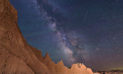
This Badlands Overnight is the Perfect Stargazing Hike for Beginners
Aug 19, 2021 from backpacker.com
Take a newbie hiker on this perfect Badlands stargazing hike.
Sub Regions
-
Badlands National Park
- 1
Popular Interior Hiking Trails
• 100 ★ 4.0 • 3,274 ft • 144 ft • 208 • • hike
After meandering through a canyon, this trail climbs a log ladder and follows a ledge to "the " for a dramatic view of the White River Valley. Trail begins at the south end of the and parking area. Watch for drop-offs. Not recommended...
• 95 ★ 3.0 • 682 ft • 0 ft • 114 • • hike
An accessible ¼ mile boardwalk leads through a break in the Badlands Wall known as "the " and to a view of the Badlands. From there, the maintained trail ends. Travel beyond this point is at your own risk. Watch for drop-offs.
• 90 ★ 4.0 • 663 ft • 6 ft • 103 • • hike
This short trail leads to a natural in the Badlands Wall with a view of an intricately eroded canyon. Please stay on the trail.
• 80 ★ 3.0 • 1,539 ft • 0 ft • 95 • • hike
Green difficulty singletrack. This hike primary trail can be used both directions. On average it takes 8 minutes to complete this trail.
• 75 ★ 4.0 • 1,453 ft • 18 ft • 74 • • hike
White difficulty paved path. This hike primary trail can be used both directions. On average it takes 8 minutes to complete this trail.
• 65 ★ 0.0 • 2 miles • 52 ft • 60 • • hike
This generally rolling trail connects with the near the Old Northeast Road and at the intersection of the and Trails. Trail users are provided the opportunity to explore the mixed grass prairie while enjoying views of the Badlands in...
• 60 ★ 0.0 • 1,864 ft • 211 ft • 50 • • hike
This short trail climbs up the Badlands Wall to a view over the White River Valley. The trail ends where it connects with the and Loop Trails.
• 45 ★ 0.0 • 5 miles • 124 ft • 39 • • hike
The longest trail in the park begins at the and parking area and travels five miles one way to the Fossil Exhibit Trail. Relatively level, the path passes along some badlands formations.
Interior Routes
11 miles • 288 ft • 3 • Loop •
A loop on the and Trails with a visit to the .
• 7 miles • 328 ft • 1 •
• 2 miles • 356 ft • 3 •
• 5,085 ft • 150 ft • 3 •
• 3 miles • 434 ft • 7 •
Recent Trail Reports
| status | trail | date | condition | info | user |
|---|---|---|---|---|---|
| Medicine Root Trail | Jun 6, 2026 @ 7:08am (America/Denver) Jun 6, 2026 | Variable | RAbike11 | ||
| Notch Trail | Aug 1, 2024 @ 10:40am Aug 1, 2024 | Very Dry | mtbiker2859 | ||
| Window Trail | Aug 1, 2024 @ 10:40am Aug 1, 2024 | Very Dry | mtbiker2859 | ||
| Access Sidewalk | Aug 1, 2024 @ 10:40am Aug 1, 2024 | Very Dry | mtbiker2859 | ||
| Door Trail | Aug 1, 2024 @ 10:40am Aug 1, 2024 | Very Dry | mtbiker2859 | ||
| Door Trail | Aug 1, 2024 @ 10:40am Aug 1, 2024 | Very Dry | mtbiker2859 | ||
| Cliff Shelf Nature Trail | May 19, 2023 @ 5:06am May 19, 2023 | Ideal | Cuda77 |
Activity Feed
| username | action | type | title | date |
|---|---|---|---|---|
| RAbike11 | add | report | activity #96511925 | Jun 7, 2026 @ 5:55pm Jun 7, 2026 |
| mtbiker2859 | vote | trail | activity #80944712 and 4 more | Sep 23, 2025 @ 4:58am Sep 23, 2025 |
| theukrainian1 | comment | trail | activity #59275292 | Sep 21, 2024 @ 8:41pm Sep 21, 2024 |
| Tca8Cg | wishlist | trail | activity #59185118 | Sep 20, 2024 @ 7:55am Sep 20, 2024 |
| mtbiker2859 | add | report | activity #56658353 and 4 more | Aug 3, 2024 @ 7:27pm Aug 3, 2024 |
Recent Comments
| username | type | title | comment | date |
|---|---|---|---|---|
| trail | It's worth it, coming down is tricky as it's... | Sep 21, 2024 @ 8:41pm Sep 21, 2024 |
Local Badges
-

Epic Hike Climb 2k0 awarded -

Climbing 10k Badge0 awarded -

Hiking 100k Badge0 awarded -

Big Hike 10k25 awarded -

Epic Hike 50k1 awarded
Activity Type Stats
| activitytype | trails | distance | descent | descent distance | total vertical | rating | global rank | state rank | photos | reports | routes | ridelogs |
|---|---|---|---|---|---|---|---|---|---|---|---|---|
| Mountain Bike | 1 | 384 ft | 13 ft | 14 | 152 | |||||||
| Horse | 1 | 384 ft | 13 ft | |||||||||
| Hike | 14 | 10 miles | 279 ft | 3 miles | 377 ft | #8,783 | #3,082 | 1 | 14 | 2 | 610 | |
| Trail Running | 13 | 10 miles | 272 ft | 3 miles | 377 ft | #10,765 | #3,697 | 14 | 82 |
Frequently Asked Questions About Interior
▼
What are the best places to hike in Interior?
Interior has 1 areas to explore for hiking. The top rated areas are:
▼
What are the highest rated hiking trails in Interior?
The highest rated hiking trails in Interior are:
- Saddle Pass Trail (0/5)
- Castle Trail (0/5)
- Medicine Root Trail (0/5)
- Access Sidewalk (0/5)
- Fossil Exhibit (0/5)
▼
What is the best time of the year to hike in Interior?
Based on ride log data, the most popular months to hike in Interior are:
- September (3 activities)
- July (3 activities)
- August (2 activities)
▼
Where can I park to hike in Interior?
There are 4 parking locations listed in Interior. The most popular parking spots are: View all parking and trailhead locations on the map to plan your visit.
Trails
Points of Interest
- By markholloway
 Trailforks Map Team & contributors
 - Admins: BHT
- #43465 - 557 views
- interior activity log | embed map of Interior mountain bike trails | interior mountain biking points of interest
Downloading of trail gps tracks in kml & gpx formats is enabled for Interior.
You must login to download files.