close
-
Layers w
- Weather Layers
- Pro
- Pro
- Pro
- Pro
- Pro
- Pro
- More Layers
- Pro
- Pro
- Pro
- Pro
-
Upgrade to

3D
Trail Conditions
- Unknown
- Snow Groomed
- Snow Packed
- Snow Covered
- Snow Cover Partial
- Freeze/thaw Cycle
- Icy
- Prevalent Mud
- Wet
- Variable
- Ideal
- Dry
- Very Dry
Trail Flow (Ridden Direction)
Trailforks scans users ridelogs to determine the most popular direction each trail is ridden. A good flowing trail network will have most trails flowing in a single direction according to their intension.
The colour categories are based on what percentage of riders are riding a trail in its intended direction.
The colour categories are based on what percentage of riders are riding a trail in its intended direction.
- > 96%
- > 90%
- > 80%
- > 70%
- > 50%
- < 50%
- bi-directional trail
- no data
Trail Last Ridden
Trailforks scans ridelogs to determine the last time a trail was ridden.
- < 2 days
- < 1 week
- < 2 weeks
- < 1 month
- < 6 months
- > 6 months
Trail Ridden Direction
The intended direction a trail should be ridden.
- Downhill Only
- Downhill Primary
- Both Directions
- Uphill Primary
- Uphill Only
- One Direction
Contribute Details
Colors indicate trail is missing specified detail.
- Description
- Photos
- Description & Photos
- Videos
Trail Popularity ?
Trailforks scans ridelogs to determine which trails are ridden the most in the last 9 months.
Trails are compared with nearby trails in the same city region with a possible 25 colour shades.
Think of this as a heatmap, more rides = more kinetic energy = warmer colors.
- most popular
- popular
- less popular
- not popular
ATV/ORV/OHV Filter
Max Vehicle Width
inches
US Cell Coverage
Legend

Radar Time
Activity Recordings
Trailforks uses anonymized public activity data.
?
Activity Recordings
Trailforks uses anonymized public activity data.
?
Personal Heatmap
▶
Activity Types
all
/
none
▶
Options
2
Date range
month
–
Winter Trails
Warning
A routing network for winter maps does not exist. Selecting trails using the winter trails layer has been disabled.
Missing Trails
Most Popular
Least Popular
Trails are colored based on popularity. The more popular a trail is, the more red. Less popular trails trend towards green.
Jump Magnitude Heatmap
Heatmap of where riders jump on trails. Zoom in to see individual jumps, click circles to view jump details.
BC Backroad Status
![map legend]()
Service Road Atlas is a free to use, community-driven service for viewing and creating reports on the numerous back-country service roads around B.C. and Alberta.

Slope Aspect
Direction the slope faces
Trails Deemphasized
Trails are shown in grey.
Only show trails with no bike usage.
Suggested Layers
Based on selected activity type
Save the current map location and zoom level as your default home location whenever this page is loaded.
Save
No description for Junik has been added yet!
Login or register to submit one.
Activities Click to view
- Mountain Bike
5 trails
- E-Bike
4 trails
- Adaptive Bike
0 trails
- Horse
5 trails
- Hike
9 trails
- Trail Running
9 trails
- ATV/ORV/OHV
1 trails
Region Details
- 1
- 1
- 2
Region Status
Open as of Dec 30, 2025Stats
- Trails (view details)
- 8
- Trails Mountain Bike
- 5
- Trails E-Bike
- 4
- Trails Horse
- 5
- Trails Hike
- 9
- Trails Trail Running
- 9
- Trails Dirtbike/Moto
- 2
- Trails Observed Trials
- 2
- Trails ATV/ORV/OHV
- 1
- Trails Snowmobile
- 1
- Trails Snowshoe
- 1
- Total Distance
- 27 miles
- Total Descent
- 2,742 ft
- Total Vertical
- 6,724 ft
- Highest Trailhead
- 8,536 ft
- Reports
- 5
- Photos
- 7
- Ridden Counter
- 13
Sub Regions
-
Gjeravica
- 2
Popular Junik Mountain Biking Trails
• 5 ★ 5.0 • 1 mile • 9 ft • 2 •
Less popular black diamond difficulty alpine singletrack. This mountain bike primary trail can be used downhill primary and has a moderate overall physical rating with a 9 ft blue climb. It features berm, bridge, drop, jump, rock face, rock garden and other. Trail visibility is sometimes hard to follow. On average it takes 4 minutes to complete this trail.
• 5 ★ 0.0 • 4 miles • 2,788 ft •
Less popular blue difficulty mixed. This multi-use trail can be used both directions and has a moderate overall physical rating with a 2,788 ft blue climb. Winter use: Classic snow grooming. Trail visibility is sometimes hard to follow.
• 5 ★ 0.0 • 4 miles • 851 ft •
Fantastic singletrail in the high zones of the Accursed mountain range, starting from the border (Cafa Bogices). It winds up and down the open slopes and valleys below Tromedja and Maja Bogicaj peaks to the beautiful glacier lake...
Videos of Junik Mountain Bike
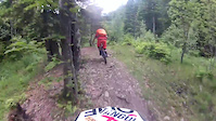
trail: Gjeravica Trail
0:00 |
51 |
Feb 27, 2019
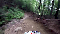
trail: Gjeravica Trail
0:46 |
27 |
Jul 2, 2018
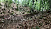
trail: Gjeravica Trail
0:16 |
25 |
Jun 30, 2018
Recent Trail Reports
| status | trail | date | condition | info | user |
|---|---|---|---|---|---|
| Gjeravica Trail | Sep 8, 2019 @ 9:14am Sep 8, 2019 | Unknown | andiqyqja TRAILFORKS |
Activity Feed
| username | action | type | title | date |
|---|---|---|---|---|
| andiqyqja | update | trail | activity #81929475 | Oct 8, 2025 @ 12:43am Oct 8, 2025 |
| felixw73 | wishlist | trail | activity #67636134 | Mar 12, 2025 @ 7:20am Mar 12, 2025 |
| OtherTrails | add | trail | activity #66451639 | Feb 19, 2025 @ 10:01am Feb 19, 2025 |
| folostom | wishlist | trail | activity #28190014 and 1 more | Apr 8, 2022 @ 12:41pm Apr 8, 2022 |
| andiqyqja | add | trail | activity #24877758 | Nov 15, 2021 @ 11:51pm Nov 15, 2021 |
Activity Type Stats
| activitytype | trails | distance | descent | descent distance | total vertical | rating | global rank | state rank | photos | reports | routes | ridelogs |
|---|---|---|---|---|---|---|---|---|---|---|---|---|
| Mountain Bike | 5 | 17 miles | 1,985 ft | 3 miles | 4,341 ft | #10,372 | #11 | 7 | 5 | 30 | ||
| E-Bike | 4 | 16 miles | 781 ft | 2 miles | 4,341 ft | #1,467 | #3 | 2 | 1 | 2 | ||
| Horse | 5 | 23 miles | 1,539 ft | 3 miles | 6,398 ft | #338 | #2 | 1 | ||||
| Hike | 9 | 27 miles | 2,743 ft | 4 miles | 6,726 ft | #1,985 | #4 | 3 | 1 | 105 | ||
| Trail Running | 9 | 27 miles | 2,743 ft | 4 miles | 6,726 ft | #1,538 | #3 | 3 | ||||
| Dirtbike/Moto | 2 | 16 miles | 781 ft | 2 miles | 4,341 ft | |||||||
| Observed Trials | 2 | 16 miles | 781 ft | 2 miles | 4,341 ft | |||||||
| ATV/ORV/OHV | 1 | 12 miles | 367 ft | 1 mile | 3,953 ft | #217 | #2 | |||||
| Snowmobile | 1 | 12 miles | 367 ft | 1 mile | 3,953 ft | |||||||
| Snowshoe | 1 | 4 miles | 413 ft | 3,688 ft | 2,602 ft | 4 |
Frequently Asked Questions About Junik
▼
What are the best places to ride in Junik?
Junik has 1 areas to explore for mountain biking. The top rated areas are:
▼
What are the highest rated mountain biking trails in Junik?
The highest rated mountain biking trails in Junik are:
- Gjeravica Trail (4.1/5)
- Maja Ujezës (0/5)
- Cafa Bogices - Tropojes Lake (0/5)
▼
Where can I park to ride in Junik?
▼
What is the longest trail in Junik?
The longest trail in Junik is Maja Ujezës at 6.4 km. View all trails sorted by distance.
Activities
Trails
Points of Interest
- By andiqyqja
 TRAILFORKS & contributors
 - Admins: andiqyqja
- #27782 - 1,729 views
- junik activity log | embed map of Junik mountain bike trails | junik mountain biking points of interest
Downloading of trail gps tracks in kml & gpx formats is enabled for Junik.
You must login to download files.