close
-
Layers w
- Weather Layers
- Pro
- Pro
- Pro
- Pro
- Pro
- Pro
- More Layers
- Pro
- Pro
- Pro
- Pro
-
Upgrade to

3D
Trail Conditions
- Unknown
- Snow Groomed
- Snow Packed
- Snow Covered
- Snow Cover Partial
- Freeze/thaw Cycle
- Icy
- Prevalent Mud
- Wet
- Variable
- Ideal
- Dry
- Very Dry
Trail Flow (Ridden Direction)
Trailforks scans users ridelogs to determine the most popular direction each trail is ridden. A good flowing trail network will have most trails flowing in a single direction according to their intension.
The colour categories are based on what percentage of riders are riding a trail in its intended direction.
The colour categories are based on what percentage of riders are riding a trail in its intended direction.
- > 96%
- > 90%
- > 80%
- > 70%
- > 50%
- < 50%
- bi-directional trail
- no data
Trail Last Ridden
Trailforks scans ridelogs to determine the last time a trail was ridden.
- < 2 days
- < 1 week
- < 2 weeks
- < 1 month
- < 6 months
- > 6 months
Trail Ridden Direction
The intended direction a trail should be ridden.
- Downhill Only
- Downhill Primary
- Both Directions
- Uphill Primary
- Uphill Only
- One Direction
Contribute Details
Colors indicate trail is missing specified detail.
- Description
- Photos
- Description & Photos
- Videos
Trail Popularity ?
Trailforks scans ridelogs to determine which trails are ridden the most in the last 9 months.
Trails are compared with nearby trails in the same city region with a possible 25 colour shades.
Think of this as a heatmap, more rides = more kinetic energy = warmer colors.
- most popular
- popular
- less popular
- not popular
ATV/ORV/OHV Filter
Max Vehicle Width
inches
US Cell Coverage
Legend

Radar Time
Activity Recordings
Trailforks uses anonymized public activity data.
?
Activity Recordings
Trailforks uses anonymized public activity data.
?
Personal Heatmap
▶
Activity Types
all
/
none
▶
Options
2
Date range
month
–
Winter Trails
Warning
A routing network for winter maps does not exist. Selecting trails using the winter trails layer has been disabled.
Missing Trails
Most Popular
Least Popular
Trails are colored based on popularity. The more popular a trail is, the more red. Less popular trails trend towards green.
Jump Magnitude Heatmap
Heatmap of where riders jump on trails. Zoom in to see individual jumps, click circles to view jump details.
BC Backroad Status
![map legend]()
Service Road Atlas is a free to use, community-driven service for viewing and creating reports on the numerous back-country service roads around B.C. and Alberta.

Slope Aspect
Direction the slope faces
Trails Deemphasized
Trails are shown in grey.
Only show trails with no bike usage.
Suggested Layers
Based on selected activity type
Save the current map location and zoom level as your default home location whenever this page is loaded.
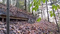
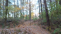
SaveKegel Alpha is a trail system located in Franklin on the city's southwest side. Kegel Alpha is mostly singletrack, with both easy and challenging loops that feature flowing trails, tight and twisty sections, and more climbing than available at Oak Hill or Hoyt.
Rules
* Multi-use trail
* Open dawn until 10pm
* Closed when muddy
* Multi-use trail
* Open dawn until 10pm
* Closed when muddy
Primary Trail Type: Cross-Country
eBikes Allowed:
No
Land Status: County Park
Land Manager: Milwaukee County Parks
 google parking directions
Links
Region Supporters & Maintainers
![]()
Metro Mountain Bikers
since 1994Sponsor
Activities Click to view
- Mountain Bike
6 trails
- Hike
11 trails
- Trail Running
11 trails
- Snowshoe
0 trails
Region Details
- 2
- 1
Region Status
Open as of May 30, 2026Stats
- Avg Trail Rating
- Trails (view details)
- 10
- Trails Mountain Bike
- 6
- Trails Winter Fat Bike
- 3
- Trails Hike
- 11
- Trails Trail Running
- 11
- Total Distance
- 5 miles
- Total Descent Distance
- 1 mile
- Total Descent
- 289 ft
- Total Vertical
- 97 ft
- Highest Trailhead
- 800 ft
- Reports
- 210
- Photos
- 97
- Ridden Counter
- 1,184
Popular Kegel Alpha Mountain Biking Trails
• 100 ★ 3.3 • 3 miles • 207 ft • 184 •
This is the main loop for the Kegel-Alpha system. It is recommended to use the cut-off trail on the north end after recent precipitation, as the northern most section by the river takes a long time to dry out.
• 95 ★ 4.0 • 1,010 ft • 55 ft • 110 •
The return trail for sessioning the downhill section of the 2.0 trail.
• 85 ★ 4.0 • 2,618 ft • 3 ft • 90 •
The old section of the Kegel-Alpha trail before the 2.0 rework. This section runs near the marsh and river so remains wet much of the year. Only ride when dry please.
Kegel Alpha Mountain Bike Routes
6 miles • 306 ft • 7 • Race •
Ride within your abilities and within all NICA rules and guidelines. Student Athletes must be with their...
Videos of Kegel Alpha Mountain Bike
trail: Kegel Alpha 2.0
0:20 |
147 |
Jan 16, 2021
trail: Kegel Alpha 2.0
0:05 |
90 |
Jan 16, 2021
trail: Kegel Alpha 2.0
0:23 |
604 |
Apr 12, 2016
trail: Kegel Alpha 2.0
22:11 |
96 |
Aug 6, 2024 , Franklin
youtuber
![The inaugural Tuesday Night Ride #TNR on...]()

trail: Kegel Alpha 2.0
5:20 |
441 |
Aug 24, 2022 , Franklin
trail: Kegel Alpha 2.0
7:50 |
603 |
Jun 19, 2022 , Franklin
Recent Trail Reports
Activity Feed
| username | action | type | title | date |
|---|---|---|---|---|
| Rabeekman | comment | report | activity #96408225 | Jun 6, 2026 @ 2:51pm Jun 6, 2026 |
| Jon-Mc | vote | trail | activity #96025114 and 6 more | Jun 1, 2026 @ 10:01am Jun 1, 2026 |
| Jon-Mc | add | report | activity #95906023 and 4 more | May 30, 2026 @ 7:37pm May 30, 2026 |
| ssstraub | add | report | activity #94188684 and 8 more | May 6, 2026 @ 5:50pm May 6, 2026 |
| ssstraub | add | photo | activity #94188253 | May 6, 2026 @ 5:42pm May 6, 2026 |
Recent Comments
| username | type | title | comment | date |
|---|---|---|---|---|
| report | H h I. Do | Jun 6, 2026 @ 2:51pm Jun 6, 2026 | ||
| trail | Great trails! Easy riding with some fun ups... | Oct 23, 2022 @ 1:01pm Oct 23, 2022 |
Nearby Areas
| name | distance | ||||
|---|---|---|---|---|---|
| Hoyt Park | 8.8 km | ||||
| Minooka Park | 2 | 2 | 8.9 km | ||
| Oak Hill | 3 | 5 | 12.4 km | ||
| Meadow View Bike Park | 1 | 1 | 14.6 km | ||
| Kletzsch Park Trails | 6 | 15.8 km |
Activity Type Stats
| activitytype | trails | distance | descent | descent distance | total vertical | rating | global rank | state rank | photos | reports | routes | ridelogs |
|---|---|---|---|---|---|---|---|---|---|---|---|---|
| Mountain Bike | 6 | 4 miles | 213 ft | 1 mile | 98 ft | #6,618 | #2,515 | 94 | 205 | 1 | 2,204 | |
| Winter Fat Bike | 3 | #4,835 | #2,127 | 2 | 2 | |||||||
| Hike | 11 | 5 miles | 289 ft | 1 mile | 98 ft | #12,541 | #5,212 | 1 | 207 | 5 | 41 | |
| Trail Running | 11 | 5 miles | 289 ft | 1 mile | 98 ft | #14,149 | #5,992 | 207 | 5 | 56 |
Frequently Asked Questions About Kegel Alpha
▼
What are the highest rated mountain biking trails in Kegel Alpha?
The highest rated mountain biking trails in Kegel Alpha are:
- Downhill 1 (4.2/5)
- Downhill 2 (Proposed) (4.1/5)
- Kegel Alpha Session Return (4.1/5)
- Kegel Alpha Root River Section (4/5)
- Uphill Trail (4/5)
▼
What is the best time of the year to ride in Kegel Alpha?
Based on ride log data, the most popular months to ride in Kegel Alpha are:
- September (19 activities)
- August (17 activities)
- November (17 activities)
▼
Where can I park to ride in Kegel Alpha?
There are 4 parking locations listed in Kegel Alpha. The most popular parking spots are:
- Root River Parkway Parking
- Luxe Golf Parking Lot
- Whitnall Golf Course Parking Lot
- Ross Lodge Parking Lot
▼
What is the longest trail in Kegel Alpha?
The longest trail in Kegel Alpha is Kegel Alpha 2.0 at 3.2 miles. View all trails sorted by distance.
Activities
Trails
- By markholloway
 Trailforks Map Team & contributors
 - Admins: Metro Milw, METRO, Metro Milw, METRO, Metro Milw
- #13494 - 9,338 views
- kegel alpha activity log | embed map of Kegel Alpha mountain bike trails | kegel alpha mountain biking points of interest
Downloading of trail gps tracks in kml & gpx formats is enabled for Kegel Alpha.
You must login to download files.