close
-
Layers w
- Weather Layers
- Pro
- Pro
- Pro
- Pro
- Pro
- Pro
- More Layers
- Pro
- Pro
- Pro
- Pro
-
Upgrade to

3D
Trail Conditions
- Unknown
- Snow Groomed
- Snow Packed
- Snow Covered
- Snow Cover Partial
- Freeze/thaw Cycle
- Icy
- Prevalent Mud
- Wet
- Variable
- Ideal
- Dry
- Very Dry
Trail Flow (Ridden Direction)
Trailforks scans users ridelogs to determine the most popular direction each trail is ridden. A good flowing trail network will have most trails flowing in a single direction according to their intension.
The colour categories are based on what percentage of riders are riding a trail in its intended direction.
The colour categories are based on what percentage of riders are riding a trail in its intended direction.
- > 96%
- > 90%
- > 80%
- > 70%
- > 50%
- < 50%
- bi-directional trail
- no data
Trail Last Ridden
Trailforks scans ridelogs to determine the last time a trail was ridden.
- < 2 days
- < 1 week
- < 2 weeks
- < 1 month
- < 6 months
- > 6 months
Trail Ridden Direction
The intended direction a trail should be ridden.
- Downhill Only
- Downhill Primary
- Both Directions
- Uphill Primary
- Uphill Only
- One Direction
Contribute Details
Colors indicate trail is missing specified detail.
- Description
- Photos
- Description & Photos
- Videos
Trail Popularity ?
Trailforks scans ridelogs to determine which trails are ridden the most in the last 9 months.
Trails are compared with nearby trails in the same city region with a possible 25 colour shades.
Think of this as a heatmap, more rides = more kinetic energy = warmer colors.
- most popular
- popular
- less popular
- not popular
ATV/ORV/OHV Filter
Max Vehicle Width
inches
US Cell Coverage
Legend

Radar Time
Activity Recordings
Trailforks uses anonymized public activity data.
?
Activity Recordings
Trailforks uses anonymized public activity data.
?
Personal Heatmap
▶
Activity Types
all
/
none
▶
Options
2
Date range
month
–
Winter Trails
Warning
A routing network for winter maps does not exist. Selecting trails using the winter trails layer has been disabled.
Missing Trails
Most Popular
Least Popular
Trails are colored based on popularity. The more popular a trail is, the more red. Less popular trails trend towards green.
Jump Magnitude Heatmap
Heatmap of where riders jump on trails. Zoom in to see individual jumps, click circles to view jump details.
BC Backroad Status
![map legend]()
Service Road Atlas is a free to use, community-driven service for viewing and creating reports on the numerous back-country service roads around B.C. and Alberta.

Slope Aspect
Direction the slope faces
Trails Deemphasized
Trails are shown in grey.
Only show trails with no bike usage.
Suggested Layers
Based on selected activity type
Save the current map location and zoom level as your default home location whenever this page is loaded.
Save
No description for Köln has been added yet!
Login or register to submit one.
This region uses the Uk/Euro style trail grading system.
Activities Click to view
- Mountain Bike
22 trails
- E-Bike
22 trails
- Adaptive Bike
0 trails
- Hike
22 trails
- Trail Running
22 trails
Region Details
- 16
- 6
Region Status
Caution as of Feb 15, 2026Stats
- Avg Trail Rating
- Trails (view details)
- 22
- Trails Mountain Bike
- 22
- Trails E-Bike
- 22
- Trails Hike
- 22
- Trails Trail Running
- 22
- Total Distance
- 15 miles
- Total Descent
- 2,960 ft
- Total Vertical
- 492 ft
- Highest Trailhead
- 643 ft
- Reports
- 71
- Photos
- 10
- Ridden Counter
- 208
Popular Köln Mountain Biking Trails
• 95 ★ 0.0 • 526 ft • 0 ft • 18 •
Nice short trail to cheer up your fireroad-tour around glessener höhe.
• 5 ★ 2.0 • 1 mile • 33 ft • 15 •
Nicest trail in the area. Some roots, small technical bits and pieces.
• 5 ★ 0.0 • 618 ft • 0 ft • 8 •
Less popular green difficulty singletrack. This mountain bike primary trail can be used downhill primary. It features jump. On average it takes 1 minutes to complete this trail.
• 5 ★ 0.0 • 3,984 ft • 175 ft • 7 •
Nach Überquerung Feldweg kleiner versteckter "Spielplatz" zum Sprünge und kleine Steilstücke üben. Alles im Wald oder über die Wiese.
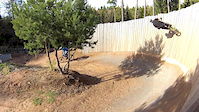
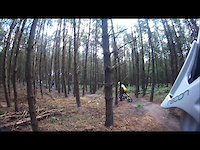
Photos of Köln Mountain Bike
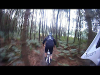
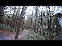
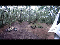
Videos of Köln Mountain Bike

trail: Beginners
4:28 |
1010 |
May 6, 2014

trail: Beginners
0:09 |
409 |
Sep 4, 2013
trail: Beginners
3:20 |
680 |
Apr 14, 2013
trail: Beginners
2:12 |
379 |
Jul 29, 2011
trail: Beginners
2:34 |
287 |
Jul 2, 2011
trail: Beginners
0:31 |
540 |
Jun 13, 2011
trail: Beginners
0:19 |
321 |
Jun 12, 2011

trail: Beginners
2:02 |
222 |
Mar 14, 2008
Recent Trail Reports
| status | trail | date | condition | info | user |
|---|---|---|---|---|---|
| Banktrail | Feb 15, 2026 @ 12:32pm (Europe/Luxembourg) Feb 15, 2026 | Wet | HorstF | ||
| Köttinger-See | Jan 2, 2026 @ 10:26am (Europe/Berlin) Jan 2, 2026 | Variable | Raymond2109 | ||
| Flattrail | Jul 13, 2024 @ 9:33am Jul 13, 2024 | Variable | Bremse7 | ||
| HeiHo Variation I | Oct 15, 2023 @ 3:41am Oct 15, 2023 | Variable | HorstF | ||
| Banktrail Variation | Apr 8, 2023 @ 7:54pm Apr 8, 2023 | Variable | HorstF | ||
| Orrer Wäldchen Trail | Apr 4, 2023 @ 9:07am Apr 4, 2023 | Wet | noisefloor | ||
| Beginners Variation Little Rollercoaster | Feb 10, 2023 @ 9:39pm Feb 10, 2023 | Wet | noisefloor | ||
| Beginners | Feb 11, 2023 @ 5:39am Feb 11, 2023 | Wet | noisefloor | ||
| Concordia | Jun 22, 2022 @ 11:33am Jun 22, 2022 | Dry | patorico | ||
| Grillhütte | May 19, 2019 @ 3:19am May 19, 2019 | Dry | JanV76 |
Activity Feed
| username | action | type | title | date |
|---|---|---|---|---|
| MihailBZiJ56 | wishlist | trail | activity #92169798 | Apr 8, 2026 @ 1:29am Apr 8, 2026 |
| HorstF | add | report | activity #88964952 | Feb 15, 2026 @ 9:04am Feb 15, 2026 |
| HorstF | add | report | activity #87413891 | Jan 18, 2026 @ 8:25am Jan 18, 2026 |
| Raymond2109 | add | report | activity #86489894 | Jan 2, 2026 @ 1:54am Jan 2, 2026 |
| tirehfeld | ridden | trail | activity #81438359 | Sep 30, 2025 @ 1:22pm Sep 30, 2025 |
Recent Comments
| username | type | title | comment | date |
|---|---|---|---|---|
| trail | officially closed by ForstNRW | Jun 2, 2025 @ 5:41am Jun 2, 2025 | ||
| trail | Hi Leute der trail ist fahrbar ist,relative... | Nov 27, 2024 @ 8:57pm Nov 27, 2024 | ||
| trail | Trail entry blocked by logs and not in good... | Oct 20, 2024 @ 8:14am Oct 20, 2024 | ||
| trail | Heute morgen gefahren, etwas matschig,... | Aug 18, 2023 @ 1:04am Aug 18, 2023 | ||
| trail | Leider ist der letzte Abschnitt gesperrt. Kein... | Oct 2, 2020 @ 11:25am Oct 2, 2020 |
Local Badges
-

Epic Ride Climb 2k9 awarded -

Climbing 10k Badge34 awarded -

Climbing 100k Badge2 awarded -

Epic Ride Descent 2k8 awarded -

Descent 10k Badge33 awarded -

Descent 100k Badge2 awarded
Activity Type Stats
| activitytype | trails | distance | descent | descent distance | total vertical | rating | global rank | state rank | photos | reports | routes | ridelogs |
|---|---|---|---|---|---|---|---|---|---|---|---|---|
| Mountain Bike | 22 | 15 miles | 2,959 ft | 7 miles | 492 ft | #10,291 | #583 | 10 | 71 | 6,717 | ||
| E-Bike | 22 | 15 miles | 2,959 ft | 7 miles | 492 ft | #3,101 | #66 | 53 | 802 | |||
| Hike | 22 | 15 miles | 2,959 ft | 7 miles | 492 ft | #6,667 | #92 | 71 | 134 | |||
| Trail Running | 22 | 15 miles | 2,959 ft | 7 miles | 492 ft | #6,121 | #85 | 71 | 33 |
Frequently Asked Questions About Köln
▼
What are the highest rated mountain biking trails in Köln?
The highest rated mountain biking trails in Köln are:
- Beginners Variation Little Rollercoaster (3.9/5)
- Banktrail (3.8/5)
- Orrer Wäldchen Trail (3.7/5)
- Flattrail (3.6/5)
- Autobahntrail West (3.6/5)
▼
What is the best time of the year to ride in Köln?
Based on ride log data, the most popular months to ride in Köln are:
- August (76 activities)
- March (59 activities)
- May (54 activities)
▼
Where can I park to ride in Köln?
Check the Köln trail map for trailhead and parking information. Community members regularly update access and parking details for trails in the area.
▼
What is the longest trail in Köln?
The longest trail in Köln is Orrer Wäldchen Trail at 2.3 km. View all trails sorted by distance.
- By checksix66
 & contributors
 - Admins: apply
- #21839 - 5,901 views
- köln activity log | embed map of Köln mountain bike trails |
Downloading of trail gps tracks in kml & gpx formats is enabled for Köln.
You must login to download files.