close
-
Layers w
- Weather Layers
- Pro
- Pro
- Pro
- Pro
- Pro
- Pro
- More Layers
- Pro
- Pro
- Pro
- Pro
-
Upgrade to

3D
Trail Conditions
- Unknown
- Snow Groomed
- Snow Packed
- Snow Covered
- Snow Cover Partial
- Freeze/thaw Cycle
- Icy
- Prevalent Mud
- Wet
- Variable
- Ideal
- Dry
- Very Dry
Trail Flow (Ridden Direction)
Trailforks scans users ridelogs to determine the most popular direction each trail is ridden. A good flowing trail network will have most trails flowing in a single direction according to their intension.
The colour categories are based on what percentage of riders are riding a trail in its intended direction.
The colour categories are based on what percentage of riders are riding a trail in its intended direction.
- > 96%
- > 90%
- > 80%
- > 70%
- > 50%
- < 50%
- bi-directional trail
- no data
Trail Last Ridden
Trailforks scans ridelogs to determine the last time a trail was ridden.
- < 2 days
- < 1 week
- < 2 weeks
- < 1 month
- < 6 months
- > 6 months
Trail Ridden Direction
The intended direction a trail should be ridden.
- Downhill Only
- Downhill Primary
- Both Directions
- Uphill Primary
- Uphill Only
- One Direction
Contribute Details
Colors indicate trail is missing specified detail.
- Description
- Photos
- Description & Photos
- Videos
Trail Popularity ?
Trailforks scans ridelogs to determine which trails are ridden the most in the last 9 months.
Trails are compared with nearby trails in the same city region with a possible 25 colour shades.
Think of this as a heatmap, more rides = more kinetic energy = warmer colors.
- most popular
- popular
- less popular
- not popular
ATV/ORV/OHV Filter
Max Vehicle Width
inches
US Cell Coverage
Legend

Radar Time
Activity Recordings
Trailforks uses anonymized public activity data.
?
Activity Recordings
Trailforks uses anonymized public activity data.
?
Personal Heatmap
▶
Activity Types
all
/
none
▶
Options
2
Date range
month
–
Winter Trails
Warning
A routing network for winter maps does not exist. Selecting trails using the winter trails layer has been disabled.
Missing Trails
Most Popular
Least Popular
Trails are colored based on popularity. The more popular a trail is, the more red. Less popular trails trend towards green.
Jump Magnitude Heatmap
Heatmap of where riders jump on trails. Zoom in to see individual jumps, click circles to view jump details.
BC Backroad Status
![map legend]()
Service Road Atlas is a free to use, community-driven service for viewing and creating reports on the numerous back-country service roads around B.C. and Alberta.

Slope Aspect
Direction the slope faces
Trails Deemphasized
Trails are shown in grey.
Only show trails with no bike usage.
Suggested Layers
Based on selected activity type
Save the current map location and zoom level as your default home location whenever this page is loaded.
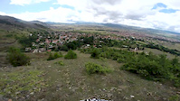
SaveKorça other names see below is a city and municipality in southeastern Albania, and the seat of Korçë County. It was formed at the 2015 local government reform by the merger of the former municipalities Drenovë, Korçë, Lekas, Mollaj, Qendër Bulgarec, Vithkuq, Voskop and Voskopojë, that became municipal units. The seat of the municipality is the city Korçë.[1] The total population is 75,994 (2011 census), in a total area of 805.99 km2 (311.19 sq mi).[2] The population of the former municipality at the 2011 census was 51,152.[3] It is the sixth largest city in Albania. It stands on a plateau some 850 m (2,789 ft) above sea level, surrounded by the Morava Mountains.
Activities Click to view
- Mountain Bike
31 trails
- E-Bike
38 trails
- Adaptive Bike
0 trails
- Winter Fat Bike
0 trails
- Horse
25 trails
- Hike
44 trails
- Trail Running
41 trails
- Dirtbike/Moto
8 trails
- ATV/ORV/OHV
12 trails
- Snowshoe
9 trails
Region Details
- 12
- 6
- 3
- 8
- 2
Region Status
Open as of Jul 17, 2025Stats
- Avg Trail Rating
- Trails (view details)
- 42
- Trails Mountain Bike
- 33
- Trails E-Bike
- 38
- Trails Horse
- 25
- Trails Hike
- 44
- Trails Trail Running
- 41
- Trails Dirtbike/Moto
- 8
- Trails ATV/ORV/OHV
- 12
- Trails Snowmobile
- 2
- Trails Snowshoe
- 9
- Trails Downhill Ski
- 1
- Total Distance
- 67 miles
- Total Descent
- 18,793 ft
- Total Vertical
- 3,073 ft
- Highest Trailhead
- 5,899 ft
- Reports
- 11
- Photos
- 439
- Ridden Counter
- 30
Sub Regions
-
Fir of Drenovë National Park
- 4
- 1
- 3
- 1
-
Prespa National Park
- 1
-
Voskopojë
- 1
- 2
- 4
Popular Korça Mountain Biking Trails
• 5 ★ 0.0 • 1 mile • 763 ft • 2 • • hike
Less popular blue difficulty alpine primitive. This hike primary trail and has a moderate overall physical rating. It features berm, rock garden and other. Trail visibility is sometimes hard to follow.
• 5 ★ 3.0 • 4,026 ft • 37 ft • 2 •
this is the exact trail that was also the race segment of the trail running about 21km which took place in Voskopoja named Wolf Trail (don’t know why) and it was located in a middle of a dense forest.Not a very fast trail with many...
• 5 ★ 4.0 • 3,061 ft • 0 ft • 2 •
A trail with not much to say about the terrain,its all made by rocks gravel Generally a very fast trail but in some segments it gets confusing due to the lack of signage and you can find yourself out of the line of track
• 5 ★ 4.0 • 3,578 ft • 8 ft • 2 •
Shëndëlli mountain but its known by all as ‘Morava cross’ since in the top of the mountain its a giant cross. A trail mostly used by the shepherds and the locals so they could climb to their sacred place. A trail which requires...
• 5 ★ 4.0 • 3,419 ft • 0 ft • 2 •
This is the second trail of the small ridge in the fields of “Dellinja” a Déjà Vu because except the fact that it had the same start as the first one it had also the same terrain smooth,berm,grass and it was very fast!
• 5 ★ 4.0 • 4,508 ft • 2 ft • 2 •
A trail with the same terrain as the two previous trails with #gravel and #stones with a #cleaner and a #faster line but with narrow #curves The major part of the trail is both directions.
• 5 ★ 3.0 • 1,470 ft • 79 ft • 2 •
Less popular white difficulty family friendly doubletrack. This multi-use trail can be used both directions and has a easy overall physical rating with a 79 ft green climb. It features berm and rock garden. Trail visibility is always easy to follow.
• 5 ★ 4.0 • 4,823 ft • 626 ft • 1 •
Less popular blue difficulty alpine singletrack. This multi-use trail can be used downhill only and has a moderate overall physical rating. It features berm. Trail visibility is sometimes hard to follow.
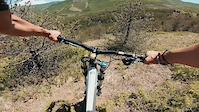
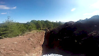
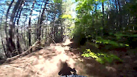
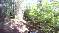
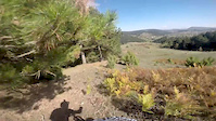
Photos of Korça Mountain Bike
Videos of Korça Mountain Bike
trail: Dishnicë-Maja Kalasë
0:39 |
|
Jun 22, 2021

trail: Shipskë Trail
0:50 |
12 |
Oct 30, 2020

0:35 |
9 |
Jul 10, 2020
0:17 |
4 |
Dec 27, 2019
0:52 |
2 |
Dec 18, 2019
trail: Kryqi Trail 2
0:50 |
12 |
Nov 29, 2019
trail: Wolf Trail vskp
0:50 |
6 |
Oct 28, 2019
trail: Dëllinja Trail 2
0:48 |
4 |
Oct 24, 2019
Recent Trail Reports
| status | trail | date | condition | info | user |
|---|---|---|---|---|---|
| Easiest Trail Maja e Ivanit north part | Nov 10, 2019 @ 3:19pm Nov 10, 2019 | Variable | andiqyqja TRAILFORKS | ||
| Shtegu i Pishave | Nov 10, 2019 @ 2:07pm Nov 10, 2019 | Wet | andiqyqja TRAILFORKS | ||
| Kovarizë Trail | Nov 10, 2019 @ 1:57pm Nov 10, 2019 | Variable | andiqyqja TRAILFORKS |
Activity Feed
| username | action | type | title | date |
|---|---|---|---|---|
| andiqyqja | add | photo | activity #98625358 and 10 more | Jul 7, 2026 @ 1:06am Jul 7, 2026 |
| TheGoodFight | wishlist | region | activity #80963981 | Sep 23, 2025 @ 10:57am Sep 23, 2025 |
| Ties04 | wishlist | trail | activity #70062023 | Apr 20, 2025 @ 11:45pm Apr 20, 2025 |
| Ties04 | wishlist | trail | activity #41534354 and 1 more | Jul 5, 2023 @ 9:41am Jul 5, 2023 |
| noldi | checkin | trail | activity #41464903 | Jul 3, 2023 @ 2:23am Jul 3, 2023 |
Local Badges
-

Epic Mountain Bike Climb 2k3 awarded -

Climbing 10k Badge0 awarded -

Mountain Biking 100k Badge0 awarded -

Epic Ride Descent 2k3 awarded -

Descent 10k Badge0 awarded -

Descent 100k Badge0 awarded
Activity Type Stats
| activitytype | trails | distance | descent | descent distance | total vertical | rating | global rank | state rank | photos | reports | routes | ridelogs |
|---|---|---|---|---|---|---|---|---|---|---|---|---|
| Mountain Bike | 31 | 51 miles | 12,490 ft | 19 miles | 3,074 ft | #2,421 | #10 | 439 | 9 | 57 | ||
| E-Bike | 38 | 58 miles | 14,895 ft | 22 miles | 3,074 ft | #1,004 | #8 | 7 | 5 | |||
| Horse | 25 | 48 miles | 12,001 ft | 18 miles | 2,904 ft | #239 | #8 | 5 | ||||
| Hike | 44 | 67 miles | 18,238 ft | 26 miles | 3,074 ft | #676 | #6 | 11 | 15 | |||
| Trail Running | 41 | 62 miles | 16,995 ft | 24 miles | 3,074 ft | #1,109 | #8 | 11 | 2 | |||
| Dirtbike/Moto | 8 | 23 miles | 4,774 ft | 9 miles | 2,789 ft | #278 | #8 | |||||
| ATV/ORV/OHV | 12 | 31 miles | 5,262 ft | 11 miles | 2,904 ft | #143 | #8 | |||||
| Snowmobile | 2 | 4 miles | 607 ft | 2 miles | 610 ft | |||||||
| Snowshoe | 9 | 16 miles | 2,507 ft | 5 miles | 2,438 ft | #210 | #2 | 3 | ||||
| Downhill Ski | 1 | 4,337 ft | 13 ft | 344 ft | 512 ft | 3 |
Frequently Asked Questions About Korça
▼
What are the best places to ride in Korça?
Korça has 3 areas to explore for mountain biking. The top rated areas are:
▼
What are the highest rated mountain biking trails in Korça?
The highest rated mountain biking trails in Korça are:
- Kisha Shën Kostandini Trail (4/5)
- Kryqi Trail 2 (4/5)
- Kryqi Trail 1 (4/5)
- Dëllinja Trail 2 (4/5)
- Shipskë Trail (4/5)
▼
Where can I park to ride in Korça?
There are 1 parking locations listed in Korça. The most popular parking spots are:
▼
What is the longest trail in Korça?
The longest trail in Korça is Easiest Trail Maja e Ivanit north part at 3.5 miles. View all trails sorted by distance.
Activities
Trails
Points of Interest
- By andiqyqja
 TRAILFORKS & contributors
 - Admins: andiqyqja
- #30051 - 2,527 views
- korça activity log | embed map of Korça mountain bike trails | korça mountain biking points of interest
Downloading of trail gps tracks in kml & gpx formats is enabled for Korça.
You must login to download files.