close
-
Layers w
- Weather Layers
- Pro
- Pro
- Pro
- Pro
- Pro
- Pro
- More Layers
- Pro
- Pro
- Pro
- Pro
-
Upgrade to

3D
Trail Conditions
- Unknown
- Snow Groomed
- Snow Packed
- Snow Covered
- Snow Cover Partial
- Freeze/thaw Cycle
- Icy
- Prevalent Mud
- Wet
- Variable
- Ideal
- Dry
- Very Dry
Trail Flow (Ridden Direction)
Trailforks scans users ridelogs to determine the most popular direction each trail is ridden. A good flowing trail network will have most trails flowing in a single direction according to their intension.
The colour categories are based on what percentage of riders are riding a trail in its intended direction.
The colour categories are based on what percentage of riders are riding a trail in its intended direction.
- > 96%
- > 90%
- > 80%
- > 70%
- > 50%
- < 50%
- bi-directional trail
- no data
Trail Last Ridden
Trailforks scans ridelogs to determine the last time a trail was ridden.
- < 2 days
- < 1 week
- < 2 weeks
- < 1 month
- < 6 months
- > 6 months
Trail Ridden Direction
The intended direction a trail should be ridden.
- Downhill Only
- Downhill Primary
- Both Directions
- Uphill Primary
- Uphill Only
- One Direction
Contribute Details
Colors indicate trail is missing specified detail.
- Description
- Photos
- Description & Photos
- Videos
Trail Popularity ?
Trailforks scans ridelogs to determine which trails are ridden the most in the last 9 months.
Trails are compared with nearby trails in the same city region with a possible 25 colour shades.
Think of this as a heatmap, more rides = more kinetic energy = warmer colors.
- most popular
- popular
- less popular
- not popular
ATV/ORV/OHV Filter
Max Vehicle Width
inches
US Cell Coverage
Legend

Radar Time
Activity Recordings
Trailforks uses anonymized public activity data.
?
Activity Recordings
Trailforks uses anonymized public activity data.
?
Personal Heatmap
▶
Activity Types
all
/
none
▶
Options
2
Date range
month
–
Winter Trails
Warning
A routing network for winter maps does not exist. Selecting trails using the winter trails layer has been disabled.
Missing Trails
Most Popular
Least Popular
Trails are colored based on popularity. The more popular a trail is, the more red. Less popular trails trend towards green.
Jump Magnitude Heatmap
Heatmap of where riders jump on trails. Zoom in to see individual jumps, click circles to view jump details.
BC Backroad Status
![map legend]()
Service Road Atlas is a free to use, community-driven service for viewing and creating reports on the numerous back-country service roads around B.C. and Alberta.

Slope Aspect
Direction the slope faces
Trails Deemphasized
Trails are shown in grey.
Only show trails with no bike usage.
Suggested Layers
Based on selected activity type
Save the current map location and zoom level as your default home location whenever this page is loaded.
Save
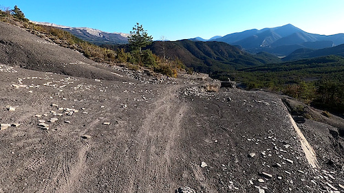
No description for Larche has been added yet!
Login or register to submit one.
This region uses the Uk/Euro style trail grading system.
Activities Click to view
- Mountain Bike
10 trails
- E-Bike
6 trails
- Hike
10 trails
- Trail Running
10 trails
- Downhill Ski
4 trails
Region Details
- 2
- 6
- 2
Region Status
Caution as of May 26, 2026Stats
- Avg Trail Rating
- Trails (view details)
- 14
- Trails Mountain Bike
- 10
- Trails E-Bike
- 6
- Trails Hike
- 10
- Trails Trail Running
- 10
- Trails Downhill Ski
- 4
- Total Distance
- 23 miles
- Total Descent
- 15,227 ft
- Total Vertical
- 5,844 ft
- Highest Trailhead
- 10,714 ft
- Reports
- 17
- Photos
- 10
- Ridden Counter
- 184
Popular Larche Mountain Biking Trails
• 85 ★ 4.7 • 2 miles • 163 ft • 23 •
Popular black difficulty singletrack. This mountain bike primary trail can be used downhill primary and has a moderate overall physical rating with a 163 ft blue climb. On average it takes 19 minutes to complete this trail.
• 70 ★ 0.0 • 2 miles • 0 ft • 21 •
Popular red difficulty singletrack. This mountain bike primary trail can be used downhill primary and has a moderate overall physical rating with a 0 ft blue climb. It features berm and rock face. On average it takes 21 minutes to complete this trail.
• 50 ★ 0.0 • 2 miles • 304 ft • 14 •
Moderately popular red difficulty singletrack. This mountain bike primary trail can be used both directions and has a hard overall physical rating with a 304 ft black diamond climb. It features rock face and rock garden. On average it takes 33 minutes to complete this trail.
• 5 ★ 4.0 • 2 miles • 148 ft • 12 •
Less popular blue difficulty singletrack. This multi-use trail can be used both directions and has a moderate overall physical rating with a 148 ft blue climb. Trail visibility is always easy to follow. On average it takes 1 hour48 minutes to complete this trail.
• ★ 0.0 • 2 miles • 10 ft • 1 • • hike
Red difficulty wilderness trail. This hike primary trail can be used both directions and has a hard overall physical rating with a 10 ft black diamond climb. Trail visibility is always easy to follow.
Larche Mountain Bike Routes
27 miles • 3,775 ft • 0 • Point to Point •
This is the first part of the Alpes Provence Great Crossing for mtb, created with the help of the french...
11 miles • 1,648 ft • 0 •
TP Trail Day 1, nice view, old buildings, great trails
Recent Trail Reports
| status | trail | date | condition | info | user |
|---|---|---|---|---|---|
| TP Day1S1 | Jul 30, 2025 @ 10:03am Jul 30, 2025 | Dry | sughero | ||
| Sous La Tête Dure | Jul 30, 2025 @ 10:03am Jul 30, 2025 | Dry | sughero | ||
| Col de Mirandol | Sep 9, 2021 @ 2:57am Sep 9, 2021 | Dry | 0gGVD8 | ||
| Col de Vallonet | Sep 2, 2021 @ 12:45am Sep 2, 2021 | Dry | sughero2 |
National Scenic Trails & Official Routes
-
Grande Traversée VTT Alpes-Provence
- Mountain Bike
- E-Bike
Activity Feed
| username | action | type | title | date |
|---|---|---|---|---|
| zestyman | add | report | activity #95561616 | May 26, 2026 @ 6:54am May 26, 2026 |
| zestyman | vote | trail | activity #95561466 | May 26, 2026 @ 6:50am May 26, 2026 |
| samale | wishlist | trail | activity #79645055 | Sep 4, 2025 @ 2:13pm Sep 4, 2025 |
| fprocacci | add | report | activity #78959870 | Aug 25, 2025 @ 11:28pm Aug 25, 2025 |
| sughero | add | report | activity #77037114 and 1 more | Jul 30, 2025 @ 11:04am Jul 30, 2025 |
Recent Comments
| username | type | title | comment | date |
|---|---|---|---|---|
| report | molto divertente | Sep 9, 2021 @ 2:58am Sep 9, 2021 | ||
| trail | Firetrack for the majority of the route with... | Aug 20, 2020 @ 5:13am Aug 20, 2020 |
Local Badges
-

Epic Ride Descent 2k0 awarded -

Descent 10k Badge0 awarded -

Descent 100k Badge0 awarded
Activity Type Stats
| activitytype | trails | distance | descent | descent distance | total vertical | rating | global rank | state rank | photos | reports | routes | ridelogs |
|---|---|---|---|---|---|---|---|---|---|---|---|---|
| Mountain Bike | 10 | 21 miles | 13,379 ft | 15 miles | 5,843 ft | #7,557 | #369 | 10 | 17 | 2 | 329 | |
| E-Bike | 6 | 8 miles | 7,792 ft | 7 miles | 5,814 ft | #5,656 | #396 | 15 | 68 | |||
| Hike | 10 | 21 miles | 13,379 ft | 15 miles | 5,843 ft | #6,862 | #256 | 17 | 1 | 206 | ||
| Trail Running | 10 | 21 miles | 13,379 ft | 15 miles | 5,843 ft | #6,368 | #239 | 17 | 4 | |||
| Downhill Ski | 4 | 1 mile | 1,850 ft | 1 mile | 915 ft | #706 | #70 | 6 |
Frequently Asked Questions About Larche
▼
What are the best places to ride in Larche?
Larche has 1 areas to explore for mountain biking.
▼
What are the highest rated mountain biking trails in Larche?
The highest rated mountain biking trails in Larche are:
- Col de Mirandol (4.2/5)
- TP Day1S1 (4/5)
- Col de Vallonet (0/5)
- Sous la Meyna (0/5)
- pointe d'aval (0/5)
▼
What is the best time of the year to ride in Larche?
Based on ride log data, the most popular months to ride in Larche are:
- August (7 activities)
- September (4 activities)
- July (2 activities)
▼
Where can I park to ride in Larche?
Check the Larche trail map for trailhead and parking information. Community members regularly update access and parking details for trails in the area.
Activities
Trails
- By tomzaniroli
 TRAILFORKS TFFRANCE & contributors
 - Admins: tomzaniroli, provencemb
- #23343 - 1,243 views
- larche activity log | embed map of Larche mountain bike trails |
Downloading of trail gps tracks in kml & gpx formats is enabled for Larche.
You must login to download files.