close
-
Layers w
- Weather Layers
- Pro
- Pro
- Pro
- Pro
- Pro
- Pro
- More Layers
- Pro
- Pro
- Pro
- Pro
-
Upgrade to

3D
Trail Conditions
- Unknown
- Snow Groomed
- Snow Packed
- Snow Covered
- Snow Cover Partial
- Freeze/thaw Cycle
- Icy
- Prevalent Mud
- Wet
- Variable
- Ideal
- Dry
- Very Dry
Trail Flow (Ridden Direction)
Trailforks scans users ridelogs to determine the most popular direction each trail is ridden. A good flowing trail network will have most trails flowing in a single direction according to their intension.
The colour categories are based on what percentage of riders are riding a trail in its intended direction.
The colour categories are based on what percentage of riders are riding a trail in its intended direction.
- > 96%
- > 90%
- > 80%
- > 70%
- > 50%
- < 50%
- bi-directional trail
- no data
Trail Last Ridden
Trailforks scans ridelogs to determine the last time a trail was ridden.
- < 2 days
- < 1 week
- < 2 weeks
- < 1 month
- < 6 months
- > 6 months
Trail Ridden Direction
The intended direction a trail should be ridden.
- Downhill Only
- Downhill Primary
- Both Directions
- Uphill Primary
- Uphill Only
- One Direction
Contribute Details
Colors indicate trail is missing specified detail.
- Description
- Photos
- Description & Photos
- Videos
Trail Popularity ?
Trailforks scans ridelogs to determine which trails are ridden the most in the last 9 months.
Trails are compared with nearby trails in the same city region with a possible 25 colour shades.
Think of this as a heatmap, more rides = more kinetic energy = warmer colors.
- most popular
- popular
- less popular
- not popular
ATV/ORV/OHV Filter
Max Vehicle Width
inches
US Cell Coverage
Legend

Radar Time
Activity Recordings
Trailforks uses anonymized public activity data.
?
Activity Recordings
Trailforks uses anonymized public activity data.
?
Personal Heatmap
▶
Activity Types
all
/
none
▶
Options
2
Date range
month
–
Winter Trails
Warning
A routing network for winter maps does not exist. Selecting trails using the winter trails layer has been disabled.
Missing Trails
Most Popular
Least Popular
Trails are colored based on popularity. The more popular a trail is, the more red. Less popular trails trend towards green.
Jump Magnitude Heatmap
Heatmap of where riders jump on trails. Zoom in to see individual jumps, click circles to view jump details.
BC Backroad Status
![map legend]()
Service Road Atlas is a free to use, community-driven service for viewing and creating reports on the numerous back-country service roads around B.C. and Alberta.

Slope Aspect
Direction the slope faces
Trails Deemphasized
Trails are shown in grey.
Only show trails with no bike usage.
Suggested Layers
Based on selected activity type
Save the current map location and zoom level as your default home location whenever this page is loaded.
Save
No description for Lawrence has been added yet!
Login or register to submit one.
Activities Click to view
- Mountain Bike
28 trails
- Adaptive Bike
0 trails
- Winter Fat Bike
0 trails
- Horse
6 trails
- Hike
36 trails
- Trail Running
36 trails
Region Details
- 5
- 9
- 7
- 6
Region Status
Open as of May 6, 2025Stats
- Avg Trail Rating
- Trails (view details)
- 34
- Trails Mountain Bike
- 29
- Trails Horse
- 6
- Trails Hike
- 36
- Trails Trail Running
- 36
- Total Distance
- 88 miles
- Total Descent
- 7,306 ft
- Total Vertical
- 781 ft
- Highest Trailhead
- 1,047 ft
- Reports
- 60
- Photos
- 90
- Ridden Counter
- 1,602
Sub Regions
-
Brook Creek Park
- 2
-
Clinton Lake State Park
- 2
- 2
-
Lawrence River Trails
- 3
Popular Lawrence Mountain Biking Trails
• 100 ★ 4.7 • 11 miles • 182 ft • 234 •
Fast, mostly smooth singletrack with some sand and a small rock garden. A couple of small, optional jumps and log-overs. Climbs are short (no more than 20-30 ft elevation change). Bikes ride clockwise, runners and hikers go...
• 95 ★ 0.0 • 538 ft • 0 ft • 195 •
Popular green difficulty singletrack. This mountain bike primary trail can be used one direction. On average it takes minutes to complete this trail.
• 45 ★ 4.5 • 8 miles • 405 ft • 69 •
Moderately popular blue difficulty singletrack. This multi-use trail can be used both directions. On average it takes 1 hour8 minutes to complete this trail.
• 60 ★ 0.0 • 12 miles • 954 ft • 45 •
Moderately popular blue difficulty singletrack. This mountain bike primary trail and has a hard overall physical rating with a 954 ft black diamond climb. It features rock garden. On average it takes 1 hour5 minutes to complete this trail.
• 15 ★ 0.0 • 2,551 ft • 64 ft • 26 •
Less popular black diamond difficulty mixed. This mountain bike primary trail can be used both directions. It features drop, jump, skinny and teeter totter. On average it takes 9 minutes to complete this trail.
• 35 ★ 0.0 • 1 mile • 89 ft • 24 •
Less popular black diamond difficulty singletrack. This mountain bike primary trail can be used both directions. On average it takes 12 minutes to complete this trail.
• 5 ★ 2.5 • 161 ft • 0 ft • 5 •
Less popular green difficulty singletrack. This multi-use trail can be used both directions. On average it takes 25 minutes to complete this trail.
Photos of Lawrence Mountain Bike
Videos of Lawrence Mountain Bike
trail: Lawrence River Trail
0:08 |
39 |
May 19, 2025
youtuber
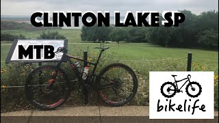
![Mountain Bike Kansas - Clinton Lake State Park...]()
6:57 |
562 |
Jul 16, 2020
Recent Trail Reports
| status | trail | date | condition | info | user |
|---|---|---|---|---|---|
| Connector | May 6, 2025 @ 9:12am May 6, 2025 | Ideal | 1cabinboy | ||
| Lawrence River Trail | May 6, 2025 @ 9:12am May 6, 2025 | Ideal | 1cabinboy | ||
| Cut Off | May 16, 2024 @ 1:31pm May 16, 2024 | Dry | 1yN7ie | ||
| Skills Loop | May 23, 2021 @ 5:17pm May 23, 2021 | Ideal | Ajdtv | ||
| Blue Trail | Apr 14, 2019 @ 9:11am Apr 14, 2019 | Wet | colewlkr | ||
| White Trail | Aug 17, 2016 @ 1:10pm Aug 17, 2016 | Dry | uncanny |
Activity Feed
| username | action | type | title | date |
|---|---|---|---|---|
| MarcoN8Ie5u | wishlist | trail | activity #91930841 | Apr 4, 2026 @ 2:06pm Apr 4, 2026 |
| DaltonqXDzfm | wishlist | trail | activity #91765698 | Apr 2, 2026 @ 9:07am Apr 2, 2026 |
| ku400m | ridden | trail | activity #90486511 | Mar 13, 2026 @ 6:19am Mar 13, 2026 |
| Val-b | update | directory | activity #89800940 | Mar 1, 2026 @ 1:02pm Mar 1, 2026 |
| Val-b | update | trail | activity #89799460 | Mar 1, 2026 @ 12:44pm Mar 1, 2026 |
Recent Comments
| username | type | title | comment | date |
|---|---|---|---|---|
| trail | VERY VERY SANDY...slooooowwww | Mar 31, 2025 @ 12:11pm Mar 31, 2025 | ||
| trail | Smooth trail with a bit of soft sand close to... | Sep 24, 2023 @ 8:07am Sep 24, 2023 | ||
| trail | The Lawrence river trail Is a flowing trail... | Dec 6, 2019 @ 6:18pm Dec 6, 2019 | ||
| trail | Absolutely do not attempt this trail unless... | Sep 11, 2019 @ 3:59pm Sep 11, 2019 |
Local Badges
-

Epic Ride Climb 2k21 awarded -

Climbing 10k Badge20 awarded -

Climbing 100k Badge3 awarded -

Epic Ride Descent 2k21 awarded -

Descent 10k Badge20 awarded -

Descent 100k Badge3 awarded
Bike & Skill Parks
| name | type | city | rating |
|---|---|---|---|
| Skills Loop | skill park | Lawrence |
Activity Type Stats
| activitytype | trails | distance | descent | descent distance | total vertical | rating | global rank | state rank | photos | reports | routes | ridelogs |
|---|---|---|---|---|---|---|---|---|---|---|---|---|
| Mountain Bike | 28 | 65 miles | 5,653 ft | 23 miles | 768 ft | #3,524 | #1,201 | 90 | 60 | 8,682 | ||
| Horse | 6 | 19 miles | 1,339 ft | 8 miles | 144 ft | #2,010 | #1,122 | 10 | ||||
| Hike | 36 | 88 miles | 7,306 ft | 33 miles | 781 ft | #3,508 | #1,233 | 60 | 207 | |||
| Trail Running | 36 | 88 miles | 7,306 ft | 33 miles | 781 ft | #3,006 | #876 | 60 | 96 |
Frequently Asked Questions About Lawrence
▼
What are the best places to ride in Lawrence?
Lawrence has 5 areas to explore for mountain biking. The top rated areas are:
▼
What are the highest rated mountain biking trails in Lawrence?
The highest rated mountain biking trails in Lawrence are:
- Lawrence River Trail (4.4/5)
- Blue Trail (4.1/5)
- Brook Creek Loop (4/5)
- Brook Creek Loop (3.6/5)
- Connector (0/5)
▼
What is the best time of the year to ride in Lawrence?
Based on ride log data, the most popular months to ride in Lawrence are:
- July (43 activities)
- March (33 activities)
- May (28 activities)
▼
Where can I park to ride in Lawrence?
There are 6 parking locations listed in Lawrence. The most popular parking spots are: View all parking and trailhead locations on the map to plan your visit.
Activities
Trails
- By ChristophColombo
 & contributors
 - Admins: LMBC, UTC Central, UTC Master
- #5281 - 4,354 views
- lawrence activity log | embed map of Lawrence mountain bike trails | lawrence mountain biking points of interest
Downloading of trail gps tracks in kml & gpx formats is enabled for Lawrence.
You must login to download files.