
close
3D
Trail Conditions
- Unknown
- Snow Groomed
- Snow Packed
- Snow Covered
- Snow Cover Partial
- Freeze/thaw Cycle
- Icy
- Prevalent Mud
- Wet
- Variable
- Ideal
- Dry
- Very Dry
Trail Flow (Ridden Direction)
Trailforks scans users activity logs to determine the most popular direction each trail is ridden. A good flowing trail network will have most trails flowing in a single direction according to their intension.
The colour categories are based on what percentage of users are riding a trail in its intended direction.
The colour categories are based on what percentage of users are riding a trail in its intended direction.
- > 96%
- > 90%
- > 80%
- > 70%
- > 50%
- < 50%
- bi-directional trail
- no data
Trail Last Used
Trailforks scans activity logs to determine the last time a trail was ridden.
- < 2 days
- < 1 week
- < 2 weeks
- < 1 month
- < 6 months
- > 6 months
Trail Ridden Direction
The intended direction a trail should be ridden.
- Downhill Only
- Downhill Primary
- Both Directions
- Uphill Primary
- Uphill Only
- One Direction
Contribute Details
Colors indicate trail is missing specified detail.
- Description
- Photos
- Description & Photos
- Videos
Trail Popularity ?
Trailforks scans activity logs to determine which trails are ridden the most in the last 9 months.
Trails are compared with nearby trails in the same city region with a possible 25 colour shades.
Think of this as a heatmap, more activities = more kinetic energy = warmer colors.
- most popular
- popular
- less popular
- not popular
ATV/ORV/OHV Filter
Max Vehicle Width
inches
US Cell Coverage
Legend

Radar Time
Activity Recordings
Trailforks uses anonymized public activity data.
?
Activity Recordings
Trailforks uses anonymized public activity data.
?
Winter Trails
Warning
A routing network for winter maps does not exist. Selecting trails using the winter trails layer has been disabled.
Missing Trails
Most Popular
Least Popular
Trails are colored based on popularity. The more popular a trail is, the more red. Less popular trails trend towards green.
Jump Magnitude Heatmap
Heatmap of where users jump on trails. Zoom in to see individual jumps, click circles to view jump details.
BC Backroad Status
![map legend]()
Service Road Atlas is a free to use, community-driven service for viewing and creating reports on the numerous back-country service roads around B.C. and Alberta.

Slope Aspect
Direction the slope faces
Trails Deemphasized
Trails are shown in grey.
Only show trails with no bike usage.
Suggested Layers
Based on selected activity type
Save the current map location and zoom level as your default home location whenever this page is loaded.
Save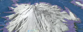
Snow & Rain 3D forecast Pro
See where it will snow, sleet or rain on Les Ménuires hour by hour, on 3D terrain.
View 3D snow forecast
Les Ménuires trails and routes are listed on Trailforks with interactive trail maps, difficulty ratings, photos, and user-reported trail conditions. The Trailforks community has mapped hundreds of trails and shared hundreds of photos in this region. Supported activity types include Mountain Biking, E-Biking, Skiing, Hiking, Trail Running and Adaptive Biking. Trails here are often faint trail and flowy. Scenery includes alpine terrain and summits. Common trail features include jumps, berms and drops. Many trails are family friendly. Popular destinations include Belleville Bikepark and Menuires ski.
This is an auto-generated description of Les Ménuires.
Login or register to submit a custom description.
This region uses the Uk/Euro style trail grading system.
Trail info last updated
Activities Click to view
- Mountain Bike
130 trails
- E-Bike
123 trails
- Adaptive Bike
3 trails
- Hike
67 trails
- Trail Running
63 trails
- Downhill Ski
116 trails
Region Details
- 25
- 1
- 5
- 24
- 41
- 28
- 4
- 2
Region Status
Open as of Nov 7, 2026Stats
- Avg Trail Rating
- Trails (view details)
- 246
- Trails Mountain Bike
- 130
- Trails E-Bike
- 123
- Trails Gravel Bike
- 28
- Trails Adaptive Bike
- 3
- Trails Horse
- 3
- Trails Hike
- 67
- Trails Trail Running
- 63
- Trails Dirtbike/Moto
- 1
- Trails ATV/ORV/OHV
- 1
- Trails Downhill Ski
- 116
- Total Distance
- 258 miles
- Total Descent Distance
- 184 miles
- Total Descent
- 144,354 ft
- Total Vertical
- 7,812 ft
- Highest Trailhead
- 9,562 ft
- Reports
- 1,330
- Photos
- 215
- Completed Counter
- 33,207
Sub Regions
-
Belleville Bikepark
- 1
- 5
- 24
- 41
- 28
- 4
Popular Les Ménuires Mountain Biking Trails
• 100 ★ 4.5 • 3,848 ft • 29 ft • 332 •
Highly rated popular blue difficulty singletrack. This multi-use trail can be used downhill primary. On average it takes 6 minutes to complete this trail.
• 100 ★ 4.5 • 1 mile • 0 ft • 302 •
Piste très ludique alternant virages relevés et mouvements de terrains, un must dans les 3 vallées !
• 95 ★ 5.0 • 1,601 ft • 0 ft • 258 •
Small black option, steep, roots, one part with big rocks, cool to ride ! Petite option noir, de la pente, de la terre, des racines et un bon passage avec des cailloux ! Fun à oruler !
• 100 ★ 5.0 • 2 miles • 2 ft • 250 •
Reshaped for 2024 ! Includes new wallrides & table jumps !
• 100 ★ 4.5 • 272 ft • 0 ft • 246 •
Popular red difficulty singletrack. This mountain bike primary trail. It features drop and jump. Trail visibility is always easy to follow. On average it takes minutes to complete this trail.
• 100 ★ 5.0 • 1 mile • 25 ft • 240 •
Single en forêt, technique et magnifique ! Partie basse de l'Enduro La Loyale.
• 95 ★ 5.0 • 3 miles • 85 ft • 188 • • hike
Le plus beau single Enduro du Monde ! Les Chiffres sont là ! 18,7km, 205mD+, 2071mD- !!! La "Dégage-à-Moûtiers!" c'est l'itinéraire entier du sommet St Martin Express jusqu'à Moûtiers ! ITINÉRAIRE ENTIER ICI:...
• 95 ★ 5.0 • 4,603 ft • 329 ft • 181 • • hike
Accès à la Croix de Praz-Coutin pour E8 la Loyale Attention, peut être toujours enneigé au mois d'avril !
Les Ménuires Mountain Bike Routes
★ 5.0 • 12 miles • 925 ft • 3 •
La "Dégage-à-Moûtiers!" c'est l'itinéraire entier du sommet St Martin Express jusqu'à Moûtiers ! Le...
★ 5.0 • 15 miles • 3,633 ft • 9 •
Le Big 6, c'est une séléction des 6 itinéraires incontournables de la vallée des Belleville ! 6...
★ 5.0 • 36 miles • 11,629 ft • 10 •
Le Big 6, c'est une séléction des 6 itinéraires incontournables de la vallée des Belleville 6 tracés,...
★ 5.0 • 12 miles • 650 ft • 3 • Point to Point •
The GOAT Trail = Greatest Of All Times Trail !!! Un single enduro de + de 2000m de D-, dans un décors...
★ 5.0 • 10 miles • 589 ft • 0 •
Le fruit commun intégral ! Du sommet de la Masse au Village du Châtelard
Photos of Les Ménuires Mountain Bike
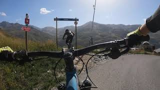
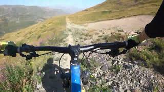
Videos of Les Ménuires Mountain Bike




Recent Trail Reports
| status | trail | date | condition | info | user |
|---|---|---|---|---|---|
| Try Again ! | Nov 7, 2026 @ 9:16pm (Europe/Paris) Nov 7, 2026 | Ideal | Dark123456net | ||
| Liaison | Aug 16, 2026 @ 10:16am (Europe/Paris) Aug 16, 2026 | Dry | lolo13430 | ||
| DH3 La Bombée | Aug 16, 2026 @ 10:16am (Europe/Paris) Aug 16, 2026 | Dry | lolo13430 | ||
| DH1 Easy Rider | Aug 16, 2026 @ 10:16am (Europe/Paris) Aug 16, 2026 | Dry | lolo13430 | ||
| Rock Shore | Aug 16, 2026 @ 10:16am (Europe/Paris) Aug 16, 2026 | Ideal | lolo13430 | ||
| DH4 Gyrophare | Aug 16, 2026 @ 10:16am (Europe/Paris) Aug 16, 2026 | Dry | lolo13430 | ||
| Pas De Cherferie (bas) | Aug 16, 2026 @ 10:16am (Europe/Paris) Aug 16, 2026 | Dry | lolo13430 | ||
| Pas De Cherferie (haut) | Aug 16, 2026 @ 10:16am (Europe/Paris) Aug 16, 2026 | Dry | lolo13430 | ||
| Skinnys | Aug 16, 2026 @ 10:16am (Europe/Paris) Aug 16, 2026 | Ideal | lolo13430 | ||
| DH13 Jumpy | Aug 16, 2026 @ 10:16am (Europe/Paris) Aug 16, 2026 | Ideal | lolo13430 |
Activity Feed
| username | action | type | title | date |
|---|---|---|---|---|
| BellevilleBikepark | add | poi | activity #107549195 and 5 more | Nov 10, 2026 @ 10:32am Nov 10, 2026 |
| BellevilleBikepark | vote | skillpark | activity #107546189 | Nov 10, 2026 @ 9:43am Nov 10, 2026 |
| BellevilleBikepark | update | trail | activity #107545143 | Nov 10, 2026 @ 9:23am Nov 10, 2026 |
| BellevilleBikepark | add | skillpark | activity #107542838 | Nov 10, 2026 @ 8:40am Nov 10, 2026 |
| BellevilleBikepark | add | trail | activity #107540631 and 6 more | Nov 10, 2026 @ 7:55am Nov 10, 2026 |
Recent Comments
| username | type | title | comment | date |
|---|---|---|---|---|
| trail | Impeccable comme d’habitude ici Plutôt... | Oct 11, 2026 @ 10:07am Oct 11, 2026 | ||
| trail | Over grown. Doesn't look used much | Aug 6, 2026 @ 2:07am Aug 6, 2026 | ||
| trail | I'd give it a light black rating. There is not... | Aug 12, 2025 @ 7:57am Aug 12, 2025 | ||
| trail | A couple of sections are quite dangerous... | Aug 9, 2025 @ 7:13am Aug 9, 2025 | ||
| trail | One of the nicer trails of the area if you are... | Aug 6, 2025 @ 9:21am Aug 6, 2025 |
Local Badges
-

Epic Mountain Bike Climb 2k427 awarded -

Climbing 10k Badge43 awarded -

Mountain Biking 100k Badge1 awarded -

Epic Ride Descent 2k435 awarded -

Descent 10k Badge68 awarded -

Descent 100k Badge3 awarded
Bike & Skill Parks
| name | type | city | rating |
|---|---|---|---|
| Belleville Bikepark | bike park | Les Ménuires | |
| Pumptrack | skill park | Les Ménuires | |
| Ludizone | skill park | Les Ménuires | |
| Ridezone | skill park | Les Ménuires |
Activity Type Stats
| activitytype | trails | distance | descent | descent distance | total vertical | rating | global rank | state rank | photos | reports | routes | activity logs |
|---|---|---|---|---|---|---|---|---|---|---|---|---|
| Mountain Bike | 130 | 192 miles | 83,176 ft | 119 miles | 7,359 ft | #858 | #8 | 206 | 1,330 | 5 | 1,319 | |
| E-Bike | 123 | 189 miles | 81,627 ft | 117 miles | 7,359 ft | #573 | #41 | 1,324 | 7 | 175 | ||
| Gravel Bike | 28 | 51 miles | 8,619 ft | 15 miles | 6,847 ft | #5,028 | #157 | 7 | ||||
| Adaptive Bike | 3 | 7 miles | 456 ft | 1 mile | 5,558 ft | #1,848 | #54 | 8 | ||||
| Horse | 3 | 3 miles | 341 ft | 3,501 ft | 3,251 ft | 1,146 | ||||||
| Hike | 67 | 121 miles | 52,096 ft | 70 miles | 7,359 ft | #1,307 | #32 | 2 | 1,285 | 225 | ||
| Trail Running | 63 | 109 miles | 50,302 ft | 66 miles | 7,359 ft | #1,250 | #29 | 1,282 | 32 | |||
| Dirtbike/Moto | 1 | 2 miles | 3 ft | 20 ft | 1,444 ft | 13 | ||||||
| ATV/ORV/OHV | 1 | 2 miles | 3 ft | 20 ft | 1,444 ft | 13 | ||||||
| Downhill Ski | 116 | 66 miles | 61,178 ft | 64 miles | 4,419 ft | #48 | #11 | 287 | 1,889 |
Frequently Asked Questions
▼
What are the best places to ride in Les Ménuires?
Les Ménuires has 2 areas to explore for mountain biking. The top rated areas are:
▼
What are the highest rated mountain biking trails in Les Ménuires?
The highest rated mountain biking trails in Les Ménuires are:
- La Loyale (bottom) (4.4/5)
- Col De La Fenêtre (4.4/5)
- Dégage-à-Moûtiers! Mystic Wood (4.3/5)
- DH3 La Bombée (4.3/5)
- Dégage-à-Moûtiers Lower (4.3/5)
▼
What is the best time of the year to ride in Les Ménuires?
Based on activity log data, the most popular months to ride in Les Ménuires are:
- August (92 activities)
- July (45 activities)
- January (14 activities)
▼
Where can I park to ride in Les Ménuires?
There are 4 parking locations listed in Les Ménuires. The most popular parking spots are: View all parking and trailhead locations on the map to plan your visit.
▼
What is the longest trail in Les Ménuires?
The longest trail in Les Ménuires is Le Fruit Commun at 4.8 miles. View all trails sorted by distance.
▼
What are the best & highest rated hiking trails in Les Ménuires?
The best hiking trails in Les Ménuires are: View all hiking trails sorted by popularity score.
▼
What are the best & highest rated trail running trails in Les Ménuires?
The best trail running trails in Les Ménuires are: View all trail running trails sorted by popularity score.
▼
How many trails are in Les Ménuires?
Les Ménuires has a total of 246 trails. Of those, 130 are designated for mountain biking. Browse top mountain biking trails in Les Ménuires to find detailed information including difficulty ratings, distances, and trail conditions.
▼
Which trail has the most elevation gain in Les Ménuires?
The trail with the most elevation gain in Les Ménuires is Varlossière with 2,389 ft of elevation gain. View all trails sorted by elevation gain.
▼
Which trail has the most elevation descent in Les Ménuires?
The trail with the most elevation descent in Les Ménuires is Plan des Queux with 3,359 ft of elevation descent. View all trails sorted by elevation descent.
▼
What activities are most popular in Les Ménuires?
Les Ménuires supports the following activities: Mountain Biking, E-Biking, Adaptive Biking, Hiking, Trail Running, Skiing.
▼
What are the steepest mountain biking trails in Les Ménuires?
The steepest mountain biking trail in Les Ménuires is Varlossière with an average grade of 12.1%. View all trails sorted by grade.
▼
Are the trails open in Les Ménuires?
The overall region status for Les Ménuires is Clear / Green. Out of 120 trails:
- Clear / Green: 118
- Closed: 2
▼
Can I ride an ebike in Les Ménuires?
Yes, Les Ménuires supports e-bike riding. There are 114 trails in Les Ménuires that allow e-bikes. Check the e-bike trails listing for specific trail access details and any local regulations.
▼
What are the most popular mountain biking routes in Les Ménuires?
The most popular mountain biking routes in Les Ménuires are: View all mountain biking routes in Les Ménuires.
▼
What type of bike is most common in Les Ménuires?
Based on activity log data, the most common bike types used in Les Ménuires are:
- AM (15 activities)
▼
What is the highest summit in Les Ménuires?
The highest summit in Les Ménuires is Aiguille de Péclet at 11,568 ft elevation.
▼
What are the top sights to see in Les Ménuires?
There are 2 notable sights in Les Ménuires. Some of the top sights include: Explore all points of interest in Les Ménuires.
▼
What are the most popular Strava Segments in Les Ménuires?
The most popular Strava segments in Les Ménuires are:
- Pantani attack ! (13,440 athletes)
- D117 Climb (3,166 athletes)
- Bleue St Martin / Croissement Loy (2,966 athletes)
▼
What are some popular technical trail features in Les Ménuires?
There are 15 technical trail features (TTFs) in Les Ménuires. Some popular features include:
- Start Dual Slalom (Other)
- Virages relevés shapés main ! (Berm)
- Montée - descente (A-Frame)
- On - Off (Drop)
- Jack (Drop)
▼
What trails are closed in Les Ménuires?
There are currently 2 closed trails in Les Ménuires. The breakdown of all trail statuses is:
- Clear / Green: 118
- Closed: 2
▼
Are there accessible or adaptive trails in Les Ménuires?
Yes, there are 3 accessible/adaptive trails in Les Ménuires. View all adaptive trails in Les Ménuires for specific accessibility information.
▼
What are the most popular mountain biking trails in Les Ménuires?
The most popular mountain biking trails in Les Ménuires are: View all mountain biking trails sorted by popularity.
▼
What are the best beginner ride trails in Les Ménuires?
The best beginner mountain biking trails in Les Ménuires are:
- DH4 Gyrophare (4.4/5)
- DH1 Easy Rider (0/5)
- Villarbon (0/5)
Activities
Trails
- By canadaka
 Trailforks & contributors
- Admins: LSBP, freerider48, provencemb, fredhornybsm, Whipperman
- #22421 - 4,243 views
- les ménuires activity log | embed map of Les Ménuires mountain bike trails | les ménuires mountain biking points of interest
Downloading of trail gps tracks in kml & gpx formats is enabled for Les Ménuires.
You must login to download files.
