close
-
Layers w
- Weather Layers
- Pro
- Pro
- Pro
- Pro
- Pro
- Pro
- More Layers
- Pro
- Pro
- Pro
- Pro
-
Upgrade to

3D
Trail Conditions
- Unknown
- Snow Groomed
- Snow Packed
- Snow Covered
- Snow Cover Partial
- Freeze/thaw Cycle
- Icy
- Prevalent Mud
- Wet
- Variable
- Ideal
- Dry
- Very Dry
Trail Flow (Ridden Direction)
Trailforks scans users ridelogs to determine the most popular direction each trail is ridden. A good flowing trail network will have most trails flowing in a single direction according to their intension.
The colour categories are based on what percentage of riders are riding a trail in its intended direction.
The colour categories are based on what percentage of riders are riding a trail in its intended direction.
- > 96%
- > 90%
- > 80%
- > 70%
- > 50%
- < 50%
- bi-directional trail
- no data
Trail Last Ridden
Trailforks scans ridelogs to determine the last time a trail was ridden.
- < 2 days
- < 1 week
- < 2 weeks
- < 1 month
- < 6 months
- > 6 months
Trail Ridden Direction
The intended direction a trail should be ridden.
- Downhill Only
- Downhill Primary
- Both Directions
- Uphill Primary
- Uphill Only
- One Direction
Contribute Details
Colors indicate trail is missing specified detail.
- Description
- Photos
- Description & Photos
- Videos
Trail Popularity ?
Trailforks scans ridelogs to determine which trails are ridden the most in the last 9 months.
Trails are compared with nearby trails in the same city region with a possible 25 colour shades.
Think of this as a heatmap, more rides = more kinetic energy = warmer colors.
- most popular
- popular
- less popular
- not popular
ATV/ORV/OHV Filter
Max Vehicle Width
inches
US Cell Coverage
Legend

Radar Time
Activity Recordings
Trailforks uses anonymized public activity data.
?
Activity Recordings
Trailforks uses anonymized public activity data.
?
Personal Heatmap
▶
Activity Types
all
/
none
▶
Options
2
Date range
month
–
Winter Trails
Warning
A routing network for winter maps does not exist. Selecting trails using the winter trails layer has been disabled.
Missing Trails
Most Popular
Least Popular
Trails are colored based on popularity. The more popular a trail is, the more red. Less popular trails trend towards green.
Jump Magnitude Heatmap
Heatmap of where riders jump on trails. Zoom in to see individual jumps, click circles to view jump details.
BC Backroad Status
![map legend]()
Service Road Atlas is a free to use, community-driven service for viewing and creating reports on the numerous back-country service roads around B.C. and Alberta.

Slope Aspect
Direction the slope faces
Trails Deemphasized
Trails are shown in grey.
Only show trails with no bike usage.
Suggested Layers
Based on selected activity type
Save the current map location and zoom level as your default home location whenever this page is loaded.
Saveis a town and municipality in northwest Albania, in the county with the same name.
One of the main strongholds of the Labeates,[1] the earliest of the fortification walls of the city seems to date to the late 4th century BC and to be of native Illyrian construction.[2] On the same site, an ancient Greek colony named Lissos was founded by Dionysius I of Syracuse.[3][4] The city was later alternatively under Illyrian, Macedonian and Roman rule.
The present municipality was formed at the 2015 local government reform by the merger of the former municipalities Balldren, Blinisht, Dajç, Kallmet, Kolsh, Lezhë, Shëngjin, Shënkoll, Ungrej and Zejmen, that became municipal units. The seat of the municipality is the town Lezhë.[5] The total population is 65,633 (2011 census), in a total area of 509.10 square kilometres (197 square miles).[6] The population of the former municipality at the 2011 census was 15,510.The city dates back to at least 8th century BC.[8] Around 385 BC, Dionysius I of Syracuse founded a Greek colony by the name of Lissos (Λισσός), on a site already occupied by Illyrian settlers,[4][2] as part of a strategy by Dionysius to secure Syracusan trade routes along the Adriatic.[9] Diodorus calls it a polis.[4] The city was separated into sectors by diateichisma[4] (Greek: διατείχισμα, "cross-wall"[10]) and there are elements of Syracusan architecture in part of its walls. At a later time it came under Illyrian rule. In 211 BC, Philip V of Macedon captured the citadel of Akrolissos, and Lissos surrendered to him.[11] The town was later recovered by the Illyrians. It was in Lissos that Perseus of Macedon negotiated an alliance against Rome with the Illyrian king Gentius, and it was from Lissos that Gentius organized his army against the Romans. Lissos maintained a large degree of municipal autonomy under both Macedonian and Illyrian rule, as evidenced by the coins minted there.[9] The city was of some importance in the Roman Civil War, being taken by Marc Antony [12] and then remaining loyal to Caesar. In Roman times, the city was part of the province of Epirus Nova,[13] its name Latinized as Lissus.[14]
From 2004 an excavation started around the ancient Acropolis of Lissos and the Skanderbeg Memorial, which revealed Hellenistic, Roman and Early Byzantine buildings, tombs and other findings.In Middle Ages Lissus (then known as Alessio) frequently changed masters until the Venetians took possession of it in 1386. It still belonged to them when Skanderbeg died, but In 1478 it fell into the hands of Turks during the siege of Shkodra, with the exception of a short period (1501–1506) when it returned to Venetian domination.[16] Because it was under the Venetian control, it was chosen in 1444 by George Castrioti (Skanderbeg) as a neutral place for the convention of Albanian, Serbian, Dalmatian and other lords of the area aiming at organizing their common defence against the Turks.[17]
According to other historians, Lezhë is considered as the site of the League of Lezhë where Skanderbeg united the Albanian princes in the fight against the Ottoman Empire.
Skanderbeg was buried in the cathedral of Lezhë which was dedicated to Saint Nicholas and later used as Selimie Mosque.
Lezhë has also been known by the Italian form of its name, Alessio and in the 19th century as Alise, Lesch, Eschenderari, or Mrtav (Catholic Encyclopedia).
Today Lezhë is a growing city. Its proximity to the port of Shëngjin as well as its location on the national road between the Montenegrin border to the North and Tirana to the South makes it an attractive location for industry and business.
Majority of the people from Lezhë descend from the Zadrima, Mirdita and Malësia/Malësi e madhe regions of northwestern Albania. The people from Zadrima and Mirdita are native to Lezhë and the surrounding area. Whilst the Malësor clans from Malësia, such as Kelmendi, Shkreli, Kastrati etc., had settled Lezhë and surrounding areas around 100–300 years ago. In terms of religion, Lezha has a Catholic majority(70-80%) and a Muslim minority(30-20%)
Activities Click to view
- Mountain Bike
12 trails
- E-Bike
10 trails
- Adaptive Bike
0 trails
- Winter Fat Bike
0 trails
- Horse
7 trails
- Hike
16 trails
- Trail Running
16 trails
- Dirtbike/Moto
7 trails
- ATV/ORV/OHV
5 trails
Region Details
- 3
- 1
- 3
- 5
Region Status
Open as of Dec 27, 2025Stats
- Avg Trail Rating
- Trails (view details)
- 18
- Trails Mountain Bike
- 12
- Trails E-Bike
- 10
- Trails Horse
- 7
- Trails Hike
- 16
- Trails Trail Running
- 16
- Trails Dirtbike/Moto
- 7
- Trails Observed Trials
- 2
- Trails ATV/ORV/OHV
- 5
- Total Distance
- 46 miles
- Total Descent Distance
- 15 miles
- Total Descent
- 6,549 ft
- Total Vertical
- 2,017 ft
- Highest Trailhead
- 2,031 ft
- Reports
- 4
- Photos
- 207
- Ridden Counter
- 20
Sub Regions
-
Kunë-Vain-Tale Nature Park
- 1
-
Zadrima
Popular Lezhë Mountain Biking Trails
• 5 ★ 2.0 • 564 ft • 0 ft • 2 •
Less popular blue difficulty primitive. This multi-use trail can be used downhill only and has a moderate overall physical rating. It features berm, rock face and rock garden. Trail visibility is always easy to follow. On average it takes 2 minutes to complete this trail.
• 5 ★ 0.0 • 709 ft • 117 ft • 1 •
Less popular green difficulty paved path. This multi-use trail can be used downhill only and has a moderate overall physical rating. Trail visibility is always easy to follow.
• 5 ★ 4.0 • 2,635 ft • 340 ft • 1 • • hike
Less popular green difficulty alpine singletrack. This hike primary trail can be used downhill only and has a moderate overall physical rating. It features berm, drop, rock face and rock garden. Trail visibility is always easy to follow.
• 5 ★ 0.0 • 3 miles • 1,351 ft • 1 •
Less popular blue difficulty dirt/gravel road. This multi-use trail can be used both directions and has a moderate overall physical rating with a 1,351 ft blue climb. It features berm. Trail visibility is always easy to follow.
• 5 ★ 0.0 • 4 miles • 541 ft • 1 •
Less popular blue difficulty dirt/gravel road. This multi-use trail can be used both directions and has a moderate overall physical rating with a 541 ft blue climb. It features berm, rock face and rock garden. Trail visibility is always easy to follow.
• 5 ★ 0.0 • 5 miles • 1,167 ft • 1 •
Less popular blue difficulty mixed. This mountain bike primary trail can be used both directions and has a hard overall physical rating with a 1,167 ft black diamond climb. It features berm, rock face and rock garden. Trail visibility is always easy to follow.
• 5 ★ 0.0 • 2,306 ft • 7 ft • • hike
Less popular white difficulty alpine mixed. This hike primary trail can be used both directions and has a easy overall physical rating with a 7 ft green climb. It features berm. Trail visibility is always easy to follow.
• 5 ★ 3.0 • 8 miles • 308 ft •
Less popular green difficulty family friendly mixed. This mountain bike primary trail can be used both directions and has a easy overall physical rating with a 308 ft green climb. It features berm. Trail visibility is always easy to follow.
Photos of Lezhë Mountain Bike
Videos of Lezhë Mountain Bike
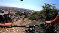
trail: Lezhë Castle Old Trail
0:57 |
11 |
Sep 25, 2020
Recent Trail Reports
no previous reports, add one now!
Activity Feed
| username | action | type | title | date |
|---|---|---|---|---|
| andiqyqja | add | photo | activity #39114894 and 11 more | Apr 17, 2023 @ 2:46am Apr 17, 2023 |
| andiqyqja | checkin | trail | activity #39114822 | Apr 17, 2023 @ 2:41am Apr 17, 2023 |
| andiqyqja | ridden | trail | activity #39114821 | Apr 17, 2023 @ 2:41am Apr 17, 2023 |
| andiqyqja | add | trail | activity #39114771 | Apr 17, 2023 @ 2:38am Apr 17, 2023 |
| andiqyqja | add | photo | activity #38327305 and 32 more | Mar 21, 2023 @ 12:26pm Mar 21, 2023 |
Local Badges
-

Epic Mountain Bike Climb 2k7 awarded -

Climbing 10k Badge0 awarded -

Mountain Biking 100k Badge0 awarded -

Epic Ride Descent 2k7 awarded -

Descent 10k Badge0 awarded -

Descent 100k Badge0 awarded
Activity Type Stats
| activitytype | trails | distance | descent | descent distance | total vertical | rating | global rank | state rank | photos | reports | routes | ridelogs |
|---|---|---|---|---|---|---|---|---|---|---|---|---|
| Mountain Bike | 12 | 33 miles | 3,691 ft | 10 miles | 2,005 ft | #3,210 | #15 | 207 | 4 | 104 | ||
| E-Bike | 10 | 30 miles | 3,343 ft | 9 miles | 2,005 ft | #1,314 | #13 | 2 | 2 | |||
| Horse | 7 | 22 miles | 2,930 ft | 6 miles | 1,988 ft | #379 | #14 | 1 | ||||
| Hike | 16 | 43 miles | 6,447 ft | 15 miles | 2,018 ft | #1,823 | #11 | 4 | 29 | |||
| Trail Running | 16 | 40 miles | 4,131 ft | 11 miles | 2,005 ft | #1,458 | #10 | 3 | 2 | |||
| Dirtbike/Moto | 7 | 27 miles | 3,284 ft | 7 miles | 1,988 ft | #272 | #7 | |||||
| Observed Trials | 2 | 3 miles | 171 ft | 3,264 ft | 1,299 ft | |||||||
| ATV/ORV/OHV | 5 | 20 miles | 2,920 ft | 6 miles | 1,988 ft | #190 | #13 |
Frequently Asked Questions About Lezhë
▼
What are the best places to ride in Lezhë?
Lezhë has 2 areas to explore for mountain biking. The top rated areas are:
▼
What are the highest rated mountain biking trails in Lezhë?
The highest rated mountain biking trails in Lezhë are:
- Lezhë Castle Trail (4/5)
- Laguna Vainit Track (3.8/5)
- Lezhë Castle Old Trail (3.7/5)
- Lissus Walls Track (0/5)
- Lezhë Castle Trail 2 (0/5)
▼
Where can I park to ride in Lezhë?
Check the Lezhë trail map for trailhead and parking information. Community members regularly update access and parking details for trails in the area.
▼
What is the longest trail in Lezhë?
The longest trail in Lezhë is Laguna Vainit Track at 7.8 miles. View all trails sorted by distance.
Activities
Trails
Points of Interest
- By andiqyqja
 TRAILFORKS & contributors
 - Admins: andiqyqja
- #30353 - 1,318 views
- lezhë activity log | embed map of Lezhë mountain bike trails |
Downloading of trail gps tracks in kml & gpx formats is enabled for Lezhë.
You must login to download files.