close
-
Layers w
- Weather Layers
- Pro
- Pro
- Pro
- Pro
- Pro
- Pro
- More Layers
- Pro
- Pro
- Pro
- Pro
-
Upgrade to

3D
Trail Conditions
- Unknown
- Snow Groomed
- Snow Packed
- Snow Covered
- Snow Cover Partial
- Freeze/thaw Cycle
- Icy
- Prevalent Mud
- Wet
- Variable
- Ideal
- Dry
- Very Dry
Trail Flow (Ridden Direction)
Trailforks scans users ridelogs to determine the most popular direction each trail is ridden. A good flowing trail network will have most trails flowing in a single direction according to their intension.
The colour categories are based on what percentage of riders are riding a trail in its intended direction.
The colour categories are based on what percentage of riders are riding a trail in its intended direction.
- > 96%
- > 90%
- > 80%
- > 70%
- > 50%
- < 50%
- bi-directional trail
- no data
Trail Last Ridden
Trailforks scans ridelogs to determine the last time a trail was ridden.
- < 2 days
- < 1 week
- < 2 weeks
- < 1 month
- < 6 months
- > 6 months
Trail Ridden Direction
The intended direction a trail should be ridden.
- Downhill Only
- Downhill Primary
- Both Directions
- Uphill Primary
- Uphill Only
- One Direction
Contribute Details
Colors indicate trail is missing specified detail.
- Description
- Photos
- Description & Photos
- Videos
Trail Popularity ?
Trailforks scans ridelogs to determine which trails are ridden the most in the last 9 months.
Trails are compared with nearby trails in the same city region with a possible 25 colour shades.
Think of this as a heatmap, more rides = more kinetic energy = warmer colors.
- most popular
- popular
- less popular
- not popular
ATV/ORV/OHV Filter
Max Vehicle Width
inches
US Cell Coverage
Legend

Radar Time
Activity Recordings
Trailforks uses anonymized public activity data.
?
Activity Recordings
Trailforks uses anonymized public activity data.
?
Personal Heatmap
▶
Activity Types
all
/
none
▶
Options
2
Date range
month
–
Winter Trails
Warning
A routing network for winter maps does not exist. Selecting trails using the winter trails layer has been disabled.
Missing Trails
Most Popular
Least Popular
Trails are colored based on popularity. The more popular a trail is, the more red. Less popular trails trend towards green.
Jump Magnitude Heatmap
Heatmap of where riders jump on trails. Zoom in to see individual jumps, click circles to view jump details.
BC Backroad Status
![map legend]()
Service Road Atlas is a free to use, community-driven service for viewing and creating reports on the numerous back-country service roads around B.C. and Alberta.

Slope Aspect
Direction the slope faces
Trails Deemphasized
Trails are shown in grey.
Only show trails with no bike usage.
Suggested Layers
Based on selected activity type
Save the current map location and zoom level as your default home location whenever this page is loaded.
Save
No description for Liphook has been added yet!
Login or register to submit one.
This region uses the Uk/Euro style trail grading system.
Activities Click to view
- Mountain Bike
9 trails
- E-Bike
9 trails
- Hike
8 trails
- Trail Running
9 trails
Region Details
- 1
- 3
- 5
Region Status
Open as of Sep 26, 2025Stats
- Avg Trail Rating
- Trails (view details)
- 9
- Trails Mountain Bike
- 9
- Trails E-Bike
- 9
- Trails Horse
- 1
- Trails Hike
- 8
- Trails Trail Running
- 9
- Total Distance
- 4 miles
- Total Descent Distance
- 3 miles
- Total Descent
- 896 ft
- Total Vertical
- 179 ft
- Highest Trailhead
- 492 ft
- Reports
- 25
- Photos
- 18
- Ridden Counter
- 447
Popular Liphook Mountain Biking Trails
• 90 ★ 4.0 • 3,182 ft • 0 ft • 83 •
Popular red difficulty singletrack. This mountain bike primary trail can be used both directions and has a moderate overall physical rating. It features berm, drop, jump, rock garden, roller coaster and skinny. Trail visibility is always easy to follow. On average it takes 8 minutes to complete this trail.
• 100 ★ 5.0 • 5,079 ft • 23 ft • 64 •
Popular green difficulty singletrack. This mountain bike primary trail can be used both directions and has a easy overall physical rating. It features skinny. Trail visibility is always easy to follow. On average it takes 9 minutes to complete this trail.
• 80 ★ 3.0 • 2,402 ft • 0 ft • 55 •
Popular blue difficulty singletrack. This mountain bike primary trail can be used downhill primary and has a easy overall physical rating. Trail visibility is always easy to follow. On average it takes 1 minutes to complete this trail.
• 70 ★ 5.0 • 1,004 ft • 0 ft • 45 •
Popular blue difficulty singletrack. This mountain bike primary trail can be used downhill primary and has a easy overall physical rating with a 0 ft green climb. It features jump and roller coaster. Trail visibility is always easy to follow. On average it takes 1 minutes to complete this trail.
• 15 ★ 3.0 • 1,358 ft • 0 ft • 41 •
Less popular red difficulty singletrack. This mountain bike primary trail can be used downhill primary and has a moderate overall physical rating. It features berm, jump, gap jump, roller coaster and skinny. Trail visibility is always easy to follow. On average it takes 2 minutes to complete this trail.
• 35 ★ 4.5 • 1,913 ft • 0 ft • 30 •
Less popular red difficulty singletrack. This mountain bike primary trail can be used downhill only and has a moderate overall physical rating. It features berm, drop, roller coaster and skinny. Trail visibility is always easy to follow. On average it takes 2 minutes to complete this trail.
• 45 ★ 4.0 • 1,631 ft • 0 ft • 21 •
A downhill trail which starts as a steep descent through loose rocks with a number of small (30 - 60 cm) drops which can be avoided if desired. Rest of the trail is less steep and has natural rollers. Sketchy in the wet.
• 25 ★ 5.0 • 3,241 ft • 15 ft • 21 •
A great section of singletrack previously used for part of the Natterjack Enduro in previous years
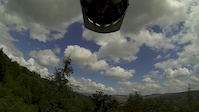
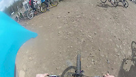
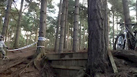
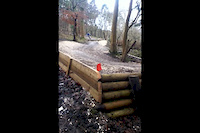
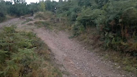
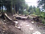
Photos of Liphook Mountain Bike
Videos of Liphook Mountain Bike

trail: Cry Havoc!
2:25 |
295 |
Aug 31, 2020
trail: Rim Dinger
0:03 |
333 |
Jun 16, 2014
trail: Rim Dinger
3:13 |
364 |
Jun 11, 2014

trail: Drop Offs
2:11 |
142 |
Oct 31, 2013
trail: Drop Offs
0:10 |
177 |
Apr 18, 2013
trail: Drop Offs
0:16 |
193 |
Jan 14, 2013
trail: Drop Offs
0:10 |
1430 |
Sep 11, 2011
trail: Drop Offs
0:13 |
222 |
Aug 25, 2010
Recent Trail Reports
| status | trail | date | condition | info | user |
|---|---|---|---|---|---|
| Cry Havoc! | Sep 26, 2025 @ 1:19pm (Europe/London) Sep 26, 2025 | Dry | StewartR0berts | ||
| Scrubbing Brush | Jul 13, 2025 @ 9:18am Jul 13, 2025 | Ideal | jezzieg | ||
| Rim Dinger | Aug 11, 2024 @ 5:16am Aug 11, 2024 | Dry | eann | ||
| Cranking The Hog | Jan 2, 2024 @ 1:48pm Jan 2, 2024 | Wet | BenpeCQzU | ||
| Holly Hills Viewpoint to Deers Hut | Jan 2, 2023 @ 11:09pm Jan 2, 2023 | Ideal | cjazz | ||
| Tokyo Berm Sliders | Oct 22, 2022 @ 6:14am Oct 22, 2022 | Variable | Rob36IRff | ||
| Let It Be | Sep 26, 2022 @ 7:05am Sep 26, 2022 | Ideal | StewartR0berts | ||
| Red Light District | May 15, 2022 @ 6:12am May 15, 2022 | Ideal | jezzieg | ||
| Drop Offs | Jun 9, 2021 @ 4:46am Jun 9, 2021 | Ideal | jezzieg |
Activity Feed
| username | action | type | title | date |
|---|---|---|---|---|
| luckyluke09 | wishlist | trail | activity #86135150 | Dec 27, 2025 @ 4:38am Dec 27, 2025 |
| sdadswell001 | wishlist | trail | activity #85688911 and 2 more | Dec 18, 2025 @ 3:48am Dec 18, 2025 |
| cgmtb25 | ridden | trail | activity #81631803 | Oct 3, 2025 @ 3:23pm Oct 3, 2025 |
| krissyO5NnVr | vote | trail | activity #81606664 | Oct 3, 2025 @ 8:23am Oct 3, 2025 |
| StewartR0berts | add | report | activity #81151899 | Sep 26, 2025 @ 2:05pm Sep 26, 2025 |
Recent Comments
| username | type | title | comment | date |
|---|---|---|---|---|
| trail | The top seems to have been mullered by logging... | Jul 31, 2025 @ 2:02pm Jul 31, 2025 | ||
| trail | Ace little trail | Apr 23, 2021 @ 12:03pm Apr 23, 2021 | ||
| trail | Definitely not a RED graded trail. fun trail... | Sep 29, 2020 @ 1:30am Sep 29, 2020 | ||
| trail | Recently moved to the area and loving this... | Sep 8, 2020 @ 5:13am Sep 8, 2020 | ||
| trail | careful of the gaps, sketchy landings youu... | Aug 17, 2020 @ 1:10pm Aug 17, 2020 |
Activity Type Stats
| activitytype | trails | distance | descent | descent distance | total vertical | rating | global rank | state rank | photos | reports | routes | ridelogs |
|---|---|---|---|---|---|---|---|---|---|---|---|---|
| Mountain Bike | 9 | 4 miles | 896 ft | 3 miles | 180 ft | #4,933 | #173 | 18 | 25 | 2,546 | ||
| E-Bike | 9 | 4 miles | 896 ft | 3 miles | 180 ft | #6,311 | #281 | 25 | 412 | |||
| Horse | 1 | 5,079 ft | 151 ft | 3,540 ft | 135 ft | 1 | ||||||
| Hike | 8 | 4 miles | 801 ft | 3 miles | 180 ft | #10,775 | #369 | 24 | 14 | |||
| Trail Running | 9 | 4 miles | 896 ft | 3 miles | 180 ft | #9,998 | #338 | 25 | 138 |
Frequently Asked Questions About Liphook
▼
What are the highest rated mountain biking trails in Liphook?
The highest rated mountain biking trails in Liphook are:
- Holly Hills Viewpoint to Deers Hut (4.1/5)
- Scrubbing Brush (4.1/5)
- Rim Dinger (4.1/5)
- Cry Havoc! (4.1/5)
- Tokyo Berm Sliders (4.1/5)
▼
What is the best time of the year to ride in Liphook?
Based on ride log data, the most popular months to ride in Liphook are:
- September (27 activities)
- August (20 activities)
- October (14 activities)
▼
Where can I park to ride in Liphook?
Check the Liphook trail map for trailhead and parking information. Community members regularly update access and parking details for trails in the area.
▼
What is the longest trail in Liphook?
The longest trail in Liphook is Holly Hills Viewpoint to Deers Hut at 5,079 ft. View all trails sorted by distance.
- By jezzieg
 & contributors
 - Admins: wisey, MathieuC, cemoorelife
- #39388 - 3,971 views
- liphook activity log | embed map of Liphook mountain bike trails |
Downloading of trail gps tracks in kml & gpx formats is enabled for Liphook.
You must login to download files.