close
-
Layers w
- Weather Layers
- Pro
- Pro
- Pro
- Pro
- Pro
- Pro
- More Layers
- Pro
- Pro
- Pro
- Pro
-
Upgrade to

3D
Trail Conditions
- Unknown
- Snow Groomed
- Snow Packed
- Snow Covered
- Snow Cover Partial
- Freeze/thaw Cycle
- Icy
- Prevalent Mud
- Wet
- Variable
- Ideal
- Dry
- Very Dry
Trail Flow (Ridden Direction)
Trailforks scans users ridelogs to determine the most popular direction each trail is ridden. A good flowing trail network will have most trails flowing in a single direction according to their intension.
The colour categories are based on what percentage of riders are riding a trail in its intended direction.
The colour categories are based on what percentage of riders are riding a trail in its intended direction.
- > 96%
- > 90%
- > 80%
- > 70%
- > 50%
- < 50%
- bi-directional trail
- no data
Trail Last Ridden
Trailforks scans ridelogs to determine the last time a trail was ridden.
- < 2 days
- < 1 week
- < 2 weeks
- < 1 month
- < 6 months
- > 6 months
Trail Ridden Direction
The intended direction a trail should be ridden.
- Downhill Only
- Downhill Primary
- Both Directions
- Uphill Primary
- Uphill Only
- One Direction
Contribute Details
Colors indicate trail is missing specified detail.
- Description
- Photos
- Description & Photos
- Videos
Trail Popularity ?
Trailforks scans ridelogs to determine which trails are ridden the most in the last 9 months.
Trails are compared with nearby trails in the same city region with a possible 25 colour shades.
Think of this as a heatmap, more rides = more kinetic energy = warmer colors.
- most popular
- popular
- less popular
- not popular
ATV/ORV/OHV Filter
Max Vehicle Width
inches
US Cell Coverage
Legend

Radar Time
Activity Recordings
Trailforks uses anonymized public activity data.
?
Activity Recordings
Trailforks uses anonymized public activity data.
?
Personal Heatmap
▶
Activity Types
all
/
none
▶
Options
2
Date range
month
–
Winter Trails
Warning
A routing network for winter maps does not exist. Selecting trails using the winter trails layer has been disabled.
Missing Trails
Most Popular
Least Popular
Trails are colored based on popularity. The more popular a trail is, the more red. Less popular trails trend towards green.
Jump Magnitude Heatmap
Heatmap of where riders jump on trails. Zoom in to see individual jumps, click circles to view jump details.
BC Backroad Status
![map legend]()
Service Road Atlas is a free to use, community-driven service for viewing and creating reports on the numerous back-country service roads around B.C. and Alberta.

Slope Aspect
Direction the slope faces
Trails Deemphasized
Trails are shown in grey.
Only show trails with no bike usage.
Suggested Layers
Based on selected activity type
Save the current map location and zoom level as your default home location whenever this page is loaded.
Save
No description for Lisboa has been added yet!
Login or register to submit one.
This region uses the Uk/Euro style trail grading system.
Activities Click to view
- Mountain Bike
4 trails
- E-Bike
3 trails
Region Details
- 2
- 2
Region Status
Caution as of May 31, 2026Stats
- Avg Trail Rating
- Trails (view details)
- 4
- Trails Mountain Bike
- 4
- Trails E-Bike
- 3
- Trails Hike
- 2
- Trails Trail Running
- 2
- Total Distance
- 4,633 ft
- Total Descent Distance
- 4,426 ft
- Total Descent
- 448 ft
- Total Vertical
- 313 ft
- Highest Trailhead
- 393 ft
- Reports
- 96
- Photos
- 8
- Ridden Counter
- 451
Popular Lisboa Mountain Biking Trails
• 100 ★ 5.0 • 892 ft • 0 ft • 126 •
Popular blue difficulty singletrack. This mountain bike primary trail can be used downhill only. It features berm, drop, jump and ladder bridge. Adaptive MTB rating: amtb black. Trail visibility is always easy to follow. On average it takes 1 minutes to complete this trail.
• 80 ★ 4.5 • 1,263 ft • 17 ft • 95 •
Popular blue difficulty singletrack. This multi-use trail can be used downhill primary and has a moderate overall physical rating. Trail visibility is always easy to follow. On average it takes 1 minutes to complete this trail.
• 5 ★ 2.0 • 1,578 ft • 0 ft • 1 •
Singletrack that flows along the mountain with easy twists and turns. Fun trail to ride on weekdays. Good spot to be developed
Videos of Lisboa Mountain Bike
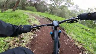
trail: Castor
2:28 |
113 |
Mar 10, 2023 , Lisboa

trail: Castor lower
3:12 |
309 |
Jan 30, 2023 , Lisboa

trail: Castor
3:12 |
196 |
Jan 30, 2023 , Lisboa
Recent Trail Reports
| status | trail | date | condition | info | user |
|---|---|---|---|---|---|
| Castor lower | May 31, 2026 @ 9:16am (Europe/Lisbon) May 31, 2026 | Dry | Santinho | ||
| Castor | May 31, 2026 @ 9:16am (Europe/Lisbon) May 31, 2026 | Dry | Santinho | ||
| Silêncio | Feb 8, 2026 @ 10:02am (Europe/Lisbon) Feb 8, 2026 | Prevalent Mud | RicardoColaco |
Activity Feed
| username | action | type | title | date |
|---|---|---|---|---|
| Santinho | add | report | activity #96005486 and 1 more | Jun 1, 2026 @ 2:46am Jun 1, 2026 |
| Ripal | add | report | activity #93878822 and 1 more | May 2, 2026 @ 11:08am May 2, 2026 |
| Miguel74 | add | report | activity #91809977 and 1 more | Apr 3, 2026 @ 3:42am Apr 3, 2026 |
| c-radicallis | add | report | activity #90144787 | Mar 7, 2026 @ 12:03pm Mar 7, 2026 |
| c-radicallis | add | report | activity #89829131 | Mar 2, 2026 @ 1:32am Mar 2, 2026 |
Activity Type Stats
| activitytype | trails | distance | descent | descent distance | total vertical | rating | global rank | state rank | photos | reports | routes | ridelogs |
|---|---|---|---|---|---|---|---|---|---|---|---|---|
| Mountain Bike | 4 | 4,633 ft | 449 ft | 4,426 ft | 312 ft | #8,543 | #82 | 8 | 96 | 1,218 | ||
| E-Bike | 3 | 3,054 ft | 262 ft | 2,858 ft | 226 ft | #5,486 | #69 | 95 | 364 | |||
| Hike | 2 | 2,162 ft | 161 ft | 1,965 ft | 115 ft | 93 | 16 | |||||
| Trail Running | 2 | 2,162 ft | 161 ft | 1,965 ft | 115 ft | 93 | 150 |
- By RicBasil & contributors
- Admins: elyari, AMG, marcossantamaria
- #33610 - 1,234 views
- lisboa activity log | embed map of Lisboa mountain bike trails | lisboa mountain biking points of interest
Downloading of trail gps tracks in kml & gpx formats is enabled for Lisboa.
You must login to download files.