close
-
Layers w
- Weather Layers
- Pro
- Pro
- Pro
- Pro
- Pro
- Pro
- More Layers
- Pro
- Pro
- Pro
- Pro
-
Upgrade to

3D
Trail Conditions
- Unknown
- Snow Groomed
- Snow Packed
- Snow Covered
- Snow Cover Partial
- Freeze/thaw Cycle
- Icy
- Prevalent Mud
- Wet
- Variable
- Ideal
- Dry
- Very Dry
Trail Flow (Ridden Direction)
Trailforks scans users ridelogs to determine the most popular direction each trail is ridden. A good flowing trail network will have most trails flowing in a single direction according to their intension.
The colour categories are based on what percentage of riders are riding a trail in its intended direction.
The colour categories are based on what percentage of riders are riding a trail in its intended direction.
- > 96%
- > 90%
- > 80%
- > 70%
- > 50%
- < 50%
- bi-directional trail
- no data
Trail Last Ridden
Trailforks scans ridelogs to determine the last time a trail was ridden.
- < 2 days
- < 1 week
- < 2 weeks
- < 1 month
- < 6 months
- > 6 months
Trail Ridden Direction
The intended direction a trail should be ridden.
- Downhill Only
- Downhill Primary
- Both Directions
- Uphill Primary
- Uphill Only
- One Direction
Contribute Details
Colors indicate trail is missing specified detail.
- Description
- Photos
- Description & Photos
- Videos
Trail Popularity ?
Trailforks scans ridelogs to determine which trails are ridden the most in the last 9 months.
Trails are compared with nearby trails in the same city region with a possible 25 colour shades.
Think of this as a heatmap, more rides = more kinetic energy = warmer colors.
- most popular
- popular
- less popular
- not popular
ATV/ORV/OHV Filter
Max Vehicle Width
inches
US Cell Coverage
Legend

Radar Time
Activity Recordings
Trailforks uses anonymized public activity data.
?
Activity Recordings
Trailforks uses anonymized public activity data.
?
Personal Heatmap
▶
Activity Types
all
/
none
▶
Options
2
Date range
month
–
Winter Trails
Warning
A routing network for winter maps does not exist. Selecting trails using the winter trails layer has been disabled.
Missing Trails
Most Popular
Least Popular
Trails are colored based on popularity. The more popular a trail is, the more red. Less popular trails trend towards green.
Jump Magnitude Heatmap
Heatmap of where riders jump on trails. Zoom in to see individual jumps, click circles to view jump details.
BC Backroad Status
![map legend]()
Service Road Atlas is a free to use, community-driven service for viewing and creating reports on the numerous back-country service roads around B.C. and Alberta.

Slope Aspect
Direction the slope faces
Trails Deemphasized
Trails are shown in grey.
Only show trails with no bike usage.
Suggested Layers
Based on selected activity type
Save the current map location and zoom level as your default home location whenever this page is loaded.
Save
No description for Loftus/Yarrawarrah has been added yet!
Login or register to submit one.
 google parking directions
Primary Trail Type: Cross-Country
Land Status: City Managed
Land Manager: Sutherland Shire Council
google parking directions Activities Click to view
- Hike
37 trails
- Mountain Bike
48 trails
- E-Bike
16 trails
- Trail Running
38 trails
Region Details
- 6
- 1
- 19
- 6
- 10
- 1
Region Status
Open as of 1 dayStats
- Avg Trail Rating
- Trails (view details)
- 44
- Trails Mountain Bike
- 51
- Trails E-Bike
- 16
- Trails Horse
- 1
- Trails Hike
- 37
- Trails Trail Running
- 38
- Trails Dirtbike/Moto
- 3
- Total Distance
- 25 miles
- Total Descent
- 3,773 ft
- Total Vertical
- 657 ft
- Highest Trailhead
- 688 ft
- Reports
- 1,279
- Photos
- 276
- Ridden Counter
- 21,987
Popular Loftus/Yarrawarrah Mountain Biking Trails
• 100 ★ 4.6 • 3,369 ft • 87 ft • 1,110 •
Fun descent from the signal box at Parade to crossing an upper section of Temptation Creek. Some small jumps and a larger log jump, some berms, drop offs aren't too technical but great fun at speed, just be careful at the creek crossing...
• 60 ★ 3.4 • 2,844 ft • 100 ft • 939 •
Moderately popular green difficulty family friendly singletrack. This mountain bike primary trail can be used both directions and has a moderate overall physical rating with a 100 ft green climb. It features roller coaster. Trail visibility is always easy to follow. On average it takes 4 minutes to complete this trail.
• 100 ★ 4.5 • 682 ft • 2 ft • 884 •
Popular green difficulty singletrack. This mountain bike primary trail can be used both directions and has a easy overall physical rating with a 2 ft green climb. On average it takes minutes to complete this trail.
• 95 ★ 3.8 • 1,729 ft • 6 ft • 866 •
Popular green difficulty singletrack. This mountain bike primary trail can be used downhill primary and has a easy overall physical rating with a 6 ft green climb. On average it takes 3 minutes to complete this trail.
• 80 ★ 5.0 • 1,253 ft • 2 ft • 849 •
on the trail was dug when the Loftus area was an army encampment in the early 1900s
• 65 ★ 3.8 • 1 mile • 34 ft • 847 •
Moderately popular green difficulty singletrack. This mountain bike primary trail can be used both directions and has a easy overall physical rating with a 34 ft green climb. On average it takes 6 minutes to complete this trail.
• 65 ★ 3.5 • 1,575 ft • 11 ft • 824 •
Moderately popular green difficulty singletrack. This mountain bike primary trail can be used both directions and has a easy overall physical rating with a 11 ft green climb. On average it takes 3 minutes to complete this trail.
• 50 ★ 4.4 • 4,925 ft • 16 ft • 816 •
You may be able to get away with a Cross Country bike, although it is very difficult in many sections of the trail.
Loftus/Yarrawarrah Mountain Bike Routes
2 miles • 249 ft • 1 • Loop •
★ 4.0 • 1,621 ft • 0 • Point to Point • Race •
A quick blast to get into race mode. Watch out for the Hobo, he has a mallet! Stage 1 of SHIT Winter...
1 mile • 8 ft • 1 • Point to Point • Race •
The classic Creek Track. With the addition of Ancient Score Stage 2 of SHIT Winter Series...
1 mile • 5 ft • 0 • Point to Point • Race •
Fast and flowy. Some legs will be required to maintain speed here Stage 3 of SHIT Winter Series...
★ 2.0 • 6 miles • 299 ft • 11 • Out & Back • Race •
Challenge Your Self To A Course, Nice and easy Engadine to Heathcote out and back loop.
• 19 miles • 1,758 ft • 0 •
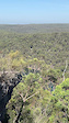
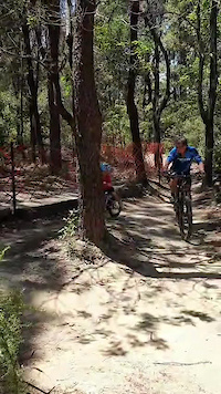
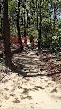
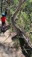
Photos of Loftus/Yarrawarrah Mountain Bike
Videos of Loftus/Yarrawarrah Mountain Bike
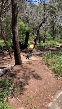
trail: Florence Parade Veh Trail
0:24 |
13 |
Mar 15, 2025
trail: Sutherland Mtb Practise loop
0:24 |
12 |
Oct 27, 2024
trail: Sutherland Mtb Practise loop
0:06 |
3 |
Oct 27, 2024
trail: Sutherland Mtb Practise loop
0:47 |
6 |
Oct 27, 2024
trail: Sutherland Mtb Practise loop
0:24 |
9 |
Oct 27, 2024
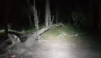
trail: Downed Log East
0:04 |
10 |
Aug 9, 2023
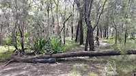
trail: Highway Trail (Upper)
0:05 |
7 |
Aug 5, 2023
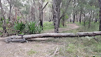
trail: Highway Trail (Upper)
0:17 |
7 |
Aug 5, 2023
Current Trail Warnings
| status | trail | date | condition | user | info |
|---|---|---|---|---|---|
| Gap Jump | May 31, 2026 @ 11:05am (Australia/Sydney) May 30, 2026 | Variable | RomanMark | damaged, overgrowing |
Recent Trail Reports
| status | trail | date | condition | info | user |
|---|---|---|---|---|---|
| Sutherland Mtb Practise loop | Jun 6, 2026 @ 11:56am (Australia/Sydney) 2 days | Ideal | MacroTiara | ||
| Savilles Creek | Jun 6, 2026 @ 11:56am (Australia/Sydney) 2 days | Ideal | MacroTiara | ||
| Holy Trail | Jun 6, 2026 @ 11:56am (Australia/Sydney) 2 days | Variable | MacroTiara | ||
| Upper Middle Bogan | Jun 6, 2026 @ 11:56am (Australia/Sydney) 2 days | Variable | MacroTiara | ||
| Back Door Lakes | Jun 6, 2026 @ 11:56am (Australia/Sydney) 2 days | Ideal | MacroTiara | ||
| Signalhouse Trail | Jun 6, 2026 @ 11:56am (Australia/Sydney) 2 days | Ideal | MacroTiara | ||
| Highway Trail (Upper) | Jun 6, 2026 @ 11:56am (Australia/Sydney) 2 days | Ideal | MacroTiara | ||
| KnoW Vaseline | Jun 6, 2026 @ 11:56am (Australia/Sydney) 2 days | Variable | MacroTiara | ||
| Bobcats to Even Flow | Jun 6, 2026 @ 2:16pm (Australia/Sydney) 2 days | Ideal | MacroTiara | ||
| Angle Road Veh Trail | May 17, 2026 @ 5:59am (Australia/Sydney) May 16, 2026 | Unknown | Trichard3 |
Activity Feed
| username | action | type | title | date |
|---|---|---|---|---|
| MacroTiara | add | report | activity #96341639 and 8 more | Jun 5, 2026 @ 9:16pm 2 days |
| RomanMark | add | report | activity #95991773 | May 31, 2026 @ 6:06pm May 31, 2026 |
| annekagoss | wishlist | trail | activity #95923396 | May 31, 2026 @ 3:53am May 31, 2026 |
| Trichard3 | add | report | activity #94871323 and 6 more | May 16, 2026 @ 8:26pm May 16, 2026 |
| Trichard3 | add | report | activity #94523800 | May 11, 2026 @ 4:16pm May 11, 2026 |
Recent Comments
| username | type | title | comment | date |
|---|---|---|---|---|
| trail | Currently overgrown | Jan 13, 2026 @ 12:02am Jan 13, 2026 | ||
| trail | Beautiful trail. Easy riding. | Nov 12, 2025 @ 8:39pm Nov 12, 2025 | ||
| trail | Fun easy trail with lots of trees and nature... | Nov 12, 2025 @ 8:39pm Nov 12, 2025 | ||
| trail | Unfortunately the wet winter has made a lot of... | Nov 12, 2025 @ 8:38pm Nov 12, 2025 | ||
| trail | I wouldn’t call this an Easy Green. It’s... | Nov 12, 2025 @ 8:37pm Nov 12, 2025 |
Nearby Areas
| name | distance | ||||
|---|---|---|---|---|---|
| Royal NP - Temptation Creek | 33 | 17 | 5 | 1 | 0.7 km |
| Engadine | 2 | 1.3 km | |||
| Yarrawarrah Valley | 1.4 km | ||||
| Woronora | 7 | 25 | 14 | 2 | 1.7 km |
| Royal NP - East Heathcote | 8 | 8 | 2.7 km |
Local Badges
-

Completionist0 awarded
Activity Type Stats
| activitytype | trails | distance | descent | descent distance | total vertical | rating | global rank | state rank | photos | reports | routes | ridelogs |
|---|---|---|---|---|---|---|---|---|---|---|---|---|
| Mountain Bike | 48 | 25 miles | 3,757 ft | 12 miles | 656 ft | #555 | #43 | 280 | 1,411 | 5 | 21,817 | |
| E-Bike | 16 | 7 miles | 807 ft | 3 miles | 512 ft | #3,479 | #163 | 2 | 1,275 | 1 | 1,301 | |
| Horse | 1 | 1,644 ft | 16 ft | 725 ft | 33 ft | 84 | ||||||
| Hike | 37 | 21 miles | 2,756 ft | 10 miles | 614 ft | #4,797 | #129 | 1,370 | 398 | |||
| Trail Running | 38 | 21 miles | 2,762 ft | 10 miles | 614 ft | #3,462 | #91 | 1,370 | 1,493 | |||
| Dirtbike/Moto | 3 | 84 | 2 |
Frequently Asked Questions About Loftus/Yarrawarrah
▼
What are the highest rated mountain biking trails in Loftus/Yarrawarrah?
The highest rated mountain biking trails in Loftus/Yarrawarrah are:
- Bobcats (4.4/5)
- Back Door Lakes (4.4/5)
- Signalhouse Trail (4.3/5)
- Holy Trail (4.2/5)
- Savilles Creek (4.1/5)
▼
What is the best time of the year to ride in Loftus/Yarrawarrah?
Based on ride log data, the most popular months to ride in Loftus/Yarrawarrah are:
- July (255 activities)
- August (239 activities)
- December (227 activities)
▼
Where can I park to ride in Loftus/Yarrawarrah?
There are 4 parking locations listed in Loftus/Yarrawarrah. The most popular parking spots are: View all parking and trailhead locations on the map to plan your visit.
▼
What is the longest trail in Loftus/Yarrawarrah?
The longest trail in Loftus/Yarrawarrah is Winifred Falls at 4.9 km. View all trails sorted by distance.
Activities
Trails
- Hard trails in Loftus/Yarrawarrah
- Easy trails in Loftus/Yarrawarrah
- Favorite trails in Loftus/Yarrawarrah
- Most ridden trails in Loftus/Yarrawarrah
- Singletrack in Loftus/Yarrawarrah
- Viewpoint trails in Loftus/Yarrawarrah
- Trails with technical features in Loftus/Yarrawarrah
- Race routes in Loftus/Yarrawarrah
- By brenthillier
 NSMBA TRAILFORKS & contributors
 - Admins: MCTA, TrailCare
- #9905 - 35,784 views
- loftus/yarrawarrah activity log | embed map of Loftus/Yarrawarrah mountain bike trails | loftus/yarrawarrah mountain biking points of interest
Downloading of trail gps tracks in kml & gpx formats is enabled for Loftus/Yarrawarrah.
You must login to download files.