close
-
Layers w
- Weather Layers
- Pro
- Pro
- Pro
- Pro
- Pro
- Pro
- More Layers
- Pro
- Pro
- Pro
- Pro
-
Upgrade to

3D
Trail Conditions
- Unknown
- Snow Groomed
- Snow Packed
- Snow Covered
- Snow Cover Partial
- Freeze/thaw Cycle
- Icy
- Prevalent Mud
- Wet
- Variable
- Ideal
- Dry
- Very Dry
Trail Flow (Ridden Direction)
Trailforks scans users ridelogs to determine the most popular direction each trail is ridden. A good flowing trail network will have most trails flowing in a single direction according to their intension.
The colour categories are based on what percentage of riders are riding a trail in its intended direction.
The colour categories are based on what percentage of riders are riding a trail in its intended direction.
- > 96%
- > 90%
- > 80%
- > 70%
- > 50%
- < 50%
- bi-directional trail
- no data
Trail Last Ridden
Trailforks scans ridelogs to determine the last time a trail was ridden.
- < 2 days
- < 1 week
- < 2 weeks
- < 1 month
- < 6 months
- > 6 months
Trail Ridden Direction
The intended direction a trail should be ridden.
- Downhill Only
- Downhill Primary
- Both Directions
- Uphill Primary
- Uphill Only
- One Direction
Contribute Details
Colors indicate trail is missing specified detail.
- Description
- Photos
- Description & Photos
- Videos
Trail Popularity ?
Trailforks scans ridelogs to determine which trails are ridden the most in the last 9 months.
Trails are compared with nearby trails in the same city region with a possible 25 colour shades.
Think of this as a heatmap, more rides = more kinetic energy = warmer colors.
- most popular
- popular
- less popular
- not popular
ATV/ORV/OHV Filter
Max Vehicle Width
inches
US Cell Coverage
Legend

Radar Time
Activity Recordings
Trailforks uses anonymized public activity data.
?
Activity Recordings
Trailforks uses anonymized public activity data.
?
Personal Heatmap
▶
Activity Types
all
/
none
▶
Options
2
Date range
month
–
Winter Trails
Warning
A routing network for winter maps does not exist. Selecting trails using the winter trails layer has been disabled.
Missing Trails
Most Popular
Least Popular
Trails are colored based on popularity. The more popular a trail is, the more red. Less popular trails trend towards green.
Jump Magnitude Heatmap
Heatmap of where riders jump on trails. Zoom in to see individual jumps, click circles to view jump details.
BC Backroad Status
![map legend]()
Service Road Atlas is a free to use, community-driven service for viewing and creating reports on the numerous back-country service roads around B.C. and Alberta.

Slope Aspect
Direction the slope faces
Trails Deemphasized
Trails are shown in grey.
Only show trails with no bike usage.
Suggested Layers
Based on selected activity type
Save the current map location and zoom level as your default home location whenever this page is loaded.
Save
No description for Losone has been added yet!
Login or register to submit one.
This region uses the Uk/Euro style trail grading system.
Activities Click to view
- Mountain Bike
28 trails
- E-Bike
20 trails
- Adaptive Bike
0 trails
- Hike
27 trails
- Trail Running
27 trails
Region Details
- 3
- 3
- 12
- 7
- 2
Region Status
Open as of Jun 13, 2026Stats
- Avg Trail Rating
- Trails (view details)
- 27
- Trails Mountain Bike
- 29
- Trails E-Bike
- 20
- Trails Hike
- 27
- Trails Trail Running
- 27
- Total Distance
- 13 miles
- Total Descent Distance
- 10 miles
- Total Descent
- 7,282 ft
- Total Vertical
- 3,365 ft
- Highest Trailhead
- 4,207 ft
- Reports
- 312
- Photos
- 30
- Ridden Counter
- 1,477
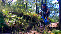
Popular Losone Mountain Biking Trails
• 80 ★ 4.0 • 2 miles • 0 ft • 244 •
Popular red difficulty singletrack. This multi-use trail can be used downhill primary. On average it takes 1 hour10 minutes to complete this trail.
• 100 ★ 4.3 • 3,228 ft • 0 ft • 193 •
Flowy single track with multiple jump/rockrolls/drop options, fast and fun.
• 95 ★ 5.0 • 1,752 ft • 0 ft • 109 •
Popular red difficulty alpine singletrack. This mountain bike primary trail can be used downhill primary. On average it takes 2 minutes to complete this trail.
• 100 ★ 5.0 • 1,306 ft • 0 ft • 109 • • hike
Popular green difficulty singletrack. This hike primary trail can be used downhill only and has a moderate overall physical rating with a 0 ft green climb. It features drop, jump, rock face, rock garden and roller coaster. Trail visibility is sometimes hard to follow. On average it takes 1 minutes to complete this trail.
• 70 ★ 2.0 • 4,022 ft • 210 ft • 58 • • hike
Popular green difficulty alpine singletrack. This hike primary trail can be used uphill primary and has a moderate overall physical rating with a 210 ft blue climb. Trail visibility is always easy to follow. On average it takes 11 minutes to complete this trail.
• 5 ★ 0.0 • 1,850 ft • 37 ft • 44 • • hike
Less popular green difficulty singletrack. This hike primary trail can be used both directions and has a easy overall physical rating with a 37 ft green climb. Trail visibility is always easy to follow. On average it takes minutes to complete this trail.
• 60 ★ 0.0 • 2,631 ft • 0 ft • 35 •
Moderately popular blue difficulty wilderness trail. This multi-use trail can be used downhill primary and has a moderate overall physical rating. Trail visibility is always easy to follow. On average it takes 4 minutes to complete this trail.
• 35 ★ 4.0 • 2,615 ft • 6 ft • 32 •
Less popular blue difficulty singletrack. This multi-use trail can be used downhill primary. On average it takes 8 minutes to complete this trail.
Photos of Losone Mountain Bike
Videos of Losone Mountain Bike
trail: Güsti trail
0:45 |
554 |
Aug 11, 2019
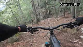
trail: Corona dei Pinci
3:50 |
231 |
Sep 27, 2024 , Losone

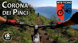
trail: Corona dei Pinci
22:30 |
367 |
May 14, 2023 , Losone
trail: Corona dei Pinci
11:43 |
366 |
Nov 28, 2022 , Losone
Recent Trail Reports
| status | trail | date | condition | info | user |
|---|---|---|---|---|---|
| Bollettina | Jun 13, 2026 @ 11:21am (Europe/Vaduz) Jun 13, 2026 | Dry | trailpapst TRAILFORKS | ||
| Busbera Trail | Jun 13, 2026 @ 11:21am (Europe/Vaduz) Jun 13, 2026 | Dry | trailpapst TRAILFORKS | ||
| Variante Pinci | Jun 13, 2026 @ 11:21am (Europe/Vaduz) Jun 13, 2026 | Dry | trailpapst TRAILFORKS | ||
| Pinci New Line | Jun 13, 2026 @ 11:21am (Europe/Vaduz) Jun 13, 2026 | Ideal | trailpapst TRAILFORKS | ||
| Güsti trail | May 7, 2026 @ 1:01pm (Europe/Vaduz) May 7, 2026 | Ideal | eile | ||
| Güsti Connector trail | May 7, 2026 @ 1:01pm (Europe/Vaduz) May 7, 2026 | Ideal | eile | ||
| Via Bedruscio | May 2, 2026 @ 2:40pm (Europe/Vaduz) May 2, 2026 | Ideal | joe27a | ||
| Moracqua | May 2, 2026 @ 2:40pm (Europe/Vaduz) May 2, 2026 | Ideal | joe27a | ||
| Maya | Apr 30, 2026 @ 11:22pm (Europe/Zurich) Apr 30, 2026 | Ideal | trailblazer | ||
| Corona dei Pinci | Apr 8, 2026 @ 9:34pm (Europe/Zurich) Apr 8, 2026 | Unknown | eIKtbT |
Activity Feed
| username | action | type | title | date |
|---|---|---|---|---|
| trailpapst | add | report | activity #97029320 and 3 more | Jun 15, 2026 @ 2:37am Jun 15, 2026 |
| trailpapst | add | trail | activity #97029133 | Jun 15, 2026 @ 2:27am Jun 15, 2026 |
| Janisjackson | wishlist | trail | activity #95380377 | May 23, 2026 @ 11:05pm May 23, 2026 |
| eile | add | report | activity #94215294 and 5 more | May 7, 2026 @ 7:17am May 7, 2026 |
| joe27a | add | report | activity #93886016 and 2 more | May 2, 2026 @ 12:29pm May 2, 2026 |
Recent Comments
| username | type | title | comment | date |
|---|---|---|---|---|
| trail | As far my information goes, the asphalt is... | Apr 13, 2026 @ 9:46am Apr 13, 2026 | ||
| trail | Absolute misery. The previous line is replaced... | Jul 9, 2025 @ 4:28am Jul 9, 2025 | ||
| trail | Lots of roots and rocks. One could even call... | Apr 6, 2025 @ 5:33am Apr 6, 2025 | ||
| trail | It’s a fun trail. Though tires recommend,... | Apr 6, 2025 @ 5:29am Apr 6, 2025 | ||
| trail | Sentiero non più percorribile a causa delle... | Jan 18, 2025 @ 1:52am Jan 18, 2025 |
Local Badges
-

Epic Mountain Bike Climb 2k6 awarded -

Climbing 10k Badge0 awarded -

Mountain Biking 100k Badge0 awarded -

Epic Ride Descent 2k6 awarded -

Descent 10k Badge0 awarded -

Descent 100k Badge0 awarded
Activity Type Stats
| activitytype | trails | distance | descent | descent distance | total vertical | rating | global rank | state rank | photos | reports | routes | ridelogs |
|---|---|---|---|---|---|---|---|---|---|---|---|---|
| Mountain Bike | 28 | 13 miles | 7,280 ft | 10 miles | 3,366 ft | #4,911 | #112 | 30 | 311 | 1,197 | ||
| E-Bike | 20 | 10 miles | 5,246 ft | 7 miles | 3,330 ft | #5,102 | #222 | 266 | 1 | 123 | ||
| Hike | 27 | 12 miles | 6,837 ft | 9 miles | 3,366 ft | #6,584 | #175 | 294 | 31 | |||
| Trail Running | 27 | 12 miles | 6,837 ft | 9 miles | 3,366 ft | #6,995 | #180 | 294 | 11 |
Frequently Asked Questions About Losone
▼
What are the highest rated mountain biking trails in Losone?
The highest rated mountain biking trails in Losone are:
- Busbera Trail (4.2/5)
- Güsti trail (4.2/5)
- Bollettina (4.1/5)
- Gratena variante Arcegno (4.1/5)
- Maya (4/5)
▼
What is the best time of the year to ride in Losone?
Based on ride log data, the most popular months to ride in Losone are:
- October (4 activities)
- November (3 activities)
- December (3 activities)
▼
Where can I park to ride in Losone?
Check the Losone trail map for trailhead and parking information. Community members regularly update access and parking details for trails in the area.
▼
What is the longest trail in Losone?
The longest trail in Losone is Corona dei Pinci at 3.0 km. View all trails sorted by distance.
Activities
Trails
Points of Interest
- By inversedotch
 & contributors
 - Admins: TIS
- #52048 - 1,719 views
- losone activity log | embed map of Losone mountain bike trails | losone mountain biking points of interest
Downloading of trail gps tracks in kml & gpx formats is enabled for Losone.
You must login to download files.