close
-
Layers w
- Weather Layers
- Pro
- Pro
- Pro
- Pro
- Pro
- Pro
- More Layers
- Pro
- Pro
- Pro
- Pro
-
Upgrade to

3D
Trail Conditions
- Unknown
- Snow Groomed
- Snow Packed
- Snow Covered
- Snow Cover Partial
- Freeze/thaw Cycle
- Icy
- Prevalent Mud
- Wet
- Variable
- Ideal
- Dry
- Very Dry
Trail Flow (Ridden Direction)
Trailforks scans users activity logs to determine the most popular direction each trail is ridden. A good flowing trail network will have most trails flowing in a single direction according to their intension.
The colour categories are based on what percentage of users are riding a trail in its intended direction.
The colour categories are based on what percentage of users are riding a trail in its intended direction.
- > 96%
- > 90%
- > 80%
- > 70%
- > 50%
- < 50%
- bi-directional trail
- no data
Trail Last Ridden
Trailforks scans activity logs to determine the last time a trail was ridden.
- < 2 days
- < 1 week
- < 2 weeks
- < 1 month
- < 6 months
- > 6 months
Trail Ridden Direction
The intended direction a trail should be ridden.
- Downhill Only
- Downhill Primary
- Both Directions
- Uphill Primary
- Uphill Only
- One Direction
Contribute Details
Colors indicate trail is missing specified detail.
- Description
- Photos
- Description & Photos
- Videos
Trail Popularity ?
Trailforks scans activity logs to determine which trails are ridden the most in the last 9 months.
Trails are compared with nearby trails in the same city region with a possible 25 colour shades.
Think of this as a heatmap, more activities = more kinetic energy = warmer colors.
- most popular
- popular
- less popular
- not popular
ATV/ORV/OHV Filter
Max Vehicle Width
inches
US Cell Coverage
Legend

Radar Time
Activity Recordings
Trailforks uses anonymized public activity data.
?
Activity Recordings
Trailforks uses anonymized public activity data.
?
Personal Heatmap
▶
Activity Types
all
/
none
▶
Options
2
Date range
month
–
Winter Trails
Warning
A routing network for winter maps does not exist. Selecting trails using the winter trails layer has been disabled.
Missing Trails
Most Popular
Least Popular
Trails are colored based on popularity. The more popular a trail is, the more red. Less popular trails trend towards green.
Jump Magnitude Heatmap
Heatmap of where users jump on trails. Zoom in to see individual jumps, click circles to view jump details.
BC Backroad Status
![map legend]()
Service Road Atlas is a free to use, community-driven service for viewing and creating reports on the numerous back-country service roads around B.C. and Alberta.

Slope Aspect
Direction the slope faces
Trails Deemphasized
Trails are shown in grey.
Only show trails with no bike usage.
Suggested Layers
Based on selected activity type
Save the current map location and zoom level as your default home location whenever this page is loaded.
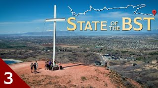
SaveMapleton sits at the base of Spanish Fork Peak (or is it Maple Mountain), with trails in town, in the foothills, and in the mountains to the east.
Region Supporters & Maintainers
![]()
Utah Valley Trails AllianceSponsor![Mapleton City, Utah]()
Mapleton City, UtahMaintainer
Activities Click to view
- Mountain Bike
21 trails
- E-Bike
8 trails
- Gravel Bike
0 trails
- Adaptive Bike
0 trails
- Horse
13 trails
- Hike
24 trails
- Trail Running
23 trails
- Dirtbike/Moto
7 trails
- Snowshoe
6 trails
Region Details
- 2
- 1
- 4
- 8
- 6
Region Status
Caution as of Jul 23, 2026Hike Stats
- Avg Trail Rating
- Global Ranking
- #1,671
- State Ranking
- #744
- Trails (view details)
- 24
- Trails Mountain Bike
- 21
- Trails E-Bike
- 8
- Trails Horse
- 13
- Trails Hike
- 24
- Trails Trail Running
- 23
- Trails Dirtbike/Moto
- 7
- Trails ATV/ORV/OHV
- 3
- Trails Snowshoe
- 6
- Total Distance
- 35 miles
- Total Descent Distance
- 8 miles
- Total Descent
- 2,707 ft
- Total Vertical
- 5,374 ft
- Reports
- 167
- Photos
- 8
- Completed Counter
- 178
Popular Mapleton Hiking Trails
• 95 ★ 4.5 • 5 miles • 4,611 ft • 62 •
Much of the trails length is shaded by beautiful Box Elder, Douglas Fir, and Aspen. It becomes more open at the upper elevations, until it crosses beautiful wilde meadows near Lake, with small groves of Apsen and Subalpine Fir...
• 100 ★ 4.3 • 1 mile • 418 ft • 31 •
Fun up and down winding short little trail. Great for a quick after work ride. A few tough but doable climbs. Really fun downhill. Popular with horse riders because the lower trailhead has trailer parking but the upper one at Whiting...
• 85 ★ 4.3 • 2,431 ft • 14 ft • 29 •
Easy trail alongside Whiting Campground. For bikers, moderate uphills and the downhill can be be slow and easy or can be difficult with some high speeds
• 90 ★ 4.2 • 4 miles • 2,474 ft • 29 •
This trail follows an old dirt road, and is open to many uses. Most of it is a gradual slope, until the climb at the end onto the ridge. For bikers, this trail has everything: medium-distance swoopy sections, interminable lengths of...
• 80 ★ 4.0 • 2 miles • 1,866 ft • 13 •
Beautiful but steep, this north-facing canyon has waterfalls, root-filled fir forests, loamy soil, aspens, and 6-foot tall ferns. While the trail is not on official USFS inventory, it's clearly been in use for decades. Because it's so...
• 75 ★ 3.0 • 2 miles • 704 ft • 6 •
Branches off from main and heads to the ridge. Motorcycles are not allowed, so it can get overgrown a bit. Some smooth sections and some great views.
• ★ 0.0 • 2,379 ft • 186 ft • 4 • • mtb
Two way direction trail in the shade and the better climbing alternative versus the climb
• 70 ★ 0.0 • 2 miles • 840 ft • 3 •
Follows a ridge out to a point overlooking Hobble Creek Canyon
Mapleton Routes
3 miles • 551 ft • 4 •
3 miles • 966 ft • 2 •
11 miles • 4,603 ft • 0 •
• 8 miles • 4,572 ft • 2 •
• 2 miles • 267 ft • 0 •
• 3 miles • 1,138 ft • 2 •
Photos of Mapleton
Videos of Mapleton
21:40 |
137 |
Sep 6, 2021 , Mapleton

21:40 |
282 |
Sep 6, 2021 , Mapleton

21:40 |
186 |
Sep 6, 2021 , Mapleton

trail: Broken BST
21:40 |
197 |
Sep 6, 2021 , Mapleton

trail: Maple Canyon Trail
4:16 |
141 |
Nov 25, 2019

trail: Maple Canyon Left Fork Trail
2:02 |
246 |
Nov 25, 2019

trail: Maple Canyon Trail
0:43 |
74 |
Nov 25, 2019

trail: Maple Canyon Trail
8:16 |
317 |
Sep 3, 2020 , Mapleton
Recent Trail Reports
| status | trail | date | condition | info | user |
|---|---|---|---|---|---|
| Dibbles Canyon | Apr 25, 2026 @ 1:00pm (America/Denver) Apr 25, 2026 | Ideal | PrestoJ440 | ||
| Maple Canyon Trail | Apr 18, 2026 @ 1:06pm (America/Boise) Apr 18, 2026 | Variable | Mapinguari | ||
| Maple Canyon Left Fork Trail | Apr 18, 2026 @ 1:06pm (America/Boise) Apr 18, 2026 | Variable | Mapinguari | ||
| Maple Canyon Trail | Apr 18, 2026 @ 1:06pm (America/Boise) Apr 18, 2026 | Variable | Mapinguari | ||
| Maple Hills | Nov 12, 2025 @ 6:20pm (America/Denver) Nov 12, 2025 | Very Dry | mattsflyfishing FOSO | ||
| Right Fork Maple Canyon | Jun 26, 2025 @ 7:57am Jun 26, 2025 | Snow Cover Partial | Alexdthomps | ||
| Mapleton Lateral Canal Trail | Mar 30, 2025 @ 4:05am Mar 30, 2025 | Variable | Rail | ||
| Little Diamond | Aug 28, 2024 @ 8:32pm Aug 28, 2024 | Very Dry | Adammcknight | ||
| Bonneville Shoreline Trail: Mapleton Central | Aug 14, 2024 @ 4:53pm Aug 14, 2024 | Dry | Mapinguari | ||
| Upper Right Fork Hobble Creek | Aug 1, 2023 @ 4:10pm Aug 1, 2023 | Dry | jed-campbell |
National Scenic Trails & Official Routes
-
Bonneville Shoreline Trail
- Mountain Bike
- E-Bike
- Horse
- Hike
- Trail Running
- Snowshoe
- Nordic Ski

Activity Feed
| username | action | type | title | date |
|---|---|---|---|---|
| ksargent99runner | add | photo | activity #100313315 | Jul 29, 2026 @ 6:41pm Jul 29, 2026 |
| tremadsen | ridden | trail | activity #99910659 and 3 more | Jul 24, 2026 @ 12:29pm Jul 24, 2026 |
| MedstudentOutside | wishlist | trail | activity #99466817 and 3 more | Jul 18, 2026 @ 11:03am Jul 18, 2026 |
| shawner79 | ridden | trail | activity #98988668 | Jul 11, 2026 @ 8:16pm Jul 11, 2026 |
| mattsflyfishing | add | trail | activity #98616618 and 1 more | Jul 6, 2026 @ 8:26pm Jul 6, 2026 |
Recent Comments
| username | type | title | comment | date |
|---|---|---|---|---|
| trail | Closed for 2024 season | Jul 6, 2024 @ 6:08am Jul 6, 2024 | ||
| trail | Closed for construction | May 28, 2024 @ 10:19am May 28, 2024 | ||
| trail | July 2023 : super overgrown, hard to see the... | Jul 23, 2023 @ 10:54am Jul 23, 2023 | ||
| trail | Closed by dirt road due to cattle fence | Sep 7, 2022 @ 9:04pm Sep 7, 2022 | ||
| trail | Rode this trail on a bike from the top down.... | Jul 15, 2022 @ 9:49pm Jul 15, 2022 |
Local Badges
-

Epic Hike 50k0 awarded -

Hiking 100k Badge0 awarded -

Epic Hike Climb 2k2 awarded -

Climbing 10k Badge2 awarded -

Big Hike 10k97 awarded
Activity Type Stats
| activitytype | trails | distance | descent | descent distance | total vertical | rating | global rank | state rank | photos | reports | routes | activity logs |
|---|---|---|---|---|---|---|---|---|---|---|---|---|
| Mountain Bike | 21 | 34 miles | 2,703 ft | 8 miles | 5,374 ft | #5,389 | #1,810 | 65 | 202 | 4 | 4,730 | |
| E-Bike | 8 | 20 miles | 551 ft | 4 miles | 3,369 ft | #5,251 | #1,629 | 182 | 244 | |||
| Horse | 13 | 20 miles | 2,365 ft | 4 miles | 3,615 ft | #1,748 | #988 | 26 | 1 | |||
| Hike | 24 | 35 miles | 2,707 ft | 8 miles | 5,374 ft | #1,671 | #744 | 8 | 167 | 3 | 606 | |
| Trail Running | 23 | 35 miles | 2,703 ft | 8 miles | 5,374 ft | #4,951 | #1,542 | 1 | 169 | 3 | 697 | |
| Dirtbike/Moto | 7 | 15 miles | 1,621 ft | 4 miles | 3,205 ft | #1,010 | #378 | 4 | 20 | 24 | ||
| ATV/ORV/OHV | 3 | 4 miles | 331 ft | 2 miles | 331 ft | 14 | 3 | |||||
| Snowshoe | 6 | 9 miles | 463 ft | 2 miles | 3,064 ft | #1,163 | #610 | 4 | 3 | 20 |
Frequently Asked Questions About Mapleton
▼
What are the highest rated hiking trails in Mapleton?
The highest rated hiking trails in Mapleton are:
- Maple Canyon Left Fork Trail (3.8/5)
- Bonneville Shoreline Trail: Mapleton Central (3.8/5)
- Crowd Canyon (3.7/5)
- Bonneville Shoreline Trail: Mapleton South (3.7/5)
- Mapleton BST-Spanish Fork Canyon Connector (3.3/5)
▼
What is the best time of the year to hike in Mapleton?
Based on activity log data, the most popular months to hike in Mapleton are:
- December (8 activities)
- June (6 activities)
- October (6 activities)
▼
Where can I park to hike in Mapleton?
There are 3 parking locations listed in Mapleton. The most popular parking spots are: View all parking and trailhead locations on the map to plan your visit.
▼
What is the longest trail in Mapleton?
The longest trail in Mapleton is Mapleton Lateral Canal Trail at 6.1 miles. View all trails sorted by distance.
Activities
Trails
- By JpWalker
 & contributors
 - Admins: jkwilliamz, UtahJohn, jpmcghee, jasonmalczyk, URMB, UVTA
- #16586 - 6,511 views
- mapleton activity log | embed map of Mapleton mountain bike trails | mapleton mountain biking points of interest
Downloading of trail gps tracks in kml & gpx formats is enabled for Mapleton.
You must login to download files.