
close
-
Layers w
- Weather Layers
- Pro
- Pro
- Pro
- Pro
- Pro
- Pro
- More Layers
- Pro
- Pro
- Pro
- Pro
-
Upgrade to

3D
Trail Conditions
- Unknown
- Snow Groomed
- Snow Packed
- Snow Covered
- Snow Cover Partial
- Freeze/thaw Cycle
- Icy
- Prevalent Mud
- Wet
- Variable
- Ideal
- Dry
- Very Dry
Trail Flow (Ridden Direction)
Trailforks scans users activity logs to determine the most popular direction each trail is ridden. A good flowing trail network will have most trails flowing in a single direction according to their intension.
The colour categories are based on what percentage of users are riding a trail in its intended direction.
The colour categories are based on what percentage of users are riding a trail in its intended direction.
- > 96%
- > 90%
- > 80%
- > 70%
- > 50%
- < 50%
- bi-directional trail
- no data
Trail Last Ridden
Trailforks scans activity logs to determine the last time a trail was ridden.
- < 2 days
- < 1 week
- < 2 weeks
- < 1 month
- < 6 months
- > 6 months
Trail Ridden Direction
The intended direction a trail should be ridden.
- Downhill Only
- Downhill Primary
- Both Directions
- Uphill Primary
- Uphill Only
- One Direction
Contribute Details
Colors indicate trail is missing specified detail.
- Description
- Photos
- Description & Photos
- Videos
Trail Popularity ?
Trailforks scans activity logs to determine which trails are ridden the most in the last 9 months.
Trails are compared with nearby trails in the same city region with a possible 25 colour shades.
Think of this as a heatmap, more activities = more kinetic energy = warmer colors.
- most popular
- popular
- less popular
- not popular
ATV/ORV/OHV Filter
Max Vehicle Width
inches
US Cell Coverage
Legend

Radar Time
Activity Recordings
Trailforks uses anonymized public activity data.
?
Activity Recordings
Trailforks uses anonymized public activity data.
?
Personal Heatmap
▶
Activity Types
all
/
none
▶
Options
2
Date range
month
–
Winter Trails
Warning
A routing network for winter maps does not exist. Selecting trails using the winter trails layer has been disabled.
Missing Trails
Most Popular
Least Popular
Trails are colored based on popularity. The more popular a trail is, the more red. Less popular trails trend towards green.
Jump Magnitude Heatmap
Heatmap of where users jump on trails. Zoom in to see individual jumps, click circles to view jump details.
BC Backroad Status
![map legend]()
Service Road Atlas is a free to use, community-driven service for viewing and creating reports on the numerous back-country service roads around B.C. and Alberta.

Slope Aspect
Direction the slope faces
Trails Deemphasized
Trails are shown in grey.
Only show trails with no bike usage.
Suggested Layers
Based on selected activity type
Save the current map location and zoom level as your default home location whenever this page is loaded.
Save
No description for Maria has been added yet!
Login or register to submit one.
Activities Click to view
- Mountain Bike
32 trails
- E-Bike
18 trails
- Hike
7 trails
- Trail Running
7 trails
Region Details
- 2
- 3
- 7
- 7
- 5
Region Status
Open as of Jul 10, 2023

Stats
- Avg Trail Rating
- Trails (view details)
- 24
- Trails Mountain Bike
- 32
- Trails E-Bike
- 18
- Trails Hike
- 7
- Trails Trail Running
- 7
- Trails ATV/ORV/OHV
- 1
- Trails Snowshoe
- 1
- Total Distance
- 8 miles
- Total Descent Distance
- 4 miles
- Total Descent
- 1,715 ft
- Total Vertical
- 418 ft
- Highest Trailhead
- 501 ft
- Reports
- 18
- Photos
- 18
- Completed Counter
- 724
Popular Maria Mountain Biking Trails
• 70 ★ 4.0 • 4,905 ft • 83 ft • 48 •
Nouveau tracé des menant au secteur vélo de Maria, Parc régional du Mont Saint-Joseph
• 100 ★ 5.0 • 906 ft • 0 ft • 41 •
La nouvelle permet de mettre à profit le over-under. C'est une courte descente rapide qui se boucle très bien avec la nouvelle montée .
• 85 ★ 5.0 • 2,267 ft • 177 ft • 40 •
La montée Plein mon casque a été modifiée pour faciliter la grimpe. Elle présente désormais un nouveau départ et une nouveau serpentin adouci tout juste avant d'arrivée au refuge. C'est la voie d'accès principale aux sentiers...
• 65 ★ 5.0 • 1,010 ft • 101 ft • 34 •
Nouvelle montée et ligne de sauts pendant la descente.
• 90 ★ 0.0 • 2,710 ft • 71 ft • 32 •
La Tricoté serré est une piste idéale pour apprendre les bases de conduite. C'est une petite boucle agréable de type "flow trail" qui enchaine mini burms, mini "table top" et mini sauts. De quoi plaire aux familles.
• 100 ★ 0.0 • 915 ft • 112 ft • 28 •
La "Pas de Zigonage" est la nouvelle version du sentier La "Zigonage". Elle propose désormais une ligne revisitée qui permet de conserver sa vitesse. Elle enchaine de petits accotoirs et quelques sauts de pierre imposants, d'où son...
Photos of Maria Mountain Bike
Videos of Maria Mountain Bike
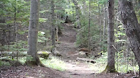
trail: La Swing la Bacaisse
0:06 |
143 |
Aug 3, 2020
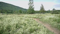
trail: Les flots
0:04 |
113 |
Aug 3, 2020
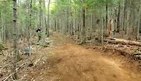
trail: Pompe Patate
0:11 |
93 |
Aug 3, 2020
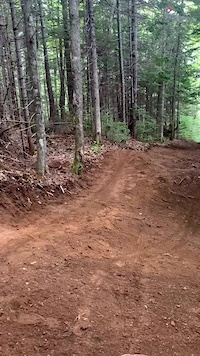
trail: Pompe Patate
0:09 |
69 |
Aug 3, 2020
Recent Trail Reports
| status | trail | date | condition | info | user |
|---|---|---|---|---|---|
| La"Dret comme un Picket" | Jul 10, 2023 @ 5:33am Jul 10, 2023 | Ideal | crouleau514 | ||
| La Stépine | Jul 10, 2023 @ 5:33am Jul 10, 2023 | Ideal | crouleau514 | ||
| La "Pas de Zigonage" | Jul 10, 2023 @ 5:33am Jul 10, 2023 | Ideal | crouleau514 | ||
| La À Planche | Jul 10, 2023 @ 5:33am Jul 10, 2023 | Ideal | crouleau514 | ||
| La À Pine | Jul 10, 2023 @ 5:33am Jul 10, 2023 | Unknown | crouleau514 | ||
| Les flots | May 13, 2021 @ 8:41am May 13, 2021 | Ideal | Whyti | ||
| La Swing la Bacaisse | Aug 5, 2020 @ 7:53am Aug 5, 2020 | Variable | anthoaudet | ||
| Portes du paradis | Aug 5, 2020 @ 7:53am Aug 5, 2020 | Ideal | anthoaudet | ||
| Pompe Patate | Aug 6, 2020 @ 5:40am Aug 6, 2020 | Ideal | ArnoMercier |
Activity Feed
| username | action | type | title | date |
|---|---|---|---|---|
| padipad | ridden | trail | activity #98044661 | Jun 28, 2026 @ 9:55pm Jun 28, 2026 |
| Pluck28 | wishlist | region | activity #95456338 | May 24, 2026 @ 5:06pm May 24, 2026 |
| Jjknapp | wishlist | region | activity #81834514 | Oct 6, 2025 @ 11:33am Oct 6, 2025 |
| Dominic3XWOwD | ridden | trail | activity #80678660 | Sep 19, 2025 @ 11:42am Sep 19, 2025 |
| boppca | ridden | trail | activity #71977901 | May 19, 2025 @ 7:46am May 19, 2025 |
Local Badges
-

Epic Mountain Bike Climb 2k0 awarded -

Climbing 10k Badge1 awarded -

Mountain Biking 100k Badge0 awarded -

Epic Ride Descent 2k0 awarded -

Descent 10k Badge1 awarded -

Descent 100k Badge0 awarded

Activity Type Stats
| activitytype | trails | distance | descent | descent distance | total vertical | rating | global rank | state rank | photos | reports | routes | activity logs |
|---|---|---|---|---|---|---|---|---|---|---|---|---|
| Mountain Bike | 32 | 8 miles | 1,716 ft | 4 miles | 417 ft | #5,119 | #75 | 18 | 18 | 896 | ||
| E-Bike | 18 | 4 miles | 938 ft | 2 miles | 417 ft | #7,552 | #84 | 15 | 20 | |||
| Hike | 7 | 2 miles | 463 ft | 5,098 ft | 404 ft | #13,385 | #160 | 18 | 41 | |||
| Trail Running | 7 | 2 miles | 463 ft | 5,098 ft | 404 ft | #12,740 | #145 | 18 | 169 | |||
| ATV/ORV/OHV | 1 | 1 mile | 56 ft | 814 ft | 289 ft | 1 | ||||||
| Snowshoe | 1 | 2,178 ft | 171 ft | 1,266 ft | 174 ft |
Frequently Asked Questions About Maria
▼
What are the highest rated mountain biking trails in Maria?
The highest rated mountain biking trails in Maria are:
- Plein l'casque (4.1/5)
- Pompe Patate (4.1/5)
- La Swing la Bacaisse (4.1/5)
- Les flots (4/5)
- Portes du paradis (4/5)
▼
What is the best time of the year to ride in Maria?
Based on activity log data, the most popular months to ride in Maria are:
- July (19 activities)
- August (17 activities)
- September (14 activities)
▼
Where can I park to ride in Maria?
▼
What is the longest trail in Maria?
The longest trail in Maria is Portes du paradis at 1.5 km. View all trails sorted by distance.
Activities
Trails
Points of Interest
- By StephaneMarceau
 TRAILFORKS & contributors
 - Admins: apply
- #20147 - 6,158 views
- maria activity log | embed map of Maria mountain bike trails | maria mountain biking points of interest
Downloading of trail gps tracks in kml & gpx formats is enabled for Maria.
You must login to download files.