close
-
Layers w
- Weather Layers
- Pro
- Pro
- Pro
- Pro
- Pro
- Pro
- More Layers
- Pro
- Pro
- Pro
- Pro
-
Upgrade to

3D
Trail Conditions
- Unknown
- Snow Groomed
- Snow Packed
- Snow Covered
- Snow Cover Partial
- Freeze/thaw Cycle
- Icy
- Prevalent Mud
- Wet
- Variable
- Ideal
- Dry
- Very Dry
Trail Flow (Ridden Direction)
Trailforks scans users ridelogs to determine the most popular direction each trail is ridden. A good flowing trail network will have most trails flowing in a single direction according to their intension.
The colour categories are based on what percentage of riders are riding a trail in its intended direction.
The colour categories are based on what percentage of riders are riding a trail in its intended direction.
- > 96%
- > 90%
- > 80%
- > 70%
- > 50%
- < 50%
- bi-directional trail
- no data
Trail Last Ridden
Trailforks scans ridelogs to determine the last time a trail was ridden.
- < 2 days
- < 1 week
- < 2 weeks
- < 1 month
- < 6 months
- > 6 months
Trail Ridden Direction
The intended direction a trail should be ridden.
- Downhill Only
- Downhill Primary
- Both Directions
- Uphill Primary
- Uphill Only
- One Direction
Contribute Details
Colors indicate trail is missing specified detail.
- Description
- Photos
- Description & Photos
- Videos
Trail Popularity ?
Trailforks scans ridelogs to determine which trails are ridden the most in the last 9 months.
Trails are compared with nearby trails in the same city region with a possible 25 colour shades.
Think of this as a heatmap, more rides = more kinetic energy = warmer colors.
- most popular
- popular
- less popular
- not popular
ATV/ORV/OHV Filter
Max Vehicle Width
inches
US Cell Coverage
Legend

Radar Time
Activity Recordings
Trailforks uses anonymized public activity data.
?
Activity Recordings
Trailforks uses anonymized public activity data.
?
Personal Heatmap
▶
Activity Types
all
/
none
▶
Options
2
Date range
month
–
Winter Trails
Warning
A routing network for winter maps does not exist. Selecting trails using the winter trails layer has been disabled.
Missing Trails
Most Popular
Least Popular
Trails are colored based on popularity. The more popular a trail is, the more red. Less popular trails trend towards green.
Jump Magnitude Heatmap
Heatmap of where riders jump on trails. Zoom in to see individual jumps, click circles to view jump details.
BC Backroad Status
![map legend]()
Service Road Atlas is a free to use, community-driven service for viewing and creating reports on the numerous back-country service roads around B.C. and Alberta.

Slope Aspect
Direction the slope faces
Trails Deemphasized
Trails are shown in grey.
Only show trails with no bike usage.
Suggested Layers
Based on selected activity type
Save the current map location and zoom level as your default home location whenever this page is loaded.
Save
No description for Marshall has been added yet!
Login or register to submit one.
Activities Click to view
- Mountain Bike
12 trails
- Winter Fat Bike
0 trails
- Hike
13 trails
- Trail Running
9 trails
Region Details
- 8
- 4
Region Status
Open as of Aug 27, 2025Stats
- Avg Trail Rating
- Trails (view details)
- 13
- Trails Mountain Bike
- 12
- Trails E-Bike
- 1
- Trails Hike
- 13
- Trails Trail Running
- 9
- Total Distance
- 17 miles
- Total Descent Distance
- 5 miles
- Total Descent
- 1,274 ft
- Total Vertical
- 123 ft
- Highest Trailhead
- 647 ft
- Reports
- 227
- Photos
- 44
- Ridden Counter
- 591
Sub Regions
-
Fay Pickering Memorial Trails @ Mill Creek Park
- 4
- 3
-
Martinsville Ridgelawn Biking and Hiking Trails
- 1
- 1
Popular Marshall Mountain Biking Trails
• 60 ★ 5.0 • 3 miles • 335 ft • 104 •
is an intermediate trail that winds through old growth forests alongside Mill Creek Lake. Sections of this re bench cut into the sides of steep hills that provide amazing views of the lake...along with some fantastic riding. The loop...
• 100 ★ 4.5 • 1,627 ft • 0 ft • 96 •
This is a gravel trail across a dam, connecting the main trailhead and parking with the Loop.
• 65 ★ 4.7 • 3 miles • 335 ft • 95 •
ranges anywhere from easy to difficult depending how it is ridden. There are a couple of long and steep climbs (for Illinois) on the southeast side of this loop. If this trail is ridden as an out and back to these climbs, then this...
• 75 ★ 5.0 • 2 miles • 164 ft • 82 •
From , follows along the contours of many lake inlets and ravines and offers gorgeous views of Mill Creek Lake. Just under a mile from its beginning, takes riders along some switchbacks and down to lake level. Riders climb out, and...
• 95 ★ 5.0 • 2 miles • 140 ft • 74 •
Follow the cut grass north from the parking area to the beginning of the trailhead. The bi-directional loop winds along gullies and the shores of Mill Creek Lake for 2.5 miles and has occasional rocks and roots, but generally flows....
• 80 ★ 4.8 • 4,970 ft • 72 ft • 71 •
is a short one mile loop that really represents what the rest of the trail system has to offer. There are some short yet challenging climbs, along with a few technical switchbacks on the south edge of this trail.
• 50 ★ 5.0 • 213 ft • 0 ft • 22 •
Moderately popular green difficulty singletrack. This multi-use trail can be used both directions and has a easy overall physical rating with a 0 ft green climb. Trail visibility is always easy to follow. On average it takes 2 minutes to complete this trail.
• 90 ★ 4.0 • 4 miles • 117 ft • 11 •
Martinsville Ridgelawn biking trail is a beginner/ intermediate single track biking and hiking trail approximately 4 miles in length located on the east edge of Martinsville. Trail will be open to the public for use for biking and...
Marshall Mountain Bike Routes
★ 5.0 • 12 miles • 647 ft • 6 • Loop •
The Fay Pickering Memorial Trails consist of four loops that wind through old growth forests alongside...
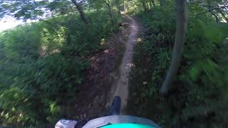
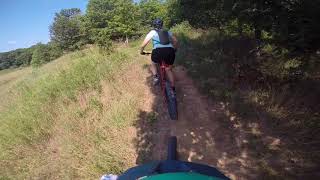
Photos of Marshall Mountain Bike
Recent Trail Reports
| status | trail | date | condition | info | user |
|---|---|---|---|---|---|
| Trail A | Aug 27, 2025 @ 11:37am Aug 27, 2025 | Ideal | nhartigan | ||
| Trail D | Aug 27, 2025 @ 11:37am Aug 27, 2025 | Ideal | nhartigan | ||
| AA (Easy A) | Mar 22, 2024 @ 2:48am Mar 22, 2024 | Ideal | tjtingley | ||
| Martinsville Ridgelawn Biking and Hiking Trails | Sep 26, 2022 @ 1:36pm Sep 26, 2022 | Ideal | EricWilsonF6s | ||
| Trail B | Sep 24, 2022 @ 1:13pm Sep 24, 2022 | Ideal | leckey | ||
| Trail C | Sep 24, 2022 @ 1:13pm Sep 24, 2022 | Ideal | leckey | ||
| Trail B Connector | Sep 24, 2022 @ 1:13pm Sep 24, 2022 | Ideal | leckey | ||
| Far Away | Oct 19, 2020 @ 1:34am Oct 19, 2020 | Variable | hpman83 TRAILFORKS | ||
| DH Bois du four | Aug 3, 2018 @ 11:27pm Aug 3, 2018 | Dry | rvince81 | ||
| Fire Road Connector | Jun 8, 2016 @ 9:42am Jun 8, 2016 | Very Dry | socalstokie |
Activity Feed
| username | action | type | title | date |
|---|---|---|---|---|
| Brentn1x8cW | ridden | trail | activity #81338457 and 4 more | Sep 28, 2025 @ 7:36pm Sep 28, 2025 |
| nhartigan | add | report | activity #79088514 and 1 more | Aug 27, 2025 @ 6:24pm Aug 27, 2025 |
| chemgirl | wishlist | route | activity #75498577 | Jul 8, 2025 @ 7:14pm Jul 8, 2025 |
| chemgirl | wishlist | route | activity #74079117 | Jun 18, 2025 @ 7:35pm Jun 18, 2025 |
| marcw121 | wishlist | region | activity #64153444 | Jan 5, 2025 @ 4:37pm Jan 5, 2025 |
Recent Comments
| username | type | title | comment | date |
|---|---|---|---|---|
| report | Thank you Ben (and Chief Stick Officer) | Jun 26, 2020 @ 4:52pm Jun 26, 2020 | ||
| report | Hand saw should do the trick | Jun 26, 2020 @ 2:15pm Jun 26, 2020 | ||
| report | Fenceline section is covered in water | Mar 23, 2019 @ 5:44am Mar 23, 2019 |
Local Badges
-

Epic Mountain Bike Climb 2k0 awarded -

Climbing 10k Badge0 awarded -

Mountain Biking 100k Badge0 awarded -

Big Ride 30k22 awarded -

Epic Ride 50k8 awarded -

Epic Ride Descent 2k0 awarded
Activity Type Stats
| activitytype | trails | distance | descent | descent distance | total vertical | rating | global rank | state rank | photos | reports | routes | ridelogs |
|---|---|---|---|---|---|---|---|---|---|---|---|---|
| Mountain Bike | 12 | 17 miles | 1,257 ft | 5 miles | 125 ft | #4,853 | #1,636 | 41 | 227 | 1 | 822 | |
| E-Bike | 1 | 4 miles | 118 ft | 1 mile | 26 ft | 193 | 6 | |||||
| Hike | 13 | 17 miles | 1,273 ft | 5 miles | 125 ft | #9,271 | #3,263 | 3 | 227 | 31 | ||
| Trail Running | 9 | 15 miles | 1,138 ft | 4 miles | 89 ft | #9,877 | #3,374 | 227 | 21 |
Frequently Asked Questions About Marshall
▼
What are the best places to ride in Marshall?
Marshall has 3 areas to explore for mountain biking. The top rated areas are:
▼
What are the highest rated mountain biking trails in Marshall?
The highest rated mountain biking trails in Marshall are:
- Trail C (4.3/5)
- Trail A (4.3/5)
- Trail D (4.2/5)
- AA (Easy A) (4.2/5)
- Trail B (4.2/5)
▼
What is the best time of the year to ride in Marshall?
Based on ride log data, the most popular months to ride in Marshall are:
- August (19 activities)
- September (12 activities)
- October (10 activities)
▼
Where can I park to ride in Marshall?
There are 3 parking locations listed in Marshall. The most popular parking spots are: View all parking and trailhead locations on the map to plan your visit.
Trails
Points of Interest
- By WimG
 FOGBP & contributors
 - Admins: apply
- #12317 - 1,919 views
- marshall activity log | embed map of Marshall mountain bike trails | marshall mountain biking points of interest
Downloading of trail gps tracks in kml & gpx formats is enabled for Marshall.
You must login to download files.