close
-
Layers w
- Weather Layers
- Pro
- Pro
- Pro
- Pro
- Pro
- Pro
- More Layers
- Pro
- Pro
- Pro
- Pro
-
Upgrade to

3D
Trail Conditions
- Unknown
- Snow Groomed
- Snow Packed
- Snow Covered
- Snow Cover Partial
- Freeze/thaw Cycle
- Icy
- Prevalent Mud
- Wet
- Variable
- Ideal
- Dry
- Very Dry
Trail Flow (Ridden Direction)
Trailforks scans users ridelogs to determine the most popular direction each trail is ridden. A good flowing trail network will have most trails flowing in a single direction according to their intension.
The colour categories are based on what percentage of riders are riding a trail in its intended direction.
The colour categories are based on what percentage of riders are riding a trail in its intended direction.
- > 96%
- > 90%
- > 80%
- > 70%
- > 50%
- < 50%
- bi-directional trail
- no data
Trail Last Ridden
Trailforks scans ridelogs to determine the last time a trail was ridden.
- < 2 days
- < 1 week
- < 2 weeks
- < 1 month
- < 6 months
- > 6 months
Trail Ridden Direction
The intended direction a trail should be ridden.
- Downhill Only
- Downhill Primary
- Both Directions
- Uphill Primary
- Uphill Only
- One Direction
Contribute Details
Colors indicate trail is missing specified detail.
- Description
- Photos
- Description & Photos
- Videos
Trail Popularity ?
Trailforks scans ridelogs to determine which trails are ridden the most in the last 9 months.
Trails are compared with nearby trails in the same city region with a possible 25 colour shades.
Think of this as a heatmap, more rides = more kinetic energy = warmer colors.
- most popular
- popular
- less popular
- not popular
ATV/ORV/OHV Filter
Max Vehicle Width
inches
US Cell Coverage
Legend

Radar Time
Activity Recordings
Trailforks uses anonymized public activity data.
?
Activity Recordings
Trailforks uses anonymized public activity data.
?
Personal Heatmap
▶
Activity Types
all
/
none
▶
Options
2
Date range
month
–
Winter Trails
Warning
A routing network for winter maps does not exist. Selecting trails using the winter trails layer has been disabled.
Missing Trails
Most Popular
Least Popular
Trails are colored based on popularity. The more popular a trail is, the more red. Less popular trails trend towards green.
Jump Magnitude Heatmap
Heatmap of where riders jump on trails. Zoom in to see individual jumps, click circles to view jump details.
BC Backroad Status
![map legend]()
Service Road Atlas is a free to use, community-driven service for viewing and creating reports on the numerous back-country service roads around B.C. and Alberta.

Slope Aspect
Direction the slope faces
Trails Deemphasized
Trails are shown in grey.
Only show trails with no bike usage.
Suggested Layers
Based on selected activity type
Save the current map location and zoom level as your default home location whenever this page is loaded.
Save
No description for Mataró has been added yet!
Login or register to submit one.
This region uses the Uk/Euro style trail grading system.
Activities Click to view
- Mountain Bike
244 trails
- E-Bike
238 trails
- Adaptive Bike
13 trails
- Hike
187 trails
- Trail Running
184 trails
- Dirtbike/Moto
9 trails
Region Details
- 77
- 51
- 77
- 18
- 7
Region Status
Open as of Jun 9, 2026Stats
- Avg Trail Rating
- Trails (view details)
- 230
- Trails Mountain Bike
- 244
- Trails E-Bike
- 238
- Trails Adaptive Bike
- 13
- Trails Horse
- 3
- Trails Hike
- 187
- Trails Trail Running
- 184
- Trails Dirtbike/Moto
- 9
- Total Distance
- 119 miles
- Total Descent
- 34,641 ft
- Total Vertical
- 1,965 ft
- Highest Trailhead
- 2,093 ft
- Reports
- 1,204
- Photos
- 58
- Ridden Counter
- 16,669
Sub Regions
-
Argentona
- 24
- 37
- 5
- 5
-
Vilassar-Premià de Dalt
- 5
- 8
- 6
Popular Mataró Mountain Biking Trails
• 95 ★ 4.4 • 4,229 ft • 7 ft • 280 •
Dels millors corriols de flow de la zona, la part de dalt són tot curves amb força peraltes ràpids. La part de baix és més plana i ressegueix la part d'una petita riera amb alguns arbres que es poden passar bé. Hi ha un gran arbre...
• 95 ★ 3.0 • 456 ft • 21 ft • 276 •
Acceso cortito y un poco técnico desde la carretera del Coll de Parpers a la de la Plana de l’Espiral
• 85 ★ 4.6 • 3,714 ft • 10 ft • 238 •
Sendero sin mayor dificultad, curvas peraltadas, saltos que puedes no hacer si quieres, toboganes. Rápida y divertida.
• 80 ★ 3.0 • 692 ft • 108 ft • 229 •
Narrow singletrack. It's possible to ride in both directions.
• 85 ★ 5.0 • 1 mile • 148 ft • 223 •
Popular blue difficulty singletrack. This multi-use trail can be used downhill primary. It features berm. On average it takes 8 minutes to complete this trail.
• 100 ★ 5.0 • 4,160 ft • 0 ft • 204 •
Corriol molt ràpid amb un nivell moderat o la dificultat la poses tu amb la velocitat que agafis. Bona feina la gent de Mataró amb el Mini-BikePark que han fet.
• 80 ★ 4.0 • 4,915 ft • 82 ft • 188 •
Popular green difficulty singletrack. This multi-use trail can be used both directions. On average it takes 5 minutes to complete this trail.
• 90 ★ 4.2 • 3,350 ft • 3 ft • 158 •
Popular blue difficulty singletrack. This multi-use trail can be used downhill only. It features berm. Trail visibility is always easy to follow. On average it takes 4 minutes to complete this trail.
Mataró Mountain Bike Routes
★ 5.0 • 14 miles • 4,094 ft • 25 • Loop •
Ruta amb les baixades més populars de la zona de Mataró. Ninguna té una dificultat excessiva exceptuant...
12 miles • 2,809 ft • 7 • Loop •
Desde Cabrils hasta Sant Mateu, de alli Jumaji, Gastronomia, Hotel y
15 miles • 3,943 ft • 17 • Loop •
Ruta endurera espaectacular cerca de Mataró encadenando las mejores trialeras (azules) de la zona.
20 miles • 3,043 ft • 4 •
Ruta que sale de Vilassar de Mar para bajar dos trialeras de Alella
Photos of Mataró Mountain Bike
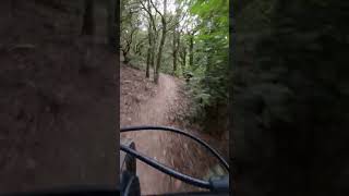
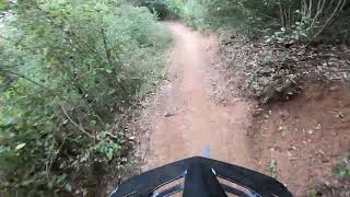
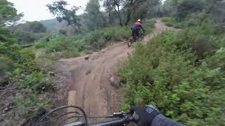
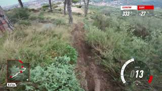
Videos of Mataró Mountain Bike
0:49 |
|
May 28, 2024
trail: La Poma Podrida
5:32 |
370 |
Mar 19, 2023
trail: Hola Ke Ase
2:42 |
10 |
Apr 28, 2026 , Mataró
trail: Mataró A
2:19 |
52 |
Apr 28, 2026 , Mataró
trail: Les Sabates
3:02 |
53 |
Apr 28, 2026 , Mataró
trail: La Nord
3:32 |
110 |
Apr 12, 2026 , Mataró
trail: Mango Loco
2:19 |
282 |
Apr 30, 2025 , Mataró
trail: Barbuts
4:28 |
135 |
Apr 28, 2025 , Mataró
Recent Trail Reports
| status | trail | date | condition | info | user |
|---|---|---|---|---|---|
| La Birra | Jun 9, 2026 @ 5:03pm (Europe/Andorra) Jun 9, 2026 | Very Dry | CarlesRocabikes | ||
| Pixats 2.0 | Jun 9, 2026 @ 5:03pm (Europe/Andorra) Jun 9, 2026 | Very Dry | CarlesRocabikes | ||
| Pixats 1.0 | Jun 9, 2026 @ 5:03pm (Europe/Andorra) Jun 9, 2026 | Very Dry | CarlesRocabikes | ||
| La Nord | Jun 9, 2026 @ 5:03pm (Europe/Andorra) Jun 9, 2026 | Dry | CarlesRocabikes | ||
| Superglu | Jun 9, 2026 @ 5:03pm (Europe/Andorra) Jun 9, 2026 | Very Dry | CarlesRocabikes | ||
| Riudemeia | May 29, 2026 @ 1:49pm (Europe/Madrid) May 29, 2026 | Dry | Pecon | ||
| El Cid | May 14, 2026 @ 5:07pm (Europe/Andorra) May 14, 2026 | Ideal | CarlesRocabikes | ||
| Antic Camí del Tramvia | May 8, 2026 @ 2:53pm (Europe/Madrid) May 8, 2026 | Dry | Pecon | ||
| Calimero | May 6, 2026 @ 8:54am (Europe/Madrid) May 5, 2026 | Variable | cristianedwards | ||
| La Riera-Can Carmany | May 1, 2026 @ 7:55am (Europe/Andorra) Apr 30, 2026 | Dry | gimber |
Activity Feed
| username | action | type | title | date |
|---|---|---|---|---|
| AlbertoFoncu | wishlist | region | activity #97067498 | Jun 15, 2026 @ 3:00pm 1 hours |
| cerasun | wishlist | trail | activity #96907765 and 5 more | Jun 13, 2026 @ 12:48pm 2 days |
| cerasun | wishlist | trail | activity #96855920 and 1 more | Jun 13, 2026 @ 2:23am 3 days |
| Pecon | vote | trail | activity #96680782 | Jun 10, 2026 @ 10:06am Jun 10, 2026 |
| CarlesRocabikes | add | report | activity #96658277 and 4 more | Jun 10, 2026 @ 12:56am Jun 10, 2026 |
Recent Comments
| username | type | title | comment | date |
|---|---|---|---|---|
| report | Menuos Retarders..... | May 6, 2026 @ 2:47pm May 6, 2026 | ||
| trail | Es lento y técnico, pero ciclable. Solo... | Apr 27, 2026 @ 12:54am Apr 27, 2026 | ||
| trail | Todo bien sin incidencias. Limpio. | Apr 19, 2026 @ 9:46am Apr 19, 2026 | ||
| trail | No está en muy buenas condiciones. A los 30... | Apr 19, 2026 @ 9:45am Apr 19, 2026 | ||
| trail | Se cambia a rojo | Apr 12, 2026 @ 10:21pm Apr 12, 2026 |
Local Badges
-

Epic Mountain Bike Climb 2k21 awarded -

Climbing 10k Badge71 awarded -

Mountain Biking 100k Badge2 awarded -

Epic Ride Descent 2k21 awarded -

Descent 10k Badge71 awarded -

Descent 100k Badge2 awarded
Activity Type Stats
| activitytype | trails | distance | descent | descent distance | total vertical | rating | global rank | state rank | photos | reports | routes | ridelogs |
|---|---|---|---|---|---|---|---|---|---|---|---|---|
| Mountain Bike | 244 | 119 miles | 34,642 ft | 57 miles | 1,965 ft | #783 | #86 | 54 | 1,205 | 9 | 10,555 | |
| E-Bike | 238 | 114 miles | 34,216 ft | 55 miles | 1,965 ft | #175 | #82 | 4 | 1,188 | 6 | 4,856 | |
| Adaptive Bike | 13 | #270 | #128 | 4 | ||||||||
| Horse | 3 | 1 mile | 157 ft | 2,425 ft | 446 ft | 30 | ||||||
| Hike | 187 | 102 miles | 24,324 ft | 44 miles | 1,965 ft | #1,541 | #165 | 1,041 | 3 | 404 | ||
| Trail Running | 184 | 101 miles | 24,314 ft | 44 miles | 1,965 ft | #1,083 | #155 | 1,035 | 937 | |||
| Dirtbike/Moto | 9 | 5 miles | 144 ft | 1,949 ft | 906 ft | #558 | #24 | 34 | 4 |
Frequently Asked Questions About Mataró
▼
What are the best places to ride in Mataró?
Mataró has 2 areas to explore for mountain biking. The top rated areas are:
▼
What are the highest rated mountain biking trails in Mataró?
The highest rated mountain biking trails in Mataró are:
- Mistral (4.4/5)
- Peraltes d'Òrrius (4.4/5)
- Tocahombros / La Bèstia (4.4/5)
- La Gerson (4.4/5)
- Mango Loco (4.4/5)
▼
What is the best time of the year to ride in Mataró?
Based on ride log data, the most popular months to ride in Mataró are:
- May (56 activities)
- July (55 activities)
- December (46 activities)
▼
Where can I park to ride in Mataró?
There are 3 parking locations listed in Mataró. The most popular parking spots are: View all parking and trailhead locations on the map to plan your visit.
Activities
Trails
Points of Interest
- By Dutchmorgan & contributors
- Admins: snaker4, kai-bcn, henrikenduro, Galis
- #26941 - 6,772 views
- mataró activity log | embed map of Mataró mountain bike trails | mataró mountain biking points of interest
Downloading of trail gps tracks in kml & gpx formats is enabled for Mataró.
You must login to download files.