close
-
Layers w
- Weather Layers
- Pro
- Pro
- Pro
- Pro
- Pro
- Pro
- More Layers
- Pro
- Pro
- Pro
- Pro
-
Upgrade to

3D
Trail Conditions
- Unknown
- Snow Groomed
- Snow Packed
- Snow Covered
- Snow Cover Partial
- Freeze/thaw Cycle
- Icy
- Prevalent Mud
- Wet
- Variable
- Ideal
- Dry
- Very Dry
Trail Flow (Ridden Direction)
Trailforks scans users ridelogs to determine the most popular direction each trail is ridden. A good flowing trail network will have most trails flowing in a single direction according to their intension.
The colour categories are based on what percentage of riders are riding a trail in its intended direction.
The colour categories are based on what percentage of riders are riding a trail in its intended direction.
- > 96%
- > 90%
- > 80%
- > 70%
- > 50%
- < 50%
- bi-directional trail
- no data
Trail Last Ridden
Trailforks scans ridelogs to determine the last time a trail was ridden.
- < 2 days
- < 1 week
- < 2 weeks
- < 1 month
- < 6 months
- > 6 months
Trail Ridden Direction
The intended direction a trail should be ridden.
- Downhill Only
- Downhill Primary
- Both Directions
- Uphill Primary
- Uphill Only
- One Direction
Contribute Details
Colors indicate trail is missing specified detail.
- Description
- Photos
- Description & Photos
- Videos
Trail Popularity ?
Trailforks scans ridelogs to determine which trails are ridden the most in the last 9 months.
Trails are compared with nearby trails in the same city region with a possible 25 colour shades.
Think of this as a heatmap, more rides = more kinetic energy = warmer colors.
- most popular
- popular
- less popular
- not popular
ATV/ORV/OHV Filter
Max Vehicle Width
inches
US Cell Coverage
Legend

Radar Time
Activity Recordings
Trailforks uses anonymized public activity data.
?
Activity Recordings
Trailforks uses anonymized public activity data.
?
Personal Heatmap
▶
Activity Types
all
/
none
▶
Options
2
Date range
month
–
Winter Trails
Warning
A routing network for winter maps does not exist. Selecting trails using the winter trails layer has been disabled.
Missing Trails
Most Popular
Least Popular
Trails are colored based on popularity. The more popular a trail is, the more red. Less popular trails trend towards green.
Jump Magnitude Heatmap
Heatmap of where riders jump on trails. Zoom in to see individual jumps, click circles to view jump details.
BC Backroad Status
![map legend]()
Service Road Atlas is a free to use, community-driven service for viewing and creating reports on the numerous back-country service roads around B.C. and Alberta.

Slope Aspect
Direction the slope faces
Trails Deemphasized
Trails are shown in grey.
Only show trails with no bike usage.
Suggested Layers
Based on selected activity type
Save the current map location and zoom level as your default home location whenever this page is loaded.
Save
No description for Mel has been added yet!
Login or register to submit one.
This region uses the Uk/Euro style trail grading system.
Activities Click to view
- Mountain Bike
4 trails
- E-Bike
4 trails
- Adaptive Bike
0 trails
- Winter Fat Bike
0 trails
- Hike
4 trails
- Trail Running
4 trails
Region Details
- 1
- 2
Region Status
Caution as of Nov 24, 2024Stats
- Avg Trail Rating
- Trails (view details)
- 3
- Trails Mountain Bike
- 4
- Trails E-Bike
- 4
- Trails Hike
- 4
- Trails Trail Running
- 4
- Total Distance
- 4 miles
- Total Descent
- 3,690 ft
- Total Vertical
- 2,676 ft
- Highest Trailhead
- 4,015 ft
- Reports
- 9
- Photos
- 4
- Ridden Counter
- 73
Popular Mel Mountain Biking Trails
• 70 ★ 5.0 • 2 miles • 29 ft • 30 • • hike
uno delle discese più divertenti dell'area. Mai troppo pendente, alterna veloci tratti flow a qualche passaggio tecnico e qualche contropendenza da affrontare con decisione.buon terreno su sentiero mista terra-pietra con un buon grip
• 100 ★ 0.0 • 4,312 ft • 43 ft • 14 •
sentiero molto corto di giunzione tra Pellegai/Frende e Zottier, facilmente collegabile tramite altri sentieri/strade, tenuto bene se non per alcuni periodi dell'anno in cui si chiude un po' causa vegetazione. Sentiero a tratti ripido...
• 5 ★ 0.0 • 2,128 ft • 0 ft • 1 •
Sentiero che collega la strada forestale accessibile dalla strada che porta in forcella Foran oppure tramite il sentiero "Al Coston Selvarego" Sentiero stretto, ripido ed in costa che si trasforma in mulattiera più in basso. Fondo...
Videos of Mel Mountain Bike
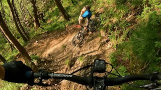
trail: Cai 989
10:12 |
71 |
May 25, 2024 , Mel
Recent Trail Reports
| status | trail | date | condition | info | user |
|---|---|---|---|---|---|
| Cai 989 | Nov 24, 2024 @ 10:36am Nov 24, 2024 | Ideal | Maurodg | ||
| Troi dei Notoi | Nov 5, 2023 @ 4:59am Nov 5, 2023 | Wet | Ciacerela |
Activity Feed
| username | action | type | title | date |
|---|---|---|---|---|
| micheletraversi | update | trail | activity #94875603 | May 16, 2026 @ 11:59pm May 16, 2026 |
| Marcomene | ridden | trail | activity #71055400 | May 5, 2025 @ 9:37am May 5, 2025 |
| Maurodg | add | report | activity #62244185 | Nov 24, 2024 @ 10:36am Nov 24, 2024 |
| Elgiako96 | add | video | activity #53126381 | May 25, 2024 @ 11:53am May 25, 2024 |
| albezug | add | report | activity #47637684 | Dec 26, 2023 @ 9:54am Dec 26, 2023 |
Recent Comments
| username | type | title | comment | date |
|---|---|---|---|---|
| trail | Sentiero tecnico e roccioso, richiede... | Jun 18, 2023 @ 6:06am Jun 18, 2023 | ||
| report | grazie, stiamo lavorando per toglierli | Feb 9, 2020 @ 6:24am Feb 9, 2020 |
Local Badges
-

Epic Ride Climb 2k59 awarded -

Climbing 10k Badge6 awarded -

Climbing 100k Badge0 awarded -

Epic Ride Descent 2k59 awarded -

Descent 10k Badge6 awarded -

Descent 100k Badge0 awarded
Activity Type Stats
| activitytype | trails | distance | descent | descent distance | total vertical | rating | global rank | state rank | photos | reports | routes | ridelogs |
|---|---|---|---|---|---|---|---|---|---|---|---|---|
| Mountain Bike | 4 | 4 miles | 3,691 ft | 3 miles | 2,677 ft | #7,581 | #647 | 4 | 9 | 762 | ||
| E-Bike | 4 | 1 mile | 984 ft | 4,409 ft | 2,116 ft | #8,797 | #962 | 8 | 171 | |||
| Hike | 4 | 4 miles | 3,691 ft | 3 miles | 2,677 ft | #11,733 | #867 | 9 | 108 | |||
| Trail Running | 4 | 4 miles | 3,691 ft | 3 miles | 2,677 ft | #11,413 | #872 | 9 | 35 |
- By poldix8 & contributors
- Admins: micheletraversi
- #21978 - 1,185 views
- mel activity log | embed map of Mel mountain bike trails | mel mountain biking points of interest
Downloading of trail gps tracks in kml & gpx formats is enabled for Mel.
You must login to download files.