close
-
Layers w
- Weather Layers
- Pro
- Pro
- Pro
- Pro
- Pro
- Pro
- More Layers
- Pro
- Pro
- Pro
- Pro
-
Upgrade to

3D
Trail Conditions
- Unknown
- Snow Groomed
- Snow Packed
- Snow Covered
- Snow Cover Partial
- Freeze/thaw Cycle
- Icy
- Prevalent Mud
- Wet
- Variable
- Ideal
- Dry
- Very Dry
Trail Flow (Ridden Direction)
Trailforks scans users ridelogs to determine the most popular direction each trail is ridden. A good flowing trail network will have most trails flowing in a single direction according to their intension.
The colour categories are based on what percentage of riders are riding a trail in its intended direction.
The colour categories are based on what percentage of riders are riding a trail in its intended direction.
- > 96%
- > 90%
- > 80%
- > 70%
- > 50%
- < 50%
- bi-directional trail
- no data
Trail Last Ridden
Trailforks scans ridelogs to determine the last time a trail was ridden.
- < 2 days
- < 1 week
- < 2 weeks
- < 1 month
- < 6 months
- > 6 months
Trail Ridden Direction
The intended direction a trail should be ridden.
- Downhill Only
- Downhill Primary
- Both Directions
- Uphill Primary
- Uphill Only
- One Direction
Contribute Details
Colors indicate trail is missing specified detail.
- Description
- Photos
- Description & Photos
- Videos
Trail Popularity ?
Trailforks scans ridelogs to determine which trails are ridden the most in the last 9 months.
Trails are compared with nearby trails in the same city region with a possible 25 colour shades.
Think of this as a heatmap, more rides = more kinetic energy = warmer colors.
- most popular
- popular
- less popular
- not popular
ATV/ORV/OHV Filter
Max Vehicle Width
inches
US Cell Coverage
Legend

Radar Time
Activity Recordings
Trailforks uses anonymized public activity data.
?
Activity Recordings
Trailforks uses anonymized public activity data.
?
Personal Heatmap
▶
Activity Types
all
/
none
▶
Options
2
Date range
month
–
Winter Trails
Warning
A routing network for winter maps does not exist. Selecting trails using the winter trails layer has been disabled.
Missing Trails
Most Popular
Least Popular
Trails are colored based on popularity. The more popular a trail is, the more red. Less popular trails trend towards green.
Jump Magnitude Heatmap
Heatmap of where riders jump on trails. Zoom in to see individual jumps, click circles to view jump details.
BC Backroad Status
![map legend]()
Service Road Atlas is a free to use, community-driven service for viewing and creating reports on the numerous back-country service roads around B.C. and Alberta.

Slope Aspect
Direction the slope faces
Trails Deemphasized
Trails are shown in grey.
Only show trails with no bike usage.
Suggested Layers
Based on selected activity type
Save the current map location and zoom level as your default home location whenever this page is loaded.
Save
No description for Mill Side has been added yet!
Login or register to submit one.
This region uses the Uk/Euro style trail grading system.
Activities Click to view
- Mountain Bike
3 trails
- Hike
3 trails
- Trail Running
2 trails
Region Details
- 2
- 1
Region Status
Caution as of 3 daysStats
- Avg Trail Rating
- Trails (view details)
- 3
- Trails Mountain Bike
- 3
- Trails E-Bike
- 1
- Trails Hike
- 3
- Trails Trail Running
- 2
- Total Distance
- 2 miles
- Total Descent
- 948 ft
- Total Vertical
- 559 ft
- Highest Trailhead
- 618 ft
- Reports
- 153
- Photos
- 12
- Ridden Counter
- 126
Popular Mill Side Mountain Biking Trails
• 100 ★ 4.0 • 1 mile • 0 ft • 51 •
Mostly used by hikers so it is best to go early in a morning or in the evening time to avoid conflict. Not a particularly difficult track to ride but there are a few features to keep you on your toes if riding the track at full pace.
• 5 ★ 4.0 • 1,808 ft • 0 ft • 1 •
starts off in the woods with a few jumps and big features which are avoidable then goes through a gap in a wall into a field with a faint single track and some optional natural jumps and drops then you end at a gate at the bottom of the...
• 5 ★ 3.5 • 3,527 ft • 0 ft • 1 •
Less popular proline difficulty singletrack. This mountain bike primary trail can be used downhill only and has a moderate overall physical rating. Trail visibility is sometimes hard to follow.
Mill Side Mountain Bike Routes
14 miles • 1,240 ft • 0 •
Trail for Whutbarrow Scar from Esential Trails by Richard Staton and Chris Gore
• 14 miles • 3,228 ft • 0 •
Photos of Mill Side Mountain Bike
Videos of Mill Side Mountain Bike
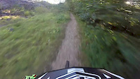
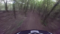
trail: Whitbarrow Scar
0:40 |
220 |
Sep 17, 2016
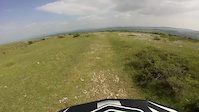
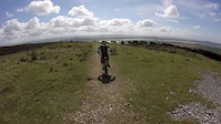
trail: Whitbarrow Scar
3:31 |
125 |
May 27, 2016
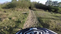
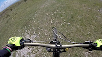
trail: Whitbarrow Scar
3:40 |
61 |
May 8, 2016

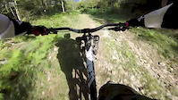
trail: Whitbarrow Scar
3:42 |
68 |
Sep 8, 2015
trail: Whitbarrow Scar
0:11 |
51 |
Aug 7, 2015
trail: Whitbarrow Scar
3:46 |
24 |
Jul 24, 2015
trail: Whitbarrow Scar
5:16 |
67 |
May 23, 2015
trail: Whitbarrow Scar
4:50 |
48 |
May 23, 2015
Recent Trail Reports
| status | trail | date | condition | info | user |
|---|---|---|---|---|---|
| Whitbarrow Scar | Jul 4, 2024 @ 10:51am Jul 4, 2024 | Wet | whyte120 | ||
| The lots freeride | Feb 21, 2020 @ 12:12pm Feb 21, 2020 | Prevalent Mud | wilderbeatsmtb |
Activity Feed
| username | action | type | title | date |
|---|---|---|---|---|
| PabloGT | wishlist | trail | activity #94411817 | May 10, 2026 @ 4:00am May 10, 2026 |
| Chrisy5eAEW | wishlist | route | activity #86135759 | Dec 27, 2025 @ 4:52am Dec 27, 2025 |
| ja197 | wishlist | route | activity #62532366 | Dec 1, 2024 @ 12:41am Dec 1, 2024 |
| Aki0692 | ridden | trail | activity #62136734 | Nov 22, 2024 @ 8:03am Nov 22, 2024 |
| whyte120 | add | report | activity #55160216 | Jul 5, 2024 @ 12:33am Jul 5, 2024 |
Recent Comments
| username | type | title | comment | date |
|---|---|---|---|---|
| trail | Who are you putting our trials on trailforks | Mar 29, 2020 @ 3:26am Mar 29, 2020 |
Activity Type Stats
| activitytype | trails | distance | descent | descent distance | total vertical | rating | global rank | state rank | photos | reports | routes | ridelogs |
|---|---|---|---|---|---|---|---|---|---|---|---|---|
| Mountain Bike | 3 | 2 miles | 948 ft | 2 miles | 558 ft | #6,290 | #220 | 12 | 153 | 1 | 8,150 | |
| E-Bike | 1 | 1,808 ft | 138 ft | 1,808 ft | 138 ft | 109 | 135 | |||||
| Hike | 3 | 2 miles | 948 ft | 2 miles | 558 ft | #12,622 | #466 | 153 | 348 | |||
| Trail Running | 2 | 2 miles | 807 ft | 2 miles | 558 ft | #12,381 | #472 | 152 | 64 |
- By brenthillier
 NSMBA TRAILFORKS & contributors
 - Admins: wisey, MathieuC, cemoorelife
- #10105 - 2,456 views
- mill side activity log | embed map of Mill Side mountain bike trails | mill side mountain biking points of interest
Downloading of trail gps tracks in kml & gpx formats is enabled for Mill Side.
You must login to download files.