
close
-
Layers w
- Weather Layers
- Pro
- Pro
- Pro
- Pro
- Pro
- Pro
- More Layers
- Pro
- Pro
- Pro
- Pro
-
Upgrade to

3D
Trail Conditions
- Unknown
- Snow Groomed
- Snow Packed
- Snow Covered
- Snow Cover Partial
- Freeze/thaw Cycle
- Icy
- Prevalent Mud
- Wet
- Variable
- Ideal
- Dry
- Very Dry
Trail Flow (Ridden Direction)
Trailforks scans users activity logs to determine the most popular direction each trail is ridden. A good flowing trail network will have most trails flowing in a single direction according to their intension.
The colour categories are based on what percentage of users are riding a trail in its intended direction.
The colour categories are based on what percentage of users are riding a trail in its intended direction.
- > 96%
- > 90%
- > 80%
- > 70%
- > 50%
- < 50%
- bi-directional trail
- no data
Trail Last Used
Trailforks scans activity logs to determine the last time a trail was ridden.
- < 2 days
- < 1 week
- < 2 weeks
- < 1 month
- < 6 months
- > 6 months
Trail Ridden Direction
The intended direction a trail should be ridden.
- Downhill Only
- Downhill Primary
- Both Directions
- Uphill Primary
- Uphill Only
- One Direction
Contribute Details
Colors indicate trail is missing specified detail.
- Description
- Photos
- Description & Photos
- Videos
Trail Popularity ?
Trailforks scans activity logs to determine which trails are ridden the most in the last 9 months.
Trails are compared with nearby trails in the same city region with a possible 25 colour shades.
Think of this as a heatmap, more activities = more kinetic energy = warmer colors.
- most popular
- popular
- less popular
- not popular
ATV/ORV/OHV Filter
Max Vehicle Width
inches
US Cell Coverage
Legend

Radar Time
Activity Recordings
Trailforks uses anonymized public activity data.
?
Activity Recordings
Trailforks uses anonymized public activity data.
?
Winter Trails
Warning
A routing network for winter maps does not exist. Selecting trails using the winter trails layer has been disabled.
Missing Trails
Most Popular
Least Popular
Trails are colored based on popularity. The more popular a trail is, the more red. Less popular trails trend towards green.
Jump Magnitude Heatmap
Heatmap of where users jump on trails. Zoom in to see individual jumps, click circles to view jump details.
BC Backroad Status
![map legend]()
Service Road Atlas is a free to use, community-driven service for viewing and creating reports on the numerous back-country service roads around B.C. and Alberta.

Slope Aspect
Direction the slope faces
Trails Deemphasized
Trails are shown in grey.
Only show trails with no bike usage.
Suggested Layers
Based on selected activity type
Save the current map location and zoom level as your default home location whenever this page is loaded.
SaveThe Mount Macpherson recreation area offers over 55 km of single track biking and 25 km of groomed Nordic ski trails, including a dog loop, a 6 km night skiing loop and a 4.5 km snowshoeing loop. Fat biking is not permitted on any of the Nordic trails.
MTB activities can be based from the Tantrum*, Flowdown*, Griffith Creek*, Mount Macpherson, Begbie Bluffs, Begbie Falls FSR North and Begbie Falls FSR South* parking areas. Class1 (pedal assist) E-bikes are permitted on this network. All riders are expected to abide by the RCA Rider Code of Conduct and share these trails in a safe and courteous manner with other trail users.
*Summer use only, closed for winter.
All XC skiing and snowshoeing is based from the Mount Macpherson parking area (winter use lodge). This is also the parking area and trailhead for backcountry touring access to the Fingers via Mountain Climb. Trail passes or parking passes are required during the winter - please visit the day lodge to enquire and pay.
MTB activities can be based from the Tantrum*, Flowdown*, Griffith Creek*, Mount Macpherson, Begbie Bluffs, Begbie Falls FSR North and Begbie Falls FSR South* parking areas. Class1 (pedal assist) E-bikes are permitted on this network. All riders are expected to abide by the RCA Rider Code of Conduct and share these trails in a safe and courteous manner with other trail users.
*Summer use only, closed for winter.
All XC skiing and snowshoeing is based from the Mount Macpherson parking area (winter use lodge). This is also the parking area and trailhead for backcountry touring access to the Fingers via Mountain Climb. Trail passes or parking passes are required during the winter - please visit the day lodge to enquire and pay.
Primary Trail Type: Cross-Country
eBikes Allowed:
Yes
 google parking directions
 Access Info:
Tantrum Parking - From Revelstoke go west on the TCH, turn south on Hwy 23 and drive for 1.7km, turn west onto a small gravel road with a RSTBC trailhead sign. The kiosk/map and start to the Tantrum trail are located 100m north down the double track powerline. Summer use only, closed for winter.
Flowdown Parking - From Revelstoke go west on the TCH, turn south on Hwy 23 and drive for 2.8km. Parking is on the west side of the highway. Amenities include a kiosk/map, donation vault and an outhouse. Summer use only, closed for winter.
Griffith Creek Parking - From Revelstoke go west on the TCH, turn south on Hwy 23 and drive for 5.4 km, turn west on the Griffith Creek FSR (RSTBC trailhead sign). Park at the small lot just off the highway or follow the FSR for about 300m to a larger car park, outhouse and trailhead kiosk/map. Summer use only, closed for winter.
Mount Macpherson Parking – From Revelstoke go west on the TCH, turn south on Hwy 23 and drive for 7.5 km. The parking area is on the west side of the highway. Year round services include a large car park, a trailhead kiosk/map, a donation vault and an outhouse. This is also the location of the Revelstoke Nordic Ski Club lodge (special function and winter use only).Trail passes or parking passes are required during the winter - please visit the day lodge to enquire and pay.
Begbie Bluffs Parking – From Revelstoke go west on the TCH, turn south on Hwy 23 and drive for 8.6km. The signed parking area is located on the east side of the highway. Amenities include a kiosk/map and outhouse.
Begbie Falls FSR North Parking - From Revelstoke go west on the TCH, turn south on Hwy 23 and drive for 2.6km, turn east onto the Mt. Begbie Road. Follow Mt. Begbie Road until it ends then continue straight onto Begbie Falls FSR for 150 m until you see the biking trailhead kiosk/map and parking area.
Begbie Falls FSR South Parking - From the North Parking area, continue south on the FSR to the parking area. Amenities include a kiosk/map and outhouse. Summer use only, closed for winter.
Flowdown Parking - From Revelstoke go west on the TCH, turn south on Hwy 23 and drive for 2.8km. Parking is on the west side of the highway. Amenities include a kiosk/map, donation vault and an outhouse. Summer use only, closed for winter.
Griffith Creek Parking - From Revelstoke go west on the TCH, turn south on Hwy 23 and drive for 5.4 km, turn west on the Griffith Creek FSR (RSTBC trailhead sign). Park at the small lot just off the highway or follow the FSR for about 300m to a larger car park, outhouse and trailhead kiosk/map. Summer use only, closed for winter.
Mount Macpherson Parking – From Revelstoke go west on the TCH, turn south on Hwy 23 and drive for 7.5 km. The parking area is on the west side of the highway. Year round services include a large car park, a trailhead kiosk/map, a donation vault and an outhouse. This is also the location of the Revelstoke Nordic Ski Club lodge (special function and winter use only).Trail passes or parking passes are required during the winter - please visit the day lodge to enquire and pay.
Begbie Bluffs Parking – From Revelstoke go west on the TCH, turn south on Hwy 23 and drive for 8.6km. The signed parking area is located on the east side of the highway. Amenities include a kiosk/map and outhouse.
Begbie Falls FSR North Parking - From Revelstoke go west on the TCH, turn south on Hwy 23 and drive for 2.6km, turn east onto the Mt. Begbie Road. Follow Mt. Begbie Road until it ends then continue straight onto Begbie Falls FSR for 150 m until you see the biking trailhead kiosk/map and parking area.
Begbie Falls FSR South Parking - From the North Parking area, continue south on the FSR to the parking area. Amenities include a kiosk/map and outhouse. Summer use only, closed for winter.
Trail info last updated
Region Supporters & Maintainers
![Revelstoke Cycling Association]()
Revelstoke Cycling AssociationSponsor![Revelstoke Nordic Ski Club]()
Revelstoke Nordic Ski ClubSponsor


Activities Click to view
- Mountain Bike
96 trails
- E-Bike
97 trails
- Hike
94 trails
- Trail Running
98 trails
- Snowshoe
1 trails
- Backcountry Ski
2 trails
- Nordic Ski
33 trails
Region Details
- 8
- 23
- 44
- 21
Region Status
Open as of Sep 7, 2026Stats
- Avg Trail Rating
- Trails (view details)
- 100
- Trails Mountain Bike
- 96
- Trails E-Bike
- 97
- Trails Gravel Bike
- 31
- Trails Adaptive Bike
- 10
- Trails Hike
- 94
- Trails Trail Running
- 98
- Trails Snowshoe
- 1
- Trails Backcountry Ski
- 2
- Trails Nordic Ski
- 33
- Total Distance
- 67 miles
- Total Descent Distance
- 30 miles
- Total Descent
- 11,441 ft
- Total Vertical
- 7,323 ft
- Highest Trailhead
- 8,782 ft
- Reports
- 2,540
- Photos
- 429
- Completed Counter
- 65,251
Popular Mount Macpherson Mountain Biking Trails
• 100 ★ 4.3 • 4 miles • 418 ft • 3,548 •
's premier flow trail makes a smooth climber, as well as a fast flowing descent trail. Remember: uphill riders have the right-of-way. This should be on your must-do list at . Follow the signs for the blue 'ride-arounds' to avoid riding...
• 95 ★ 4.4 • 1 mile • 176 ft • 2,148 •
Undulating, rooty, rocky sections. Lots of variety and challenges.
• 100 ★ 4.6 • 2,428 ft • 173 ft • 1,649 •
Fun winding trail through the forest beside Wells Creek then it crosses the Nordic Trail and continues winding it's way to . Part of a beginner Loop from Griffith Creek Parking when included with , , , and . Good to / from & .
• 90 ★ 4.1 • 4,262 ft • 63 ft • 1,520 •
Friendly and flowing with some rocky sections. route to .
• 100 ★ 4.2 • 1,549 ft • 116 ft • 1,486 •
Part of a fun and challenging green loop of trails from the Griffith Creek Trailhead when connected with , , the lower part of and . An easy singletrack route to when connected with and .
• 90 ★ 4.3 • 1 mile • 10 ft • 1,482 •
This great, flowy descent that has a few surprises in store - including ascending riders. Keep your heads up everybody and make some noise! Enjoy the from the top while you catch your breath after the climb up.
• 95 ★ 4.5 • 1,857 ft • 141 ft • 1,471 •
Fun winding trail through forest and openings. Part of a fun beginner Loop from Griffith Creek Parking when includes with , , and . Singletrack to / .
• 90 ★ 3.8 • 1,634 ft • 6 ft • 1,433 •
is a fun little connector that flows well in both directions. It has a couple of gentle switch backs and a quick undulating straight. Part of a green loop when included with , , and .
Mount Macpherson Mountain Bike Routes
★ 5.0 • 17 miles • 2,653 ft • 11 • Loop •
Tantrum Ride Co. Loop from Town #1 Tantrum / Beaver / / / Tantrum Hard, technical,single track
★ 3.0 • 8 miles • 1,433 ft • 6 • Loop •
The best part about this loop is that it gets all the hard stuff out of the way first. From the , climb up...
18 miles • 3,300 ft • 8 •
The 2025 Revelstoke Women's Enduro course brings all the Crow favorites together START: Macpherson Nordic...
18 miles • 3,300 ft • 8 •
The 2025 Revelstoke Women's Enduro course brings all the Crowd favorites to the table. You ask, we...
6 miles • 997 ft • 4 •
Tantrum Ride Co. Summer Enduro #2 Stage 1: Stage 2: Stage 3:
Photos of Mount Macpherson Mountain Bike
Videos of Mount Macpherson Mountain Bike
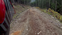
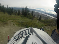
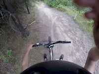
Recent Trail Reports
| status | trail | date | condition | info | user |
|---|---|---|---|---|---|
| Buff Enuff | Sep 7, 2026 @ 12:01pm (America/Vancouver) Sep 7, 2026 | Ideal | cemoorelife TRAILFORKS | ||
| Dusty Beaver | Sep 7, 2026 @ 12:01pm (America/Vancouver) Sep 7, 2026 | Ideal | cemoorelife TRAILFORKS | ||
| Toad School | Sep 7, 2026 @ 12:01pm (America/Vancouver) Sep 7, 2026 | Ideal | cemoorelife TRAILFORKS | ||
| Tightrope | Sep 7, 2026 @ 12:01pm (America/Vancouver) Sep 7, 2026 | Ideal | cemoorelife TRAILFORKS | ||
| Yew R Here | Aug 31, 2026 @ 3:09pm (America/Vancouver) Aug 31, 2026 | Variable | cemoorelife TRAILFORKS | ||
| Quarry | Aug 31, 2026 @ 3:09pm (America/Vancouver) Aug 31, 2026 | Variable | cemoorelife TRAILFORKS | ||
| Quarry Lower | Aug 31, 2026 @ 3:09pm (America/Vancouver) Aug 31, 2026 | Variable | cemoorelife TRAILFORKS | ||
| Hemlock Groove | Aug 31, 2026 @ 3:09pm (America/Vancouver) Aug 31, 2026 | Variable | cemoorelife TRAILFORKS | ||
| Ridge Walk | Aug 24, 2026 @ 11:03am (America/Vancouver) Aug 24, 2026 | Ideal | cemoorelife TRAILFORKS | ||
| Break-a-Leg | Aug 24, 2026 @ 11:03am (America/Vancouver) Aug 24, 2026 | Variable | cemoorelife TRAILFORKS |
Activity Feed
| username | action | type | title | date |
|---|---|---|---|---|
| Mfulford | wishlist | trail | activity #103589503 | Sep 11, 2026 @ 10:38pm 1 day |
| Mfulford | wishlist | route | activity #103589328 and 1 more | Sep 11, 2026 @ 10:31pm 1 day |
| LAvPGG | wishlist | route | activity #103574510 | Sep 11, 2026 @ 4:15pm 1 day |
| emoneyerica | wishlist | route | activity #103473359 | Sep 10, 2026 @ 7:04am 3 days |
| Cchirks | wishlist | route | activity #103455379 | Sep 9, 2026 @ 9:08pm Sep 9, 2026 |
Recent Comments
| username | type | title | comment | date |
|---|---|---|---|---|
| trail | Enjoyed this trail, it’s fun and flowing. | Jul 12, 2026 @ 9:20pm Jul 12, 2026 | ||
| report | Obviously | May 11, 2026 @ 2:24pm May 11, 2026 | ||
| report | There’s more cleanup needed below too | Aug 28, 2025 @ 3:19pm Aug 28, 2025 | ||
| trail | Lot of comments saying this trail has no flow... | Aug 22, 2025 @ 11:16am Aug 22, 2025 | ||
| trail | Best trail name ever. | Aug 3, 2025 @ 4:10pm Aug 3, 2025 |
Nearby Areas
| name | distance | ||||
|---|---|---|---|---|---|
| City/Greenbelt Trails | 2 km | ||||
| Greenbelt/Flats | 17 | 2.3 km | |||
| Mount Mackenzie | 1 | 1 | 3.2 km | ||
| Mount Revelstoke National Park | 1 | 4 | 3.9 km | ||
| Boulder Mountain | 7 | 12 | 5 | 4 km |
Local Badges
-

Completionist1 awarded
Upcoming Local Events





Local Trail Supporters
- Selkirk Dental Clinic
- Columbia Bookkeeping
- Williamson Lake Campground
- Cycle Logic - Kamloops
- The Taco Club
- Taco Clube
- VRGE Hotel
- Selkirk Powder Descents
![]()
- Paramount Recreation
![]()
- The Big Eddy Pub
- Revelstoke Mountain Resort
- The Copeland
- Six Percent Bike
![]()
![]()
- Chubby Funster's
- The Village Idiot

Activity Type Stats
| activitytype | trails | distance | descent | descent distance | total vertical | rating | global rank | state rank | photos | reports | routes | activity logs |
|---|---|---|---|---|---|---|---|---|---|---|---|---|
| Mountain Bike | 96 | 55 miles | 10,486 ft | 28 miles | 1,280 ft | #282 | #37 | 394 | 2,455 | 64 | 24,689 | |
| E-Bike | 97 | 58 miles | 10,830 ft | 29 miles | 1,280 ft | #1,469 | #65 | 2,122 | 6 | 836 | ||
| Gravel Bike | 31 | 19 miles | 2,530 ft | 8 miles | 1,027 ft | #104 | #22 | 96 | 41 | |||
| Adaptive Bike | 10 | 4 miles | 719 ft | 2 miles | 732 ft | #104 | #21 | 140 | ||||
| Hike | 94 | 63 miles | 10,843 ft | 28 miles | 7,323 ft | #2,040 | #110 | 6 | 2,454 | 7 | 896 | |
| Trail Running | 98 | 65 miles | 11,099 ft | 29 miles | 7,323 ft | #1,089 | #44 | 6 | 2,454 | 17 | 1,256 | |
| Snowshoe | 1 | 2 miles | 302 ft | 1 mile | 213 ft | #352 | #31 | 157 | 134 | |||
| Backcountry Ski | 2 | 3,684 ft | 449 ft | 525 ft | #146 | #13 | 154 | 399 | ||||
| Nordic Ski | 33 | 18 miles | 2,070 ft | 7 miles | 656 ft | #43 | #8 | 171 | 4,877 |
Frequently Asked Questions
▼
What are the highest rated mountain biking trails in Mount Macpherson?
The highest rated mountain biking trails in Mount Macpherson are:
- Beaver Tail (4.4/5)
- Tantrum South (4.3/5)
- Berm Donor (4.3/5)
- Flowdown (4.3/5)
- Break-a-Leg (4.2/5)
▼
Where can I park to ride in Mount Macpherson?
There are 11 parking locations listed in Mount Macpherson. The most popular parking spots are:
- Griffith Creek Upper Parking
- Mt. Macpherson Parking
- Griffith Creek Parking
- Griffith Creek Lower Parking
- Flowdown Trail Head Parking
▼
What is the longest trail in Mount Macpherson?
The longest trail in Mount Macpherson is Flowdown at 3.9 miles. View all trails sorted by distance.
▼
What are the best & highest rated hiking trails in Mount Macpherson?
The best hiking trails in Mount Macpherson are: View all hiking trails sorted by popularity score.
▼
How many trails are in Mount Macpherson?
Mount Macpherson has a total of 100 trails. Of those, 96 are designated for mountain biking. Browse top mountain biking trails in Mount Macpherson to find detailed information including difficulty ratings, distances, and trail conditions.
▼
Which trail has the most elevation gain in Mount Macpherson?
The trail with the most elevation gain in Mount Macpherson is Main Loop (Nordic Trail) with 487 ft of elevation gain. View all trails sorted by elevation gain.
▼
Which trail has the most elevation descent in Mount Macpherson?
The trail with the most elevation descent in Mount Macpherson is Flowdown with 951 ft of elevation descent. View all trails sorted by elevation descent.
▼
What activities are most popular in Mount Macpherson?
Mount Macpherson supports the following activities: Mountain Biking, E-Biking, Hiking, Trail Running, Snowshoeing, Backcountry Skiing, Nordic Skiing.
▼
What are the steepest mountain biking trails in Mount Macpherson?
The steepest mountain biking trail in Mount Macpherson is View with an average grade of 12.4%. View all trails sorted by grade.
▼
Are there any trails with scenic viewpoints in Mount Macpherson?
Yes, there are 4 scenic viewpoints marked along trails in Mount Macpherson. Some popular viewpoints include: Explore more points of interest to find trails with the best views.
▼
Are the trails open in Mount Macpherson?
The overall region status for Mount Macpherson is Clear / Green. Out of 88 trails:
- Clear / Green: 72
- Minor Issue / Yellow: 7
- Significant Issue / Amber: 1
- Closed: 8
▼
What are the trail conditions in Mount Macpherson?
Based on trail reports from the past week in Mount Macpherson:
- Ideal: 4 trails
▼
Can I ride an ebike in Mount Macpherson?
Yes, Mount Macpherson supports e-bike riding. There are 98 trails in Mount Macpherson that allow e-bikes. Check the e-bike trails listing for specific trail access details and any local regulations.
▼
What are the most popular mountain biking routes in Mount Macpherson?
The most popular mountain biking routes in Mount Macpherson are: View all mountain biking routes in Mount Macpherson.
▼
What are the most popular Strava Segments in Mount Macpherson?
The most popular Strava segments in Mount Macpherson are:
- RWE Flowdown 2018 (8,056 athletes)
- Dust Beaver Climb (5,526 athletes)
- Flowdown Complete (4,009 athletes)
▼
What are some popular technical trail features in Mount Macpherson?
There are 2 technical trail features (TTFs) in Mount Macpherson. Some popular features include: View all technical trail features in Mount Macpherson.
▼
What trails are closed in Mount Macpherson?
There are currently 8 closed trails in Mount Macpherson. The breakdown of all trail statuses is:
- Clear / Green: 72
- Minor Issue / Yellow: 7
- Significant Issue / Amber: 1
- Closed: 8
▼
Are there local clubs or events in Mount Macpherson?
There are 1 upcoming events in Mount Macpherson. View upcoming events.
▼
What are the most popular mountain biking trails in Mount Macpherson?
The most popular mountain biking trails in Mount Macpherson are: View all mountain biking trails sorted by popularity.
▼
What are the best beginner ride trails in Mount Macpherson?
The best beginner mountain biking trails in Mount Macpherson are:
- Beaver Tail (4.6/5)
- Dusty Beaver (4.1/5)
- Leap Frog (4.5/5)
Activities
Trails
- By ankhou
 & contributors
 - Admins: RCA, RNSC, RMR
- #4131 - 73,014 views
- mount macpherson activity log | embed map of Mount Macpherson mountain bike trails | mount macpherson mountain biking points of interest
Downloading of trail gps tracks in kml & gpx formats is enabled for Mount Macpherson.
You must login to download files.