close
-
Layers w
- Weather Layers
- Pro
- Pro
- Pro
- Pro
- Pro
- Pro
- More Layers
- Pro
- Pro
- Pro
- Pro
-
Upgrade to

3D
Trail Conditions
- Unknown
- Snow Groomed
- Snow Packed
- Snow Covered
- Snow Cover Partial
- Freeze/thaw Cycle
- Icy
- Prevalent Mud
- Wet
- Variable
- Ideal
- Dry
- Very Dry
Trail Flow (Ridden Direction)
Trailforks scans users ridelogs to determine the most popular direction each trail is ridden. A good flowing trail network will have most trails flowing in a single direction according to their intension.
The colour categories are based on what percentage of riders are riding a trail in its intended direction.
The colour categories are based on what percentage of riders are riding a trail in its intended direction.
- > 96%
- > 90%
- > 80%
- > 70%
- > 50%
- < 50%
- bi-directional trail
- no data
Trail Last Ridden
Trailforks scans ridelogs to determine the last time a trail was ridden.
- < 2 days
- < 1 week
- < 2 weeks
- < 1 month
- < 6 months
- > 6 months
Trail Ridden Direction
The intended direction a trail should be ridden.
- Downhill Only
- Downhill Primary
- Both Directions
- Uphill Primary
- Uphill Only
- One Direction
Contribute Details
Colors indicate trail is missing specified detail.
- Description
- Photos
- Description & Photos
- Videos
Trail Popularity ?
Trailforks scans ridelogs to determine which trails are ridden the most in the last 9 months.
Trails are compared with nearby trails in the same city region with a possible 25 colour shades.
Think of this as a heatmap, more rides = more kinetic energy = warmer colors.
- most popular
- popular
- less popular
- not popular
ATV/ORV/OHV Filter
Max Vehicle Width
inches
US Cell Coverage
Legend

Radar Time
Activity Recordings
Trailforks uses anonymized public activity data.
?
Activity Recordings
Trailforks uses anonymized public activity data.
?
Personal Heatmap
▶
Activity Types
all
/
none
▶
Options
2
Date range
month
–
Winter Trails
Warning
A routing network for winter maps does not exist. Selecting trails using the winter trails layer has been disabled.
Missing Trails
Most Popular
Least Popular
Trails are colored based on popularity. The more popular a trail is, the more red. Less popular trails trend towards green.
Jump Magnitude Heatmap
Heatmap of where riders jump on trails. Zoom in to see individual jumps, click circles to view jump details.
BC Backroad Status
![map legend]()
Service Road Atlas is a free to use, community-driven service for viewing and creating reports on the numerous back-country service roads around B.C. and Alberta.

Slope Aspect
Direction the slope faces
Trails Deemphasized
Trails are shown in grey.
Only show trails with no bike usage.
Suggested Layers
Based on selected activity type
Save the current map location and zoom level as your default home location whenever this page is loaded.
Save
No description for Oamaru has been added yet!
Login or register to submit one.
Links
Activities Click to view
- Mountain Bike
38 trails
- E-Bike
7 trails
- Gravel Bike
0 trails
- Adaptive Bike
0 trails
- Winter Fat Bike
0 trails
- Horse
0 trails
- Hike
32 trails
- Trail Running
32 trails
- Dirtbike/Moto
0 trails
- ATV/ORV/OHV
0 trails
- Snowmobile
0 trails
- Snowshoe
0 trails
- Nordic Ski
0 trails
Region Details
- 3
- 2
- 11
- 16
- 1
Region Status
Open as of 1 dayStats
- Avg Trail Rating
- Trails (view details)
- 42
- Trails Mountain Bike
- 38
- Trails E-Bike
- 7
- Trails Hike
- 32
- Trails Trail Running
- 32
- Total Distance
- 31 miles
- Total Descent
- 3,875 ft
- Total Vertical
- 1,115 ft
- Highest Trailhead
- 1,138 ft
- Reports
- 155
- Photos
- 53
- Ridden Counter
- 4,351
Sub Regions
-
Cape Wanbrow
- 1
- 9
- 14
- 1
-
Herbert Forest
- 3
- 10
- 5
- 5
-
Oamaru Reservoir
- 1
Popular Oamaru Mountain Biking Trails
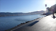
• 100 ★ 3.5 • 4,516 ft • 21 ft • 282 •
Popular white difficulty gravel path. This mountain bike primary trail can be used both directions and has a easy overall physical rating. On average it takes 7 minutes to complete this trail.
• 95 ★ 4.5 • 11 miles • 394 ft • 200 •
The Alps 2 Ocean Cycle Trail is truly one of New Zealand's great rides! For over 300 km visitors can experience some of the most beautiful scenery New Zealand has to offer. Suitable for all ages, the trail is an easy grade, and...
• 95 ★ 3.4 • 3,907 ft • 3 ft • 170 •
The trail travels trough a mix of treed and open areas, and provides some varied, intermediate-level riding.
• 80 ★ 4.6 • 2,051 ft • 7 ft • 162 •
Popular blue difficulty singletrack. This mountain bike primary trail can be used downhill only and has a moderate overall physical rating. It features berm, drop, jump and roller coaster. Trail visibility is always easy to follow. On average it takes 2 minutes to complete this trail.
• 65 ★ 0.0 • 1,900 ft • 162 ft • 122 •
Moderately popular blue difficulty singletrack. This mountain bike primary trail can be used uphill primary and has a moderate overall physical rating with a 162 ft blue climb. It features berm. Trail visibility is always easy to follow. On average it takes 6 minutes to complete this trail.
• 45 ★ 4.2 • 1,220 ft • 0 ft • 111 •
Sweet DH track with a few small jumps and one double (chicken routes round them all). To make it longer, add "Blairs Corner"or " to the top of it.
Oamaru Mountain Bike Routes
12 miles • 2,050 ft • 0 •
Photos of Oamaru Mountain Bike
Videos of Oamaru Mountain Bike

trail: A Digger Did It
0:08 |
651 |
Feb 16, 2019
trail: Gully
4:28 |
220 |
Aug 3, 2015

trail: Macro Scarpa
53 |
Jun 7, 2025 , Oamaru

trail: Knuckle Rock
70 |
Jun 7, 2025 , Oamaru

trail: Snookered
57 |
Jun 7, 2025 , Oamaru

trail: South Ridge Singletrack
66 |
Jun 7, 2025 , Oamaru
youtuber
![Mountain Biking Trails of MT.HERBERT, Oamaru....]()
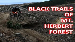
trail: Top to Skid
22:16 |
575 |
Sep 27, 2020 , Oamaru
youtuber
![Mountain Biking Trails of MT.HERBERT, Oamaru....]()

trail: Piggy Smalls
22:16 |
587 |
Sep 27, 2020 , Oamaru
Current Trail Warnings
| status | trail | date | condition | user | info |
|---|---|---|---|---|---|
| Knott Rode | Jun 14, 2026 @ 9:20pm (Pacific/Auckland) 1 day | Unknown | rattyboy | ||
| South Ridge Road | Jun 14, 2026 @ 9:19pm (Pacific/Auckland) 1 day | Unknown | rattyboy | closed until further notice | |
| South Ridge Singletrack | Jun 14, 2026 @ 9:18pm (Pacific/Auckland) 1 day | Unknown | rattyboy |
Recent Trail Reports
| status | trail | date | condition | info | user |
|---|---|---|---|---|---|
| Alps 2 Ocean: Victoria Hill Road to A2O turnoff | Mar 25, 2026 @ 9:06am (Pacific/Auckland) Mar 24, 2026 | Ideal | AIntemann | ||
| Old Fence Line | Oct 8, 2025 @ 1:35pm (Pacific/Auckland) Oct 7, 2025 | Variable | tom-herbert-forest | ||
| Kihya's Way | Oct 8, 2025 @ 1:35pm (Pacific/Auckland) Oct 7, 2025 | Variable | tom-herbert-forest | ||
| Snookered | Oct 8, 2025 @ 1:35pm (Pacific/Auckland) Oct 7, 2025 | Variable | tom-herbert-forest | ||
| Jumpy Middle | Oct 8, 2025 @ 1:35pm (Pacific/Auckland) Oct 7, 2025 | Ideal | tom-herbert-forest | ||
| Upper Tombstone | Oct 8, 2025 @ 1:35pm (Pacific/Auckland) Oct 7, 2025 | Variable | tom-herbert-forest | ||
| Digger Track | Jul 20, 2025 @ 1:36pm Jul 20, 2025 | Wet | tom-herbert-forest | ||
| Cross Track | Jul 20, 2025 @ 1:36pm Jul 20, 2025 | Variable | tom-herbert-forest | ||
| Contours | Jul 20, 2025 @ 1:36pm Jul 20, 2025 | Variable | tom-herbert-forest | ||
| Access Road | Jul 20, 2025 @ 1:36pm Jul 20, 2025 | Variable | tom-herbert-forest |
Activity Feed
| username | action | type | title | date |
|---|---|---|---|---|
| rattyboy | add | report | activity #96946488 and 2 more | Jun 14, 2026 @ 2:18am 1 day |
| AIntemann | add | report | activity #91248389 | Mar 24, 2026 @ 11:44pm Mar 24, 2026 |
| AIntemann | ridden | trail | activity #91244814 and 1 more | Mar 24, 2026 @ 8:23pm Mar 24, 2026 |
| Jonoofarc | ridden | trail | activity #88712223 | Feb 10, 2026 @ 10:39pm Feb 10, 2026 |
| MattR78 | ridden | trail | activity #88532958 and 4 more | Feb 7, 2026 @ 4:17pm Feb 7, 2026 |
Recent Comments
| username | type | title | comment | date |
|---|---|---|---|---|
| trail | It's not obvious looking on TF, or the trail... | Jan 9, 2026 @ 1:12pm Jan 9, 2026 | ||
| trail | Loved this trail. Semi-muddy meant I was on my... | Jan 9, 2026 @ 1:09pm Jan 9, 2026 | ||
| trail | Easy climb up to access Squashed Possum.... | Sep 20, 2025 @ 10:08pm Sep 20, 2025 | ||
| trail | Nice flow trail. A bit dry and some loose... | Sep 20, 2025 @ 10:07pm Sep 20, 2025 | ||
| trail | A great combo of open and flowy followed by... | Jan 18, 2025 @ 10:18pm Jan 18, 2025 |
Local Badges
-

Epic Ride Climb 2k5 awarded -

Climbing 10k Badge8 awarded -

Climbing 100k Badge0 awarded -

Epic Ride Descent 2k4 awarded -

Descent 10k Badge8 awarded -

Descent 100k Badge0 awarded
Activity Type Stats
| activitytype | trails | distance | descent | descent distance | total vertical | rating | global rank | state rank | photos | reports | routes | ridelogs |
|---|---|---|---|---|---|---|---|---|---|---|---|---|
| Mountain Bike | 38 | 29 miles | 3,409 ft | 14 miles | 1,115 ft | #2,104 | #36 | 53 | 155 | 1 | 3,024 | |
| E-Bike | 7 | 2 miles | 354 ft | 4,449 ft | 174 ft | #3,702 | #63 | 138 | 1 | 418 | ||
| Hike | 32 | 28 miles | 3,245 ft | 13 miles | 1,115 ft | #1,210 | #26 | 150 | 59 | |||
| Trail Running | 32 | 28 miles | 3,245 ft | 13 miles | 1,115 ft | #3,879 | #53 | 150 | 1 | 140 |
Frequently Asked Questions About Oamaru
▼
What are the best places to ride in Oamaru?
Oamaru has 3 areas to explore for mountain biking. The top rated areas are:
▼
What are the highest rated mountain biking trails in Oamaru?
The highest rated mountain biking trails in Oamaru are:
- Jumpy Middle (4.3/5)
- Snookered (4.2/5)
- Stagger and Roll (4.2/5)
- Connors Track (4.1/5)
- Cliffhanger (4.1/5)
▼
What is the best time of the year to ride in Oamaru?
Based on ride log data, the most popular months to ride in Oamaru are:
- October (28 activities)
- February (26 activities)
- December (25 activities)
▼
Where can I park to ride in Oamaru?
Activities
Trails
Points of Interest
- By oamaruandy
 MTBNO & contributors
 - Admins: Alps2Ocean-Cycle-Trail, MBO, Dubnyk, MTBNO, mgoldingham
- #18000 - 12,024 views
- oamaru activity log | embed map of Oamaru mountain bike trails | oamaru mountain biking points of interest
Downloading of trail gps tracks in kml & gpx formats is enabled for Oamaru.
You must login to download files.