
close
3D
Trail Conditions
- Unknown
- Snow Groomed
- Snow Packed
- Snow Covered
- Snow Cover Partial
- Freeze/thaw Cycle
- Icy
- Prevalent Mud
- Wet
- Variable
- Ideal
- Dry
- Very Dry
Trail Flow (Ridden Direction)
Trailforks scans users activity logs to determine the most popular direction each trail is ridden. A good flowing trail network will have most trails flowing in a single direction according to their intension.
The colour categories are based on what percentage of users are riding a trail in its intended direction.
The colour categories are based on what percentage of users are riding a trail in its intended direction.
- > 96%
- > 90%
- > 80%
- > 70%
- > 50%
- < 50%
- bi-directional trail
- no data
Trail Last Used
Trailforks scans activity logs to determine the last time a trail was ridden.
- < 2 days
- < 1 week
- < 2 weeks
- < 1 month
- < 6 months
- > 6 months
Trail Ridden Direction
The intended direction a trail should be ridden.
- Downhill Only
- Downhill Primary
- Both Directions
- Uphill Primary
- Uphill Only
- One Direction
Contribute Details
Colors indicate trail is missing specified detail.
- Description
- Photos
- Description & Photos
- Videos
Trail Popularity ?
Trailforks scans activity logs to determine which trails are ridden the most in the last 9 months.
Trails are compared with nearby trails in the same city region with a possible 25 colour shades.
Think of this as a heatmap, more activities = more kinetic energy = warmer colors.
- most popular
- popular
- less popular
- not popular
ATV/ORV/OHV Filter
Max Vehicle Width
inches
US Cell Coverage
Legend

Radar Time
Activity Recordings
Trailforks uses anonymized public activity data.
?
Activity Recordings
Trailforks uses anonymized public activity data.
?
Winter Trails
Warning
A routing network for winter maps does not exist. Selecting trails using the winter trails layer has been disabled.
Missing Trails
Most Popular
Least Popular
Trails are colored based on popularity. The more popular a trail is, the more red. Less popular trails trend towards green.
Jump Magnitude Heatmap
Heatmap of where users jump on trails. Zoom in to see individual jumps, click circles to view jump details.
BC Backroad Status
![map legend]()
Service Road Atlas is a free to use, community-driven service for viewing and creating reports on the numerous back-country service roads around B.C. and Alberta.

Slope Aspect
Direction the slope faces
Trails Deemphasized
Trails are shown in grey.
Only show trails with no bike usage.
Suggested Layers
Based on selected activity type
Save the current map location and zoom level as your default home location whenever this page is loaded.
SaveOaxaca de Juárez es la capital del estado de Oaxaca, ubicada en el sur de México. Rodeada por la Sierra Madre y valles fértiles, esta ciudad combina historia, cultura y naturaleza. Su centro histórico, Patrimonio de la Humanidad por la UNESCO, está lleno de arquitectura colonial y tradiciones vivas. Para los amantes del ciclismo y senderismo, Oaxaca ofrece rutas que atraviesan montañas, bosques y comunidades indígenas, con paisajes espectaculares y clima templado la mayor parte del año. Es un destino ideal para quienes buscan aventura, gastronomía y conexión con la cultura local.
Oaxaca de Juárez is the capital of the state of Oaxaca, located in southern Mexico. Surrounded by the Sierra Madre mountains and fertile valleys, this city blends history, culture, and nature. Its historic center, a UNESCO World Heritage Site, is rich in colonial architecture and vibrant traditions. For cycling and hiking enthusiasts, Oaxaca offers trails through mountains, forests, and indigenous communities, featuring stunning landscapes and mild weather most of the year. It’s an ideal destination for those seeking adventure, gastronomy, and a deep connection with local culture.
Oaxaca de Juárez is the capital of the state of Oaxaca, located in southern Mexico. Surrounded by the Sierra Madre mountains and fertile valleys, this city blends history, culture, and nature. Its historic center, a UNESCO World Heritage Site, is rich in colonial architecture and vibrant traditions. For cycling and hiking enthusiasts, Oaxaca offers trails through mountains, forests, and indigenous communities, featuring stunning landscapes and mild weather most of the year. It’s an ideal destination for those seeking adventure, gastronomy, and a deep connection with local culture.
Trail info last updated
Activities Click to view
- Mountain Bike
74 trails
- E-Bike
20 trails
- Gravel Bike
8 trails
- Adaptive Bike
9 trails
- Winter Fat Bike
1 trails
- Hike
70 trails
- Trail Running
71 trails
Region Details
- 5
- 6
- 46
- 16
- 1
Region Status
Open as of Feb 8, 2026Stats
- Avg Trail Rating
- Trails (view details)
- 75
- Trails Mountain Bike
- 74
- Trails E-Bike
- 20
- Trails Gravel Bike
- 8
- Trails Adaptive Bike
- 9
- Trails Winter Fat Bike
- 1
- Trails Horse
- 1
- Trails Hike
- 70
- Trails Trail Running
- 71
- Total Distance
- 150 miles
- Total Descent
- 94,057 ft
- Total Vertical
- 5,437 ft
- Highest Trailhead
- 10,721 ft
- Reports
- 127
- Photos
- 454
- Completed Counter
- 3,973
Articles

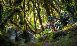
Event Report: Riding Oaxaca with the Smith Optics crew
Aug 21, 2026 from pinkbike.com
Looks like a good time.
Race Report: Transierra Norte 2025
Nov 6, 2025 from pinkbike.com
The five-day journey from pines to playas.

Video: Highlights from the 2023 TranSierra Norte
Nov 27, 2023 from pinkbike.com
The Mexican adventure enduro race celebrated its 6th anniversary this year.

Video: How To Make The Most Of Your Mexican MTB Adventure
Feb 7, 2023 from pinkbike.com
Christina shares some tips she learned from her trip to Oaxaca, Mexico, for the TranSierra Norte enduro.
Sub Regions
-
Etla Trail Network
- 1
- 11
- 7
-
La Cumbre Ixtepeji Trail Network
- 1
- 22
- 6
-
Oaxaca de Juárez Trail Network
- 4
- 11
- 3
Popular Oaxaca Mountain Biking Trails
• 90 ★ 5.0 • 1 mile • 94 ft • 789 •
A popular blue flow trail located near Oaxaca, this track has it all and is surrounded with beautiful pine trees. You'll experience high swooping corners, a chute, rock roll, and a small gap jump near the end of the descent.
• 100 ★ 5.0 • 4 miles • 217 ft • 568 •
Highly rated popular black diamond difficulty singletrack. This mountain bike primary trail can be used downhill only. On average it takes 56 minutes to complete this trail.
• 100 ★ 5.0 • 1 mile • 65 ft • 533 •
Popular blue difficulty singletrack. This mountain bike primary trail can be used downhill only. It features jump and gap jump. On average it takes 7 minutes to complete this trail.
• 95 ★ 5.0 • 4,869 ft • 20 ft • 517 •
Popular blue difficulty singletrack. This mountain bike primary trail can be used downhill only and has a moderate overall physical rating. On average it takes 7 minutes to complete this trail.
• 100 ★ 0.0 • 2,388 ft • 0 ft • 486 •
Popular blue difficulty singletrack. This mountain bike primary trail can be used downhill only. On average it takes 4 minutes to complete this trail.
• 90 ★ 5.0 • 3 miles • 136 ft • 483 •
Flowy, steep at times, through the pines. All the smiles.
• 95 ★ 0.0 • 1 mile • 0 ft • 465 •
Popular blue difficulty singletrack. This mountain bike primary trail can be used downhill only. On average it takes 13 minutes to complete this trail.
Oaxaca Mountain Bike Routes
★ 5.0 • 1 mile • 36 ft • 0 • Point to Point •
Es un trail de dificultad fácil, puedes subir caminando desde donde termina o entrar por San Juan del...
5 miles • 254 ft • 0 • Loop •
18 miles • 3,415 ft • 3 • Shuttled • Race •
Race course planned to perform in the 3rd round of MTB enduro series
0 • Race •
Oaxaca se ha convertido en la Meca de la bici de montaña en México. Con sus paisajes y sus largas...
Photos of Oaxaca Mountain Bike
Videos of Oaxaca Mountain Bike




Recent Trail Reports
| status | trail | date | condition | info | user |
|---|---|---|---|---|---|
| Gnomo | Feb 16, 2026 @ 4:25pm (America/Mexico_City) Feb 16, 2026 | Unknown | cyboha24 | ||
| Herradura | Feb 8, 2026 @ 7:58am (America/Mexico_City) Feb 8, 2026 | Very Dry | milo2023 | ||
| Veredita | Feb 5, 2026 @ 6:53pm (America/Mexico_City) Feb 5, 2026 | Dry | dkidd | ||
| Lloo-lia | Feb 5, 2026 @ 6:52pm (America/Mexico_City) Feb 5, 2026 | Dry | dkidd | ||
| Cieneguilla | Feb 5, 2026 @ 6:50pm (America/Mexico_City) Feb 5, 2026 | Dry | dkidd | ||
| El Toro | Nov 11, 2025 @ 12:49pm (America/Mexico_City) Nov 11, 2025 | Ideal | LemuellC7eqB | ||
| Martinez | Mar 29, 2025 @ 11:05am Mar 29, 2025 | Ideal | canadaka Trailforks | ||
| Desviación a Nevería | Mar 29, 2025 @ 11:05am Mar 29, 2025 | Ideal | canadaka Trailforks | ||
| El Arastradero | Mar 28, 2025 @ 11:45am Mar 28, 2025 | Very Dry | canadaka Trailforks | ||
| arrastradero | Mar 28, 2025 @ 11:45am Mar 28, 2025 | Dry | canadaka Trailforks |
Activity Feed
| username | action | type | title | date |
|---|---|---|---|---|
| aminalbackwards | wishlist | trail | activity #106614964 and 1 more | Oct 25, 2026 @ 9:26pm 2 days |
| scottdess | wishlist | region | activity #106446449 | Oct 23, 2026 @ 1:11pm Oct 23, 2026 |
| Buca8 | add | trail | activity #106300475 and 1 more | Oct 20, 2026 @ 5:34pm Oct 20, 2026 |
| transierranorte | add | trail | activity #106300310 | Oct 20, 2026 @ 5:31pm Oct 20, 2026 |
| DreyMX | add | trail | activity #106299409 | Oct 20, 2026 @ 5:19pm Oct 20, 2026 |
Recent Comments
| username | type | title | comment | date |
|---|---|---|---|---|
| trail | This track is sick | Jan 1, 2026 @ 5:17pm Jan 1, 2026 | ||
| trail | it’s not closed. Come ride bikes! | Dec 31, 2025 @ 8:04am Dec 31, 2025 | ||
| trail | Cienaguilla Ecotourismo is closed. | Sep 14, 2025 @ 12:17pm Sep 14, 2025 | ||
| trail | Does not intersect with llano carterra as shown. | Oct 18, 2024 @ 6:39pm Oct 18, 2024 | ||
| trail | The sign at the top calls this trail “Boca... | Aug 18, 2024 @ 1:24pm Aug 18, 2024 |
Local Badges
-

10 Blue Trails29 awarded -

Epic Mountain Bike Climb 2k175 awarded -

Climbing 10k Badge30 awarded -

Mountain Biking 100k Badge5 awarded -

Epic Ride Descent 2k175 awarded -

Descent 10k Badge55 awarded




Activity Type Stats
| activitytype | trails | distance | descent | descent distance | total vertical | rating | global rank | state rank | photos | reports | routes | activity logs |
|---|---|---|---|---|---|---|---|---|---|---|---|---|
| Mountain Bike | 74 | 149 miles | 93,707 ft | 110 miles | 5,436 ft | #710 | #3 | 449 | 127 | 8 | 16,675 | |
| E-Bike | 20 | 25 miles | 12,336 ft | 14 miles | 4,980 ft | #1,392 | #26 | 115 | 2 | 918 | ||
| Gravel Bike | 8 | 18 miles | 5,069 ft | 8 miles | 4,478 ft | #694 | #8 | 8 | 1 | 42 | ||
| Adaptive Bike | 9 | 19 miles | 5,912 ft | 9 miles | 4,590 ft | #356 | #10 | 11 | ||||
| Winter Fat Bike | 1 | 2 miles | 843 ft | 1 mile | 791 ft | #643 | #15 | 5 | ||||
| Horse | 1 | 2 miles | 187 ft | 2,313 ft | 889 ft | 28 | ||||||
| Hike | 70 | 144 miles | 88,317 ft | 104 miles | 5,436 ft | #866 | #7 | 4 | 125 | 2 | 693 | |
| Trail Running | 71 | 145 miles | 88,904 ft | 106 miles | 5,436 ft | #598 | #6 | 1 | 125 | 1 | 45 |
Frequently Asked Questions
▼
What are the best places to ride in Oaxaca?
Oaxaca has 3 areas to explore for mountain biking. The top rated areas are:
▼
What are the highest rated mountain biking trails in Oaxaca?
The highest rated mountain biking trails in Oaxaca are:
- Llano carreta (4.4/5)
- Ola Hawaiana (4.4/5)
- Peña Prieta (4.4/5)
- Cruz de Estacas (4.4/5)
- El Cerezo (4.3/5)
▼
What is the best time of the year to ride in Oaxaca?
Based on activity log data, the most popular months to ride in Oaxaca are:
- October (127 activities)
- November (103 activities)
- February (92 activities)
▼
Where can I park to ride in Oaxaca?
Check the Oaxaca trail map for trailhead and parking information. Community members regularly update access and parking details for trails in the area.
▼
What is the longest trail in Oaxaca?
The longest trail in Oaxaca is Mil Rios at 13.2 km. View all trails sorted by distance.
▼
What are the best & highest rated hiking trails in Oaxaca?
The best hiking trails in Oaxaca are: View all hiking trails sorted by popularity score.
▼
What are the best & highest rated trail running trails in Oaxaca?
The best trail running trails in Oaxaca are: View all trail running trails sorted by popularity score.
▼
How many trails are in Oaxaca?
Oaxaca has a total of 75 trails. Of those, 74 are designated for mountain biking. Browse top mountain biking trails in Oaxaca to find detailed information including difficulty ratings, distances, and trail conditions.
▼
Which trail has the most elevation gain in Oaxaca?
The trail with the most elevation gain in Oaxaca is Capulalpam Logmill to Las Pavas to Cerro Pelado with 1,033 m of elevation gain. View all trails sorted by elevation gain.
▼
Which trail has the most elevation descent in Oaxaca?
The trail with the most elevation descent in Oaxaca is Cruz de Estacas with 1,460 m of elevation descent. View all trails sorted by elevation descent.
▼
What activities are most popular in Oaxaca?
Oaxaca supports the following activities: Mountain Biking, E-Biking, Gravel Biking, Adaptive Biking, Winter Fat Biking, Hiking, Trail Running.
▼
What bike services are there in Oaxaca?
The following bike services are available in Oaxaca:
- Guides & Tours (3)
- Shuttle Service (2)
- Coaching & Camps (1)
- Trail Builders (1)
- Race/Event Organizer (1)
▼
What are the steepest mountain biking trails in Oaxaca?
The steepest mountain biking trail in Oaxaca is Trail with an average grade of 6.4%. View all trails sorted by grade.
▼
What trails have the biggest jumps in Oaxaca?
The trails with the biggest jumps in Oaxaca are: Browse all mountain bike trails to find trails with jumps and technical features.
▼
Are the trails open in Oaxaca?
The overall region status for Oaxaca is Clear / Green. Out of 34 trails:
- Clear / Green: 31
- Minor Issue / Yellow: 3
▼
Can I ride an ebike in Oaxaca?
Yes, Oaxaca supports e-bike riding. There are 15 trails in Oaxaca that allow e-bikes. Check the e-bike trails listing for specific trail access details and any local regulations.
▼
What are the most popular mountain biking routes in Oaxaca?
The most popular mountain biking routes in Oaxaca are: View all mountain biking routes in Oaxaca.
▼
What type of bike is most common in Oaxaca?
Based on activity log data, the most common bike types used in Oaxaca are:
- AM (69 activities)
- XC (35 activities)
- RD (1 activities)
▼
What is the highest summit in Oaxaca?
The highest summit in Oaxaca is Cerro Nube Flane at 3,701 m elevation.
▼
What are the most popular Strava Segments in Oaxaca?
The most popular Strava segments in Oaxaca are:
- end of carbonera to crucero (1,958 athletes)
- Cerezo Arranque! (1,833 athletes)
- Descenso Ixtepeji - El Punto (1,803 athletes)
▼
What are some popular technical trail features in Oaxaca?
There are 1 technical trail features (TTFs) in Oaxaca. Some popular features include: View all technical trail features in Oaxaca.
▼
Are there accessible or adaptive trails in Oaxaca?
Yes, there are 9 accessible/adaptive trails in Oaxaca. View all adaptive trails in Oaxaca for specific accessibility information.
▼
Are there any mountain biking guiding or tour operators in Oaxaca?
Yes, there are mountain biking guiding and tour operators in Oaxaca: Browse all guiding and tour operators in Oaxaca.
▼
What are the most popular mountain biking trails in Oaxaca?
The most popular mountain biking trails in Oaxaca are: View all mountain biking trails sorted by popularity.
▼
What are the best beginner ride trails in Oaxaca?
The best beginner mountain biking trails in Oaxaca are:
- Trail DDM Doctor de Magnolia (4/5)
- Capulalpam Logmill to Las Pavas to Cerro Pelado (5/5)
- Cabeza de Vaca (0/5)
Activities
Trails
- By industrychett
 & contributors
- Admins: apply
- #7010 - 28,273 views
- oaxaca activity log | embed map of Oaxaca mountain bike trails | oaxaca mountain biking points of interest
Downloading of trail gps tracks in kml & gpx formats is enabled for Oaxaca.
You must login to download files.
