close
-
Layers w
- Weather Layers
- Pro
- Pro
- Pro
- Pro
- Pro
- Pro
- More Layers
- Pro
- Pro
- Pro
- Pro
-
Upgrade to

3D
Trail Conditions
- Unknown
- Snow Groomed
- Snow Packed
- Snow Covered
- Snow Cover Partial
- Freeze/thaw Cycle
- Icy
- Prevalent Mud
- Wet
- Variable
- Ideal
- Dry
- Very Dry
Trail Flow (Ridden Direction)
Trailforks scans users ridelogs to determine the most popular direction each trail is ridden. A good flowing trail network will have most trails flowing in a single direction according to their intension.
The colour categories are based on what percentage of riders are riding a trail in its intended direction.
The colour categories are based on what percentage of riders are riding a trail in its intended direction.
- > 96%
- > 90%
- > 80%
- > 70%
- > 50%
- < 50%
- bi-directional trail
- no data
Trail Last Ridden
Trailforks scans ridelogs to determine the last time a trail was ridden.
- < 2 days
- < 1 week
- < 2 weeks
- < 1 month
- < 6 months
- > 6 months
Trail Ridden Direction
The intended direction a trail should be ridden.
- Downhill Only
- Downhill Primary
- Both Directions
- Uphill Primary
- Uphill Only
- One Direction
Contribute Details
Colors indicate trail is missing specified detail.
- Description
- Photos
- Description & Photos
- Videos
Trail Popularity ?
Trailforks scans ridelogs to determine which trails are ridden the most in the last 9 months.
Trails are compared with nearby trails in the same city region with a possible 25 colour shades.
Think of this as a heatmap, more rides = more kinetic energy = warmer colors.
- most popular
- popular
- less popular
- not popular
ATV/ORV/OHV Filter
Max Vehicle Width
inches
US Cell Coverage
Legend

Radar Time
Activity Recordings
Trailforks uses anonymized public activity data.
?
Activity Recordings
Trailforks uses anonymized public activity data.
?
Personal Heatmap
▶
Activity Types
all
/
none
▶
Options
2
Date range
month
–
Winter Trails
Warning
A routing network for winter maps does not exist. Selecting trails using the winter trails layer has been disabled.
Missing Trails
Most Popular
Least Popular
Trails are colored based on popularity. The more popular a trail is, the more red. Less popular trails trend towards green.
Jump Magnitude Heatmap
Heatmap of where riders jump on trails. Zoom in to see individual jumps, click circles to view jump details.
BC Backroad Status
![map legend]()
Service Road Atlas is a free to use, community-driven service for viewing and creating reports on the numerous back-country service roads around B.C. and Alberta.

Slope Aspect
Direction the slope faces
Trails Deemphasized
Trails are shown in grey.
Only show trails with no bike usage.
Suggested Layers
Based on selected activity type
Save the current map location and zoom level as your default home location whenever this page is loaded.
Save
No description for Łódź has been added yet!
Login or register to submit one.
This region uses the Uk/Euro style trail grading system.
Activities Click to view
- Mountain Bike
87 trails
- E-Bike
8 trails
- Gravel Bike
0 trails
- Adaptive Bike
0 trails
- Hike
86 trails
- Trail Running
86 trails
Region Details
- 53
- 31
- 3
Region Status
Open as of May 24, 2026Stats
- Avg Trail Rating
- Trails (view details)
- 87
- Trails Mountain Bike
- 87
- Trails E-Bike
- 8
- Trails Horse
- 1
- Trails Hike
- 86
- Trails Trail Running
- 86
- Total Distance
- 59 miles
- Total Descent
- 4,736 ft
- Total Vertical
- 363 ft
- Highest Trailhead
- 897 ft
- Reports
- 262
- Photos
- 450
- Ridden Counter
- 1,572
Sub Regions
-
Las Łagiewnicki
- 30
- 1
Popular Łódź Mountain Biking Trails
• 95 ★ 4.5 • 1,770 ft • 0 ft • 57 •
Popular green difficulty singletrack. This mountain bike primary trail can be used both directions and has a easy overall physical rating. It features other. On average it takes 2 minutes to complete this trail.
• 100 ★ 3.0 • 2,185 ft • 0 ft • 38 •
Popular green difficulty mixed. This mountain bike primary trail can be used both directions and has a easy overall physical rating. It features other. On average it takes 1 minutes to complete this trail.
• 80 ★ 0.0 • 2,627 ft • 11 ft • 37 •
Popular green difficulty singletrack. This mountain bike primary trail can be used both directions and has a easy overall physical rating. It features other. On average it takes 1 minutes to complete this trail.
• 100 ★ 0.0 • 1,296 ft • 0 ft • 37 •
Popular green difficulty singletrack. This mountain bike primary trail can be used both directions and has a easy overall physical rating with a 0 ft blue climb. Trail visibility is always easy to follow. On average it takes minutes to complete this trail.
• 80 ★ 0.0 • 3 miles • 185 ft • 36 •
Popular green difficulty singletrack. This mountain bike primary trail can be used both directions and has a easy overall physical rating with a 185 ft green climb. It features other. On average it takes 12 minutes to complete this trail.
• 80 ★ 5.0 • 1,368 ft • 0 ft • 35 •
Popular blue difficulty singletrack. This mountain bike primary trail can be used both directions. On average it takes 1 minutes to complete this trail.
• 100 ★ 0.0 • 2,142 ft • 29 ft • 35 •
Popular green difficulty singletrack. This mountain bike primary trail can be used both directions and has a easy overall physical rating with a 29 ft green climb. Trail visibility is always easy to follow. On average it takes 11 minutes to complete this trail.
• 95 ★ 2.0 • 2,056 ft • 2 ft • 33 •
Popular green difficulty singletrack. This mountain bike primary trail can be used both directions and has a easy overall physical rating. It features other. On average it takes 2 minutes to complete this trail.
Łódź Mountain Bike Routes
29 miles • 1,319 ft • 0 • Loop •
Łagiewniki & Smardzew - two of the best bike places around LD
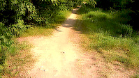
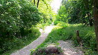
Photos of Łódź Mountain Bike
Videos of Łódź Mountain Bike

trail: Babia Góra
5:20 |
15 |
Apr 1, 2024
trail: Rudzka Góra
0:58 |
112 |
Sep 3, 2015
trail: Rudzka Góra
0:29 |
103 |
Sep 3, 2015
trail: Zielona
2:38 |
237 |
Jul 12, 2012
trail: Zielona
0:06 |
224 |
May 3, 2012
3:55 |
78 |
Feb 23, 2025
trail: Babia Góra
0:05 |
255 |
Nov 6, 2011
trail: Zielona
0:04 |
441 |
Aug 25, 2010
Recent Trail Reports
Activity Feed
| username | action | type | title | date |
|---|---|---|---|---|
| R62 | add | report | activity #95444120 and 4 more | May 24, 2026 @ 2:03pm May 24, 2026 |
| R62 | add | report | activity #94024056 and 1 more | May 4, 2026 @ 7:40am May 4, 2026 |
| Ravall | add | report | activity #93004433 and 4 more | Apr 20, 2026 @ 12:27am Apr 20, 2026 |
| DominicWilbrink | add | video | activity #90436520 | Mar 12, 2026 @ 7:00am Mar 12, 2026 |
| R62 | add | report | activity #90256680 and 4 more | Mar 9, 2026 @ 2:53am Mar 9, 2026 |
Local Badges
-

10 Green Trails21 awarded -

Epic Ride Climb 2k7 awarded -

Climbing 10k Badge37 awarded -

Climbing 100k Badge5 awarded -

Epic Ride Descent 2k7 awarded -

Descent 10k Badge37 awarded
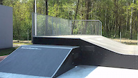
Bike & Skill Parks
| name | type | city | rating |
|---|---|---|---|
| Tor Rowerowy | skill park | Łódź | |
| Pumptrack Łódź Park Podolski | skill park | Łódź | |
| Pumptrack w Dolinie Łódki | skill park | Łódź | |
| Pumptrack Łódź Bałuty | skill park | Łódź | |
| Pumptrack Łódź Stawy | skill park | Łódź |
Local Mountain Biking Directory
-
Bikemia
-
Bike-parts.plBike Shop
-
O'neal PolskaBike Shop
Activity Type Stats
| activitytype | trails | distance | descent | descent distance | total vertical | rating | global rank | state rank | photos | reports | routes | ridelogs |
|---|---|---|---|---|---|---|---|---|---|---|---|---|
| Mountain Bike | 87 | 59 miles | 4,734 ft | 30 miles | 364 ft | #2,036 | #34 | 450 | 262 | 1 | 14,279 | |
| E-Bike | 8 | 4 miles | 394 ft | 2 miles | 331 ft | #2,916 | #304 | 262 | 332 | |||
| Horse | 1 | 2 miles | 69 ft | 2,156 ft | 46 ft | 20 | ||||||
| Hike | 86 | 59 miles | 4,711 ft | 30 miles | 364 ft | #2,255 | #52 | 262 | 212 | |||
| Trail Running | 86 | 59 miles | 4,711 ft | 30 miles | 364 ft | #1,764 | #42 | 262 | 81 |
Frequently Asked Questions About Łódź
▼
What are the best places to ride in Łódź?
Łódź has 1 areas to explore for mountain biking. The top rated areas are:
▼
What are the highest rated mountain biking trails in Łódź?
The highest rated mountain biking trails in Łódź are:
- Jagoda 1 (4.2/5)
- Łużyk (4.1/5)
- Szpacza Góra (4/5)
- Kamienna Góra (4/5)
- Rudzka Góra (4/5)
▼
What is the best time of the year to ride in Łódź?
Based on ride log data, the most popular months to ride in Łódź are:
- September (79 activities)
- October (72 activities)
- July (63 activities)
▼
Where can I park to ride in Łódź?
There are 2 parking locations listed in Łódź. The most popular parking spots are:
Activities
Trails
Points of Interest
- By lordon & contributors
- Admins: PMBA, Poland, KarolinaTo
- #5205 - 5,677 views
- Łódź activity log | embed map of Łódź mountain bike trails | Łódź mountain biking points of interest
Downloading of trail gps tracks in kml & gpx formats is enabled for Łódź.
You must login to download files.