close
-
Layers w
- Weather Layers
- Pro
- Pro
- Pro
- Pro
- Pro
- Pro
- More Layers
- Pro
- Pro
- Pro
- Pro
-
Upgrade to

3D
Trail Conditions
- Unknown
- Snow Groomed
- Snow Packed
- Snow Covered
- Snow Cover Partial
- Freeze/thaw Cycle
- Icy
- Prevalent Mud
- Wet
- Variable
- Ideal
- Dry
- Very Dry
Trail Flow (Ridden Direction)
Trailforks scans users ridelogs to determine the most popular direction each trail is ridden. A good flowing trail network will have most trails flowing in a single direction according to their intension.
The colour categories are based on what percentage of riders are riding a trail in its intended direction.
The colour categories are based on what percentage of riders are riding a trail in its intended direction.
- > 96%
- > 90%
- > 80%
- > 70%
- > 50%
- < 50%
- bi-directional trail
- no data
Trail Last Ridden
Trailforks scans ridelogs to determine the last time a trail was ridden.
- < 2 days
- < 1 week
- < 2 weeks
- < 1 month
- < 6 months
- > 6 months
Trail Ridden Direction
The intended direction a trail should be ridden.
- Downhill Only
- Downhill Primary
- Both Directions
- Uphill Primary
- Uphill Only
- One Direction
Contribute Details
Colors indicate trail is missing specified detail.
- Description
- Photos
- Description & Photos
- Videos
Trail Popularity ?
Trailforks scans ridelogs to determine which trails are ridden the most in the last 9 months.
Trails are compared with nearby trails in the same city region with a possible 25 colour shades.
Think of this as a heatmap, more rides = more kinetic energy = warmer colors.
- most popular
- popular
- less popular
- not popular
ATV/ORV/OHV Filter
Max Vehicle Width
inches
US Cell Coverage
Legend

Radar Time
Activity Recordings
Trailforks uses anonymized public activity data.
?
Activity Recordings
Trailforks uses anonymized public activity data.
?
Personal Heatmap
▶
Activity Types
all
/
none
▶
Options
2
Date range
month
–
Winter Trails
Warning
A routing network for winter maps does not exist. Selecting trails using the winter trails layer has been disabled.
Missing Trails
Most Popular
Least Popular
Trails are colored based on popularity. The more popular a trail is, the more red. Less popular trails trend towards green.
Jump Magnitude Heatmap
Heatmap of where riders jump on trails. Zoom in to see individual jumps, click circles to view jump details.
BC Backroad Status
![map legend]()
Service Road Atlas is a free to use, community-driven service for viewing and creating reports on the numerous back-country service roads around B.C. and Alberta.

Slope Aspect
Direction the slope faces
Trails Deemphasized
Trails are shown in grey.
Only show trails with no bike usage.
Suggested Layers
Based on selected activity type
Save the current map location and zoom level as your default home location whenever this page is loaded.
Save
No description for Oneida has been added yet!
Login or register to submit one.
Activities Click to view
- Mountain Bike
17 trails
- E-Bike
1 trails
- Gravel Bike
0 trails
- Adaptive Bike
0 trails
- Horse
91 trails
- Hike
137 trails
- Trail Running
137 trails
Region Details
- 4
- 6
- 7
Region Status
Caution as of Jun 6, 2026Stats
- Avg Trail Rating
- Trails (view details)
- 137
- Trails Mountain Bike
- 17
- Trails E-Bike
- 1
- Trails Horse
- 91
- Trails Hike
- 137
- Trails Trail Running
- 137
- Total Distance
- 267 miles
- Total Descent
- 27,945 ft
- Total Vertical
- 897 ft
- Highest Trailhead
- 1,739 ft
- Reports
- 135
- Photos
- 49
- Ridden Counter
- 3,331
Sub Regions
-
Big South Fork National River and Recreation Area
- 6
- 7
Popular Oneida Mountain Biking Trails
• 100 ★ 4.8 • 6 miles • 879 ft • 368 •
Popular blue difficulty singletrack. This multi-use trail can be used both directions and has a moderate overall physical rating with a 879 ft blue climb. On average it takes 1 hour13 minutes to complete this trail.
• 90 ★ 0.0 • 1,806 ft • 34 ft • 221 •
Popular green difficulty singletrack. This mountain bike primary trail. On average it takes 1 minutes to complete this trail.
• 80 ★ 2.7 • 3 miles • 608 ft • 221 •
Popular green difficulty singletrack. This mountain bike primary trail. On average it takes 40 minutes to complete this trail.
• 85 ★ 0.0 • 2,310 ft • 66 ft • 189 •
Popular green difficulty singletrack. This mountain bike primary trail. On average it takes 6 minutes to complete this trail.
• 75 ★ 3.5 • 3 miles • 614 ft • 187 •
Popular green difficulty singletrack. This mountain bike primary trail. On average it takes 29 minutes to complete this trail.
• 60 ★ 4.8 • 8 miles • 787 ft • 135 •
Moderately popular blue difficulty singletrack. This multi-use trail can be used both directions and has a moderate overall physical rating with a 787 ft blue climb. On average it takes 1 hour13 minutes to complete this trail.
• 70 ★ 2.5 • 2 miles • 368 ft • 119 •
Popular blue difficulty singletrack. This mountain bike primary trail. On average it takes 14 minutes to complete this trail.
• 55 ★ 3.0 • 2 miles • 115 ft • 73 •
Moderately popular green difficulty singletrack. This mountain bike primary trail. On average it takes 10 minutes to complete this trail.
Oneida Mountain Bike Routes
★ 4.0 • 33 miles • 2,849 ft • 14 •
103 miles • 8,757 ft • 13 • Loop •
The original 3-night trip was published here - https://bikepacking.com/routes/no-business-loop/ This...
Photos of Oneida Mountain Bike
Videos of Oneida Mountain Bike

trail: Grand Gap Loop
7:09 |
361 |
Dec 19, 2015
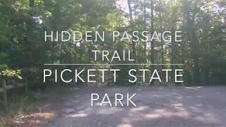
trail: Hidden Passage Trail
19:52 |
427 |
May 3, 2020 , Oneida
Recent Trail Reports
| status | trail | date | condition | info | user |
|---|---|---|---|---|---|
| West Entrance Trail | Jun 6, 2026 @ 2:38pm (America/Kentucky/Monticello) Jun 6, 2026 | Ideal | tntrailbuilder Aspire | ||
| Collier Ridge East | Jun 6, 2026 @ 2:38pm (America/Kentucky/Monticello) Jun 6, 2026 | Ideal | tntrailbuilder Aspire | ||
| Collier Ridge Connector | Jun 6, 2026 @ 2:38pm (America/Kentucky/Monticello) Jun 6, 2026 | Ideal | tntrailbuilder Aspire | ||
| Grand Gap Loop | May 2, 2026 @ 3:17pm (America/New_York) May 2, 2026 | Ideal | RAbike11 | ||
| John Muir Trail | Apr 27, 2026 @ 8:34am (America/New_York) Apr 27, 2026 | Ideal | tntrailbuilder Aspire | ||
| Alfred Smith Road | Oct 10, 2025 @ 12:26pm (America/Kentucky/Monticello) Oct 10, 2025 | Variable | RonN5PqgH | ||
| Duncan Hollow Bike Loop | Oct 10, 2025 @ 12:26pm (America/Kentucky/Monticello) Oct 10, 2025 | Very Dry | RonN5PqgH | ||
| Duncan Hollow Bypass | Oct 10, 2025 @ 12:26pm (America/Kentucky/Monticello) Oct 10, 2025 | Variable | RonN5PqgH | ||
| West Bandy | Oct 10, 2025 @ 12:26pm (America/Kentucky/Monticello) Oct 10, 2025 | Very Dry | RonN5PqgH | ||
| John Muir | Jan 1, 2025 @ 10:06am Jan 1, 2025 | Ideal | tntrailbuilder Aspire |
Activity Feed
| username | action | type | title | date |
|---|---|---|---|---|
| kcrossman | like | report | activity #96491953 and 2 more | Jun 7, 2026 @ 1:13pm Jun 7, 2026 |
| tntrailbuilder | add | report | activity #96478137 and 2 more | Jun 7, 2026 @ 10:48am Jun 7, 2026 |
| fej313 | wishlist | route | activity #96159042 | Jun 3, 2026 @ 8:52am Jun 3, 2026 |
| soundslikebs | wishlist | trail | activity #94716314 and 3 more | May 14, 2026 @ 3:59pm May 14, 2026 |
| VermontRider60 | ridden | trail | activity #94366147 | May 9, 2026 @ 12:04pm May 9, 2026 |
Recent Comments
| username | type | title | comment | date |
|---|---|---|---|---|
| report | Thanks Randy Great picture | Apr 27, 2026 @ 6:22am Apr 27, 2026 | ||
| report | This has been cleared | Oct 21, 2025 @ 5:18pm Oct 21, 2025 | ||
| report | Great day | Mar 9, 2025 @ 12:34pm Mar 9, 2025 | ||
| report | Tks | Mar 9, 2025 @ 12:34pm Mar 9, 2025 | ||
| trail | Okay trail we rode from the bottom which is... | Nov 14, 2024 @ 1:12pm Nov 14, 2024 |
Local Badges
-

Epic Ride Climb 2k15 awarded -

Climbing 10k Badge11 awarded -

Climbing 100k Badge0 awarded -

Epic Ride Descent 2k15 awarded -

Descent 10k Badge11 awarded -

Descent 100k Badge0 awarded
Activity Type Stats
| activitytype | trails | distance | descent | descent distance | total vertical | rating | global rank | state rank | photos | reports | routes | ridelogs |
|---|---|---|---|---|---|---|---|---|---|---|---|---|
| Mountain Bike | 17 | 57 miles | 6,345 ft | 24 miles | 823 ft | #4,897 | #1,648 | 45 | 130 | 2 | 1,848 | |
| E-Bike | 1 | 4 miles | 325 ft | 2 miles | 161 ft | #9,479 | #2,948 | 102 | 111 | |||
| Horse | 91 | 170 miles | 16,138 ft | 73 miles | 889 ft | #129 | #383 | 12 | 22 | |||
| Hike | 137 | 267 miles | 27,946 ft | 113 miles | 899 ft | #673 | #311 | 4 | 135 | 731 | ||
| Trail Running | 137 | 267 miles | 27,946 ft | 113 miles | 899 ft | #562 | #216 | 135 | 85 |
Frequently Asked Questions About Oneida
▼
What are the best places to ride in Oneida?
Oneida has 2 areas to explore for mountain biking. The top rated areas are:
▼
What are the highest rated mountain biking trails in Oneida?
The highest rated mountain biking trails in Oneida are:
- Grand Gap Loop (4.4/5)
- John Muir (4.3/5)
- John Muir Trail (4.1/5)
- West Bandy (3.9/5)
- Collier Ridge West (3.8/5)
▼
What is the best time of the year to ride in Oneida?
Based on ride log data, the most popular months to ride in Oneida are:
- October (24 activities)
- July (22 activities)
- November (21 activities)
▼
Where can I park to ride in Oneida?
There are 15 parking locations listed in Oneida. The most popular parking spots are: View all parking and trailhead locations on the map to plan your visit.
Activities
Trails
Points of Interest
- By brenthillier
 NSMBA TRAILFORKS & contributors
 - Admins: apply
- #9268 - 3,187 views
- oneida activity log | embed map of Oneida mountain bike trails | oneida mountain biking points of interest
Downloading of trail gps tracks in kml & gpx formats is enabled for Oneida.
You must login to download files.